Skeo Taing

Coastal Feature, Headland, Point in Shetland

Scotland

Skeo Taing

Gun emplacement at the summit of Score Hill Score Hill is on Aith Ness at the north of Bressay. All previous photos of this spot (they are worth looking at!) show the gun itself. I therefore assumed, wrongly, that it had been removed between 2013 and 2018, which felt like a rather pointless and expensive operation to me.

However, I soon realised that I was wrong. In this photo we are looking almost straight down the gun barrel! (Of course the barrel had been blocked, not that it could have been used in anger anyway.) Apologies to anyone misled by that error.

Immediately ahead are Inner Score and Outer Score, with the tiny channel (Gloup of the Scores) between them. On the horizon beyond them is Whalsay, with the Out Skerries on the right.

David Purchase
Gun emplacement at the summit of Score Hill Credit: Michael Earnshaw

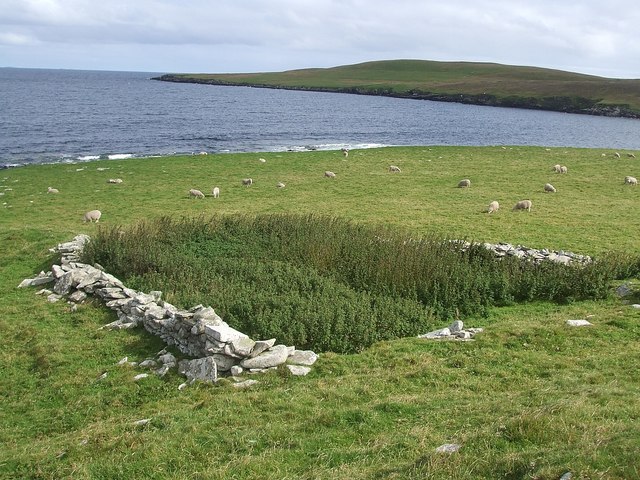
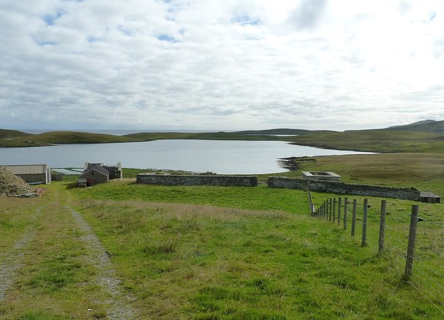
Skeo Taing is a prominent coastal feature located in the Shetland Islands, Scotland. It is a picturesque headland that juts out into the North Sea, forming a distinct point. The name "Skeo Taing" is derived from the Old Norse language, reflecting the Viking influence in the region's history.

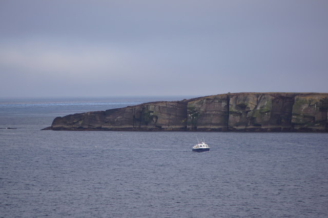
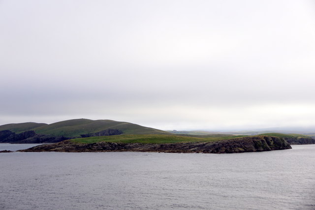
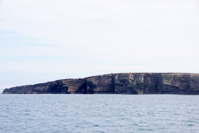
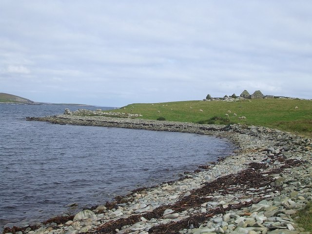
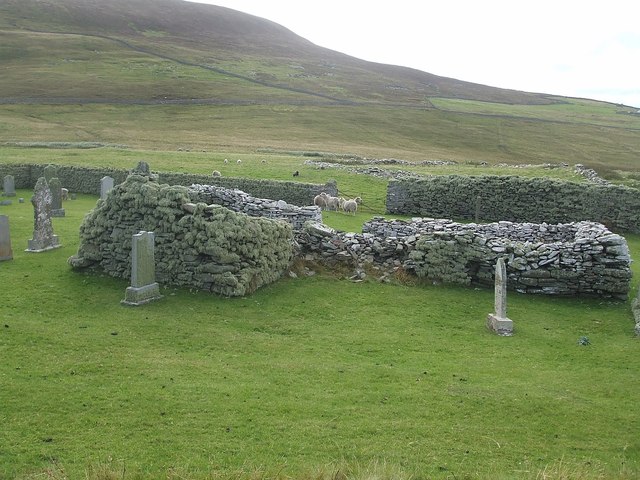
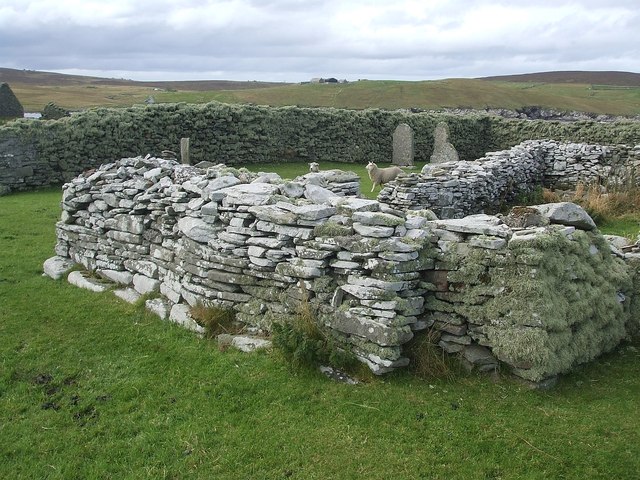
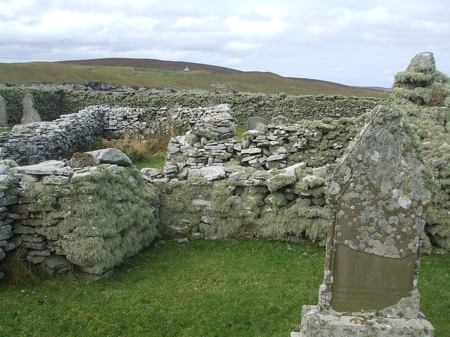
This coastal feature is characterized by its rugged and dramatic landscape. The headland is composed of steep cliffs that overlook the sea, providing breathtaking views of the surrounding waters. The cliffs are formed from ancient rocks, displaying layers of different sedimentary formations that offer valuable insights into the geological history of the area.

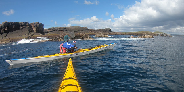
Skeo Taing is home to a diverse range of flora and fauna, making it a haven for nature enthusiasts. The headland provides habitat for various seabird species, including puffins, guillemots, and kittiwakes, which nest in the cliffs during the breeding season. Visitors can often spot seals and dolphins swimming in the waters surrounding the point, adding to the area's natural charm.

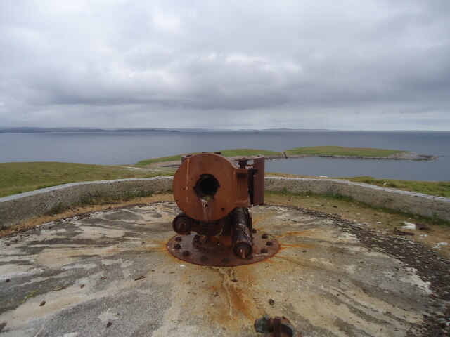
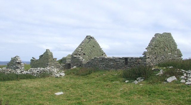
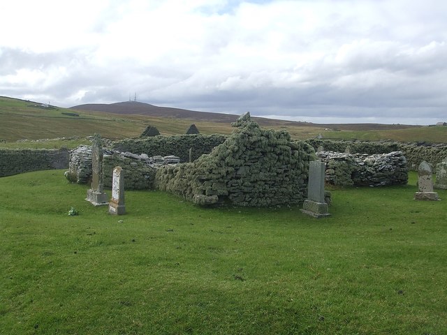
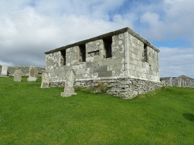
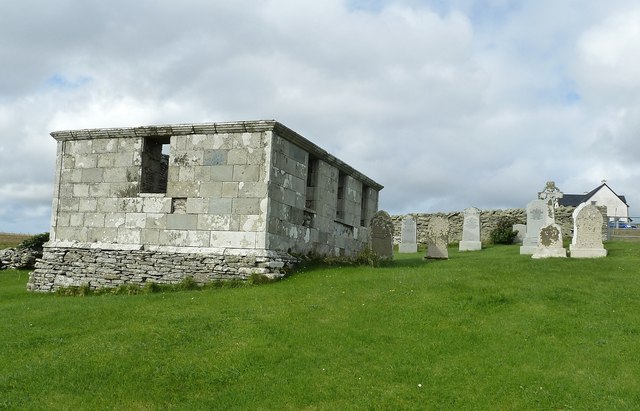
The location of Skeo Taing also holds historical significance. The Shetland Islands have a rich cultural heritage, and this coastal feature serves as a reminder of the islands' past. The area has been inhabited for thousands of years, with evidence of ancient settlements and archaeological sites nearby. The headland's strategic position overlooking the sea would have made it an important vantage point for early inhabitants, offering views of approaching vessels and potential threats.

Overall, Skeo Taing is a captivating coastal feature that combines natural beauty, ecological importance, and historical significance. It is a must-visit destination for those seeking a glimpse into the diverse and fascinating landscape of the Shetland Islands.

If you have any feedback on the listing, please let us know in the comments section below.

Skeo Taing Images

Images are sourced within 2km of 60.177598/-1.0732194 or Grid Reference HU5144. Thanks to Geograph Open Source API. All images are credited.

Gun emplacement at the summit of Score Hill Score Hill is on Aith Ness at the north of Bressay. All previous photos of this spot (they are worth looking at!) show the gun itself. I therefore assumed, wrongly, that it had been removed between 2013 and 2018, which felt like a rather pointless and expensive operation to me.

However, I soon realised that I was wrong. In this photo we are looking almost straight down the gun barrel! (Of course the barrel had been blocked, not that it could have been used in anger anyway.) Apologies to anyone misled by that error.

Immediately ahead are Inner Score and Outer Score, with the tiny channel (Gloup of the Scores) between them. On the horizon beyond them is Whalsay, with the Out Skerries on the right.

David Purchase
Gun emplacement at the summit of Score Hill
Score Hill is on Aith Ness at the north of Bressay. All previous photos of this spot (they are worth looking at!) show the gun itself. I therefore assumed, wrongly, that it had been removed between 2013 and 2018, which felt like a rather pointless and expensive operation to me. However, I soon realised that I was wrong. In this photo we are looking almost straight down the gun barrel! (Of course the barrel had been blocked, not that it could have been used in anger anyway.) Apologies to anyone misled by that error. Immediately ahead are Inner Score and Outer Score, with the tiny channel (Gloup of the Scores) between them. On the horizon beyond them is Whalsay, with the Out Skerries on the right. David Purchase
Skerry-hopping at Loder Head Last time I'd been to Bressay nine years ago, we didn't even get round the corner to see Noss, as the wind was too much. On this trip, despite a spell of bad weather as we came to Shetland on the ferry, the wind had dropped dramatically by our second day, and the east side of Shetland was relatively protected from the big swells. Coming round the top of Bressay, there was still enough for rock-hopping (paddling over reefs and rocks that would be too shallow without the help of a wave and good timing) but it was unpredictable enough (the result of two separate swell directions interfering producing occasional big waves) that sport was certainly to be had. The first through this gap had been caught by a bigger set as he came over, then three of us had popped through before the next set arrived. The last paddler has dropped back a little to wait for the next calmer spell and is just about to make her way through.
Skerry-hopping at Loder Head
Last time I'd been to Bressay nine years ago, we didn't even get round the corner to see Noss, as the wind was too much. On this trip, despite a spell of bad weather as we came to Shetland on the ferry, the wind had dropped dramatically by our second day, and the east side of Shetland was relatively protected from the big swells. Coming round the top of Bressay, there was still enough for rock-hopping (paddling over reefs and rocks that would be too shallow without the help of a wave and good timing) but it was unpredictable enough (the result of two separate swell directions interfering producing occasional big waves) that sport was certainly to be had. The first through this gap had been caught by a bigger set as he came over, then three of us had popped through before the next set arrived. The last paddler has dropped back a little to wait for the next calmer spell and is just about to make her way through.
Score Head, Bressay, from the sea
Outer Score, Score Head, Bressay, from the sea
Pow of Cullingsburgh This small bay curves around on the western side of the little promontory containing the remains of the village of Cullingsburgh and its ruined church of St Mary which can be seen a little way ahead on the right. (See adjacent square to east for images)
Pow of Cullingsburgh
This small bay curves around on the western side of the little promontory containing the remains of the village of Cullingsburgh and its ruined church of St Mary which can be seen a little way ahead on the right. (See adjacent square to east for images)
The remains of Cullingsburgh A general view of the former village of Cullingsburgh as seen when approaching from south along the path from Setter.
The remains of Cullingsburgh
A general view of the former village of Cullingsburgh as seen when approaching from south along the path from Setter.
Ruined cottages at Cullingsburgh Some of the ruined former dwellings at Cullingsburgh on Bressay.
Ruined cottages at Cullingsburgh
Some of the ruined former dwellings at Cullingsburgh on Bressay.
Ruins of St Mary's church, Cullingsburgh The ruined village of Cullingsburgh on Bressay has a ruined church. It is set in a walled churchyard which contained several sheep when I visited. Whether the sheep had been intentionally let in to graze the grass of the burial ground, been let in accidentally by earlier visitors, or had worked out a method of getting in here under their own trotter power I have no idea - but they seemed to be trapped within.
Ruins of St Mary's church, Cullingsburgh
The ruined village of Cullingsburgh on Bressay has a ruined church. It is set in a walled churchyard which contained several sheep when I visited. Whether the sheep had been intentionally let in to graze the grass of the burial ground, been let in accidentally by earlier visitors, or had worked out a method of getting in here under their own trotter power I have no idea - but they seemed to be trapped within.
Cullingsburgh - St Mary's and churchyard Part of the former church of St Mary in the abandoned and ruined village of Cullingsburgh on Bressay. Surrounded by gravestones, many of which I'm sure postdate the ruination of the church.
Cullingsburgh - St Mary's and churchyard
Part of the former church of St Mary in the abandoned and ruined village of Cullingsburgh on Bressay. Surrounded by gravestones, many of which I'm sure postdate the ruination of the church.
St Mary's church and churchyard wall, Cullingsburgh Part of the remaining structure of the former church of St Mary in the ruined village of Cullingsburgh with a section of the enclosing churchyard wall seen behind.
St Mary's church and churchyard wall, Cullingsburgh
Part of the remaining structure of the former church of St Mary in the ruined village of Cullingsburgh with a section of the enclosing churchyard wall seen behind.
Gravestones of St Mary's, Cullingsburgh Gravestones not only surround but are also within the walls of the ruined church of St Mary at Cullingsburgh. I'm sure this church has been a ruin far longer than the dates on many of the gravestones, suggesting that it continued as a graveyard for many decades after the ruination of the church and probably the abandonment of the village.
Gravestones of St Mary's, Cullingsburgh
Gravestones not only surround but are also within the walls of the ruined church of St Mary at Cullingsburgh. I'm sure this church has been a ruin far longer than the dates on many of the gravestones, suggesting that it continued as a graveyard for many decades after the ruination of the church and probably the abandonment of the village.
Table tombstone at St Mary's, Cullingsburgh There are several gravestones set within the ruins of the church of St Mary at Cullingsburgh in addition to the numerous ones outside its walls. The one seen in the foreground here is perhaps the largest and most noticeable, being raised off the ground on little legs forming a table tomb.
Table tombstone at St Mary's, Cullingsburgh
There are several gravestones set within the ruins of the church of St Mary at Cullingsburgh in addition to the numerous ones outside its walls. The one seen in the foreground here is perhaps the largest and most noticeable, being raised off the ground on little legs forming a table tomb.
Looking over St Mary's to Garth Taken from northwest of the churchyard at St Mary's Cullingsburgh looking over a small tumulus and the site of the Pictish broch (see <a href="https://www.geograph.org.uk/photo/2707627">HU5242 : Traces of an ancient broch, Cullingsburgh</a>) past the northeastern corner of the churchyard. In the mid-distance can be seen the walls and remains of "Garth" - presumably an old abandoned farmstead.
Looking over St Mary's to Garth
Taken from northwest of the churchyard at St Mary's Cullingsburgh looking over a small tumulus and the site of the Pictish broch (see HU5242 : Traces of an ancient broch, Cullingsburgh) past the northeastern corner of the churchyard. In the mid-distance can be seen the walls and remains of "Garth" - presumably an old abandoned farmstead.
Traces of an ancient broch, Cullingsburgh This semicircular loop of stones is all that remains of the ancient broch that once stood here at Cullinsburgh. Dating from about 2000 years ago it is  approximately twice as old as the oldest parts of the adjacent ruined church of St Mary. The later building cut across the Pictish remains and very probably stones from the broch were "mined" for use in the construction of the church.
Traces of an ancient broch, Cullingsburgh
This semicircular loop of stones is all that remains of the ancient broch that once stood here at Cullinsburgh. Dating from about 2000 years ago it is approximately twice as old as the oldest parts of the adjacent ruined church of St Mary. The later building cut across the Pictish remains and very probably stones from the broch were "mined" for use in the construction of the church.
View across Gunnista churchyard to Aith Voe Gunnista is a little settlement at the north of the island of Bressay. There is a walled churchyard here for the long vanished St Ola's Church. The graveyard contains a notable mausoleum and gravestones many of them quite recent. Beyond the land can be seen the landward end of Aith Voe, an inlet that curls round southeastwards from the north, and beyond that the land is the southern end of Aith Ness. For photographs of the mausoleum and churchyard, see <a href="https://www.geograph.org.uk/photo/2707684">HU5043 : Churchyard and Mausoleum, Gunnista</a> <a href="https://www.geograph.org.uk/photo/2707683">HU5043 : Gunnista Mausoleum</a>
View across Gunnista churchyard to Aith Voe
Gunnista is a little settlement at the north of the island of Bressay. There is a walled churchyard here for the long vanished St Ola's Church. The graveyard contains a notable mausoleum and gravestones many of them quite recent. Beyond the land can be seen the landward end of Aith Voe, an inlet that curls round southeastwards from the north, and beyond that the land is the southern end of Aith Ness. For photographs of the mausoleum and churchyard, see HU5043 : Churchyard and Mausoleum, Gunnista HU5043 : Gunnista Mausoleum
Gunnista Mausoleum This small mausoleum in the churchyard of the now vanished St Ola's Church was built for the Hendersons of Gardie. St Ola's was the parish church for the island of Bressay until the 1720s when a new church was built at Mail on the west of the island. The old church fell into ruin and was demolished. The mausoleum dates from the C18th and may stand where the old church once stood.
Gunnista Mausoleum
This small mausoleum in the churchyard of the now vanished St Ola's Church was built for the Hendersons of Gardie. St Ola's was the parish church for the island of Bressay until the 1720s when a new church was built at Mail on the west of the island. The old church fell into ruin and was demolished. The mausoleum dates from the C18th and may stand where the old church once stood.
Churchyard and Mausoleum, Gunnista The churchyard of the vanished St Ola's church, once the parish church for the island of Bressay contains the Henderson Mausoleum and a number of more recent headstones. Information about the Hendersons of Gardie here <span class="nowrap"><a title="http://shetlopedia.com/Henderson_of_Gardie_-_Grant%27s_County_Families" rel="nofollow ugc noopener" href="http://shetlopedia.com/Henderson_of_Gardie_-_Grant%27s_County_Families">Link</a><img style="margin-left:2px;" alt="External link" title="External link - shift click to open in new window" src="https://s1.geograph.org.uk/img/external.png" width="10" height="10"/></span>
Churchyard and Mausoleum, Gunnista
The churchyard of the vanished St Ola's church, once the parish church for the island of Bressay contains the Henderson Mausoleum and a number of more recent headstones. Information about the Hendersons of Gardie here LinkExternal link
Show me another place!

Skeo Taing is located at Grid Ref: HU5144 (Lat: 60.177598, Lng: -1.0732194)

Unitary Authority: Shetland Islands

Police Authority: Highlands and Islands

What 3 Words

///shorten.stag.chum. Near Lerwick, Shetland Islands

Related Wikis

Voe of Cullingsburgh

Voe of Cullingsburgh is a large sea loch off the Shetland island of Bressay, voe meaning "sea inlet" in Shetland dialect. The local spelling of the name...

Broch of Cullingsburgh

The Broch of Cullingsburgh is an Iron Age broch located in the Shetland islands. == Location == Located on Bressay, off the east coast of mainland Shetland...

Bressay

Bressay (Scots: Bressa) is a populated island in the Shetland archipelago of Scotland. == Geography and geology == Bressay lies due south of Whalsay, west...

Gardie House

Gardie House is an 18th-century estate house on Bressay in Shetland, Scotland. Located opposite Lerwick, across the Bressay Sound, Gardie is described...

Lerwick and Bressay Parish Church

Lerwick and Bressay Parish Church is the largest Church of Scotland congregation in Shetland, serving the islands' capital Lerwick and the surrounding...

Mareel

Mareel is a multi-purpose entertainment venue located on the waterfront of Lerwick, the capital of Shetland. Opening in 2012, the facility includes a music...

Isle of Noss

The Isle of Noss or Noss (Scots: Noss) is a small, previously inhabited island in Shetland, Scotland. Noss is separated from the island of Bressay by the...

Viking bus station

Viking Bus Station is a bus station in Lerwick, Shetland, Scotland. The station is used both by passengers and for freight, which is transported by bus...

Nearby Amenities

Located within 500m of 60.177598,-1.0732194
Minni of Aith
Natural: bay
Lat/Long: 60.1763446/-1.0746861
The data included in this document is from www.openstreetmap.org. The data is made available under ODbL.

Have you been to Skeo Taing?

Leave your review of Skeo Taing below (or comments, questions and feedback).