Score Hill

Hill, Mountain in Shetland

Scotland

Score Hill

Gun emplacement at the summit of Score Hill Score Hill is on Aith Ness at the north of Bressay. All previous photos of this spot (they are worth looking at!) show the gun itself. I therefore assumed, wrongly, that it had been removed between 2013 and 2018, which felt like a rather pointless and expensive operation to me.

However, I soon realised that I was wrong. In this photo we are looking almost straight down the gun barrel! (Of course the barrel had been blocked, not that it could have been used in anger anyway.) Apologies to anyone misled by that error.

Immediately ahead are Inner Score and Outer Score, with the tiny channel (Gloup of the Scores) between them. On the horizon beyond them is Whalsay, with the Out Skerries on the right.

David Purchase
Gun emplacement at the summit of Score Hill Credit: Michael Earnshaw

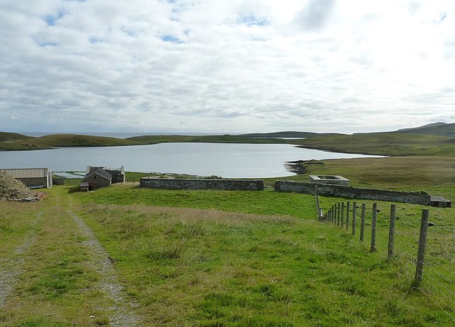
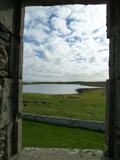
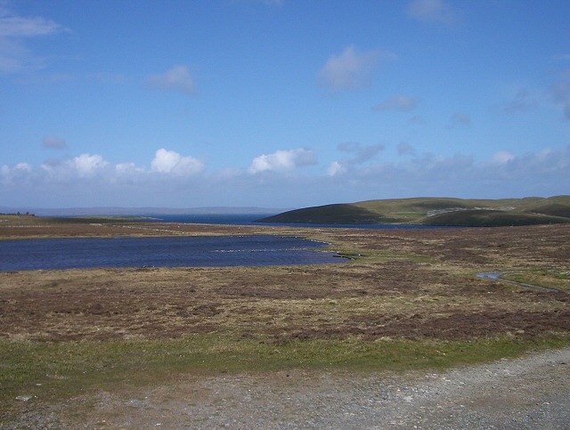
Score Hill is a prominent hill located in the picturesque archipelago of Shetland, Scotland. Situated on the mainland of Shetland, this hill stands at an elevation of approximately 140 meters (460 feet) above sea level. It is known for its distinctive shape and panoramic views of the surrounding landscape.

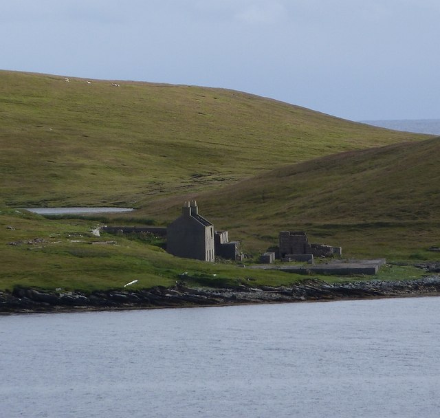
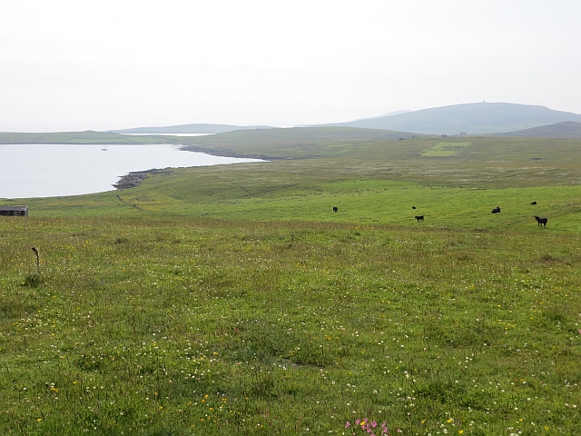
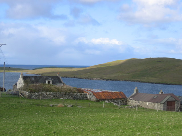
Score Hill is characterized by its gentle slopes and grassy terrain, making it a relatively easy climb for hikers and outdoor enthusiasts. The hill is covered in a patchwork of heather and moorland vegetation, adding to its natural charm. Its strategic location offers stunning vistas of the surrounding countryside, including rolling hills, meandering rivers, and the North Sea.

The summit of Score Hill provides a breathtaking panorama, showcasing the rugged beauty of Shetland's coastline. On a clear day, visitors can admire the vast expanse of the Atlantic Ocean, observe seabirds soaring above the cliffs, and even catch glimpses of passing ships.

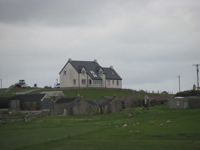
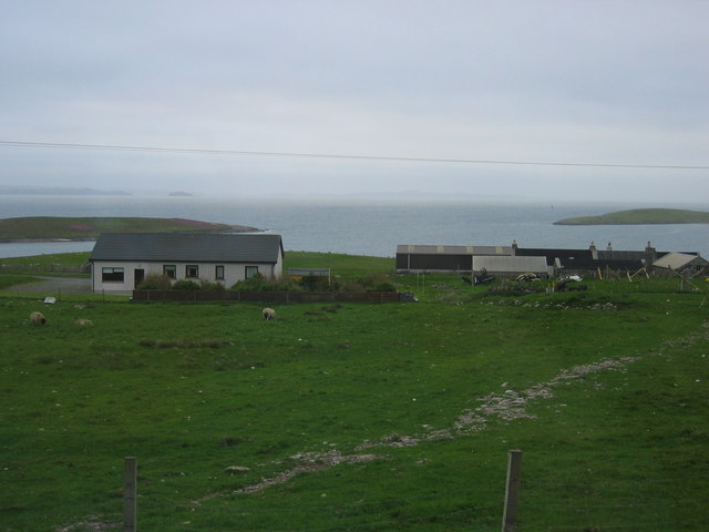
The hill is a popular destination for both locals and tourists, offering a peaceful retreat from the bustling towns and villages of Shetland. It provides a serene and tranquil setting for picnics, nature walks, and photography enthusiasts. The surrounding area also boasts a diverse range of wildlife, including various bird species, sheep, and even otters.

Overall, Score Hill is a natural gem in the heart of Shetland, offering an accessible and visually stunning experience for those seeking to explore the region's remarkable landscapes and immerse themselves in its rich natural heritage.

If you have any feedback on the listing, please let us know in the comments section below.
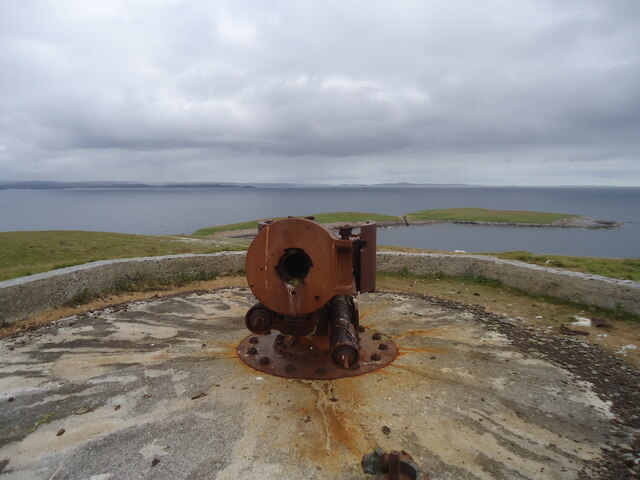
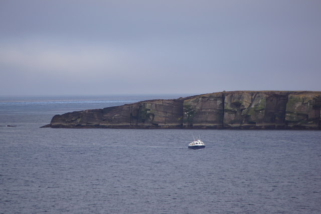
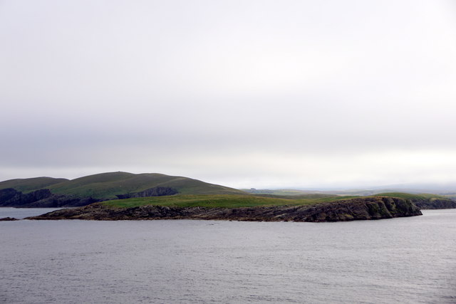
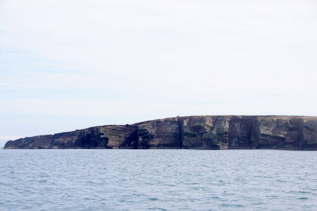
Score Hill Images

Images are sourced within 2km of 60.184209/-1.0774143 or Grid Reference HU5144. Thanks to Geograph Open Source API. All images are credited.

Gun emplacement at the summit of Score Hill Score Hill is on Aith Ness at the north of Bressay. All previous photos of this spot (they are worth looking at!) show the gun itself. I therefore assumed, wrongly, that it had been removed between 2013 and 2018, which felt like a rather pointless and expensive operation to me.

However, I soon realised that I was wrong. In this photo we are looking almost straight down the gun barrel! (Of course the barrel had been blocked, not that it could have been used in anger anyway.) Apologies to anyone misled by that error.

Immediately ahead are Inner Score and Outer Score, with the tiny channel (Gloup of the Scores) between them. On the horizon beyond them is Whalsay, with the Out Skerries on the right.

David Purchase
Gun emplacement at the summit of Score Hill
Score Hill is on Aith Ness at the north of Bressay. All previous photos of this spot (they are worth looking at!) show the gun itself. I therefore assumed, wrongly, that it had been removed between 2013 and 2018, which felt like a rather pointless and expensive operation to me. However, I soon realised that I was wrong. In this photo we are looking almost straight down the gun barrel! (Of course the barrel had been blocked, not that it could have been used in anger anyway.) Apologies to anyone misled by that error. Immediately ahead are Inner Score and Outer Score, with the tiny channel (Gloup of the Scores) between them. On the horizon beyond them is Whalsay, with the Out Skerries on the right. David Purchase
Score Head, Bressay, from the sea
Outer Score, Score Head, Bressay, from the sea
View across Gunnista churchyard to Aith Voe Gunnista is a little settlement at the north of the island of Bressay. There is a walled churchyard here for the long vanished St Ola's Church. The graveyard contains a notable mausoleum and gravestones many of them quite recent. Beyond the land can be seen the landward end of Aith Voe, an inlet that curls round southeastwards from the north, and beyond that the land is the southern end of Aith Ness. For photographs of the mausoleum and churchyard, see <a href="https://www.geograph.org.uk/photo/2707684">HU5043 : Churchyard and Mausoleum, Gunnista</a> <a href="https://www.geograph.org.uk/photo/2707683">HU5043 : Gunnista Mausoleum</a>
View across Gunnista churchyard to Aith Voe
Gunnista is a little settlement at the north of the island of Bressay. There is a walled churchyard here for the long vanished St Ola's Church. The graveyard contains a notable mausoleum and gravestones many of them quite recent. Beyond the land can be seen the landward end of Aith Voe, an inlet that curls round southeastwards from the north, and beyond that the land is the southern end of Aith Ness. For photographs of the mausoleum and churchyard, see HU5043 : Churchyard and Mausoleum, Gunnista HU5043 : Gunnista Mausoleum
Gunnista Mausoleum This small mausoleum in the churchyard of the now vanished St Ola's Church was built for the Hendersons of Gardie. St Ola's was the parish church for the island of Bressay until the 1720s when a new church was built at Mail on the west of the island. The old church fell into ruin and was demolished. The mausoleum dates from the C18th and may stand where the old church once stood.
Gunnista Mausoleum
This small mausoleum in the churchyard of the now vanished St Ola's Church was built for the Hendersons of Gardie. St Ola's was the parish church for the island of Bressay until the 1720s when a new church was built at Mail on the west of the island. The old church fell into ruin and was demolished. The mausoleum dates from the C18th and may stand where the old church once stood.
Churchyard and Mausoleum, Gunnista The churchyard of the vanished St Ola's church, once the parish church for the island of Bressay contains the Henderson Mausoleum and a number of more recent headstones. Information about the Hendersons of Gardie here <span class="nowrap"><a title="http://shetlopedia.com/Henderson_of_Gardie_-_Grant%27s_County_Families" rel="nofollow ugc noopener" href="http://shetlopedia.com/Henderson_of_Gardie_-_Grant%27s_County_Families">Link</a><img style="margin-left:2px;" alt="External link" title="External link - shift click to open in new window" src="https://s1.geograph.org.uk/img/external.png" width="10" height="10"/></span>
Churchyard and Mausoleum, Gunnista
The churchyard of the vanished St Ola's church, once the parish church for the island of Bressay contains the Henderson Mausoleum and a number of more recent headstones. Information about the Hendersons of Gardie here LinkExternal link
Inside the Henderson Mausoleum at Gunnista The rectangular mausoleum in the churchyard of the former St Ola's church at Gunnista was built for the Hendersons of Gardie. see <span class="nowrap"><a title="http://shetlopedia.com/Henderson_of_Gardie_-_Grant%27s_County_Families" rel="nofollow ugc noopener" href="http://shetlopedia.com/Henderson_of_Gardie_-_Grant%27s_County_Families">Link</a><img style="margin-left:2px;" alt="External link" title="External link - shift click to open in new window" src="https://s1.geograph.org.uk/img/external.png" width="10" height="10"/></span>
Inside the Henderson Mausoleum at Gunnista
The rectangular mausoleum in the churchyard of the former St Ola's church at Gunnista was built for the Hendersons of Gardie. see LinkExternal link
A tomb with a view A view through the eastern window of the Henderson Mausoleum in the churchyard of the long-demolished church of St Ola at Gunnista on Bressay. Through the window can be seen the landward end of Aith Voe. Information on the Henderson family of Gardie here <span class="nowrap"><a title="http://shetlopedia.com/Henderson_of_Gardie_-_Grant%27s_County_Families" rel="nofollow ugc noopener" href="http://shetlopedia.com/Henderson_of_Gardie_-_Grant%27s_County_Families">Link</a><img style="margin-left:2px;" alt="External link" title="External link - shift click to open in new window" src="https://s1.geograph.org.uk/img/external.png" width="10" height="10"/></span>
A tomb with a view
A view through the eastern window of the Henderson Mausoleum in the churchyard of the long-demolished church of St Ola at Gunnista on Bressay. Through the window can be seen the landward end of Aith Voe. Information on the Henderson family of Gardie here LinkExternal link
Ruin across Aith Voe from Gunnista Looking across Aith Voe from the churchyard at Gunnista, the ruins of a building which I believe was a factory involved in the herring industry. It has a large concrete "courtyard" in front of it, presumably for dealing with the landed catch. Beyond the ruined building can be glimpsed a little of the small Loch of Aithness. It seems there were several quarries on Aith Ness which I think produced slate.
Ruin across Aith Voe from Gunnista
Looking across Aith Voe from the churchyard at Gunnista, the ruins of a building which I believe was a factory involved in the herring industry. It has a large concrete "courtyard" in front of it, presumably for dealing with the landed catch. Beyond the ruined building can be glimpsed a little of the small Loch of Aithness. It seems there were several quarries on Aith Ness which I think produced slate.
Score Hill Score Hill, 66 metres and a P62 hill.  Richard Speirs appears to be having some trouble with the firing pin of this old gun.
Score Hill
Score Hill, 66 metres and a P62 hill. Richard Speirs appears to be having some trouble with the firing pin of this old gun.
House And Boat At Aith
Coastline at Score Head The most northerly point of Bressay.
Coastline at Score Head
The most northerly point of Bressay.
Gunnista croftland Northern Bressay.
Gunnista croftland
Northern Bressay.
Gunnista
Gunnista
Gunnista
Gunnista
Gunnista looking North
Loch of Aith Taken from the track to Aith Ness
Loch of Aith
Taken from the track to Aith Ness
Show me another place!

Score Hill is located at Grid Ref: HU5144 (Lat: 60.184209, Lng: -1.0774143)

Unitary Authority: Shetland Islands

Police Authority: Highlands and Islands

What 3 Words

///bandage.ombudsman.surveyed. Near Lerwick, Shetland Islands

Related Wikis

Voe of Cullingsburgh

Voe of Cullingsburgh is a large sea loch off the Shetland island of Bressay, voe meaning "sea inlet" in Shetland dialect. The local spelling of the name...

Broch of Cullingsburgh

The Broch of Cullingsburgh is an Iron Age broch located in the Shetland islands. == Location == Located on Bressay, off the east coast of mainland Shetland...

Gardie House

Gardie House is an 18th-century estate house on Bressay in Shetland, Scotland. Located opposite Lerwick, across the Bressay Sound, Gardie is described...

Bressay

Bressay (Scots: Bressa) is a populated island in the Shetland archipelago of Scotland. == Geography and geology == Bressay lies due south of Whalsay, west...

Mareel

Mareel is a multi-purpose entertainment venue located on the waterfront of Lerwick, the capital of Shetland. Opening in 2012, the facility includes a music...

Shetland Museum

The Shetland Museum and Archives is a museum in Lerwick, Shetland, Scotland. The new Shetland Museum at Hay's Dock was officially opened on 31 May 2007...

Viking bus station

Viking Bus Station is a bus station in Lerwick, Shetland, Scotland. The station is used both by passengers and for freight, which is transported by bus...

Lerwick and Bressay Parish Church

Lerwick and Bressay Parish Church is the largest Church of Scotland congregation in Shetland, serving the islands' capital Lerwick and the surrounding...

Nearby Amenities

Located within 500m of 60.184209,-1.0774143
Coastal Defence Gun
Tourism: information
Lat/Long: 60.184105/-1.0769386
Score Hill
Man Made: survey_point
Lat/Long: 60.184215/-1.0769895
The data included in this document is from www.openstreetmap.org. The data is made available under ODbL.

Have you been to Score Hill?

Leave your review of Score Hill below (or comments, questions and feedback).