Eegittle

Coastal Feature, Headland, Point in Shetland

Scotland

Eegittle

Markamouth Promontory on the Vigon coast. Taken from one of the Yell Sound ferries on a North Isles cruise.
Markamouth Credit: Mike Pennington

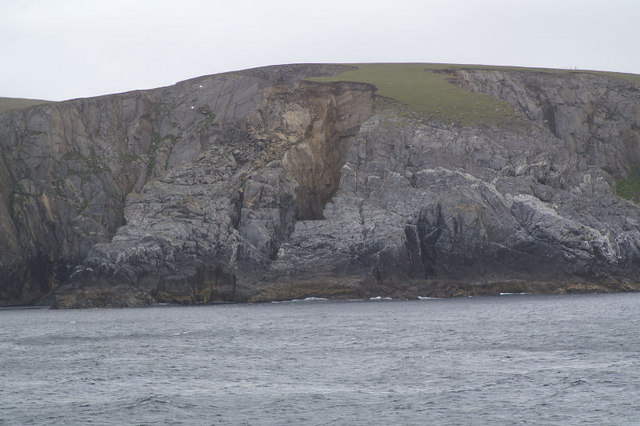
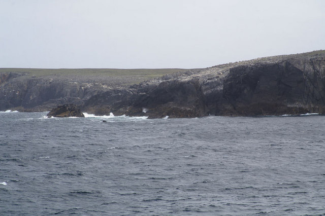
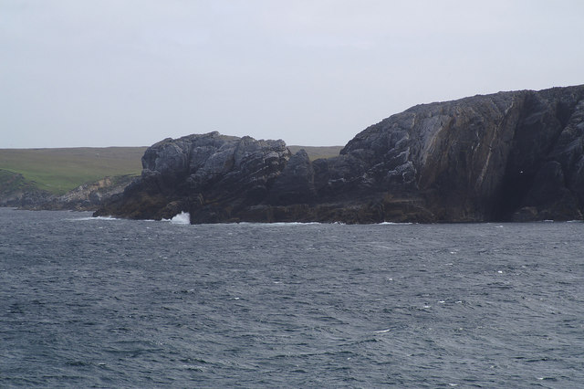
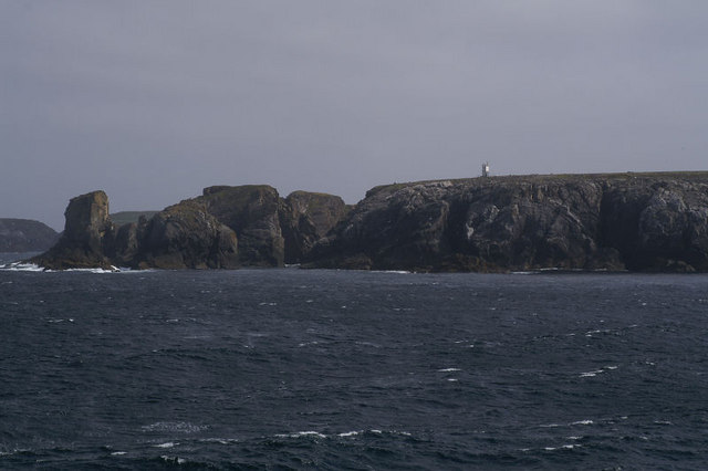
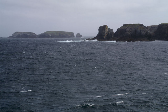
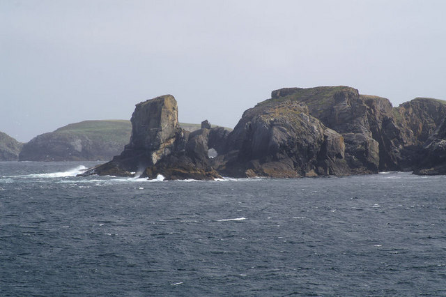
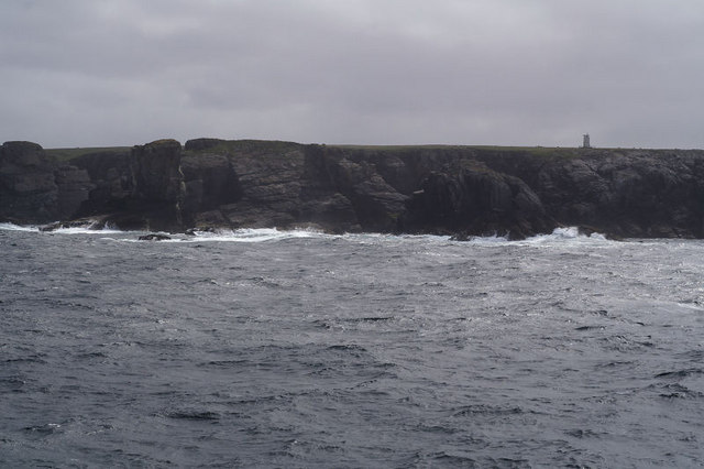
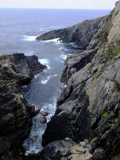
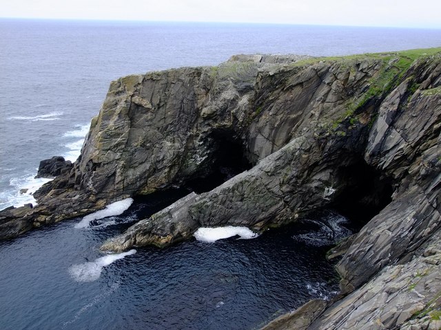
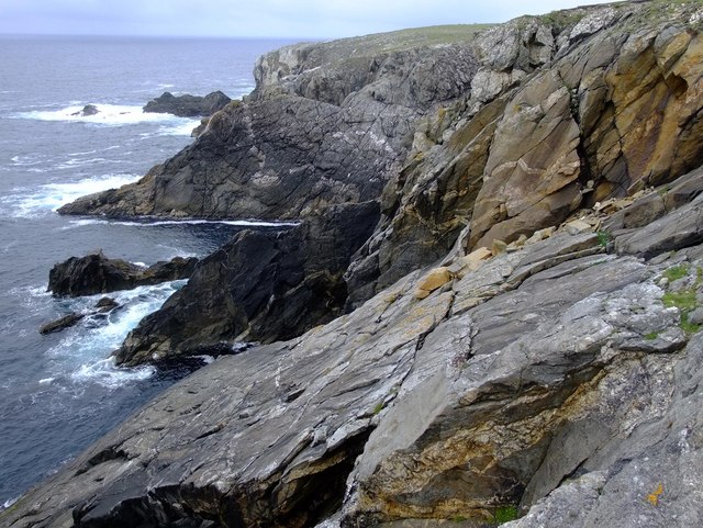
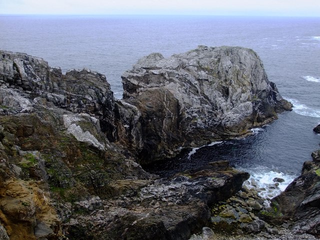
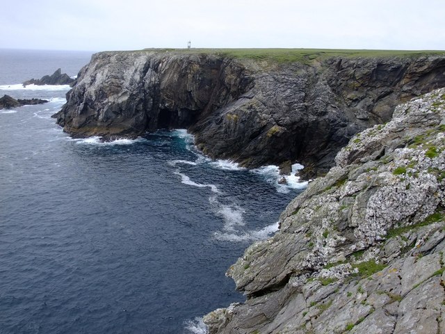
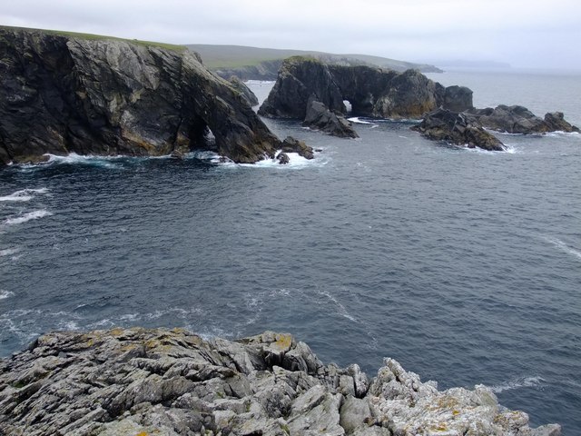
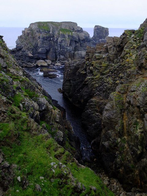
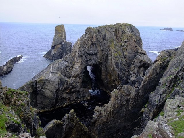
Eegittle is a small coastal headland located in the Shetland Islands, Scotland. Situated on the northernmost point of the mainland, it is known for its stunning natural beauty and rugged cliffs that overlook the North Sea.

This headland is characterized by its distinctive geological formations, with layers of sedimentary rock exposed along its cliffs. These rock formations provide a fascinating insight into the region's geological history, showcasing the effects of erosion and tectonic activity over millions of years.

Eegittle is a popular spot for birdwatching enthusiasts, as it serves as a nesting site for various seabird species, including puffins, guillemots, and razorbills. Visitors can often spot these birds perched on the ledges of the cliffs or flying above the crashing waves. The headland's location also makes it an ideal vantage point for observing marine wildlife, such as seals and dolphins, as they navigate the surrounding waters.

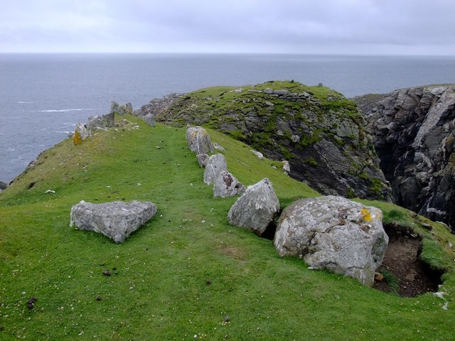
The headland offers breathtaking panoramic views of the surrounding coastline, with its sweeping vistas of rugged cliffs, sandy beaches, and turquoise waters. On a clear day, it is even possible to spot the distant islands of Yell and Unst from Eegittle.

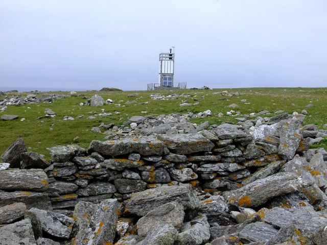
Access to Eegittle is relatively straightforward, with a well-marked footpath leading from the nearby village of Haroldswick. The path takes visitors along the cliff edge, allowing them to fully appreciate the dramatic scenery and natural wonders that Eegittle has to offer.

Overall, Eegittle is a captivating coastal feature that showcases the raw beauty of the Shetland Islands. Its unique geological formations, diverse birdlife, and stunning views make it a must-visit destination for nature lovers and outdoor enthusiasts.

If you have any feedback on the listing, please let us know in the comments section below.

Eegittle Images

Images are sourced within 2km of 60.714486/-1.1278626 or Grid Reference HP4703. Thanks to Geograph Open Source API. All images are credited.

Markamouth Promontory on the Vigon coast. Taken from one of the Yell Sound ferries on a North Isles cruise.
Markamouth
Promontory on the Vigon coast. Taken from one of the Yell Sound ferries on a North Isles cruise.
Swinga Taing Promontory on the north-west coast of Yell. Taken from one of the Yell Sound ferries on a North Isles cruise.
Swinga Taing
Promontory on the north-west coast of Yell. Taken from one of the Yell Sound ferries on a North Isles cruise.
Eegittle Promontory on the north-west coast of Yell. Taken from one of the Yell Sound ferries on a North Isles cruise.
Eegittle
Promontory on the north-west coast of Yell. Taken from one of the Yell Sound ferries on a North Isles cruise.
Coast between Aastack Geo and Bagi Stack The north-west corner of Yell, with the small light on the un-named headland above Bagi stack. The light is misplaced on both 1:50,000 and 1:25,000 maps, but according to Google Earth, magic.defra.gov.uk (and this photo) it is in this square and on this un-named headland. Taken from one of the Yell Sound ferries on a North Isles cruise.
Coast between Aastack Geo and Bagi Stack
The north-west corner of Yell, with the small light on the un-named headland above Bagi stack. The light is misplaced on both 1:50,000 and 1:25,000 maps, but according to Google Earth, magic.defra.gov.uk (and this photo) it is in this square and on this un-named headland. Taken from one of the Yell Sound ferries on a North Isles cruise.
North-west Yell Bagi Stack and, further out on the left, Gloup Holm. Taken from one of the Yell Sound ferries on a North Isles cruise.
North-west Yell
Bagi Stack and, further out on the left, Gloup Holm. Taken from one of the Yell Sound ferries on a North Isles cruise.
Natural arch off the coast of north-west Yell According to the 1:25,000 map, this may be Grey Stack, although the names of the stacks (and the location of the light) are rather obscure. Taken from one of the Yell Sound ferries on a North Isles cruise.
Natural arch off the coast of north-west Yell
According to the 1:25,000 map, this may be Grey Stack, although the names of the stacks (and the location of the light) are rather obscure. Taken from one of the Yell Sound ferries on a North Isles cruise.
Bagi Stack from the north With the small light on the headland beyond. Taken from one of the Yell Sound ferries on a North Isles cruise.
Bagi Stack from the north
With the small light on the headland beyond. Taken from one of the Yell Sound ferries on a North Isles cruise.
Geo south of Swinga Taing
Sea caves, Swinga Taing
Fishing floats, Burn of Blackies Glen An old sheep fank is being used to store these old fishing floats by Burn of Blackies Glen.  However, it will not be so easy to get them out by sea because there is no safe place to land a boat here.  The nearest place is Geo of Vigon, some 1.5 km north of here.
Fishing floats, Burn of Blackies Glen
An old sheep fank is being used to store these old fishing floats by Burn of Blackies Glen. However, it will not be so easy to get them out by sea because there is no safe place to land a boat here. The nearest place is Geo of Vigon, some 1.5 km north of here.
Looking north across Burgi Geos Burgi Geos derive their name from an Iron-Age fort which sits on the peninsula dividing the two geos.
Looking north across Burgi Geos
Burgi Geos derive their name from an Iron-Age fort which sits on the peninsula dividing the two geos.
Iron-age peninsula fort, Burgi Geo The fort is built on a narrow promontory, surrounded on three sides by 50 m cliffs. It dates from approximately 800 BC, and is typical of many Western European promontory forts of this period.  The well-preserved processional "fence" of stones leads to the fortification itself, some of which can be seen on the promontory.  Remains of hut circles have been found within the fortified area, although much of the fort has now collapsed into the sea.
Iron-age peninsula fort, Burgi Geo
The fort is built on a narrow promontory, surrounded on three sides by 50 m cliffs. It dates from approximately 800 BC, and is typical of many Western European promontory forts of this period. The well-preserved processional "fence" of stones leads to the fortification itself, some of which can be seen on the promontory. Remains of hut circles have been found within the fortified area, although much of the fort has now collapsed into the sea.
Eegittle from the east The narrow peninsula of Eegittle is geologically very interesting because it is composed of a rather more sandy type of meta-sediment than elsewhere on the western Yell coast, and it allows for a good understanding of the complexities of the structural geology in the area.  It is also shot through with a number of deformed white granite veins.
Eegittle from the east
The narrow peninsula of Eegittle is geologically very interesting because it is composed of a rather more sandy type of meta-sediment than elsewhere on the western Yell coast, and it allows for a good understanding of the complexities of the structural geology in the area. It is also shot through with a number of deformed white granite veins.
Aastack Geo The geograph for this page in fact covers half of HP4705 and half of HP4704, and should in fact have a supplementary classification.  The light-house is shown at a different location on both the 1:50,000 and 1:25,000 maps, but neither are correct as it is at HP47840496 according to my GPS.
Aastack Geo
The geograph for this page in fact covers half of HP4705 and half of HP4704, and should in fact have a supplementary classification. The light-house is shown at a different location on both the 1:50,000 and 1:25,000 maps, but neither are correct as it is at HP47840496 according to my GPS.
Looking south across Aastack Geo
Bagi Stack Light-house This modern, steel-clad metal framework light-house is not at the position shown on either of the 1:50,000 or 1:25,000 maps, but (according to my GPS) is located at HP47840496.  It flashes 4 times every 20 seconds and has a nominal range of 10 nautical miles.
Bagi Stack Light-house
This modern, steel-clad metal framework light-house is not at the position shown on either of the 1:50,000 or 1:25,000 maps, but (according to my GPS) is located at HP47840496. It flashes 4 times every 20 seconds and has a nominal range of 10 nautical miles.
Grey Stack from Bagi Stack
Bagi Stack, North Neaps The huge boulders between the stack and the mainland are probably the result of the collapse of a sea-arch.
Bagi Stack, North Neaps
The huge boulders between the stack and the mainland are probably the result of the collapse of a sea-arch.
Show me another place!

Eegittle is located at Grid Ref: HP4703 (Lat: 60.714486, Lng: -1.1278626)

Unitary Authority: Shetland Islands

Police Authority: Highlands and Islands

What 3 Words

///dribble.guidebook.votes. Near Gutcher, Shetland Islands

Nearby Locations

Eegittle Burgi Geos

Related Wikis

Gloup

Note: Gloup is common in Scottish placenames referring to a sea jet. Gloup is a village in the far north of the island of Yell in the Shetland Islands...

Gloup Holm

Gloup Holm is an islet in the Shetland Islands, lying to the north of Yell. == Geography and geology == Gloup Holm is near to the part of Yell called North...

Cullivoe

Cullivoe (Old Norse: Kollavágr - Bay of Kolli), is a village on Yell in the Shetland Islands. It is in the north east of the island, near Bluemull Sound...

Ern Stack

Ern Stack is a sea stack off Yell, in Shetland, Scotland. The word "ern" means an eagle (it is a cognate of, for example, Swedish "örn"), and it is said...

Bluemull Sound

Bluemull Sound is the strait between Unst and Yell in Shetland's North Isles. A ferry service crosses it regularly. Cullivoe is on the Yell side, and the...

Gutcher

Gutcher is a settlement on the northeast coast of Yell in the Shetland islands. From here, rollon/roll off ferry services to Belmont on Unst and Hamars...

North Isles

The North Isles are the northern islands of the Shetland Islands, Scotland. The main islands in the group are Yell, Unst and Fetlar. Sometimes the islands...

St Olaf's Church, Unst

St Olaf's Church, Unst is a ruined medieval church located on the island of Unst, in Shetland, Scotland, UK. The church was built in the Celtic style,...

Have you been to Eegittle?

Leave your review of Eegittle below (or comments, questions and feedback).