Elkstone, Lower

Settlement in Staffordshire Staffordshire Moorlands

England

Elkstone, Lower

View from a ruined farm building at Clough Head
View from a ruined farm building at Clough Head Credit: Neil Theasby

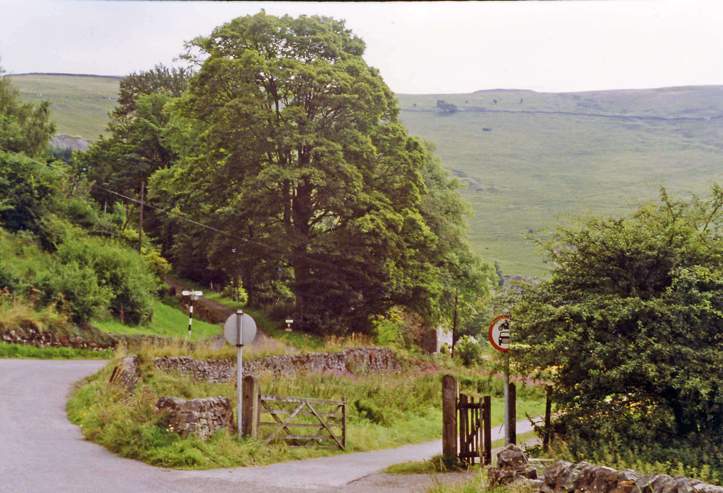
Elkstone is a small village located in the district of Lower Staffordshire, England. Situated in the picturesque Staffordshire Moorlands, the village is nestled amidst rolling hills and lush green countryside. It is situated approximately 5 miles southwest of the town of Leek.

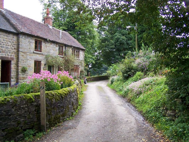
The village of Elkstone boasts a charming and peaceful atmosphere, making it an ideal destination for those seeking a tranquil retreat from the hustle and bustle of city life. The village is characterized by its quaint cottages, many of which date back several centuries, adding to its historical charm.

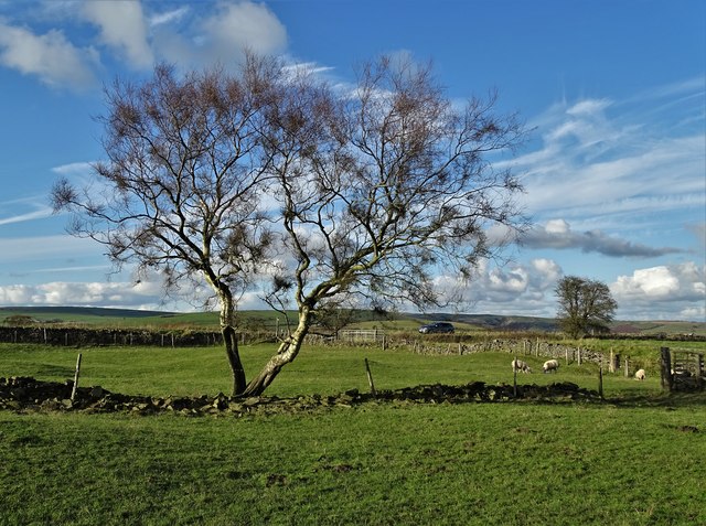
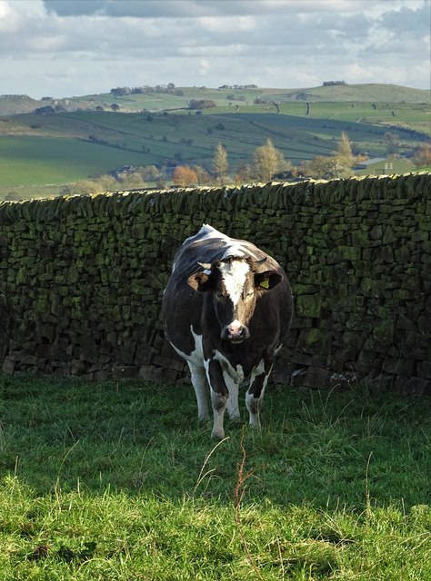
Nature enthusiasts will find themselves in awe of the natural beauty that surrounds Elkstone. The village is surrounded by stunning landscapes, including vast meadows, dense woodlands, and picturesque streams. The nearby Peak District National Park offers ample opportunities for outdoor activities such as hiking, cycling, and wildlife spotting.

Despite its small size, Elkstone is home to a close-knit community that takes pride in its heritage. The village has a local pub, The Elkstone Inn, which serves as a social hub for residents and visitors alike. There are also several community events throughout the year, including a summer fete and a Christmas fair, which bring the community together.

Overall, Elkstone, Lower Staffordshire, is a charming village that offers a serene and idyllic setting for those seeking a peaceful escape. Its natural beauty, rich history, and community spirit make it a hidden gem in the Staffordshire countryside.

If you have any feedback on the listing, please let us know in the comments section below.

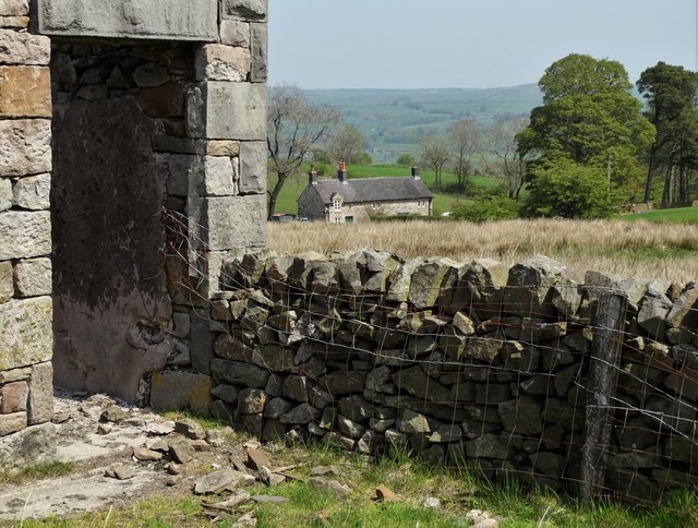
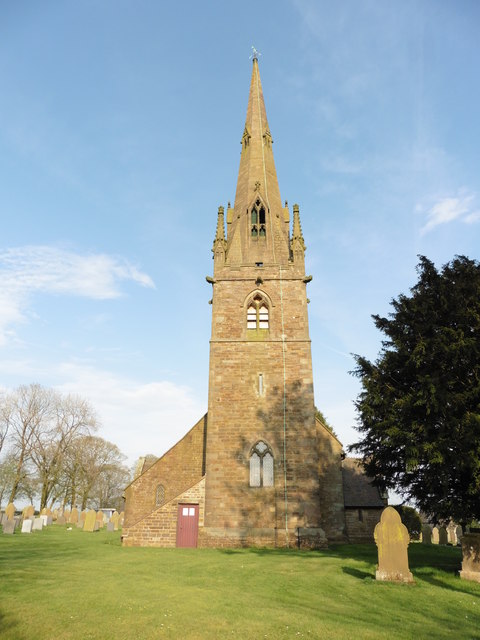
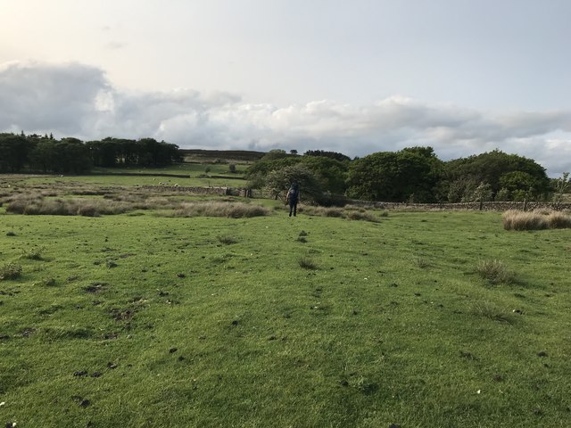
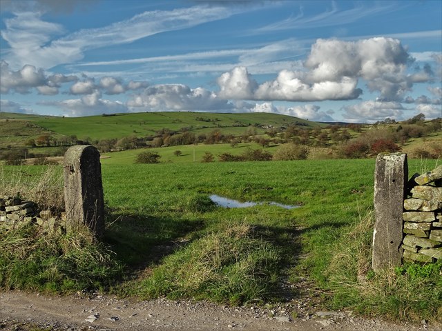
Elkstone, Lower Images

Images are sourced within 2km of 53.120651/-1.905531 or Grid Reference SK0658. Thanks to Geograph Open Source API. All images are credited.

View from a ruined farm building at Clough Head
In a small plantation above Clough Head
Ford at Lower Elkstone This interesting cattle bridge ford is found on the Warslow Brook at Lower Elkstone.
Ford at Lower Elkstone
This interesting cattle bridge ford is found on the Warslow Brook at Lower Elkstone.
Butterton, Staffordshire, St Bartholomew
Old Milepost by the B5053, Warslow Road, Butterton parish Cast iron post by the B5053, in parish of BUTTERTON (STAFFORDSHIRE MOORLANDS District), Warslow Road, Brownlow Bank, 200m Southwest of Brownlow Bridge, on grass in front of hedge, on North side of road. Lathe iron casting, erected by the County Council in the 19th/20th century. 

Inscription reads:-
: WARSLOW 1¼ / LONGNOR 5¼ / BUXTON 11½ : : BUTTERTON : : ONECOTE 2 / IPSTONES 6 / FROGHALL 8 / LEEK 8½ / CHEADLE 11 :
Maker:-
: Chas. Lathe, Tipton. :

Grade II listed.  
List Entry Number: 1188336 <span class="nowrap"><a title="https://historicengland.org.uk/listing/the-list/list-entry/1188336" rel="nofollow ugc noopener" href="https://historicengland.org.uk/listing/the-list/list-entry/1188336">Link</a><img style="margin-left:2px;" alt="External link" title="External link - shift click to open in new window" src="https://s1.geograph.org.uk/img/external.png" width="10" height="10"/></span>

Milestone Society National ID: ST_CDBX11.
Old Milepost by the B5053, Warslow Road, Butterton parish
Cast iron post by the B5053, in parish of BUTTERTON (STAFFORDSHIRE MOORLANDS District), Warslow Road, Brownlow Bank, 200m Southwest of Brownlow Bridge, on grass in front of hedge, on North side of road. Lathe iron casting, erected by the County Council in the 19th/20th century. Inscription reads:- : WARSLOW 1¼ / LONGNOR 5¼ / BUXTON 11½ : : BUTTERTON : : ONECOTE 2 / IPSTONES 6 / FROGHALL 8 / LEEK 8½ / CHEADLE 11 : Maker:- : Chas. Lathe, Tipton. : Grade II listed. List Entry Number: 1188336 LinkExternal link Milestone Society National ID: ST_CDBX11.
Footpath to Revidge Wood Farmland to the north west of Warslow village. Revidge access moorland rises in the middle distance between the plantations.
Footpath to Revidge Wood
Farmland to the north west of Warslow village. Revidge access moorland rises in the middle distance between the plantations.
Road to Warslow Village This road cuts across the south west corner of the grid square here. Warslow village is less than a mile distant.
Road to Warslow Village
This road cuts across the south west corner of the grid square here. Warslow village is less than a mile distant.
View to Brund Hays from Black Brook
Longhorn cow by Farmoor
Staffordshire Countryside Looking north from Far Moor
Staffordshire Countryside
Looking north from Far Moor
Tree near Malbon House Farm
Cow by a wall near Malbon House Farm
Footbridge over The River Hamps
Approaching Black Brook When another Geograph member passed by here in 2011, the farm appeared to be abandoned but it has clearly enjoyed rejuvenation since then:- <a title="https://www.geograph.org.uk/photo/2515522" href="https://www.geograph.org.uk/photo/2515522">Link</a>
Approaching Black Brook
When another Geograph member passed by here in 2011, the farm appeared to be abandoned but it has clearly enjoyed rejuvenation since then:- Link
On the track from Farmoor
View across the Hamps Valley from Mixon
Stoneyfold Lane
Stoneyfold Lane
Farm ruin at Moorside with sheep I put "ruin" rather than "barn" in the title as barns do not normally have chimneys.
Farm ruin at Moorside with sheep
I put "ruin" rather than "barn" in the title as barns do not normally have chimneys.
Show me another place!

Elkstone, Lower is located at Grid Ref: SK0658 (Lat: 53.120651, Lng: -1.905531)

Administrative County: Staffordshire

District: Staffordshire Moorlands

Police Authority: Staffordshire

What 3 Words

///ascendant.manuals.closet. Near Leek, Staffordshire

Related Wikis

Elkstones

Elkstones is a small hamlet in the parish of Warslow and Elkstones, consisting of Upper Elkstone and Lower Elkstone. Situated high in the Staffordshire...

Warslow and Elkstones

Warslow and Elkstones is a civil parish in the district of Staffordshire Moorlands in north-east Staffordshire, England. It includes the village of Warslow...

Butterton

Butterton is a small village in the Staffordshire Peak District of England (grid reference SK075565). It overlooks the Manifold Valley and Ecton Hill,...

St Bartholomew's Church, Butterton

St Bartholomew's Church, Butterton is a Grade II listed parish church in the Church of England in Butterton. == History == St Bartholomew's Church was...

Warslow

Warslow is a small village in Staffordshire, England. It is located in the Peak District National Park about 10 miles (16 km) north of Ashbourne. Although...
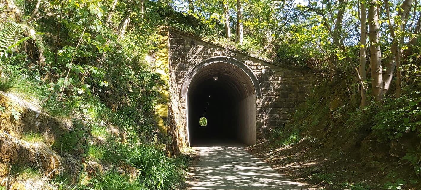
Swainsley Tunnel

Swainsley Tunnel is a tunnel on the route of the former Leek and Manifold Light Railway, which connected the market town of Leek with Hulme End, via Waterhouses...

Butterton railway station

Butterton railway station was a station on the Leek and Manifold Light Railway. It served the village of Butterton in Staffordshire. The site is now part...

Ecton railway station

Ecton railway station was a station on the Leek and Manifold Light Railway. It served the hamlet of Ecton, Staffordshire. Today, the site is now part of...

Nearby Amenities

Located within 500m of 53.120651,-1.905531
Bus Stop
Townhead Farm
Naptan AtcoCode: 3800C810700
Naptan Bearing: SE
Naptan CommonName: Townhead Farm
Naptan Indicator: Adj
Naptan Landmark: Townhead Farm
Naptan Street: Main Rd
Naptan Verified: no
Source: naptan_import
Lat/Long: 53.1232625/-1.9072206
Townhead Farm
Naptan AtcoCode: 3800C810701
Naptan Bearing: W
Naptan BusStopType: CUS
Naptan CommonName: Townhead Farm
Naptan Indicator: Opp
Naptan Landmark: Townhead Farm
Naptan Street: Main Rd
Naptan Verified: no
Source: naptan_import
Lat/Long: 53.1230976/-1.9072765
Barrier: stile
Material: wood
Source: survey;gps
Stile: stepover
Lat/Long: 53.1201659/-1.9035159
Barrier: stile
Material: wood
Source: survey;gps
Stile: stepover
Lat/Long: 53.120188/-1.9035482
Barrier: stile
Material: ss
Source: survey;gps
Stile: squeezer
Lat/Long: 53.1206154/-1.9037671
Barrier: stile
Material: stone
Source: survey;gps
Stile: squeezer
Lat/Long: 53.1206992/-1.9037016
Note: According to OS there is a PROW crossing the river her heading sout east to join the othe PROW. The river has cut out a gully which means the PROW is no longer viable.
Lat/Long: 53.1180633/-1.9051032
Barrier: cattle_grid
Bicycle: yes
Foot: yes
Lat/Long: 53.1190326/-1.9051322
Barrier: cattle_grid
Bicycle: yes
Foot: yes
Lat/Long: 53.1192399/-1.9045929
Barrier: cattle_grid
Bicycle: yes
Foot: yes
Lat/Long: 53.1234483/-1.908395
Townhead
Place: hamlet
Lat/Long: 53.1232652/-1.9081468
Lower Elkstone
Place: hamlet
Lat/Long: 53.120927/-1.9049592
The data included in this document is from www.openstreetmap.org. The data is made available under ODbL.

Have you been to Elkstone, Lower?

Leave your review of Elkstone, Lower below (or comments, questions and feedback).