Orkna Geo

Coastal Feature, Headland, Point in Shetland

Scotland

Orkna Geo

Helli Ness to Bard Head We are at the parking place above Crossie Geo halfway between Lerwick and Sumburgh Head on the mainland of Shetland and I am looking north east across Greenmow and Helli Ness to Bard Head, Bressay. The Isle of Noss can be seen beyond Bressay.
Helli Ness to Bard Head Credit: Carroll Pierce

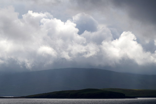
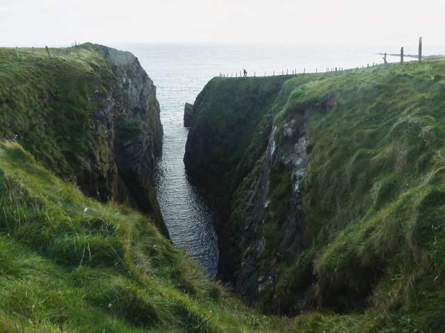
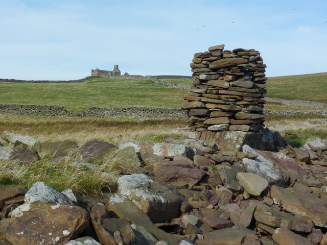
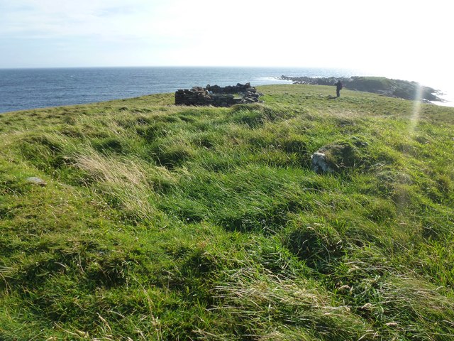
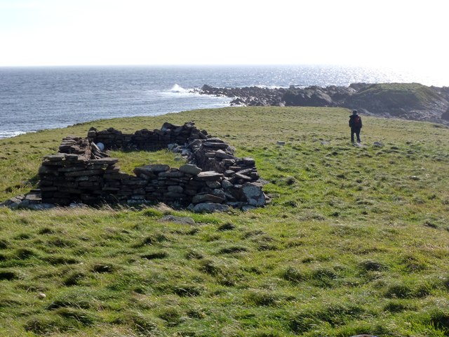
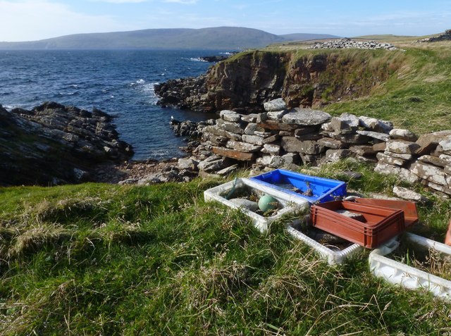
Located on the east coast of the Shetland Islands, Orkna Geo is a prominent coastal feature characterized by its rugged headland and striking cliffs. Situated near the village of Vidlin, this geological formation is known for its stunning views and unique rock formations.

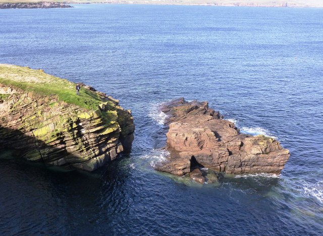
Orkna Geo is primarily composed of sedimentary rocks, including sandstone and shale, which have been shaped by thousands of years of erosion from the relentless North Sea. The cliffs at Orkna Geo rise to an impressive height of approximately 60 meters, providing visitors with a dramatic panorama of the surrounding coastline.

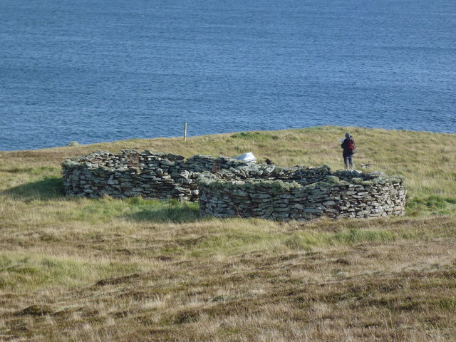
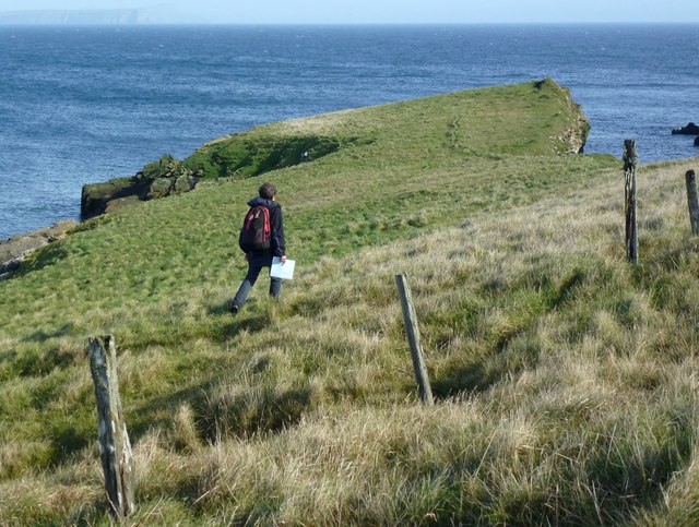
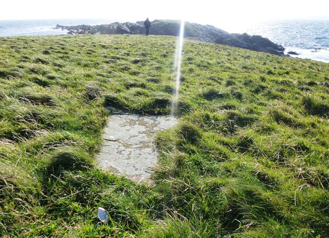
The headland is accessible through a network of walking trails that wind their way along the cliff tops, offering visitors the opportunity to explore the area and take in the breathtaking vistas. The trails are well-maintained and provide safe access to various viewpoints, allowing visitors to witness the power of the ocean waves crashing against the cliffs.

The area surrounding Orkna Geo is rich in wildlife, with numerous seabirds including puffins, guillemots, and fulmars nesting on the cliffs. The coastal waters are also home to various marine species, such as seals and dolphins, which can often be spotted from the headland.

Orkna Geo is a popular destination for outdoor enthusiasts and photographers, who are drawn to its natural beauty and striking geological features. Its remote location and unspoiled surroundings make it an ideal spot for those seeking a peaceful and scenic escape.

If you have any feedback on the listing, please let us know in the comments section below.

Orkna Geo Images

Images are sourced within 2km of 60.03949/-1.1741114 or Grid Reference HU4628. Thanks to Geograph Open Source API. All images are credited.

Helli Ness to Bard Head We are at the parking place above Crossie Geo halfway between Lerwick and Sumburgh Head on the mainland of Shetland and I am looking north east across Greenmow and Helli Ness to Bard Head, Bressay. The Isle of Noss can be seen beyond Bressay.
Helli Ness to Bard Head
We are at the parking place above Crossie Geo halfway between Lerwick and Sumburgh Head on the mainland of Shetland and I am looking north east across Greenmow and Helli Ness to Bard Head, Bressay. The Isle of Noss can be seen beyond Bressay.
Greenmow and Helli Ness, Cunningsburgh, from the air
Helli Ness, Cunningsburgh, from the air
Helli Ness, Cunningsburgh, from the sea Taken from the ferry en route to Orkney, from about 3 km distance.
Helli Ness, Cunningsburgh, from the sea
Taken from the ferry en route to Orkney, from about 3 km distance.
Aithsvoe Marina A very nice facility, built in 2004, still looking new.
The biggish boat off the water is the Mousa Ferry (Solan IV); both it <a href="https://www.geograph.org.uk/photo/1180671">HU4428 : Mousa ferry at winter home, Aithsvoe, Cunningsburgh</a> and the ferry business is up for sale (2011)
Aithsvoe Marina
A very nice facility, built in 2004, still looking new. The biggish boat off the water is the Mousa Ferry (Solan IV); both it HU4428 : Mousa ferry at winter home, Aithsvoe, Cunningsburgh and the ferry business is up for sale (2011)
Planticrubs Turri Ness These, usually round, structures are to be found all over Shetland.
The near one, in this case, is still in use (few are).
Traditionally used for growing Kale or Cabbages in shelter and protected from rabbits and livestock.
In this case all but a few red cabbage seedlings had been recently removed.
Nice old pictures here - <span class="nowrap"><a title="http://shetlopedia.com/Planticrubs" rel="nofollow ugc noopener" href="http://shetlopedia.com/Planticrubs">Link</a><img style="margin-left:2px;" alt="External link" title="External link - shift click to open in new window" src="https://s1.geograph.org.uk/img/external.png" width="10" height="10"/></span>
Planticrubs Turri Ness
These, usually round, structures are to be found all over Shetland. The near one, in this case, is still in use (few are). Traditionally used for growing Kale or Cabbages in shelter and protected from rabbits and livestock. In this case all but a few red cabbage seedlings had been recently removed. Nice old pictures here - LinkExternal link
Shetland Crub The Planticrub <a href="https://www.geograph.org.uk/photo/2622576">HU4529 : Planticrubs Turri Ness</a> here is in use. It is totally closed off to protect the cabbage plants.
Dot stands on the step used for access.
The tanker Loch Rannoch sits way out, biding her time.
Shetland Crub
The Planticrub HU4529 : Planticrubs Turri Ness here is in use. It is totally closed off to protect the cabbage plants. Dot stands on the step used for access. The tanker Loch Rannoch sits way out, biding her time.
Hellia A small peninsula in Uxna Geo reaching into another grid square
Hellia
A small peninsula in Uxna Geo reaching into another grid square
Uxna Geo The tip of Hellia just in the square
Uxna Geo
The tip of Hellia just in the square
Orkna Geo A narrow dark place, full of seal sound today - dramatic on a wild night I bet.
Orkna Geo
A narrow dark place, full of seal sound today - dramatic on a wild night I bet.
Heliport or Helliness? We weren't expecting aircraft of course but what we did find was nice and very interesting <a href="https://www.geograph.org.uk/photo/2628093">HU4528 : Helliness or Heliport</a>.
A little more here <span class="nowrap"><a title="http://shetlopedia.com/Helli_Ness" rel="nofollow ugc noopener" href="http://shetlopedia.com/Helli_Ness">Link</a><img style="margin-left:2px;" alt="External link" title="External link - shift click to open in new window" src="https://s1.geograph.org.uk/img/external.png" width="10" height="10"/></span>
Heliport or Helliness?
We weren't expecting aircraft of course but what we did find was nice and very interesting HU4528 : Helliness or Heliport. A little more here LinkExternal link
Helliness or Heliport The inside of the house mapped as Heliport but known as the House of Helliness - a strange anomaly.
However, it is rather interesting architecturally as well as archaeologically.
See <a href="https://www.geograph.org.uk/photo/2628082">HU4528 : Heliport or Helliness?</a>
Helliness or Heliport
The inside of the house mapped as Heliport but known as the House of Helliness - a strange anomaly. However, it is rather interesting architecturally as well as archaeologically. See HU4528 : Heliport or Helliness?
The House of Helliness The house, mapped as Heliport, but more widely known as Helliness is very prominent. It is surrounded and protected by substantial walling.
See also - <a href="https://www.geograph.org.uk/photo/2628082">HU4528 : Heliport or Helliness?</a>
The House of Helliness
The house, mapped as Heliport, but more widely known as Helliness is very prominent. It is surrounded and protected by substantial walling. See also - HU4528 : Heliport or Helliness?
Helliness Cairn Probably an old landing cairn, marking a fairly safe approach from the sea. But it would have to be pretty calm.
Heliport <a href="https://www.geograph.org.uk/photo/2628082">HU4528 : Heliport or Helliness?</a> is on the hill behind.
Helliness Cairn
Probably an old landing cairn, marking a fairly safe approach from the sea. But it would have to be pretty calm. Heliport HU4528 : Heliport or Helliness? is on the hill behind.
Very Old Structure - Taing of Helliness A few metres to the NW of the mapped structure <a href="https://www.geograph.org.uk/photo/2632629">HU4628 : Marked Structure - Taing of Helliness</a> is a faint outline of a much older one - it looks like a dwelling.
Viewed on Google Earth, there is even another feature, very close-by and circular.
I had the feeling there was a lot of archaeology here.
Very Old Structure - Taing of Helliness
A few metres to the NW of the mapped structure HU4628 : Marked Structure - Taing of Helliness is a faint outline of a much older one - it looks like a dwelling. Viewed on Google Earth, there is even another feature, very close-by and circular. I had the feeling there was a lot of archaeology here.
Marked Structure - Taing of Helliness The obvious feature may have been a crub or a lambing enclosure.
It's likely that the stone was robbed from the nearby unmarked feature <a href="https://www.geograph.org.uk/photo/2632614">HU4628 : Very Old Structure - Taing of Helliness</a>
Marked Structure - Taing of Helliness
The obvious feature may have been a crub or a lambing enclosure. It's likely that the stone was robbed from the nearby unmarked feature HU4628 : Very Old Structure - Taing of Helliness
Uncanny Paver There is an interesting line of well spaced flat pavers reaching from the structure <a href="https://www.geograph.org.uk/photo/2632629">HU4628 : Marked Structure - Taing of Helliness</a> to the very point of the Taing.
They are so obviously placed there for a purpose. I do not think they were ever standing stones.
Uncanny Paver
There is an interesting line of well spaced flat pavers reaching from the structure HU4628 : Marked Structure - Taing of Helliness to the very point of the Taing. They are so obviously placed there for a purpose. I do not think they were ever standing stones.
Hoe Geo - Helliness Cletts The livestock wall terminates in the geo.
Fish boxes had been collected by a previous visitor.
Hoe Geo - Helliness Cletts
The livestock wall terminates in the geo. Fish boxes had been collected by a previous visitor.
Show me another place!

Orkna Geo is located at Grid Ref: HU4628 (Lat: 60.03949, Lng: -1.1741114)

Unitary Authority: Shetland Islands

Police Authority: Highlands and Islands

What 3 Words

///grain.stockpile.epic. Near Sandwick, Shetland Islands

Related Wikis

Aithsetter

Aithsetter (Old Norse: EiĆ°seti, meaning "the farm at the isthmus") is a village on the island of Mainland, in Shetland, Scotland. Aithsetter is in the...

Mail, Shetland

Mail is a hamlet on the island of Mainland, in the Shetland Islands, Scotland. == Geography == Mail is located on the south-eastern side of the island...

Bremirehoull

Bremirehoull is a settlement on the island of Mainland, in Shetland, Scotland. Bremirehoull is situated on the A970 in the Cunningsburgh area. == References... ==

Cunningsburgh

Cunningsburgh, formerly also known as Coningsburgh (Old Norse: Konungsborgr meaning "King's castle"), is a new hamlet and ancient parish in the south of...

Catpund

Catpund is a quarry site in Shetland, Scotland, where steatite vessels were cut from the rock from prehistory onwards. The quarrying marks are still visible...

Mousa

Mousa (Old Norse: Mosey "moss island") is a small island in Shetland, Scotland, uninhabited since the nineteenth century. The island is known for the...

Peerie Bard

Perie Bard is one of the Shetland Islands. It is a small islet off the east coast of the island of Mousa.Although named 'Perie Bard' on OS Maps, the name...

Broch of Mousa

Broch of Mousa (or Mousa Broch) is a preserved Iron Age broch or round tower. It is on the island of Mousa in Shetland, Scotland. It is the tallest broch...

Nearby Amenities

Located within 500m of 60.03949,-1.1741114
Man Made: survey_point
Lat/Long: 60.0405863/-1.1742804
The data included in this document is from www.openstreetmap.org. The data is made available under ODbL.

Have you been to Orkna Geo?

Leave your review of Orkna Geo below (or comments, questions and feedback).