Skersund

Coastal Feature, Headland, Point in Shetland

Scotland

Skersund

Setter, Gulberwick
Setter, Gulberwick Credit: Mike Pennington

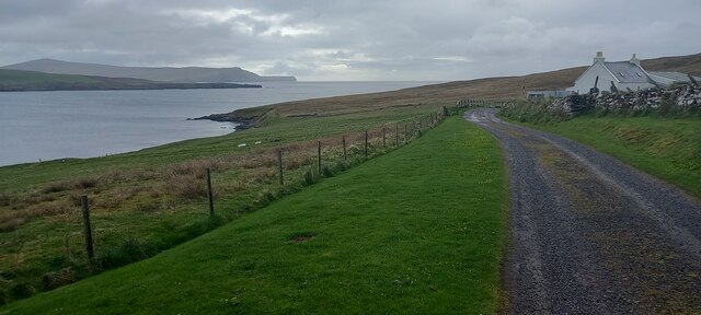
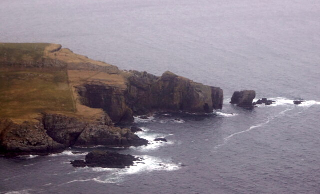
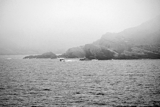
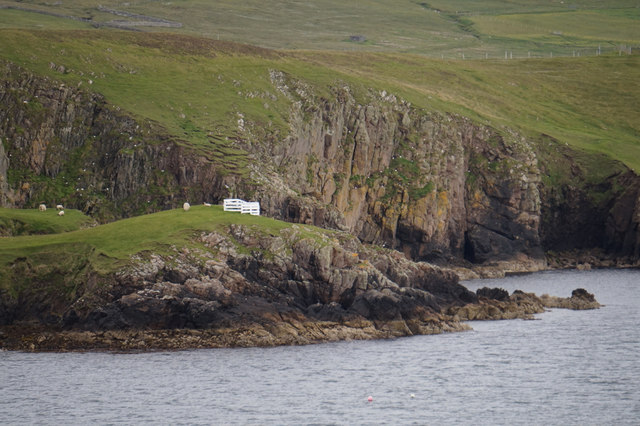
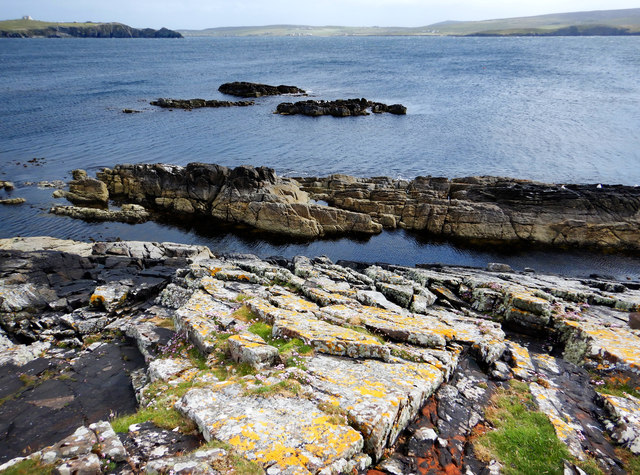
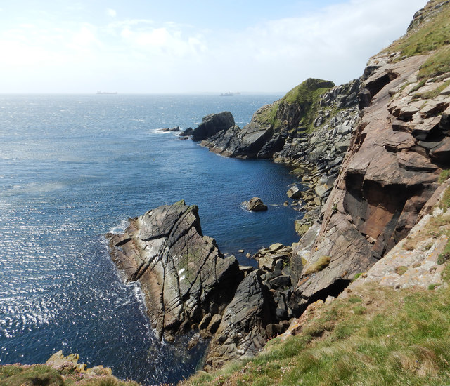
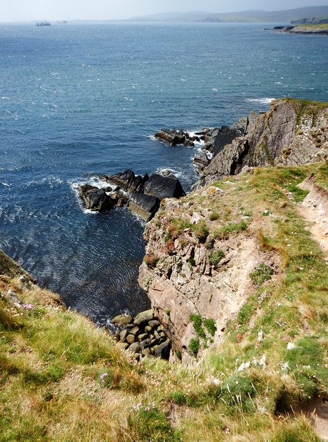
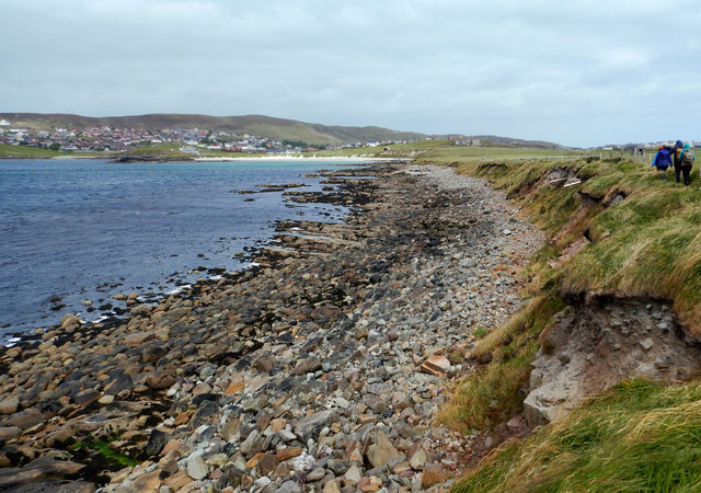
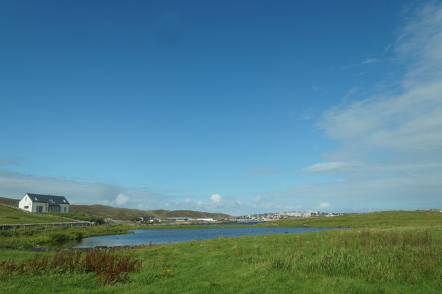
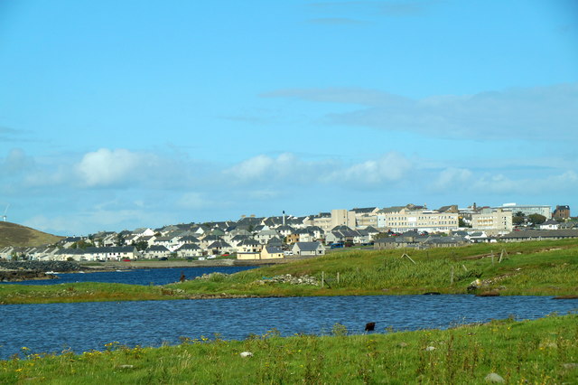
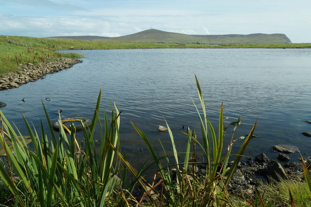
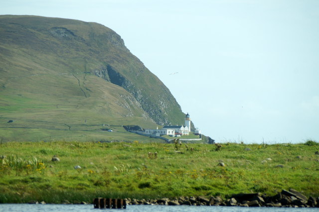
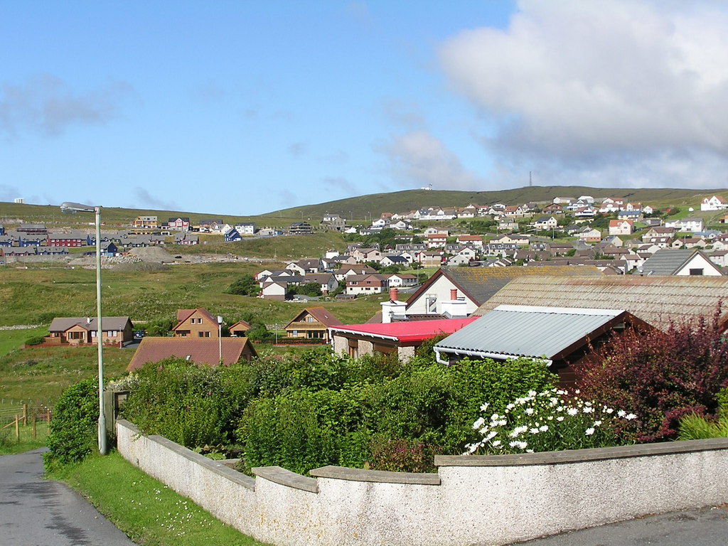
Skersund is a prominent coastal feature located on the Shetland Islands in Scotland. It is a headland that extends into the North Sea, forming a distinct point along the rugged coastline. Skersund is known for its dramatic cliffs and rocky terrain, which provide breathtaking views of the surrounding landscape.

The headland is characterized by its steep slopes and jagged cliffs, reaching heights of up to 100 meters in some areas. These cliffs are composed of layers of sedimentary rock, displaying a variety of colors and textures that add to the visual appeal of Skersund.

The area surrounding Skersund is rich in biodiversity, with numerous seabird colonies nesting along the cliffs. Species such as puffins, guillemots, and fulmars can be spotted here, making it a popular destination for birdwatchers and nature enthusiasts.

Skersund also holds historical significance, as it is believed to have been a strategic location for Viking settlements in the past. Archaeological evidence, such as artifacts and ruins, have been discovered in the vicinity, further adding to the area's allure.

Access to Skersund is primarily by foot, with a coastal path leading visitors to the headland. The path offers stunning panoramic views of the surrounding coastline and is a popular route for hikers and walkers. It is advised to take caution when navigating the cliffs, as they can be slippery and unstable.

Overall, Skersund is a picturesque and historically significant coastal feature, offering visitors a glimpse into the natural beauty and cultural heritage of the Shetland Islands.

If you have any feedback on the listing, please let us know in the comments section below.

Skersund Images

Images are sourced within 2km of 60.12665/-1.173747 or Grid Reference HU4638. Thanks to Geograph Open Source API. All images are credited.

Setter, Gulberwick
Setter, Gulberwick
Pullar's Loch, Sound, from the air
Ness of Sound, Lerwick, from the air
Ness of Sound from the air
Gulberwick from the air
Marine activity in Gulber Wick A reminder that despite the problems in the oil industry there is still activity in Shetland's waters.
Marine activity in Gulber Wick
A reminder that despite the problems in the oil industry there is still activity in Shetland's waters.
Small boat off Ness of Sound Taken from the Knab in Lerwick.
Small boat off Ness of Sound
Taken from the Knab in Lerwick.
Cuddie Sound Passing Ness of Sound as the mist falls.
Cuddie Sound
Passing Ness of Sound as the mist falls.
Ruggen, Ness of Sound Taken from the Marco Polo cruise ship on the way out of Lerwick.
Ruggen, Ness of Sound
Taken from the Marco Polo cruise ship on the way out of Lerwick.
Skerries on east side of Ness of Sound The gently dipping Middle Old Red Sandstone of east Mainland produces skerries with a steep side facing the shore of Ness of Sound, and a slope off into the waters of Brei Wick. This makes them easy for seals to haul out on the seaward side, and slide quickly away from the shore if disturbed, though the ones we saw had chosen a boulder beach a little way north where they seemed better camouflaged. Perhaps the less visible ones remained while ones here had already departed before we got to them ! There certainly seeme to be seal heads popping up all along the shore of Brei Wick, watching the people passing by.

In the distance in this view is Bressay Sound, overlooked by Lerwick on the left (with the prominent coastguard building on the hilltop) and Bressay on the right.
Skerries on east side of Ness of Sound
The gently dipping Middle Old Red Sandstone of east Mainland produces skerries with a steep side facing the shore of Ness of Sound, and a slope off into the waters of Brei Wick. This makes them easy for seals to haul out on the seaward side, and slide quickly away from the shore if disturbed, though the ones we saw had chosen a boulder beach a little way north where they seemed better camouflaged. Perhaps the less visible ones remained while ones here had already departed before we got to them ! There certainly seeme to be seal heads popping up all along the shore of Brei Wick, watching the people passing by. In the distance in this view is Bressay Sound, overlooked by Lerwick on the left (with the prominent coastguard building on the hilltop) and Bressay on the right.
Ruggen - the end of Ness of Sound Although the sea looks calm from this height on the Ness of Sound circular path, we'd just had a very lumpy crossing from mainland Scotland, and the view includes lots of ships taking shelter on the lee side of Shetland's long southern peninsula towards Sumburgh Head. The strong westerly had moderated a little from its overnight peak of 7-8, but was still perhaps a little gusty for cliff top walking, but at least the sun was shining. The Devonian Middle Old Red Sandstone beds (typical of east Mainland) are here dipping quite steeply to the east, producing rather pointy skerries, and less than confidence-inspiring cliff edges where they face east into Brei Wick.
Ruggen - the end of Ness of Sound
Although the sea looks calm from this height on the Ness of Sound circular path, we'd just had a very lumpy crossing from mainland Scotland, and the view includes lots of ships taking shelter on the lee side of Shetland's long southern peninsula towards Sumburgh Head. The strong westerly had moderated a little from its overnight peak of 7-8, but was still perhaps a little gusty for cliff top walking, but at least the sun was shining. The Devonian Middle Old Red Sandstone beds (typical of east Mainland) are here dipping quite steeply to the east, producing rather pointy skerries, and less than confidence-inspiring cliff edges where they face east into Brei Wick.
The southwestern tip of Ness of Sound Steeply dipping sandstones of Devonian age (Middle Old Red Sandstone) produce quite pointy skerries and smooth east-facing cliff faces here at the very end of Ness of Sound, west of Ruggen. Although Voe of Sound and the sea to our south are protected from the big westerly swells, white foam on the wave tops shows that there is quite a strong and gusty wind blowing (we'd had a pretty lumpy crossing from mainland Scotland overnight). There are numerous ships in the background of this view, all taking shelter in the lee of Shetland's long southern peninsula - anchored with their bows facing the coast and close in to minimise the fetch.
The southwestern tip of Ness of Sound
Steeply dipping sandstones of Devonian age (Middle Old Red Sandstone) produce quite pointy skerries and smooth east-facing cliff faces here at the very end of Ness of Sound, west of Ruggen. Although Voe of Sound and the sea to our south are protected from the big westerly swells, white foam on the wave tops shows that there is quite a strong and gusty wind blowing (we'd had a pretty lumpy crossing from mainland Scotland overnight). There are numerous ships in the background of this view, all taking shelter in the lee of Shetland's long southern peninsula - anchored with their bows facing the coast and close in to minimise the fetch.
Voe of Sound This is the low western side of Ness of Sound, with no cliffs and a short drop to the bouldery beach overlooking Voe of Sound. Although the Voe is not very wide, and doesn't have much in the way of waves even in the fresh gusty wind, it is clear that it can get a lot rougher. Much of the shoreline vegetation was blackened by dehydration caused by the salt spray which blows over - anything brave enough to stick up above the surrounding grasses seemed badly affected, particularly the nettles.

To the left (west) of Sands of Sound, the green lump is Holm of Sound, behind which are the houses of Sound and Upper Sound (now westerly suburbs of Lerwick).
Voe of Sound
This is the low western side of Ness of Sound, with no cliffs and a short drop to the bouldery beach overlooking Voe of Sound. Although the Voe is not very wide, and doesn't have much in the way of waves even in the fresh gusty wind, it is clear that it can get a lot rougher. Much of the shoreline vegetation was blackened by dehydration caused by the salt spray which blows over - anything brave enough to stick up above the surrounding grasses seemed badly affected, particularly the nettles. To the left (west) of Sands of Sound, the green lump is Holm of Sound, behind which are the houses of Sound and Upper Sound (now westerly suburbs of Lerwick).
Pullar's Loch, Ness of Sound, Lerwick
Pullar's Loch, Ness of Sound, Lerwick Lerwick, and the Gilbert Bain Hospital, in the background.
Pullar's Loch, Ness of Sound, Lerwick
Lerwick, and the Gilbert Bain Hospital, in the background.
Pullar's Loch, Ness of Sound, Lerwick
Pullar's Loch, Ness of Sound, Lerwick Looking across Bressay Sound to the Bressay lighthouse.
Pullar's Loch, Ness of Sound, Lerwick
Looking across Bressay Sound to the Bressay lighthouse.
Show me another place!

Skersund is located at Grid Ref: HU4638 (Lat: 60.12665, Lng: -1.173747)

Unitary Authority: Shetland Islands

Police Authority: Highlands and Islands

What 3 Words

///racing.paramedic.unit. Near Lerwick, Shetland Islands

Related Wikis

Lerwick Observatory

Lerwick Observatory (also known as Lerwick Magnetic Observatory) is a British meteorological observatory located near the port at Lerwick, Shetland Islands...

Sound, Lerwick

Sound is an area situated to the south-west of central Lerwick, the capital of Shetland, Scotland.Sound is home to a primary school, public hall, and gospel...

Gulberwick

Gulberwick is a village on Mainland, 2.5 mi (4 km) southwest of Lerwick, Shetland, Scotland, which contains approximately 200 houses. In recent years the...
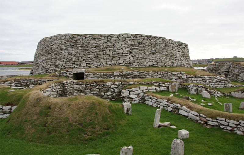
Broch of Clickimin

The Broch of Clickimin (also Clickimin or Clickhimin Broch) is a large, well-preserved but restored broch in Lerwick, Shetland, Scotland (grid reference...

Brindister, South Mainland

Brindister is a village on South Mainland in Shetland, Scotland. Brindister is within the parish of Lerwick, and adjacent to the A970 south of Gulberwick...

Clickimin Loch

Clickimin Loch is a loch in Shetland, Scotland, west of Lerwick. A Pictish fort from the 6th century called Clickimin Broch is located on a small islet...

Gilbert Bain Hospital

The Gilbert Bain Hospital is a rural general hospital in the burgh of Lerwick, Shetland, Scotland. It is managed by NHS Shetland. == History == The hospital...

Anderson High School, Lerwick

The Anderson High School (AHS) is a comprehensive secondary school in Lerwick, Shetland, Scotland. The AHS is the largest school in Shetland with around...

Have you been to Skersund?

Leave your review of Skersund below (or comments, questions and feedback).