Busiers Holes

Coastal Feature, Headland, Point in Durham

England

Busiers Holes

Hawthorn Burn The burn seen deep in Hawthorn Dene.
Hawthorn Burn Credit: David Robinson

Busiers Holes is a prominent coastal feature located in Durham, England. It is widely recognized as a headland and point on the coast, attracting both locals and tourists alike due to its natural beauty and unique geological characteristics.

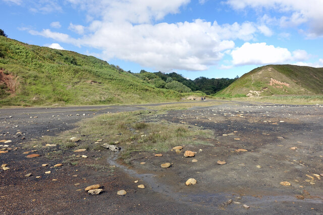
Situated along the Durham Heritage Coast, Busiers Holes offers breathtaking views of the North Sea and the surrounding coastline. The headland is composed of rugged cliffs that rise dramatically from the sea, creating an impressive sight. These cliffs are made up of layers of sedimentary rock, showcasing the area's geological history and providing a valuable resource for researchers and geologists.

One of the distinctive features of Busiers Holes is the presence of several large holes or caves along the cliff face. These holes have been naturally carved out by the relentless pounding of the waves over thousands of years. They vary in size and shape, some forming small caves while others resemble arches or tunnels. These formations not only add to the scenic beauty of the area but also provide habitat for a variety of marine life, including nesting birds and other coastal species.

Visitors to Busiers Holes can enjoy various activities, such as hiking along the coastal path, exploring the caves, or simply taking in the stunning views. It is also a popular spot for birdwatching, as the headland attracts a diverse range of bird species throughout the year.

Overall, Busiers Holes in Durham is a captivating coastal feature that combines natural beauty, geological interest, and diverse wildlife, making it a must-visit destination for nature enthusiasts and those seeking a peaceful escape by the sea.

If you have any feedback on the listing, please let us know in the comments section below.

Busiers Holes Images

Images are sourced within 2km of 54.788569/-1.3109178 or Grid Reference NZ4443. Thanks to Geograph Open Source API. All images are credited.

Hawthorn Burn The burn seen deep in Hawthorn Dene.
Hawthorn Burn
The burn seen deep in Hawthorn Dene.
Hawthorn Dene Viaduct The viaduct carries the Durham Coast railway across Hawthorn Dene. Built in 1905 the viaduct is grade II listed. The railway was once very busy with freight traffic, allowing connection to Tyne Dock, Sunderland docks, Seaham harbour, Hartlepool docks, the Durham coalfield's coastal collieries, and Billingham with the associated petrochemical industries on the North side of the Tees. The line still sees a smattering of freight traffic but is primarily the passenger route linking Newcastle to Middlesbrough via Sunderland, Hartlepool and Stockton, with an hourly service.
Hawthorn Dene Viaduct
The viaduct carries the Durham Coast railway across Hawthorn Dene. Built in 1905 the viaduct is grade II listed. The railway was once very busy with freight traffic, allowing connection to Tyne Dock, Sunderland docks, Seaham harbour, Hartlepool docks, the Durham coalfield's coastal collieries, and Billingham with the associated petrochemical industries on the North side of the Tees. The line still sees a smattering of freight traffic but is primarily the passenger route linking Newcastle to Middlesbrough via Sunderland, Hartlepool and Stockton, with an hourly service.
Hawthorn Burn exiting Hawthorn Dene Several denes run west - east into the North Sea along the Durham coast. They were formed by meltwaters cutting channels through the limestone ridge that runs down the Durham coast.
Hawthorn Burn exiting Hawthorn Dene
Several denes run west - east into the North Sea along the Durham coast. They were formed by meltwaters cutting channels through the limestone ridge that runs down the Durham coast.
Sewage Works
Sewage Works
Easington Miners' Picnic
The Pit Cage Monument, Easington Colliery Standing on the Durham Heritage Coast in the Spring sunshine the monument is a memorial to the colliery which closed in 1993.
See Andrew Curtis's photo for more information <a href="https://www.geograph.org.uk/photo/1578726">NZ4344 : Pit Cage Monument, Easington Colliery</a>
The Pit Cage Monument, Easington Colliery
Standing on the Durham Heritage Coast in the Spring sunshine the monument is a memorial to the colliery which closed in 1993. See Andrew Curtis's photo for more information NZ4344 : Pit Cage Monument, Easington Colliery
Easington Colliery Timeline The path to the Pit Cage Monument <a href="https://www.geograph.org.uk/photo/7156716">NZ4344 : The Pit Cage Monument, Easington Colliery</a> is lined with bronze plaques which record significant events in the history of Easington Colliery which opened in 1899 and closed in 1953.
Easington Colliery Timeline
The path to the Pit Cage Monument NZ4344 : The Pit Cage Monument, Easington Colliery is lined with bronze plaques which record significant events in the history of Easington Colliery which opened in 1899 and closed in 1953.
Byron Street, Easington Colliery Two houses displaying individual taste but to the detriment of the street scene
Byron Street, Easington Colliery
Two houses displaying individual taste but to the detriment of the street scene
Cliff Top View at Fox Holes Part of the Durham Coast National Nature Reserve.
Cliff Top View at Fox Holes
Part of the Durham Coast National Nature Reserve.
Wild Flowers by the Coast Path At Fox Holes Dene a stream has cut a deep chine through the cliffs so the coast path has to make a detour of around 1km to cover less than 200m of coastline. It's a pleasant wooded walk though, very different from the clifftop scenery.
The flowers look like sweet peas and willow herb.
Wild Flowers by the Coast Path
At Fox Holes Dene a stream has cut a deep chine through the cliffs so the coast path has to make a detour of around 1km to cover less than 200m of coastline. It's a pleasant wooded walk though, very different from the clifftop scenery. The flowers look like sweet peas and willow herb.
Coast Path Waymark Just south of the big detour around Fox Holes Dene.
Coast Path Waymark
Just south of the big detour around Fox Holes Dene.
Byron (or Ascot?) Street The map calls it Byron Street. Other contributors call it Byron Street. But there is definitely a street name sign on the end house calling it Ascot Street.
Why would that be? 
It's a very distinctive terrace anyway.
Byron (or Ascot?) Street
The map calls it Byron Street. Other contributors call it Byron Street. But there is definitely a street name sign on the end house calling it Ascot Street. Why would that be? It's a very distinctive terrace anyway.
Station Road, Easington Colliery The main road through the village. The station, like the colliery, is no longer there.
Station Road, Easington Colliery
The main road through the village. The station, like the colliery, is no longer there.
A Low Black Cliff When there were coal mines working nearby they would dump old waste mining rubble onto the beaches along this bit of coast.
Old pictures show it covering a large area but a lot of it has been cleared or washed away. Some still remains and makes a line of low cliffs around a metre high which collapse into the sea at intervals. Large lumps of coal can still be found in the mixture.
A Low Black Cliff
When there were coal mines working nearby they would dump old waste mining rubble onto the beaches along this bit of coast. Old pictures show it covering a large area but a lot of it has been cleared or washed away. Some still remains and makes a line of low cliffs around a metre high which collapse into the sea at intervals. Large lumps of coal can still be found in the mixture.
Mining Waste by the Sea Looking back inland from the edge of the  area shown here <a href="https://www.geograph.org.uk/photo/7273671">NZ4442 : A Low Black Cliff</a> where coal mining debris was dumped onto the beach. Much of it is still bare and inhospitable and naturalists are watching with interest to see what types of plant will gradually start growing here.
Mining Waste by the Sea
Looking back inland from the edge of the area shown here NZ4442 : A Low Black Cliff where coal mining debris was dumped onto the beach. Much of it is still bare and inhospitable and naturalists are watching with interest to see what types of plant will gradually start growing here.
Mine Water Treatment Pond As has been found in many former mining districts, you can't just close a deep mine and forget about it. Once the pumps that drained the workings are turned off, groundwater comes back in and gets polluted. 
The limestone aquifer here supplies clean water to a large area and cannot be allowed to become contaminated.
These ponds contain polluted mine water and are part of the cleaning up process.
Mine Water Treatment Pond
As has been found in many former mining districts, you can't just close a deep mine and forget about it. Once the pumps that drained the workings are turned off, groundwater comes back in and gets polluted. The limestone aquifer here supplies clean water to a large area and cannot be allowed to become contaminated. These ponds contain polluted mine water and are part of the cleaning up process.
Treatment Pond for Mine Water Another picture of one of the ponds which are part of the treatment process for polluted water from a former coal mine.
Treatment Pond for Mine Water
Another picture of one of the ponds which are part of the treatment process for polluted water from a former coal mine.
Explaining the Treatment Ponds An information panel by the ponds where polluted water coming from an old coal mine is treated.
Explaining the Treatment Ponds
An information panel by the ponds where polluted water coming from an old coal mine is treated.
Show me another place!

Busiers Holes is located at Grid Ref: NZ4443 (Lat: 54.788569, Lng: -1.3109178)

Unitary Authority: County Durham

Police Authority: Durham

What 3 Words

///gender.exam.glaze. Near Easington Colliery, Co. Durham

Related Wikis

Easington railway station

Easington railway station served the town of Easington Colliery and Easington Village in County Durham, North East England. It was located on the Durham...
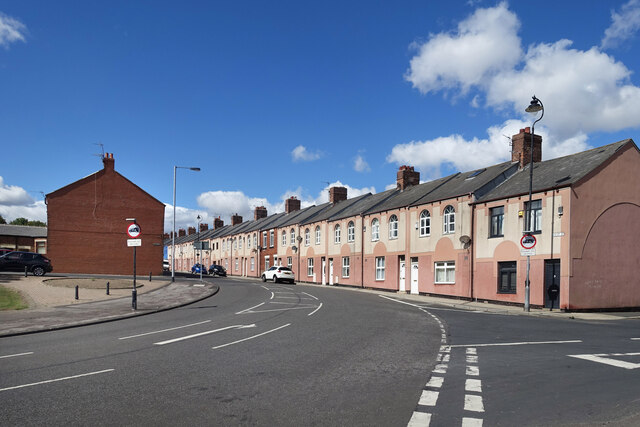
Easington Colliery

Easington Colliery is a town in County Durham, England, known for a history of coal mining. It is situated to the north of Horden, a short distance to...

Easington Colliery A.F.C.

Easington Colliery Association Football Club is a football club based in Easington Colliery, County Durham, England. They are currently members of the...

Hope Wood Academy

54.7898°N 1.3362°W / 54.7898; -1.3362 Hope Wood Academy is an academy based in Easington Colliery, County Durham. The school caters for pupils aged 2...

Hawthorn Dene

Hawthorn Dene is a Site of Special Scientific Interest in the Easington district of County Durham, England. The site occupies the incised valley of Hawthorn...

Horden Colliery

Horden Colliery was a coal mine situated in Horden, near Peterlee in County Durham. == History == It opened in 1900 and was closed on 28 February 1987...

Yoden Village Quarry

Yoden Village Quarry is a Site of Special Scientific Interest in the Easington district of east County Durham, England. It is a disused quarry in the Horden...

Little Thorpe

Little Thorpe is a hamlet in County Durham, England. It is situated between Easington and Peterlee. This small settlement literally derives its name from...

Nearby Amenities

Located within 500m of 54.788569,-1.3109178
Source: PGS
Lat/Long: 54.7861876/-1.308568
Source: PGS
Lat/Long: 54.7864806/-1.3085844
Source: PGS
Lat/Long: 54.7866836/-1.3089054
Source: PGS
Lat/Long: 54.7866893/-1.3092392
Source: PGS
Lat/Long: 54.7883642/-1.3109059
Source: PGS
Lat/Long: 54.7892916/-1.3117552
Source: PGS
Lat/Long: 54.7901119/-1.3121963
Source: PGS
Lat/Long: 54.7911387/-1.3122369
Source: PGS
Lat/Long: 54.7917334/-1.3114024
Bench
Lat/Long: 54.7867322/-1.3105501
Bench
Lat/Long: 54.7848034/-1.3150951
Bench
Lat/Long: 54.7853072/-1.3130036
Bench
Lat/Long: 54.7855474/-1.3108264
Bench
Lat/Long: 54.7858341/-1.3096151
The data included in this document is from www.openstreetmap.org. The data is made available under ODbL.

Have you been to Busiers Holes?

Leave your review of Busiers Holes below (or comments, questions and feedback).