Andrews Crib

Coastal Feature, Headland, Point in Shetland

Scotland

Andrews Crib

Spiggie and Loch of Spiggie
Spiggie and Loch of Spiggie Credit: Mike Pennington

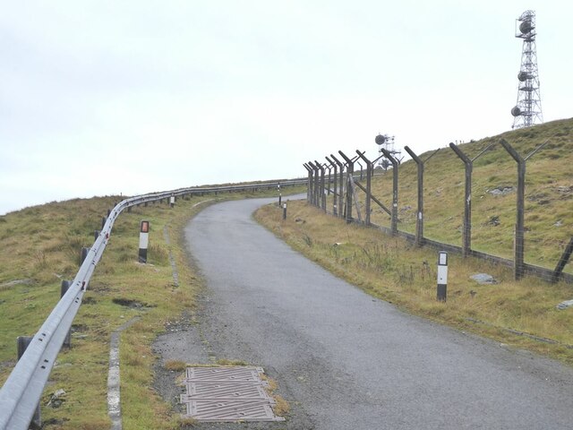
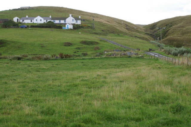
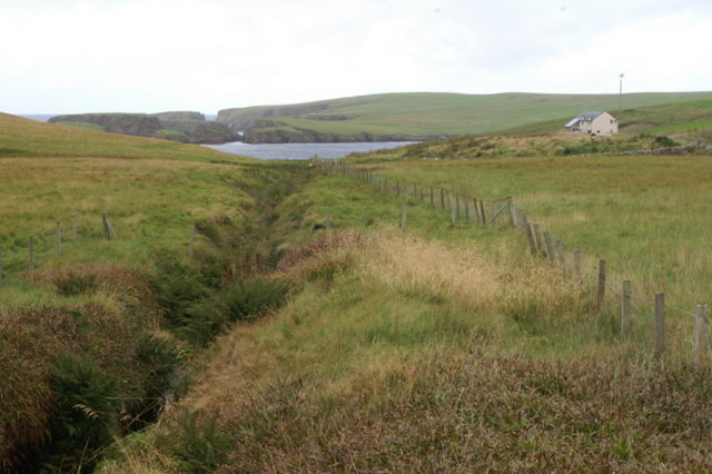
Andrews Crib is a prominent coastal feature located in the Shetland Islands, an archipelago in Scotland, United Kingdom. It is classified as a headland and point, jutting out into the North Sea. This geographical formation is situated on the eastern coast of the main island, known as the Mainland, specifically in the vicinity of the village of Voe.

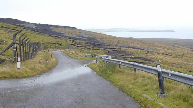
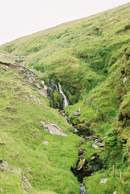
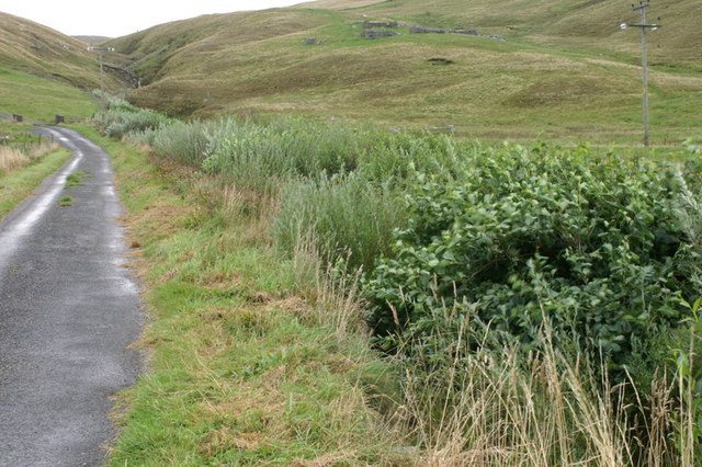
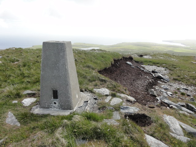
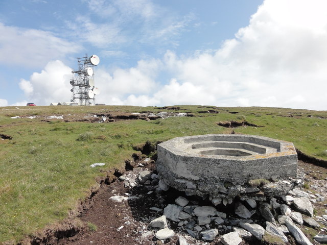
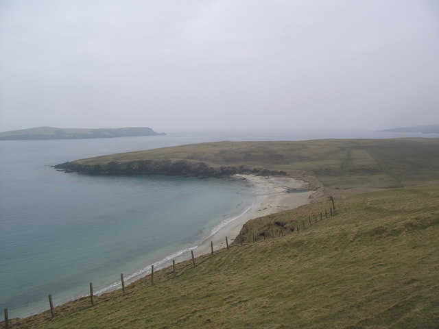
The landscape of Andrews Crib is characterized by rugged cliffs that rise dramatically from the sea, creating a visually striking sight. The headland is composed of sedimentary rocks, displaying layers of sandstone and shale, which have been shaped over centuries by the relentless forces of erosion from wind and waves. These processes have contributed to the creation of caves and sea stacks along the coastline.

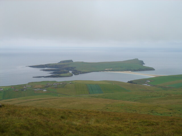
The headland offers breathtaking panoramic views of the surrounding area, including the vast expanse of the North Sea and the neighboring islands. It is a popular spot for nature enthusiasts, hikers, and photographers, who are drawn to its natural beauty and the opportunity to observe a variety of seabirds nesting on the cliffs, such as puffins, guillemots, and fulmars.

The name "Andrews Crib" is believed to have originated from a local legend or historical figure associated with the area, although the exact origins remain uncertain. The site is accessible via a footpath that winds along the coastline, providing visitors with the chance to explore the unique geology and immerse themselves in the captivating coastal scenery of Andrews Crib.

If you have any feedback on the listing, please let us know in the comments section below.

Andrews Crib Images

Images are sourced within 2km of 59.947119/-1.3296333 or Grid Reference HU3718. Thanks to Geograph Open Source API. All images are credited.

Spiggie and Loch of Spiggie
Sand dunes at Sands of Scousburgh
Colsay from the air
Colsay from the air
View from the slopes of the Ward of Scousburgh With a good view of St Ninian's Isle and tombolo <a href="https://www.geograph.org.uk/gridref/HU3620">HU3620</a>.
View from the slopes of the Ward of Scousburgh
With a good view of St Ninian's Isle and tombolo HU3620.
View from the slopes of the Ward of Scousburgh A good view of Scousburgh Bay <a href="https://www.geograph.org.uk/gridref/HU3718">HU3718</a>, Northern Ness and Muckle Sound <a href="https://www.geograph.org.uk/gridref/HU3618">HU3618</a>.
View from the slopes of the Ward of Scousburgh
A good view of Scousburgh Bay HU3718, Northern Ness and Muckle Sound HU3618.
Ward of Scousburgh Telecommunications mast on the summit, served by private road in foreground.
Ward of Scousburgh
Telecommunications mast on the summit, served by private road in foreground.
Private road over Ward of Scousburgh The road was built to service the telecommunications installations on the Ward of Scousburgh. To the left is the derelict fencing enclosing the old site. The active masts are on the summit a short way to the south. Looking north-east down to the eastern coast of Mainland.
Private road over Ward of Scousburgh
The road was built to service the telecommunications installations on the Ward of Scousburgh. To the left is the derelict fencing enclosing the old site. The active masts are on the summit a short way to the south. Looking north-east down to the eastern coast of Mainland.
The slopes of Ward of Scousburgh From the minor road which serves various transmission masts and a former NATO station. Below is St Ninian's Isle and the tombolo which connects it to Shetland Mainland.
The slopes of Ward of Scousburgh
From the minor road which serves various transmission masts and a former NATO station. Below is St Ninian's Isle and the tombolo which connects it to Shetland Mainland.
Burn of Geosetter, near Bigton, Shetland
Geosetter, near Bigton The house sits on the hillside beside the small ravine cut by the eponymous burn.
Geosetter, near Bigton
The house sits on the hillside beside the small ravine cut by the eponymous burn.
Burn of Geosetter, near Bigton This short burn, little more than 2km in length, cuts a small ravine quite disproportionate in size for its length, as it hurries to the sea. For much of its length it has been planted with willows and other bushes, making it an attractive site for migrant birds, and birdwatchers.
Burn of Geosetter, near Bigton
This short burn, little more than 2km in length, cuts a small ravine quite disproportionate in size for its length, as it hurries to the sea. For much of its length it has been planted with willows and other bushes, making it an attractive site for migrant birds, and birdwatchers.
Burn of Geosetter, near Bigton The lower reaches of the burn as it flows into St Ninian's Bay; St Ninian's Isle is in the background. The house is a new addition, not currently on any maps.
Burn of Geosetter, near Bigton
The lower reaches of the burn as it flows into St Ninian's Bay; St Ninian's Isle is in the background. The house is a new addition, not currently on any maps.
Bay of Scousburgh at dusk
Loch of Spiggie at dusk From Scousburgh looking towards Fitful Head.
Loch of Spiggie at dusk
From Scousburgh looking towards Fitful Head.
Communications array Mossy Hill communications array
Communications array
Mossy Hill communications array
Triangulation Station Ordnance Survey triangulation station, TP5851 - Scousburgh.
Triangulation Station
Ordnance Survey triangulation station, TP5851 - Scousburgh.
Concrete gun base Concrete gun base at Ward of Scousburgh
Concrete gun base
Concrete gun base at Ward of Scousburgh
Looking across the Bay of Scousburgh to the Ness of Rerwick
Show me another place!

Andrews Crib is located at Grid Ref: HU3718 (Lat: 59.947119, Lng: -1.3296333)

Unitary Authority: Shetland Islands

Police Authority: Highlands and Islands

What 3 Words

///firepower.mercy.relocated. Near Sandwick, Shetland Islands

Related Wikis

Scousburgh

Scousburgh is a small community in the parish of Dunrossness, in the South Mainland of Shetland, Scotland, overlooking the picturesque Scousburgh Sand...

Colsay

Colsay is an uninhabited island off the South West coast of Mainland, Shetland. Fora Ness lies to the south, across the Muckle Sound. The highest elevation...

Lochs of Spiggie and Brow

The Lochs of Spiggie and Brow are located west of Boddam in the parish of Dunrossness, in the South Mainland of Shetland, Scotland, about 6 km north of...

Dunrossness

Dunrossness, (Old Norse: Dynrastarnes meaning "headland of the loud tide-race", referring to the noise of Sumburgh Roost) is the southernmost parish of...

Clumlie Broch

Clumlie Broch is an Iron Age broch located on Mainland, Shetland, in Scotland (grid reference HU40451811). == Location == Clumlie Broch is located in Dunrossness...

St Ninian's Isle

St Ninian's Isle is a small tied island connected by the largest tombolo in the UK to the south-western coast of the Mainland, Shetland, in Scotland. It...

Bigton

Bigton is a small settlement on South Mainland, Shetland, UK. Bigton is within the civil parish of Dunrossness.Bigton lies on the Atlantic coast of the...

Boddam, Shetland

Boddam is a village on the island of Mainland, in Shetland, Scotland. Boddam is an area of Dunrossness in the South Mainland of Shetland. Although Boddam...

Nearby Amenities

Located within 500m of 59.947119,-1.3296333
Scousburgh
Place: hamlet
Lat/Long: 59.9442654/-1.3262347
Post Box
Brand: Royal Mail
Brand Wikidata: Q638098
Image: https://s0.geograph.org.uk/geophotos/02/65/20/2652059_0f6b20f3.jpg
Mapillary: 131414102878590
Note: Lamp box mounted to side of building
Operator: Royal Mail
Operator Wikidata: Q638098
Post Box Type: lamp
Ref: ZE2 114
Royal Cypher: scottish_crown
Lat/Long: 59.9439381/-1.3263082
Bus Stop
Lat/Long: 59.9437073/-1.3255675
Power: pole
Lat/Long: 59.9513129/-1.3275506
Power: pole
Lat/Long: 59.9505587/-1.3271579
Power: pole
Lat/Long: 59.9498173/-1.3267675
Power: pole
Lat/Long: 59.9493187/-1.3265042
Power: pole
Lat/Long: 59.9487889/-1.3262178
Power: pole
Lat/Long: 59.9481689/-1.3259036
Power: pole
Lat/Long: 59.9475616/-1.3255895
Power: pole
Lat/Long: 59.947115/-1.3253515
Power: pole
Lat/Long: 59.946739/-1.3251459
Power: pole
Lat/Long: 59.9460068/-1.3244599
Power: pole
Lat/Long: 59.9453913/-1.3238731
Power: pole
Lat/Long: 59.9447168/-1.3236237
Power: pole
Lat/Long: 59.9443246/-1.3231778
Power: pole
Lat/Long: 59.9474424/-1.3261669
Power: pole
Lat/Long: 59.9473371/-1.3266705
Power: pole
Lat/Long: 59.946975/-1.3266613
Power: pole
Lat/Long: 59.9466835/-1.3266474
Power: pole
Lat/Long: 59.9452606/-1.3244368
Power: pole
Lat/Long: 59.9450049/-1.325474
Power: pole
Lat/Long: 59.9447434/-1.3265504
Power: pole
Lat/Long: 59.9440134/-1.3271002
Telephone
Booth: K6
Covered: booth
Image: https://s0.geograph.org.uk/geophotos/02/65/20/2652059_0f6b20f3.jpg
Mapillary: 131414102878590
Lat/Long: 59.9438208/-1.326155
The data included in this document is from www.openstreetmap.org. The data is made available under ODbL.

Have you been to Andrews Crib?

Leave your review of Andrews Crib below (or comments, questions and feedback).