Sands of Rerwick

Beach in Shetland

Scotland

Sands of Rerwick

Spiggie and Loch of Spiggie
Spiggie and Loch of Spiggie Credit: Mike Pennington

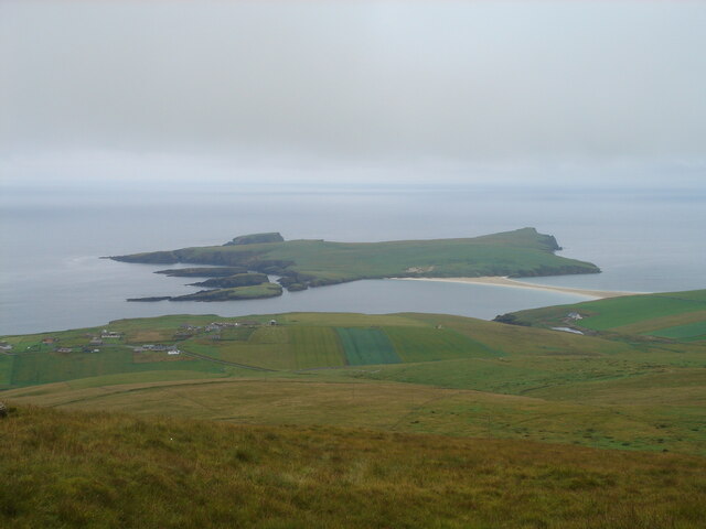
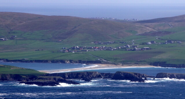
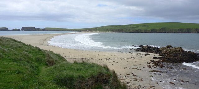
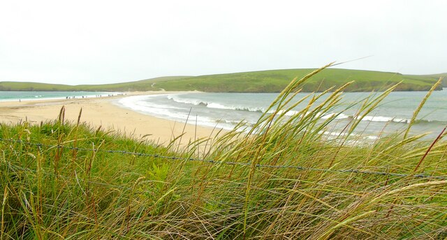
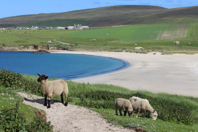
Sands of Rerwick is a picturesque beach located on the remote island of Shetland, Scotland. It is situated on the west coast of the Mainland, the largest island in the Shetland archipelago. With its stunning natural beauty and peaceful ambiance, Sands of Rerwick is a hidden gem that offers visitors a truly tranquil and unspoiled coastal experience.

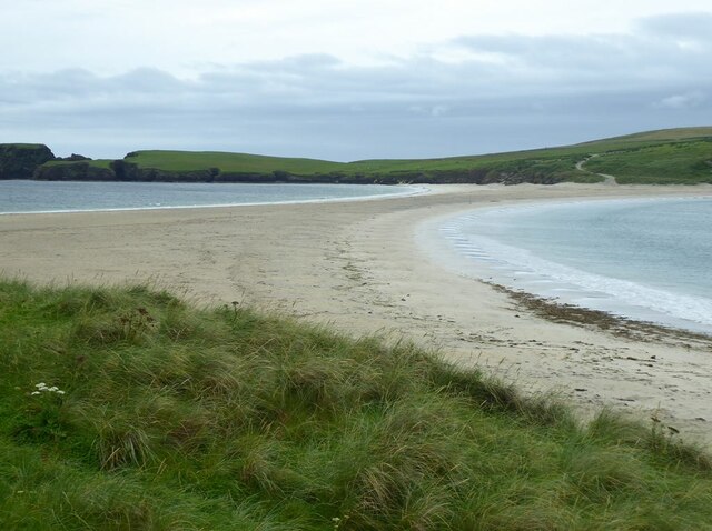
The beach is known for its pristine white sand, which stretches for approximately 1 kilometer (0.6 miles) along the shoreline. The sand is exceptionally fine and soft, making it a perfect spot for leisurely walks, sunbathing, and picnics. The crystal-clear turquoise waters are relatively calm and inviting, making it an ideal swimming spot during the warmer months of the year.

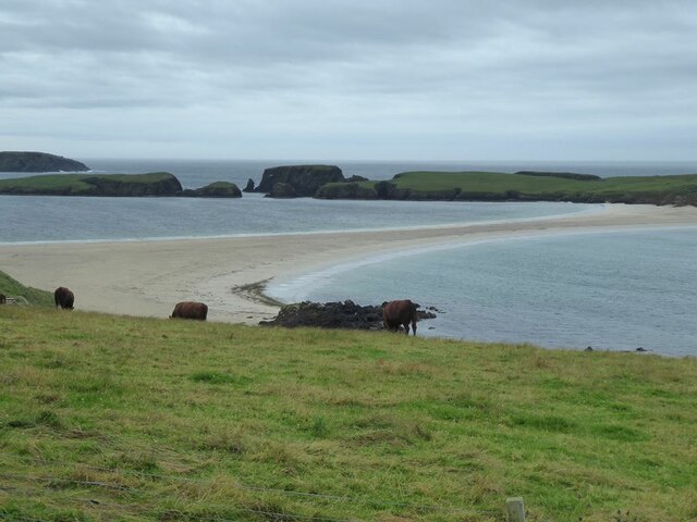
Surrounded by rolling green hills and rugged cliffs, Sands of Rerwick offers breathtaking panoramic views of the surrounding landscape, making it a haven for nature lovers and photographers. The beach is also home to diverse wildlife, including various seabirds, seals, and occasionally, otters.

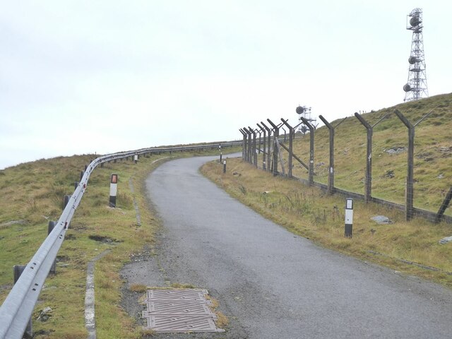
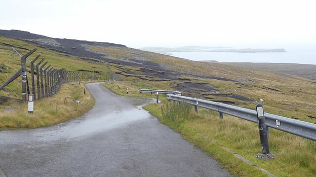
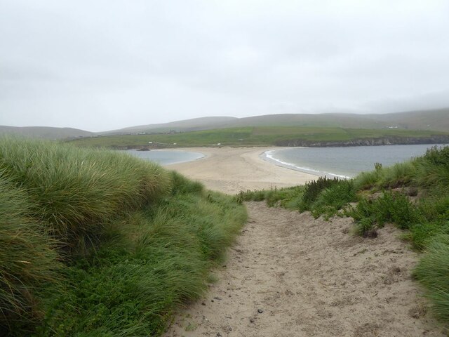
Access to Sands of Rerwick is relatively easy, with a small parking area available nearby. A short walk through the sand dunes leads visitors to the beach, where they can enjoy the peacefulness and serenity of the area. It is important to note that there are no facilities or amenities at Sands of Rerwick, so visitors are advised to come prepared with any necessary supplies.

Overall, Sands of Rerwick is a true hidden treasure, offering visitors a chance to escape the hustle and bustle of everyday life and immerse themselves in the beauty of Shetland's untamed coastline.

If you have any feedback on the listing, please let us know in the comments section below.

Sands of Rerwick Images

Images are sourced within 2km of 59.953301/-1.3304215 or Grid Reference HU3718. Thanks to Geograph Open Source API. All images are credited.

Spiggie and Loch of Spiggie
Sand dunes at Sands of Scousburgh
Colsay from the air
Colsay from the air
View from the slopes of the Ward of Scousburgh With a good view of St Ninian's Isle and tombolo <a href="https://www.geograph.org.uk/gridref/HU3620">HU3620</a>.
View from the slopes of the Ward of Scousburgh
With a good view of St Ninian's Isle and tombolo HU3620.
View from the slopes of the Ward of Scousburgh A good view of Scousburgh Bay <a href="https://www.geograph.org.uk/gridref/HU3718">HU3718</a>, Northern Ness and Muckle Sound <a href="https://www.geograph.org.uk/gridref/HU3618">HU3618</a>.
View from the slopes of the Ward of Scousburgh
A good view of Scousburgh Bay HU3718, Northern Ness and Muckle Sound HU3618.
Ward of Scousburgh Telecommunications mast on the summit, served by private road in foreground.
Ward of Scousburgh
Telecommunications mast on the summit, served by private road in foreground.
Private road over Ward of Scousburgh The road was built to service the telecommunications installations on the Ward of Scousburgh. To the left is the derelict fencing enclosing the old site. The active masts are on the summit a short way to the south. Looking north-east down to the eastern coast of Mainland.
Private road over Ward of Scousburgh
The road was built to service the telecommunications installations on the Ward of Scousburgh. To the left is the derelict fencing enclosing the old site. The active masts are on the summit a short way to the south. Looking north-east down to the eastern coast of Mainland.
The slopes of Ward of Scousburgh From the minor road which serves various transmission masts and a former NATO station. Below is St Ninian's Isle and the tombolo which connects it to Shetland Mainland.
The slopes of Ward of Scousburgh
From the minor road which serves various transmission masts and a former NATO station. Below is St Ninian's Isle and the tombolo which connects it to Shetland Mainland.
St Ninian's Ayre from the air
St Ninian's Ayre
St Ninian's Ayre
St Ninian's Ayre
St Ninian's Ayre
Track on St Ninian's Isle Leading down to the tombolo which ties the island to the mainland.
Track on St Ninian's Isle
Leading down to the tombolo which ties the island to the mainland.
Tombolo linking Mainland to St Ninian's Isle A textbook example of a tombolo. Bigton Wick to the right, St Ninian's Bay to the left.
Tombolo linking Mainland to St Ninian's Isle
A textbook example of a tombolo. Bigton Wick to the right, St Ninian's Bay to the left.
View from Bigton Looking over the tombolo towards St Ninian's Bay and the southern end of St Ninian's Isle.
View from Bigton
Looking over the tombolo towards St Ninian's Bay and the southern end of St Ninian's Isle.
Tombolo at St Ninian's Isle Taken on St Ninian's beach at Bigton, Shetland, I am looking along the tombolo linking the mainland to St Ninian's Isle, site of the remains of St Ninian's Chapel.
Tombolo at St Ninian's Isle
Taken on St Ninian's beach at Bigton, Shetland, I am looking along the tombolo linking the mainland to St Ninian's Isle, site of the remains of St Ninian's Chapel.
St Ninian's Bay I am standing at the mainland end of the tombolo leading to St Ninian's Isle and looking south down St Ninian's Bay towards Inns Holm with Colsay off to the right. Northern Ness, Fora Ness and Noss Hill can be gilmpsed in the clouded distance.
St Ninian's Bay
I am standing at the mainland end of the tombolo leading to St Ninian's Isle and looking south down St Ninian's Bay towards Inns Holm with Colsay off to the right. Northern Ness, Fora Ness and Noss Hill can be gilmpsed in the clouded distance.
St Ninian's Sheep Looking eastwards from St Ninian's Isle over the sand bar to Bigton.
St Ninian's Sheep
Looking eastwards from St Ninian's Isle over the sand bar to Bigton.
Kites on the Sand The double sided beach here must be great for kites whichever way the wind blows.
Kites on the Sand
The double sided beach here must be great for kites whichever way the wind blows.
Show me another place!

Sands of Rerwick is located at Grid Ref: HU3718 (Lat: 59.953301, Lng: -1.3304215)

Unitary Authority: Shetland Islands

Police Authority: Highlands and Islands

What 3 Words

///school.supplied.encoding. Near Sandwick, Shetland Islands

Related Wikis

Scousburgh

Scousburgh is a small community in the parish of Dunrossness, in the South Mainland of Shetland, Scotland, overlooking the picturesque Scousburgh Sand...

Colsay

Colsay is an uninhabited island off the South West coast of Mainland, Shetland. Fora Ness lies to the south, across the Muckle Sound. The highest elevation...

Dunrossness

Dunrossness, (Old Norse: Dynrastarnes meaning "headland of the loud tide-race", referring to the noise of Sumburgh Roost) is the southernmost parish of...

Lochs of Spiggie and Brow

The Lochs of Spiggie and Brow are located west of Boddam in the parish of Dunrossness, in the South Mainland of Shetland, Scotland, about 6 km north of...

St Ninian's Isle

St Ninian's Isle is a small tied island connected by the largest tombolo in the UK to the south-western coast of the Mainland, Shetland, in Scotland. It...

Bigton

Bigton is a small settlement on South Mainland, Shetland, UK. Bigton is within the civil parish of Dunrossness.Bigton lies on the Atlantic coast of the...

Clumlie Broch

Clumlie Broch is an Iron Age broch located on Mainland, Shetland, in Scotland (grid reference HU40451811). == Location == Clumlie Broch is located in Dunrossness...

Boddam, Shetland

Boddam is a village on the island of Mainland, in Shetland, Scotland. Boddam is an area of Dunrossness in the South Mainland of Shetland. Although Boddam...

Nearby Amenities

Located within 500m of 59.953301,-1.3304215
Power: pole
Lat/Long: 59.9558509/-1.3249066
Power: pole
Lat/Long: 59.9563827/-1.3245875
Power: pole
Lat/Long: 59.9550939/-1.3253515
Power: pole
Lat/Long: 59.9543456/-1.3257835
Power: pole
Lat/Long: 59.9536944/-1.3261646
Power: pole
Lat/Long: 59.9530525/-1.3265296
Power: pole
Lat/Long: 59.9524603/-1.3268646
Power: pole
Lat/Long: 59.9518901/-1.3271995
Power: pole
Lat/Long: 59.9513129/-1.3275506
Power: pole
Lat/Long: 59.9505587/-1.3271579
Power: pole
Lat/Long: 59.9498173/-1.3267675
Power: pole
Lat/Long: 59.9493187/-1.3265042
The data included in this document is from www.openstreetmap.org. The data is made available under ODbL.

Have you been to Sands of Rerwick?

Leave your review of Sands of Rerwick below (or comments, questions and feedback).