South Trei Geo

Coastal Feature, Headland, Point in Shetland

Scotland

South Trei Geo

Loose Head, St Ninian's Isle, from the air
Loose Head, St Ninian's Isle, from the air Credit: Mike Pennington

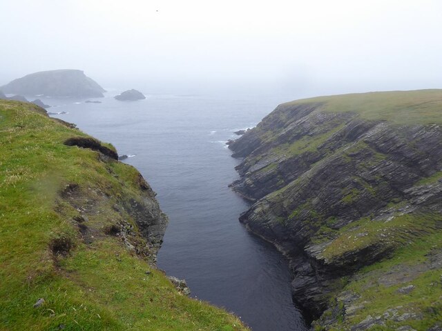
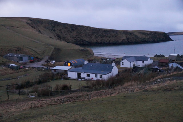
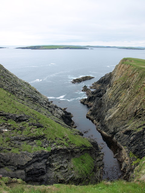
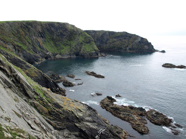
South Trei Geo is a prominent coastal feature located on the southern coast of Shetland, an archipelago in Scotland. It is classified as a headland or point due to its distinctive shape and geographical characteristics. The name "Trei Geo" is derived from the Old Norse language and translates to "three geos," referring to the three narrow inlets or sea caves that are present along the coastline.

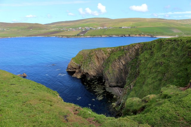
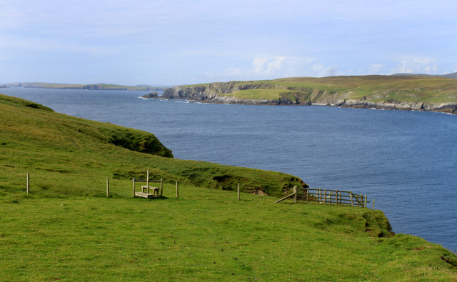
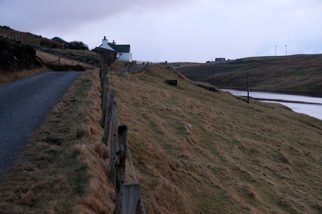
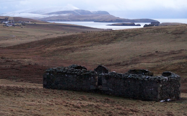
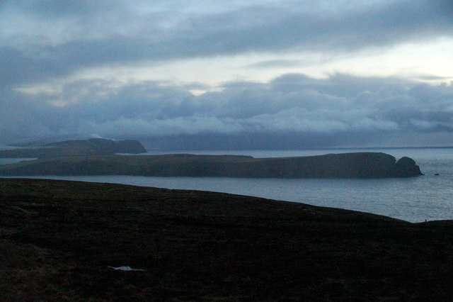
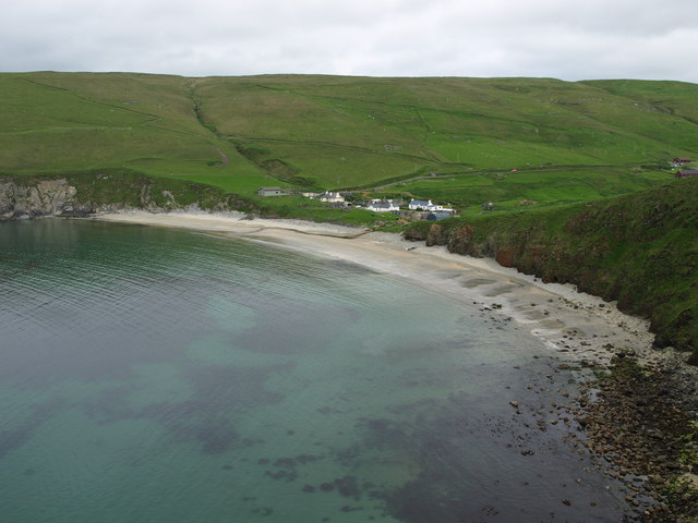
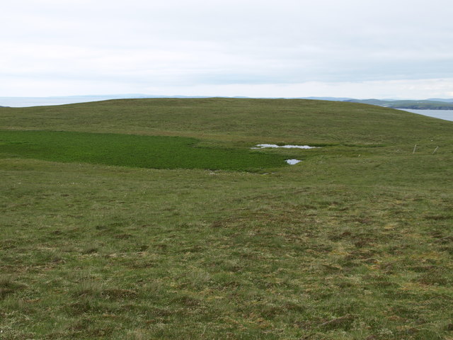
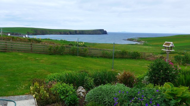
Situated on the southwestern side of the Shetland mainland, South Trei Geo is known for its rugged cliffs that tower above the North Sea, offering breathtaking views of the surrounding landscape. The cliffs are composed of sedimentary rocks, predominantly sandstone and shale, which have been shaped by centuries of erosion caused by wind and wave action.

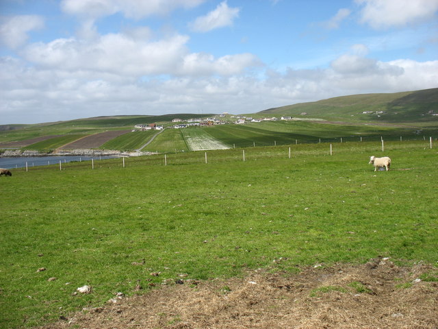
The headland is home to a diverse range of marine and bird life, attracting nature enthusiasts and birdwatchers from around the world. Seabirds such as puffins, guillemots, and razorbills can be spotted nesting on the cliff ledges, while seals and dolphins are often seen swimming in the waters below.

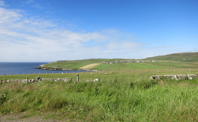
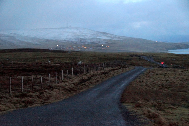
Access to South Trei Geo is possible via a footpath that leads from the nearby village of Sumburgh. The path takes visitors along the cliff edge, offering spectacular views of the headland and the surrounding coastline. However, caution is advised as the cliffs can be hazardous, and strong winds are common in the area.

Overall, South Trei Geo is a stunning coastal feature in Shetland, attracting visitors with its dramatic cliffs, diverse wildlife, and natural beauty. It serves as a testament to the powerful forces of nature that have shaped the Scottish coastline over time.

If you have any feedback on the listing, please let us know in the comments section below.

South Trei Geo Images

Images are sourced within 2km of 59.991186/-1.3448917 or Grid Reference HU3623. Thanks to Geograph Open Source API. All images are credited.

Loose Head, St Ninian's Isle, from the air
Inlet on the west coast of St Ninian's Isle Out to sea is the island of Hich Holm <a href="https://www.geograph.org.uk/gridref/HU3521">HU3521</a> and to the right, Fora Stack.
Inlet on the west coast of St Ninian's Isle
Out to sea is the island of Hich Holm HU3521 and to the right, Fora Stack.
View north from Bigton Ireland Wick and the hamlet of Ireland on the far hillside.
View north from Bigton
Ireland Wick and the hamlet of Ireland on the far hillside.
Scarfi Taing The easternmost point of St Ninian's Isle, discounting the sand bar.
Scarfi Taing
The easternmost point of St Ninian's Isle, discounting the sand bar.
Pathway, St Ninian's Isle St Ninian's Isle seems to be mostly sandy grassland and easy to wander about on.
At least, the bits we went to were.
The Isle is home to a lot of sheep and there are a number of fences.
Pathway, St Ninian's Isle
St Ninian's Isle seems to be mostly sandy grassland and easy to wander about on. At least, the bits we went to were. The Isle is home to a lot of sheep and there are a number of fences.
Ireland in the distance Looking across the square to the village of Ireland, with its long fields running downhill from the houses.
Ireland in the distance
Looking across the square to the village of Ireland, with its long fields running downhill from the houses.
Houses at Maywick The houses above the bay.
Houses at Maywick
The houses above the bay.
South Lochend, Maywick House above the Loch of Vatsetter.
South Lochend, Maywick
House above the Loch of Vatsetter.
Ruin near Ellister, Bigton Fitful Head in the distance.
Ruin near Ellister, Bigton
Fitful Head in the distance.
View to St Ninian's Isle from the Ness of Ireland
Road to the Ness of Ireland
Fields west of Bigton Looking towards Ireland. No, not the country, just a small village in southern Shetland. The agricultural methods here make some of the fields look like airstrips.
Fields west of Bigton
Looking towards Ireland. No, not the country, just a small village in southern Shetland. The agricultural methods here make some of the fields look like airstrips.
May Wick May Wick & Maywick seen from the east side of Taing of Maywick Headland.
May Wick
May Wick & Maywick seen from the east side of Taing of Maywick Headland.
Hundi Geo Geo on the west side of Taing of Maywick Headland.
South Havra is the first island in the distance.
Hundi Geo
Geo on the west side of Taing of Maywick Headland. South Havra is the first island in the distance.
Corbie Geo Erne's Kame & Corbie Geo Cliffs.
Corbie Geo
Erne's Kame & Corbie Geo Cliffs.
Johnie's Water From Johnie's Water, looking north in the direction of Taing of Maywick Headland.
Johnie's Water
From Johnie's Water, looking north in the direction of Taing of Maywick Headland.
Tomb Stone Tomb Stone at Maywick on the east end of the Cliffs:
"In memory of 
Laurence Smith 
the beloved husband of 
Andrena Yonson.
He was drowned at the ling fishing 
27th jan 1857. Aged 44 yrs.
Erected by his sons"
Tomb Stone
Tomb Stone at Maywick on the east end of the Cliffs: "In memory of Laurence Smith the beloved husband of Andrena Yonson. He was drowned at the ling fishing 27th jan 1857. Aged 44 yrs. Erected by his sons"
View from a Bigton garden Looking out over the waters of Ireland Wick and the northern tip of St Ninian's Isle, over to Foula (pronounced 'foola') in the far hazy distance.
View from a Bigton garden
Looking out over the waters of Ireland Wick and the northern tip of St Ninian's Isle, over to Foula (pronounced 'foola') in the far hazy distance.
Show me another place!

South Trei Geo is located at Grid Ref: HU3623 (Lat: 59.991186, Lng: -1.3448917)

Unitary Authority: Shetland Islands

Police Authority: Highlands and Islands

What 3 Words

///zoomed.people.thousands. Near Sandwick, Shetland Islands

Related Wikis

St Ninian's Isle

St Ninian's Isle is a small tied island connected by the largest tombolo in the UK to the south-western coast of the Mainland, Shetland, in Scotland. It...

Bigton

Bigton is a small settlement on South Mainland, Shetland, UK. Bigton is within the civil parish of Dunrossness.Bigton lies on the Atlantic coast of the...

Little Havra

Little Havra is a small island off the west of South Mainland in Shetland. It is 35 metres (115 ft) at its highest point, upon which there is a cairn....

South Havra

South Havra (Scots: Sooth Haevra; Old Norse: Hafrey), formerly Hevera, is an uninhabited island in the Scalloway Islands, Shetland, Scotland. == Geography... ==

Colsay

Colsay is an uninhabited island off the South West coast of Mainland, Shetland. Fora Ness lies to the south, across the Muckle Sound. The highest elevation...

Levenwick

Levenwick is a small village about 17 miles (27 km) south of Lerwick, on the east side of the South Mainland of Shetland, Scotland. It is part of the parish...

Hoswick

Hoswick is a settlement in Sandwick in the south mainland of Shetland, Scotland, on the eastern part of the Dunrossness civil parish. It is separated from...

Scousburgh

Scousburgh is a small community in the parish of Dunrossness, in the South Mainland of Shetland, Scotland, overlooking the picturesque Scousburgh Sand...

Nearby Amenities

Located within 500m of 59.991186,-1.3448917
Griskerry
Place: islet
Lat/Long: 59.9895871/-1.3431524
The data included in this document is from www.openstreetmap.org. The data is made available under ODbL.

Have you been to South Trei Geo?

Leave your review of South Trei Geo below (or comments, questions and feedback).