Muckle Fogla Stack

Island in Shetland

Scotland

Muckle Fogla Stack

Loose Head, St Ninian's Isle, from the air
Loose Head, St Ninian's Isle, from the air Credit: Mike Pennington

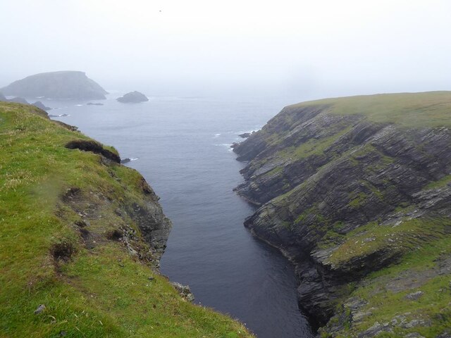
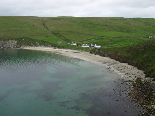
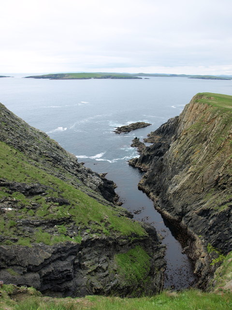
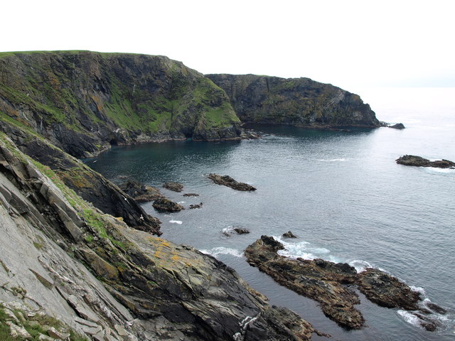
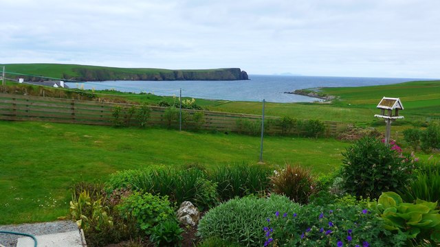
Muckle Fogla Stack is a prominent sea stack located on the northeast coast of Shetland, an archipelago in Scotland. It stands tall and imposing, rising approximately 122 meters (400 feet) above the North Sea. The stack is situated near the village of Brae and can be easily seen from the surrounding cliffs and coastline.

Muckle Fogla Stack is made up of layers of sedimentary rock, primarily sandstone, which has been shaped and eroded by the relentless forces of the sea and weather over thousands of years. Its isolated position and sheer size make it a striking natural feature and a popular attraction for visitors and nature enthusiasts.

The stack is home to a variety of seabirds, including guillemots, razorbills, and kittiwakes, which nest on its ledges and crannies during the breeding season. These birds can be observed in great numbers, creating a cacophony of sounds and a spectacle of aerial displays.

Access to Muckle Fogla Stack is limited to viewing from the cliffs and coastline, as it is not safe or advisable to attempt to climb or reach the stack itself due to its steep and unstable nature. Visitors can enjoy the dramatic views and take photographs of this geological wonder from designated viewpoints along the coastal paths.

Muckle Fogla Stack serves as a reminder of the powerful natural forces that have shaped the Shetland Islands over time. Its rugged beauty and the abundance of wildlife it supports make it a must-see destination for those exploring the unique landscapes of Shetland.

If you have any feedback on the listing, please let us know in the comments section below.

Muckle Fogla Stack Images

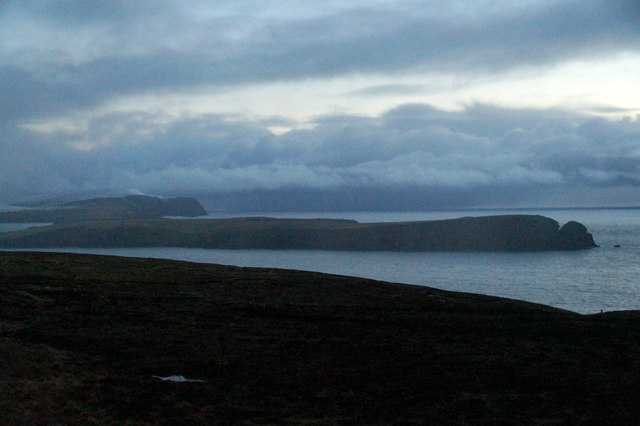
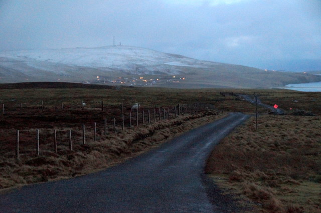
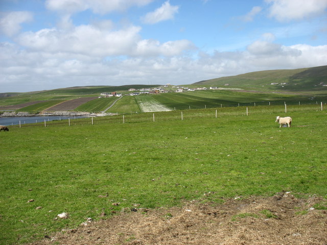
Images are sourced within 2km of 59.990869/-1.344432 or Grid Reference HU3623. Thanks to Geograph Open Source API. All images are credited.

Loose Head, St Ninian's Isle, from the air
Inlet on the west coast of St Ninian's Isle Out to sea is the island of Hich Holm <a href="https://www.geograph.org.uk/gridref/HU3521">HU3521</a> and to the right, Fora Stack.
Inlet on the west coast of St Ninian's Isle
Out to sea is the island of Hich Holm HU3521 and to the right, Fora Stack.
View north from Bigton Ireland Wick and the hamlet of Ireland on the far hillside.
View north from Bigton
Ireland Wick and the hamlet of Ireland on the far hillside.
Houses at Maywick The houses above the bay.
Houses at Maywick
The houses above the bay.
South Lochend, Maywick House above the Loch of Vatsetter.
South Lochend, Maywick
House above the Loch of Vatsetter.
Ruin near Ellister, Bigton Fitful Head in the distance.
Ruin near Ellister, Bigton
Fitful Head in the distance.
View to St Ninian's Isle from the Ness of Ireland
Road to the Ness of Ireland
Fields west of Bigton Looking towards Ireland. No, not the country, just a small village in southern Shetland. The agricultural methods here make some of the fields look like airstrips.
Fields west of Bigton
Looking towards Ireland. No, not the country, just a small village in southern Shetland. The agricultural methods here make some of the fields look like airstrips.
May Wick May Wick & Maywick seen from the east side of Taing of Maywick Headland.
May Wick
May Wick & Maywick seen from the east side of Taing of Maywick Headland.
Hundi Geo Geo on the west side of Taing of Maywick Headland.
South Havra is the first island in the distance.
Hundi Geo
Geo on the west side of Taing of Maywick Headland. South Havra is the first island in the distance.
Corbie Geo Erne's Kame & Corbie Geo Cliffs.
Corbie Geo
Erne's Kame & Corbie Geo Cliffs.
Johnie's Water From Johnie's Water, looking north in the direction of Taing of Maywick Headland.
Johnie's Water
From Johnie's Water, looking north in the direction of Taing of Maywick Headland.
Tomb Stone Tomb Stone at Maywick on the east end of the Cliffs:
"In memory of 
Laurence Smith 
the beloved husband of 
Andrena Yonson.
He was drowned at the ling fishing 
27th jan 1857. Aged 44 yrs.
Erected by his sons"
Tomb Stone
Tomb Stone at Maywick on the east end of the Cliffs: "In memory of Laurence Smith the beloved husband of Andrena Yonson. He was drowned at the ling fishing 27th jan 1857. Aged 44 yrs. Erected by his sons"
View from a Bigton garden Looking out over the waters of Ireland Wick and the northern tip of St Ninian's Isle, over to Foula (pronounced 'foola') in the far hazy distance.
View from a Bigton garden
Looking out over the waters of Ireland Wick and the northern tip of St Ninian's Isle, over to Foula (pronounced 'foola') in the far hazy distance.
The Neapack from Loose Head A day for walking round St. Ninian's Isle, looking down to see why we weren't sea kayaking round it. There are plenty of caves and geos, and skerries to rock-hop around in a bit of swell, but not this much ! There's quite a lot of wind waves, too, and whilst not as strong as it had been, the westerly was still quite gusty. The metamorphic rocks here are micaceous psammites of the Colla Firth group, Whiteness Division, and correlate with the Dalradian of mainland Scotland. They are dipping moderately steeply to the southwest, making for somewhat unstable and treacherous cliff edges, so the base of these cliffs is only readily seen from a bit that sticks out, as Loose Head does, offering a view back along the coast.
The Neapack from Loose Head
A day for walking round St. Ninian's Isle, looking down to see why we weren't sea kayaking round it. There are plenty of caves and geos, and skerries to rock-hop around in a bit of swell, but not this much ! There's quite a lot of wind waves, too, and whilst not as strong as it had been, the westerly was still quite gusty. The metamorphic rocks here are micaceous psammites of the Colla Firth group, Whiteness Division, and correlate with the Dalradian of mainland Scotland. They are dipping moderately steeply to the southwest, making for somewhat unstable and treacherous cliff edges, so the base of these cliffs is only readily seen from a bit that sticks out, as Loose Head does, offering a view back along the coast.
Slopes of Midi Field from Vatsetter
Shorewood, Vatsetter, Maywick
Show me another place!

Muckle Fogla Stack is located at Grid Ref: HU3623 (Lat: 59.990869, Lng: -1.344432)

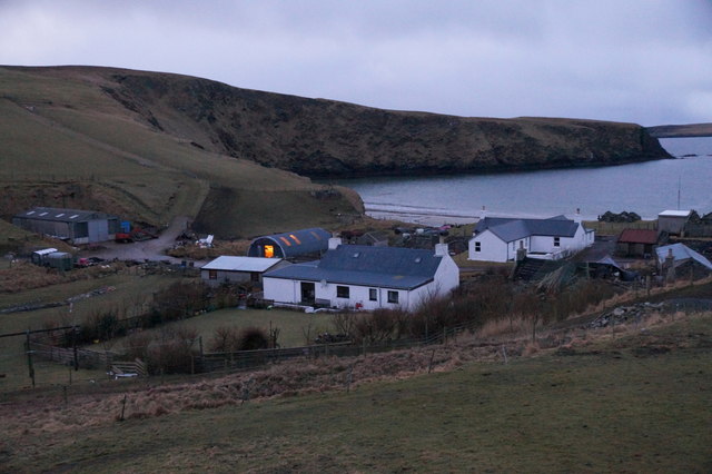
Unitary Authority: Shetland Islands

Police Authority: Highlands and Islands

What 3 Words

///carpeted.prettiest.derailed. Near Sandwick, Shetland Islands

Related Wikis

St Ninian's Isle

St Ninian's Isle is a small tied island connected by the largest tombolo in the UK to the south-western coast of the Mainland, Shetland, in Scotland. It...

Bigton

Bigton is a small settlement on South Mainland, Shetland, UK. Bigton is within the civil parish of Dunrossness. Bigton lies on the Atlantic coast of the...

Little Havra

Little Havra is a small island off the west of South Mainland in Shetland. It is 35 metres (115 ft) at its highest point, upon which there is a cairn....

South Havra

South Havra (Scots: Sooth Haevra; Old Norse: Hafrey), formerly Hevera, is an uninhabited island in the Scalloway Islands, Shetland, Scotland. == Geography... ==

Nearby Amenities

Located within 500m of 59.990869,-1.344432
Griskerry
Place: islet
Lat/Long: 59.9895871/-1.3431524
The data included in this document is from www.openstreetmap.org. The data is made available under ODbL.

Have you been to Muckle Fogla Stack?

Leave your review of Muckle Fogla Stack below (or comments, questions and feedback).