Hamna Stack
Coastal Feature, Headland, Point in Shetland
Scotland
Hamna Stack
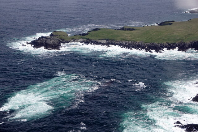
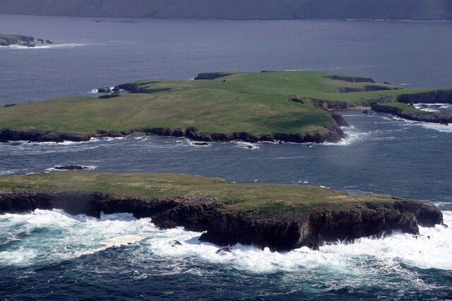
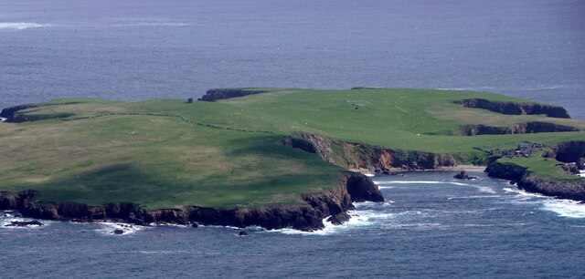
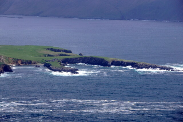
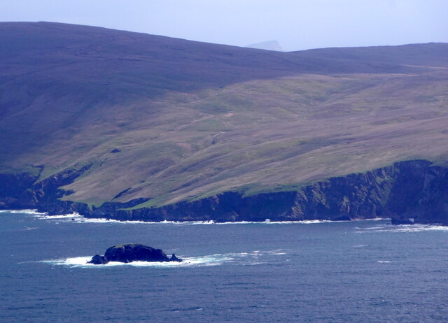
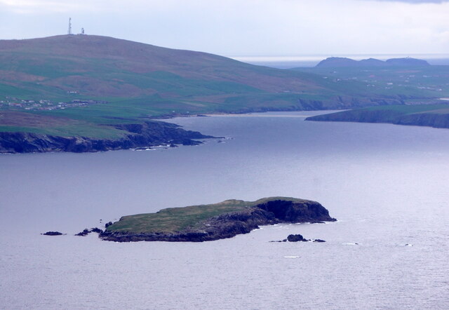
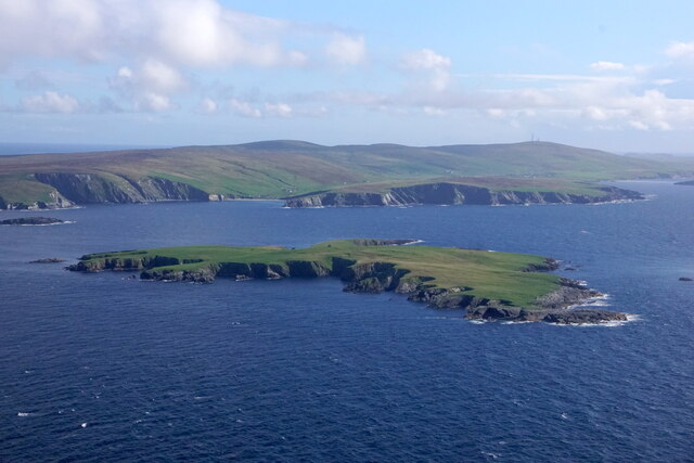
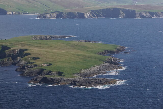
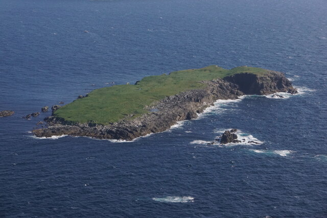
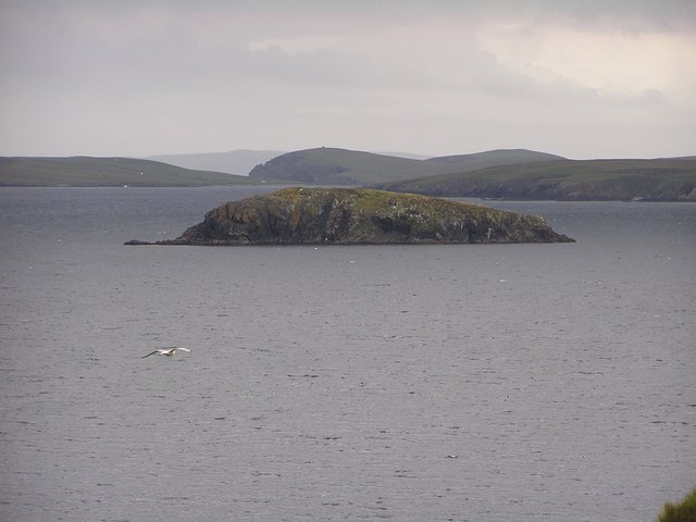
Hamna Stack is a prominent coastal feature located in the Shetland Islands, Scotland. It is classified as a headland or a point due to its distinct shape and geographical characteristics. Hamna Stack is situated on the west coast of the island of Unst, the northernmost island in the Shetland archipelago.
Rising approximately 41 meters (135 feet) above sea level, Hamna Stack is a towering stack of layered rocks that juts out into the North Atlantic Ocean. The stack is composed of sandstone, which has been eroded over thousands of years by the relentless force of the waves.
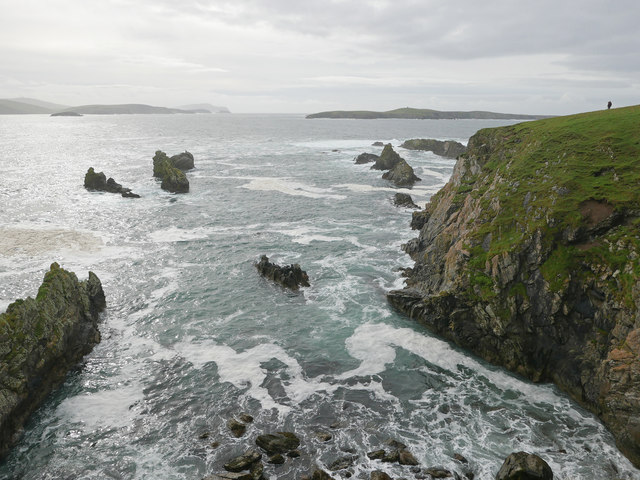
Hamna Stack offers breathtaking views of the surrounding coastal landscape, with its sheer cliffs and rugged terrain. The stack itself is a haven for seabirds, including puffins, guillemots, and fulmars, which nest and breed on its rocky ledges.
Access to Hamna Stack is possible via a coastal footpath that leads visitors to a viewpoint overlooking the headland. While the footpath provides a relatively easy route, caution is advised due to the potentially hazardous coastal conditions, including strong winds and unpredictable tides.
As a popular tourist destination, Hamna Stack attracts nature enthusiasts, photographers, and birdwatchers who come to appreciate its natural beauty and observe the diverse wildlife in the area. Additionally, the stack is a popular subject for landscape photography and has been featured in various publications and travel guides.
In summary, Hamna Stack is an awe-inspiring coastal feature and headland located on the island of Unst in the Shetland Islands. Its towering presence, rocky cliffs, and abundance of seabirds make it a must-visit destination for anyone exploring the region.
If you have any feedback on the listing, please let us know in the comments section below.
Hamna Stack Images
Images are sourced within 2km of 60.023697/-1.3498105 or Grid Reference HU3626. Thanks to Geograph Open Source API. All images are credited.


Hamna Stack is located at Grid Ref: HU3626 (Lat: 60.023697, Lng: -1.3498105)
Unitary Authority: Shetland Islands
Police Authority: Highlands and Islands
What 3 Words
///barbarian.vineyard.rocks. Near Sandwick, Shetland Islands
Nearby Locations
Related Wikis

South Havra
South Havra (Scots: Sooth Haevra; Old Norse: Hafrey), formerly Hevera, is an uninhabited island in the Scalloway Islands, Shetland, Scotland. == Geography... ==

Little Havra
Little Havra is a small island off the west of South Mainland in Shetland. It is 35 metres (115 ft) at its highest point, upon which there is a cairn....
St Ninian's Isle
St Ninian's Isle is a small tied island connected by the largest tombolo in the UK to the south-western coast of the Mainland, Shetland, in Scotland. It...

Bigton
Bigton is a small settlement on South Mainland, Shetland, UK. Bigton is within the civil parish of Dunrossness.Bigton lies on the Atlantic coast of the...

West Burra
West Burra is one of the Scalloway Islands, a subgroup of the Shetland Islands in Scotland. It is connected by bridge to East Burra. With an area of 743...

Burra, Shetland
Burra (Old Norse: Barrey ) is the collective name for two of the Shetland Islands, West (pop. 753) and East Burra (pop. 66), which are connected by bridge...

Hoswick
Hoswick is a settlement in Sandwick in the south mainland of Shetland, Scotland, on the eastern part of the Dunrossness civil parish. It is separated from...

Catpund
Catpund is a quarry site in Shetland, Scotland, where steatite vessels were cut from the rock from prehistory onwards. The quarrying marks are still visible...
Nearby Amenities
Located within 500m of 60.023697,-1.3498105Have you been to Hamna Stack?
Leave your review of Hamna Stack below (or comments, questions and feedback).