Ox Geo

Coastal Feature, Headland, Point in Shetland

Scotland

Ox Geo

Spiggie and Loch of Spiggie
Spiggie and Loch of Spiggie Credit: Mike Pennington

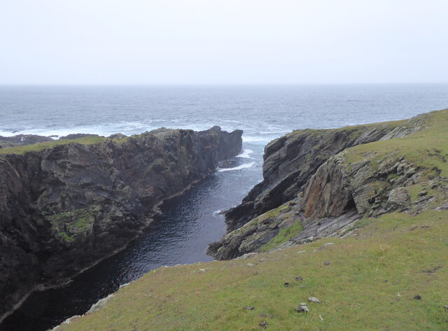
Ox Geo is a prominent coastal feature located on the Shetland Islands, Scotland. It is specifically situated on the West Mainland, near the village of Walls. Ox Geo is a headland, jutting out into the North Atlantic Ocean, and it is also commonly referred to as "Ox Head" or "Ox Headland."

This headland is characterized by its rugged and dramatic cliffs, which rise steeply from the sea. The cliffs at Ox Geo are composed of various types of rock, such as sandstone and shale, giving them a distinctive layered appearance. These geological formations have been shaped by the relentless forces of erosion over thousands of years, resulting in the creation of caves, arches, and stacks along the coastline.

The name "Ox Geo" is believed to have originated from the Old Norse word "geirr," meaning "a triangular piece of land." This name accurately describes the triangular shape of the headland, which extends out into the ocean.

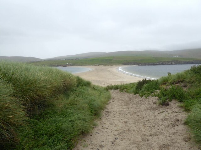
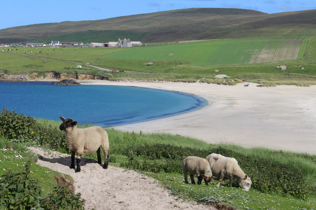
Ox Geo is a popular destination for tourists and nature enthusiasts due to its stunning natural beauty and rich biodiversity. The cliffs provide nesting sites for a variety of seabirds, including puffins, guillemots, and fulmars. The surrounding waters also support a diverse marine ecosystem, making it a haven for seals and otters.

Visitors to Ox Geo can enjoy breathtaking views of the surrounding coastline, as well as opportunities for coastal walks and birdwatching. It is advisable to exercise caution when exploring the area, as the cliffs can be unstable, and the strong currents of the Atlantic Ocean make swimming dangerous.

In summary, Ox Geo is a captivating headland on the Shetland Islands, boasting striking cliffs, diverse wildlife, and picturesque views, making it a must-visit destination for nature lovers and adventure seekers.

If you have any feedback on the listing, please let us know in the comments section below.

Ox Geo Images

Images are sourced within 2km of 59.954445/-1.3563768 or Grid Reference HU3619. Thanks to Geograph Open Source API. All images are credited.

Spiggie and Loch of Spiggie
Sand dunes at Sands of Scousburgh
Colsay from the air
Colsay from the air
View from the slopes of the Ward of Scousburgh A good view of Scousburgh Bay <a href="https://www.geograph.org.uk/gridref/HU3718">HU3718</a>, Northern Ness and Muckle Sound <a href="https://www.geograph.org.uk/gridref/HU3618">HU3618</a>.
View from the slopes of the Ward of Scousburgh
A good view of Scousburgh Bay HU3718, Northern Ness and Muckle Sound HU3618.
Inlet on the south-west corner of St Ninian's Isle Channel separating Sweyn Holm (to the left) from St Ninian's Isle.
Inlet on the south-west corner of St Ninian's Isle
Channel separating Sweyn Holm (to the left) from St Ninian's Isle.
Track on St Ninian's Isle Leading down to the tombolo which ties the island to the mainland.
Track on St Ninian's Isle
Leading down to the tombolo which ties the island to the mainland.
St Ninian's Bay I am standing at the mainland end of the tombolo leading to St Ninian's Isle and looking south down St Ninian's Bay towards Inns Holm with Colsay off to the right. Northern Ness, Fora Ness and Noss Hill can be gilmpsed in the clouded distance.
St Ninian's Bay
I am standing at the mainland end of the tombolo leading to St Ninian's Isle and looking south down St Ninian's Bay towards Inns Holm with Colsay off to the right. Northern Ness, Fora Ness and Noss Hill can be gilmpsed in the clouded distance.
The south of St Ninian's Isle Seen from high on the slopes of Ward of Scousburgh, St Ninian's Isle seems to be preparing to repel boarders from the south (left).

The small village in the foreground is Rerwick.
The south of St Ninian's Isle
Seen from high on the slopes of Ward of Scousburgh, St Ninian's Isle seems to be preparing to repel boarders from the south (left). The small village in the foreground is Rerwick.
St Ninian's Sheep Looking eastwards from St Ninian's Isle over the sand bar to Bigton.
St Ninian's Sheep
Looking eastwards from St Ninian's Isle over the sand bar to Bigton.
South coast of St Ninian's Isle
St Ninian's Bay Looking over the bay from the beach connecting the mainland with St Ninian's Isle.
St Ninian's Bay
Looking over the bay from the beach connecting the mainland with St Ninian's Isle.
The tombolo at St Ninian's Isle Bigton Wick on the left, St Ninian's Bay to the right.
The tombolo at St Ninian's Isle
Bigton Wick on the left, St Ninian's Bay to the right.
The tombolo at St Ninian's Isle
The path to Longa Berg, St Ninian's Isle
Looking down to the Mare from Longa Berg Having walked round from the tombolo beach via the southwest and south coasts of St. Ninian's Isle, we had thought that conditions for sea kayaking round the island didn't look too bad, despite the wind. This first view out through the channel separating Sweyn Holm from the main part of the island confirmed us in our original view that this was a day for walking round looking from above, not poking in to caves and geos at sea level. Although the swell was not penetrating the geo at all, there was big surf all along the outer rocks - this coast is very exposed to the Atlantic.
Looking down to the Mare from Longa Berg
Having walked round from the tombolo beach via the southwest and south coasts of St. Ninian's Isle, we had thought that conditions for sea kayaking round the island didn't look too bad, despite the wind. This first view out through the channel separating Sweyn Holm from the main part of the island confirmed us in our original view that this was a day for walking round looking from above, not poking in to caves and geos at sea level. Although the swell was not penetrating the geo at all, there was big surf all along the outer rocks - this coast is very exposed to the Atlantic.
Nesting on a pointy skerry There seem to be Fulmars nesting on almost every cliff or ledge in most parts of Shetland, many in relatively accessible places, but I was rather taken with this one who had chosen to nest right on the top of a distinctly pointy skerry just off the southern tip of St. Ninian's Isle. The metamorphic rock is a micaceous psammite of the Colla Firth Group (Whiteness division 0 correlated with the Dalradian in mainland Scotland) here dipping quite steeply to the southwest. This produces the characteristic steep smooth rock faces on southwest-facing cliffs. The northeast-facing sides are steep, but much more ledgy, which produces many little niches which are the more favoured nesting sites, as you can see on High Herbi Clett on the right of the photo. Further out is Inns Holm, the southern tip of which is catching quite a lot of surf from the westerly swell (which is why we were walking today, and not sea kayaking).
Nesting on a pointy skerry
There seem to be Fulmars nesting on almost every cliff or ledge in most parts of Shetland, many in relatively accessible places, but I was rather taken with this one who had chosen to nest right on the top of a distinctly pointy skerry just off the southern tip of St. Ninian's Isle. The metamorphic rock is a micaceous psammite of the Colla Firth Group (Whiteness division 0 correlated with the Dalradian in mainland Scotland) here dipping quite steeply to the southwest. This produces the characteristic steep smooth rock faces on southwest-facing cliffs. The northeast-facing sides are steep, but much more ledgy, which produces many little niches which are the more favoured nesting sites, as you can see on High Herbi Clett on the right of the photo. Further out is Inns Holm, the southern tip of which is catching quite a lot of surf from the westerly swell (which is why we were walking today, and not sea kayaking).
View across tombolo from St Ninian's Isle Preparations are being made in the distance for Bigton Regatta.
Isles rowing crews launch their six oared yoals in all weathers, practising for the Bigton event on Saturday 1st June, held here at the St Ninian’s Isle sands.
The local youths zoom up and down the tombolo on their quad bikes disturbing the pristine sand.
View across tombolo from St Ninian's Isle
Preparations are being made in the distance for Bigton Regatta. Isles rowing crews launch their six oared yoals in all weathers, practising for the Bigton event on Saturday 1st June, held here at the St Ninian’s Isle sands. The local youths zoom up and down the tombolo on their quad bikes disturbing the pristine sand.
Promnontory and stacks at St. Ninian's Isle, Shetland Masts on the Ward of Scousburgh can be seen in the background
Promnontory and stacks at St. Ninian's Isle, Shetland
Masts on the Ward of Scousburgh can be seen in the background
Show me another place!

Ox Geo is located at Grid Ref: HU3619 (Lat: 59.954445, Lng: -1.3563768)

Unitary Authority: Shetland Islands

Police Authority: Highlands and Islands

What 3 Words

///fastening.comedians.cackling. Near Sandwick, Shetland Islands

Related Wikis

Colsay

Colsay is an uninhabited island off the South West coast of Mainland, Shetland. Fora Ness lies to the south, across the Muckle Sound. The highest elevation...

St Ninian's Isle

St Ninian's Isle is a small tied island connected by the largest tombolo in the UK to the south-western coast of the Mainland, Shetland, in Scotland. It...

Scousburgh

Scousburgh is a small community in the parish of Dunrossness, in the South Mainland of Shetland, Scotland, overlooking the picturesque Scousburgh Sand...

Lochs of Spiggie and Brow

The Lochs of Spiggie and Brow are located west of Boddam in the parish of Dunrossness, in the South Mainland of Shetland, Scotland, about 6 km north of...

Bigton

Bigton is a small settlement on South Mainland, Shetland, UK. Bigton is within the civil parish of Dunrossness.Bigton lies on the Atlantic coast of the...

Dunrossness

Dunrossness, (Old Norse: Dynrastarnes meaning "headland of the loud tide-race", referring to the noise of Sumburgh Roost) is the southernmost parish of...

Clumlie Broch

Clumlie Broch is an Iron Age broch located on Mainland, Shetland, in Scotland (grid reference HU40451811). == Location == Clumlie Broch is located in Dunrossness...

Boddam, Shetland

Boddam is a village on the island of Mainland, in Shetland, Scotland. Boddam is an area of Dunrossness in the South Mainland of Shetland. Although Boddam...

Have you been to Ox Geo?

Leave your review of Ox Geo below (or comments, questions and feedback).