Bens Vird

Coastal Feature, Headland, Point in Shetland

Scotland

Bens Vird

Fethaland (1) This is Fethaland, a long-abandoned haaf fishing settlement located at the extreme north of Shetland's mainland. (See <span class="nowrap"><a title="https://www.northlinkferries.co.uk/shetland-blog/haaf-fishing-in-shetland/" rel="nofollow ugc noopener" href="https://www.northlinkferries.co.uk/shetland-blog/haaf-fishing-in-shetland/">Link</a><img style="margin-left:2px;" alt="External link" title="External link - shift click to open in new window" src="https://s1.geograph.org.uk/img/external.png" width="10" height="10"/></span> )
Fethaland (1) Credit: Carroll Pierce

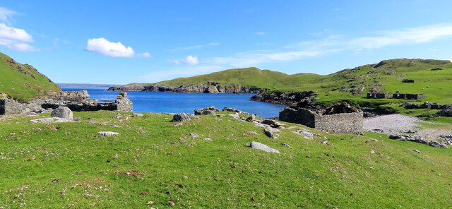
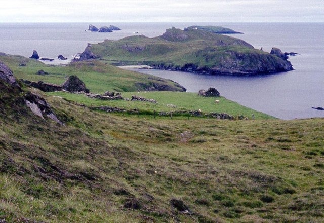
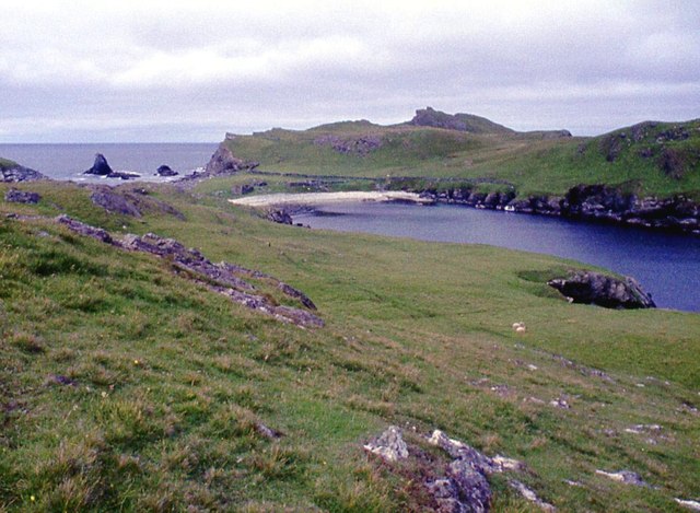
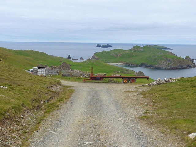
Bens Vird is a prominent coastal feature located in the Shetland Islands, an archipelago off the north coast of Scotland. It is a headland that juts out into the North Sea, situated on the eastern coast of the mainland Shetland. The name "Bens Vird" is derived from the Old Norse language, where "bens" means "head" and "vird" refers to a "point" or "promontory."

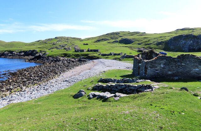
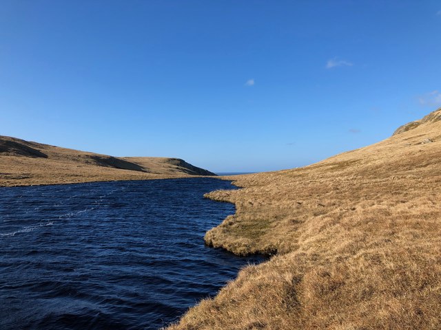
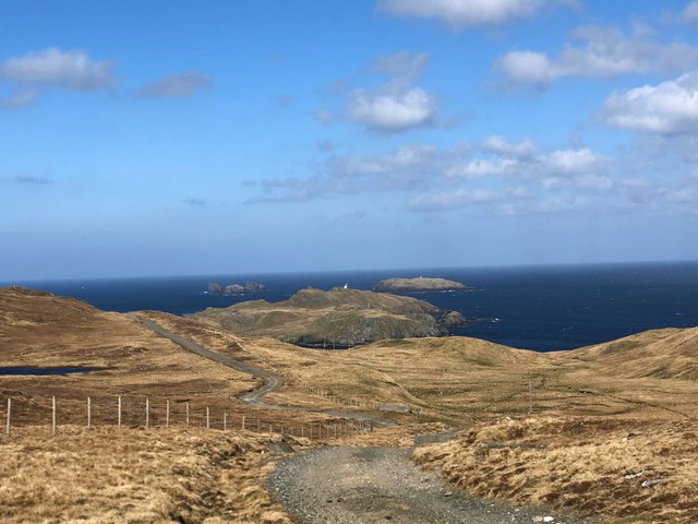
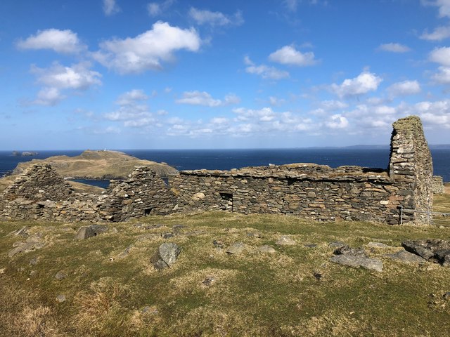
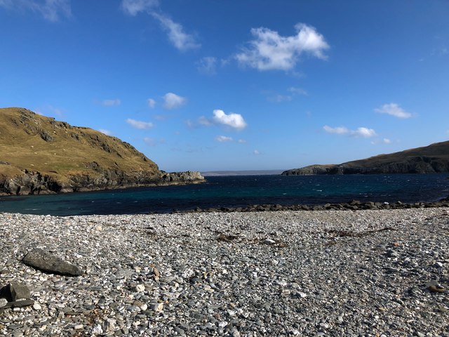
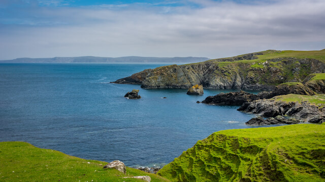
This headland presents a striking natural landscape with its rugged cliffs and steep slopes. The cliffs rise dramatically from the sea, reaching heights of around 100 meters (330 feet) in some areas. The rock formations found at Bens Vird are predominantly composed of sandstone and shale, showcasing layers of sedimentary deposits that have accumulated over millions of years.

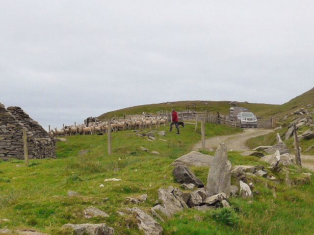
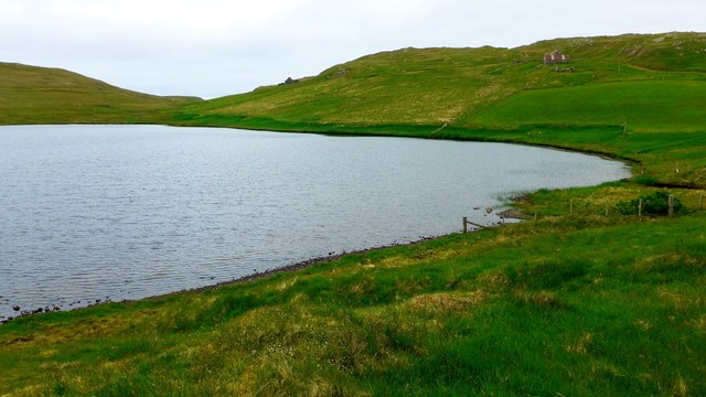
The headland offers breathtaking panoramic views of the surrounding coastal areas and the vast expanse of the North Sea. It is a popular spot for visitors and locals alike, who come to experience the raw beauty of the Shetland coastline. The area is also known for its abundant birdlife, including colonies of seabirds such as puffins, guillemots, and razorbills, which nest on the cliffs and provide a captivating spectacle for nature enthusiasts.

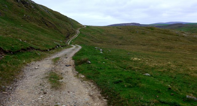
Bens Vird is an ideal location for coastal walks and hiking, with several trails and paths leading to and around the headland. The area is rich in flora and fauna, with a variety of plant species adapted to the harsh coastal environment. It is also home to a diverse marine ecosystem, with seals, otters, and various fish species inhabiting the waters surrounding the headland.

In summary, Bens Vird is a stunning headland on the eastern coast of the Shetland Islands, offering breathtaking views, diverse wildlife, and opportunities for outdoor exploration and appreciation of the natural world.

If you have any feedback on the listing, please let us know in the comments section below.

Bens Vird Images

Images are sourced within 2km of 60.622863/-1.3439138 or Grid Reference HU3693. Thanks to Geograph Open Source API. All images are credited.

Fethaland (1) This is Fethaland, a long-abandoned haaf fishing settlement located at the extreme north of Shetland's mainland. (See <span class="nowrap"><a title="https://www.northlinkferries.co.uk/shetland-blog/haaf-fishing-in-shetland/" rel="nofollow ugc noopener" href="https://www.northlinkferries.co.uk/shetland-blog/haaf-fishing-in-shetland/">Link</a><img style="margin-left:2px;" alt="External link" title="External link - shift click to open in new window" src="https://s1.geograph.org.uk/img/external.png" width="10" height="10"/></span> )
Fethaland (1)
This is Fethaland, a long-abandoned haaf fishing settlement located at the extreme north of Shetland's mainland. (See LinkExternal link )
Fethaland (2) This is Fethaland, a long-abandoned haaf fishing community at the very extreme north of Shetland's mainland (see <span class="nowrap"><a title="https://www.northlinkferries.co.uk/shetland-blog/haaf-fishing-in-shetland/" rel="nofollow ugc noopener" href="https://www.northlinkferries.co.uk/shetland-blog/haaf-fishing-in-shetland/">Link</a><img style="margin-left:2px;" alt="External link" title="External link - shift click to open in new window" src="https://s1.geograph.org.uk/img/external.png" width="10" height="10"/></span> ). The stone-lined hollows in the foreground are boat-shaped storage spaces used to house the fishing vessels outside season.
Fethaland (2)
This is Fethaland, a long-abandoned haaf fishing community at the very extreme north of Shetland's mainland (see LinkExternal link ). The stone-lined hollows in the foreground are boat-shaped storage spaces used to house the fishing vessels outside season.
Fethaland Ruins at the north tip of Mainland Shetland.
Fethaland
Ruins at the north tip of Mainland Shetland.
Isle of Fethaland The 'Isle' beyond the isthmus is currently a peninsula. No doubt spring tides and storm force winds would make it seem more island-like.
Isle of Fethaland
The 'Isle' beyond the isthmus is currently a peninsula. No doubt spring tides and storm force winds would make it seem more island-like.
Track to the Point of Fethaland The power line is to supply the lighthouse at the point.
Track to the Point of Fethaland
The power line is to supply the lighthouse at the point.
Sheep pens at Breibister And the pens were in use.  The shepherd said that after the prolonged dry spell his sheep "were scouring and he needed to drench them."  His two sheep dogs worked beautifully to gather the flock.  The following day they were all to be on the ferry to Aberdeen for sheep dog trials.
Sheep pens at Breibister
And the pens were in use. The shepherd said that after the prolonged dry spell his sheep "were scouring and he needed to drench them." His two sheep dogs worked beautifully to gather the flock. The following day they were all to be on the ferry to Aberdeen for sheep dog trials.
Sheep pens at Breibister And the pens were in use. The shepherd said that after the prolonged dry spell his sheep "were scouring and he needed to drench them." His two sheep dogs worked beautifully to gather the flock. The following day shepherd and dogs were all to be on the ferry to Aberdeen for sheep dog trials.
Sheep pens at Breibister
And the pens were in use. The shepherd said that after the prolonged dry spell his sheep "were scouring and he needed to drench them." His two sheep dogs worked beautifully to gather the flock. The following day shepherd and dogs were all to be on the ferry to Aberdeen for sheep dog trials.
Gate on the path by the Lower Loch of Setter Through the gate to Sand Voe.
Gate on the path by the Lower Loch of Setter
Through the gate to Sand Voe.
The Lower Loch of Setter
The track to Benigarth and Sand Voe Coming from Lower Loch of Setter.
The track to Benigarth and Sand Voe
Coming from Lower Loch of Setter.
Viga Water Looking north along Viga Water - the sea is just visible on the horizon.
Viga Water
Looking north along Viga Water - the sea is just visible on the horizon.
Landrover Carcass at Loch of Setter End of the road for this one - southern end of Loch of Setter
Landrover Carcass at Loch of Setter
End of the road for this one - southern end of Loch of Setter
Fethaland Vista Looking north down track - Isle of Fethaland and Gruney visible in distance
Fethaland Vista
Looking north down track - Isle of Fethaland and Gruney visible in distance
Ruined Farm Buildings at Breibister
Easter Wick Pebble beach and Easter Wick Bay, Fethaland. On this day we watched gannets fishing in the bay.
Easter Wick
Pebble beach and Easter Wick Bay, Fethaland. On this day we watched gannets fishing in the bay.
Wick of Breibister
Wick of Breibister
Deserted Fishing Village, Fethaland, Shetland Looking NNE at the "Homestead" or deserted fishing village on the pebble isthmus at the southern end of the Isle of Fethaland.
Deserted Fishing Village, Fethaland, Shetland
Looking NNE at the "Homestead" or deserted fishing village on the pebble isthmus at the southern end of the Isle of Fethaland.
Deserted fishermen's village, Fethaland Ruin shells of houses once used by fishermen at the extreme northern end of the Shetland Mainland.
Deserted fishermen's village, Fethaland
Ruin shells of houses once used by fishermen at the extreme northern end of the Shetland Mainland.
Show me another place!

Bens Vird is located at Grid Ref: HU3693 (Lat: 60.622863, Lng: -1.3439138)

Unitary Authority: Shetland Islands

Police Authority: Highlands and Islands

What 3 Words

///names.gossiping.cove. Near Ulsta, Shetland Islands

Related Wikis

Fethaland

Fethaland or Fedeland (pronounced [ˈfeɪdələnd]) is an abandoned settlement at the extreme north end of Mainland, Shetland. It was the site of the largest...

North Roe

North Roe is a village, and protected area at the northern tip in the large Northmavine peninsula of the Mainland of Shetland, Scotland. It is a small...

Gruney

Gruney is a small, uninhabited island in Shetland, Scotland. It lies north of the Northmavine peninsula of the Shetland Mainland, from which it is separated...

Uyea, Northmavine

Uyea (Scots: Öya in Shetland dialect spelling) is an uninhabited tidal island located to the northwest of Mainland, Shetland. Uyea lies off the Northmavine...

Have you been to Bens Vird?

Leave your review of Bens Vird below (or comments, questions and feedback).