Chedworth, Lower
Settlement in Gloucestershire Cotswold
England
Chedworth, Lower
![A walk around the Fosse Way [1] The minor road runs from the Fosse Way (A429) towards Coln St Dennis.
Starting at Fossebridge, where the Fosse Way descends precipitously to cross the River Coln, the walk gently ascends on a road and then a bridleway to meet a minor road which is part of the Salt Way. After using the Salt Way to cross the Fosse Way the route descends on footpaths and minor roads via Oxpens Farm and Stowell Mill to return to Fossebridge.](https://s2.geograph.org.uk/geophotos/06/99/49/6994958_d768d550.jpg)
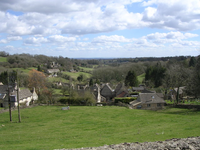
Chedworth is a small village located in Lower Gloucestershire, England. Situated in the picturesque Cotswolds, it is surrounded by rolling hills, lush green countryside, and charming stone-built houses. The village is part of the Cotswold District and lies approximately 11 miles northeast of the town of Cirencester.
Historically, Chedworth has deep roots, with evidence of Roman presence dating back to the 2nd century AD. The most significant archaeological find in the village is the Chedworth Roman Villa, a well-preserved Roman villa complex that attracts visitors from far and wide. The villa boasts stunning mosaics, bathhouses, and intricate frescoes, providing a glimpse into Roman life in Britain.
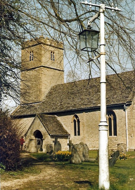
In terms of amenities, Chedworth offers a range of facilities to its residents and visitors. The village has a primary school, a village hall, and a charming parish church, St. Andrew's. There are also several quaint cottages and bed and breakfast establishments, allowing visitors to experience the village's unique charm.
Nature lovers will find plenty to explore in the surrounding area, with numerous walking and cycling trails offering breathtaking views of the Cotswold countryside. The village is also close to the Cotswold Water Park, a popular destination for water sports and outdoor activities.
Chedworth is well-connected to nearby towns and cities, with regular bus services and good road links. The village provides a peaceful and idyllic rural lifestyle, making it a desirable place to reside or visit for those seeking a tranquil escape in the heart of the Cotswolds.
If you have any feedback on the listing, please let us know in the comments section below.
Chedworth, Lower Images
Images are sourced within 2km of 51.798014/-1.903535 or Grid Reference SP0611. Thanks to Geograph Open Source API. All images are credited.
![A walk around the Fosse Way [2] The minor road runs from the Fosse Way (A429) towards Coln St Dennis. The telephone box in the distance is a K6 and there is a closer view at <a href="https://www.geograph.org.uk/photo/6994971">SP0811 : A walk around the Fosse Way [3]</a>.
Starting at Fossebridge, where the Fosse Way descends precipitously to cross the River Coln, the walk gently ascends on a road and then a bridleway to meet a minor road which is part of the Salt Way. After using the Salt Way to cross the Fosse Way the route descends on footpaths and minor roads via Oxpens Farm and Stowell Mill to return to Fossebridge.](https://s3.geograph.org.uk/geophotos/06/99/49/6994959_e9b82b35.jpg)
![A walk around the Fosse Way [3] A K6 telephone box, designed in 1935 by Sir Giles Gilbert Scott. The box is seen in context at <a href="https://www.geograph.org.uk/photo/6994959">SP0811 : A walk around the Fosse Way [2]</a>.
Starting at Fossebridge, where the Fosse Way descends precipitously to cross the River Coln, the walk gently ascends on a road and then a bridleway to meet a minor road which is part of the Salt Way. After using the Salt Way to cross the Fosse Way the route descends on footpaths and minor roads via Oxpens Farm and Stowell Mill to return to Fossebridge.](https://s3.geograph.org.uk/geophotos/06/99/49/6994971_072b3497.jpg)
![A walk around the Fosse Way [4] The entrance driveway to The Manor, Coln St Dennis.
Starting at Fossebridge, where the Fosse Way descends precipitously to cross the River Coln, the walk gently ascends on a road and then a bridleway to meet a minor road which is part of the Salt Way. After using the Salt Way to cross the Fosse Way the route descends on footpaths and minor roads via Oxpens Farm and Stowell Mill to return to Fossebridge.](https://s2.geograph.org.uk/geophotos/06/99/49/6994982_71a491c9.jpg)
![A walk around the Fosse Way [5] The driveway to Manor Farm, a public bridleway, leaves the minor road.
Starting at Fossebridge, where the Fosse Way descends precipitously to cross the River Coln, the walk gently ascends on a road and then a bridleway to meet a minor road which is part of the Salt Way. After using the Salt Way to cross the Fosse Way the route descends on footpaths and minor roads via Oxpens Farm and Stowell Mill to return to Fossebridge.](https://s2.geograph.org.uk/geophotos/06/99/59/6995946_00b78739.jpg)
![A walk around the Fosse Way [6] The track leading to Manor Farm is also a public bridleway.
Starting at Fossebridge, where the Fosse Way descends precipitously to cross the River Coln, the walk gently ascends on a road and then a bridleway to meet a minor road which is part of the Salt Way. After using the Salt Way to cross the Fosse Way the route descends on footpaths and minor roads via Oxpens Farm and Stowell Mill to return to Fossebridge.](https://s3.geograph.org.uk/geophotos/06/99/59/6995947_3d389408.jpg)
![A walk around the Fosse Way [74] A horse jump alongside the path.
Starting at Fossebridge, where the Fosse Way descends precipitously to cross the River Coln, the walk gently ascends on a road and then a bridleway to meet a minor road which is part of the Salt Way. After using the Salt Way to cross the Fosse Way the route descends on footpaths and minor roads via Oxpens Farm and Stowell Mill to return to Fossebridge.](https://s1.geograph.org.uk/geophotos/06/99/84/6998405_ea5fad9d.jpg)
![A walk around the Fosse Way [76] Raybrook Barn, seen from the path.
Starting at Fossebridge, where the Fosse Way descends precipitously to cross the River Coln, the walk gently ascends on a road and then a bridleway to meet a minor road which is part of the Salt Way. After using the Salt Way to cross the Fosse Way the route descends on footpaths and minor roads via Oxpens Farm and Stowell Mill to return to Fossebridge.](https://s0.geograph.org.uk/geophotos/06/99/84/6998408_b56ffaea.jpg)
![A walk around the Fosse Way [77] A view down the valley as the path now runs close to the river.
Starting at Fossebridge, where the Fosse Way descends precipitously to cross the River Coln, the walk gently ascends on a road and then a bridleway to meet a minor road which is part of the Salt Way. After using the Salt Way to cross the Fosse Way the route descends on footpaths and minor roads via Oxpens Farm and Stowell Mill to return to Fossebridge.](https://s2.geograph.org.uk/geophotos/06/99/84/6998410_c3c79540.jpg)
![A walk around the Fosse Way [78] The path passes into the next field via this overgrown gate.
Starting at Fossebridge, where the Fosse Way descends precipitously to cross the River Coln, the walk gently ascends on a road and then a bridleway to meet a minor road which is part of the Salt Way. After using the Salt Way to cross the Fosse Way the route descends on footpaths and minor roads via Oxpens Farm and Stowell Mill to return to Fossebridge.](https://s2.geograph.org.uk/geophotos/06/99/84/6998414_f185ad04.jpg)
![A walk around the Fosse Way [79] A rustic bridge carries the farm track over the river. Seen from the path.
Starting at Fossebridge, where the Fosse Way descends precipitously to cross the River Coln, the walk gently ascends on a road and then a bridleway to meet a minor road which is part of the Salt Way. After using the Salt Way to cross the Fosse Way the route descends on footpaths and minor roads via Oxpens Farm and Stowell Mill to return to Fossebridge.](https://s2.geograph.org.uk/geophotos/06/99/84/6998418_ff9a2054.jpg)
![A walk around the Fosse Way [80] The line of the path runs straight across this field to the roadside gate.
Starting at Fossebridge, where the Fosse Way descends precipitously to cross the River Coln, the walk gently ascends on a road and then a bridleway to meet a minor road which is part of the Salt Way. After using the Salt Way to cross the Fosse Way the route descends on footpaths and minor roads via Oxpens Farm and Stowell Mill to return to Fossebridge.](https://s1.geograph.org.uk/geophotos/06/99/84/6998421_985a0c71.jpg)
![A walk around the Fosse Way [81] At this point the path runs close to the river.
Starting at Fossebridge, where the Fosse Way descends precipitously to cross the River Coln, the walk gently ascends on a road and then a bridleway to meet a minor road which is part of the Salt Way. After using the Salt Way to cross the Fosse Way the route descends on footpaths and minor roads via Oxpens Farm and Stowell Mill to return to Fossebridge.](https://s3.geograph.org.uk/geophotos/06/99/84/6998423_3575e6bd.jpg)
![A walk around the Fosse Way [82] Just before it exits the field onto the minor road, the path crosses this small stream.
Starting at Fossebridge, where the Fosse Way descends precipitously to cross the River Coln, the walk gently ascends on a road and then a bridleway to meet a minor road which is part of the Salt Way. After using the Salt Way to cross the Fosse Way the route descends on footpaths and minor roads via Oxpens Farm and Stowell Mill to return to Fossebridge.](https://s0.geograph.org.uk/geophotos/06/99/84/6998424_c94d1d19.jpg)
![A walk around the Fosse Way [83] The path exits the field onto the minor road.
Starting at Fossebridge, where the Fosse Way descends precipitously to cross the River Coln, the walk gently ascends on a road and then a bridleway to meet a minor road which is part of the Salt Way. After using the Salt Way to cross the Fosse Way the route descends on footpaths and minor roads via Oxpens Farm and Stowell Mill to return to Fossebridge.](https://s2.geograph.org.uk/geophotos/06/99/84/6998426_d7fa2e93.jpg)
![A walk around the Fosse Way [84] A recently built house, constructed using traditional materials.
Starting at Fossebridge, where the Fosse Way descends precipitously to cross the River Coln, the walk gently ascends on a road and then a bridleway to meet a minor road which is part of the Salt Way. After using the Salt Way to cross the Fosse Way the route descends on footpaths and minor roads via Oxpens Farm and Stowell Mill to return to Fossebridge.](https://s0.geograph.org.uk/geophotos/06/99/84/6998428_0bfe3fed.jpg)
![A walk around the Fosse Way [85] The Old Forge is a substantial property. There is another view at <a href="https://www.geograph.org.uk/photo/6998431">SP0711 : A walk around the Fosse Way [86]</a>.
Starting at Fossebridge, where the Fosse Way descends precipitously to cross the River Coln, the walk gently ascends on a road and then a bridleway to meet a minor road which is part of the Salt Way. After using the Salt Way to cross the Fosse Way the route descends on footpaths and minor roads via Oxpens Farm and Stowell Mill to return to Fossebridge.](https://s1.geograph.org.uk/geophotos/06/99/84/6998429_e3bc313e.jpg)
![A walk around the Fosse Way [86] The Old Forge is a substantial property. There is another view at <a href="https://www.geograph.org.uk/photo/6998429">SP0711 : A walk around the Fosse Way [85]</a>.
Starting at Fossebridge, where the Fosse Way descends precipitously to cross the River Coln, the walk gently ascends on a road and then a bridleway to meet a minor road which is part of the Salt Way. After using the Salt Way to cross the Fosse Way the route descends on footpaths and minor roads via Oxpens Farm and Stowell Mill to return to Fossebridge.](https://s3.geograph.org.uk/geophotos/06/99/84/6998431_170f5393.jpg)
Chedworth, Lower is located at Grid Ref: SP0611 (Lat: 51.798014, Lng: -1.903535)
Administrative County: Gloucestershire
District: Cotswold
Police Authority: Gloucestershire
What 3 Words
///enjoyable.tightrope.blog. Near Northleach, Gloucestershire
Nearby Locations
Related Wikis

Stony Furlong Railway Cutting
Stony Furlong Railway Cutting (grid reference SP063106) is a 2.7-hectare (6.7-acre) geological Site of Special Scientific Interest in Gloucestershire,...
Chedworth Halt railway station
Chedworth Halt railway station was on the Midland and South Western Junction Railway in Gloucestershire. The station opened on 1 October 1892, 14 months...
Foss Cross railway station
Foss Cross railway station was on the Midland and South Western Junction Railway in Gloucestershire. The station opened on 1 August 1891 with the section...
Chedworth
Chedworth is a village and civil parish in Gloucestershire, southwest England, in the Cotswolds. It is known as the location of Chedworth Roman Villa,...

Church of St James, Coln St. Dennis
The Anglican Church of St James at Coln St. Dennis in the Cotswold District of Gloucestershire, England was built in the 12th century. It is a grade I...

Church of St Andrew, Chedworth
The Anglican Church of St Andrew at Chedworth in the Cotswold District of Gloucestershire, England was built in the late 12th century. It is a grade I...
Foss Cross Quarry
Foss Cross Quarry (grid reference SP056092) is a 0.67-hectare (1.7-acre) geological Site of Special Scientific Interest in Gloucestershire, notified in...
Coln Rogers
Coln Rogers is a village and former civil parish, now in the parish of Coln St. Dennis, in the Cotswold district of the county of Gloucestershire, England...
Nearby Amenities
Located within 500m of 51.798014,-1.903535Have you been to Chedworth, Lower?
Leave your review of Chedworth, Lower below (or comments, questions and feedback).