Berrgutters

Coastal Feature, Headland, Point in Shetland

Scotland

Berrgutters

The tip of Moo Ness, Papa Little The island of Muckle Roe can be seen in the background
The tip of Moo Ness, Papa Little Credit: Ruth Sharville

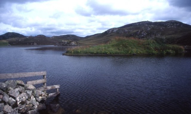
Berrgutters is a prominent coastal feature located in Shetland, Scotland. It is primarily known as a headland, also sometimes referred to as a point, due to its distinctive shape and geographical characteristics.

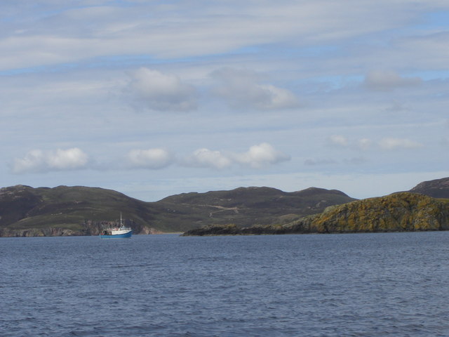
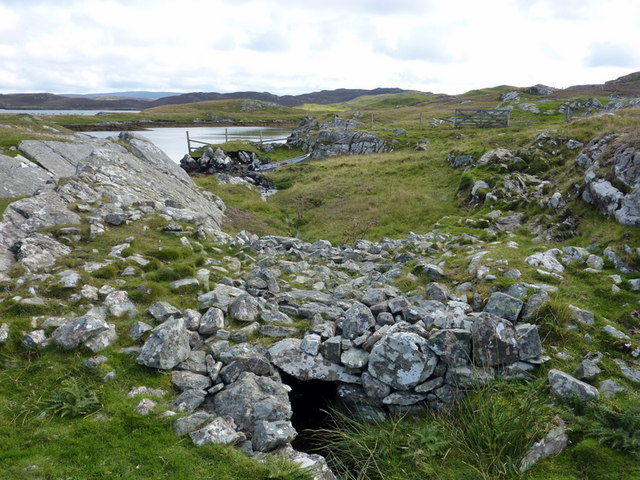
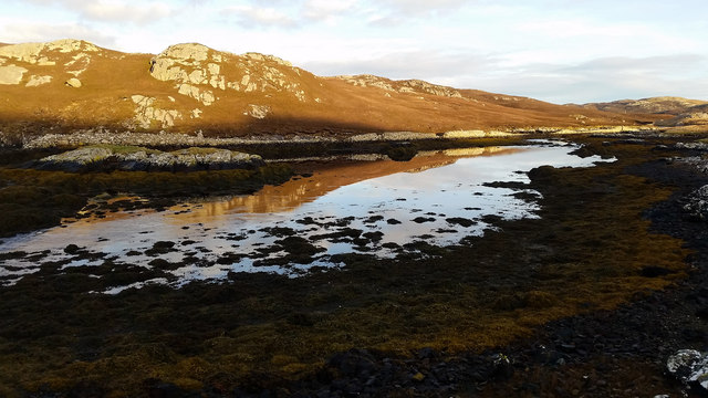
Situated on the northern coast of Shetland, Berrgutters juts out into the North Sea, forming a prominent landmass that extends into the ocean. The headland is positioned between two bays, creating a visually striking landscape that is often admired by locals and visitors alike. The headland is characterized by its steep cliffs, which rise dramatically from the sea, and its rocky terrain.

Berrgutters is known for its natural beauty and is a popular spot for outdoor enthusiasts and nature lovers. The headland offers stunning panoramic views of the surrounding coastline, with the crashing waves of the North Sea creating a captivating spectacle. The rugged and untamed nature of Berrgutters attracts hikers and walkers who are keen to explore its trails and paths, taking in the breathtaking scenery and enjoying the fresh sea air.

The headland is also home to a diverse range of wildlife, making it an ideal location for birdwatchers and nature photographers. Seabirds such as puffins, gannets, and fulmars can be spotted nesting along the cliffs, while seals and even occasional sightings of whales can be observed in the waters below.

Overall, Berrgutters is a stunning coastal feature in Shetland, offering a unique blend of natural beauty, rugged terrain, and abundant wildlife. It is a must-visit destination for those seeking an immersive experience in Scotland's coastal landscapes.

If you have any feedback on the listing, please let us know in the comments section below.
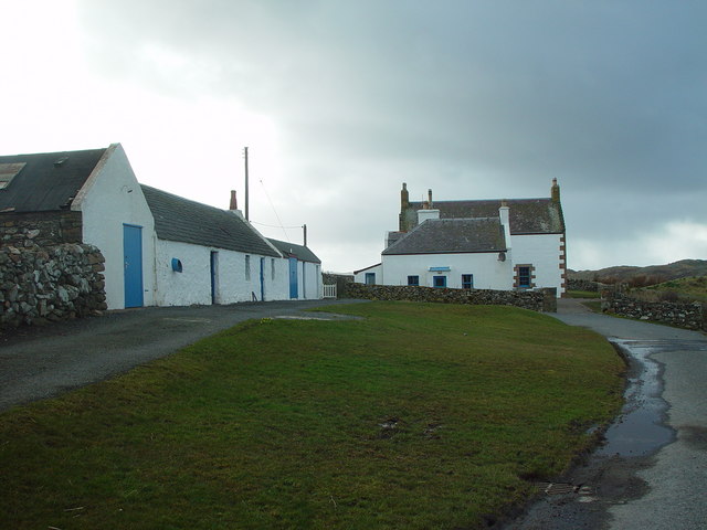
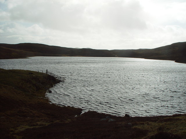
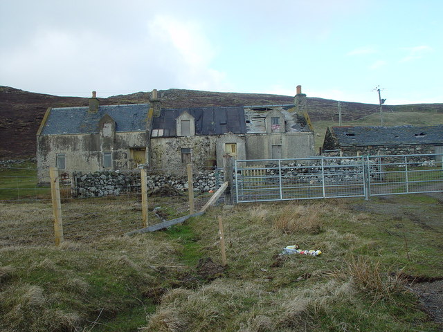
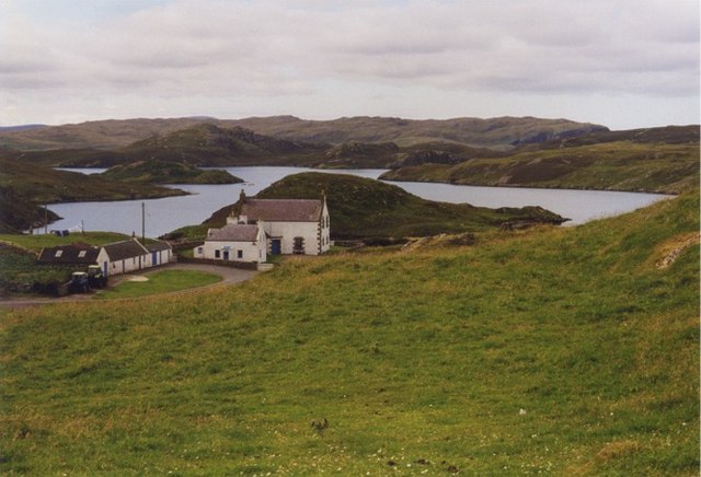
Berrgutters Images

Images are sourced within 2km of 60.318587/-1.4301644 or Grid Reference HU3159. Thanks to Geograph Open Source API. All images are credited.

The tip of Moo Ness, Papa Little The island of Muckle Roe can be seen in the background
The tip of Moo Ness, Papa Little
The island of Muckle Roe can be seen in the background
Braga Ness, Shetland Confusingly there's a Vementry on the Mainland Shetland opposite Vementry Isle.  This ness is actually on the Mainland, on the Westside.
Braga Ness, Shetland
Confusingly there's a Vementry on the Mainland Shetland opposite Vementry Isle. This ness is actually on the Mainland, on the Westside.
Ness at Scarva Clett, Vementry Isle
South Voe, with ruined building Vementry Isle is no longer inhabited, but here is an example of evidence that people lived here relatively recently.
South Voe, with ruined building
Vementry Isle is no longer inhabited, but here is an example of evidence that people lived here relatively recently.
Beach at Scarva Clett, Vementry Isle The cairn on Cow Head can also be seen.
Beach at Scarva Clett, Vementry Isle
The cairn on Cow Head can also be seen.
Holms of Uyea Sound The northern part of Cow Head is on the left, with the islands to the centre and right of the image.
Holms of Uyea Sound
The northern part of Cow Head is on the left, with the islands to the centre and right of the image.
Beach at Lamba Wick, Vementry Isle
Maa Loch brig A fine stone brig over the short outflow burn from the Maa Loch into sheltered Peerie Voe.
Maa Loch brig
A fine stone brig over the short outflow burn from the Maa Loch into sheltered Peerie Voe.
The Brigs of Clousta Da Brigs o Clousta at low tide.
The Brigs of Clousta
Da Brigs o Clousta at low tide.
Buildings at Vementry, Shetland These buildings are on the Shetland Mainland.  The uninhabited Isle of Vementry is close by, across the sound.
Buildings at Vementry, Shetland
These buildings are on the Shetland Mainland. The uninhabited Isle of Vementry is close by, across the sound.
Vementry, Shetland Farmhouse and farmbuildings at Vementry.
Vementry, Shetland
Farmhouse and farmbuildings at Vementry.
North Loch of Hostigates, Shetland There are two neighbouring lochs shown as 'Lochs of Hostigates' at Braewick, near Aith. This is the more northerly of the two.
North Loch of Hostigates, Shetland
There are two neighbouring lochs shown as 'Lochs of Hostigates' at Braewick, near Aith. This is the more northerly of the two.
Loch of Clousta, Shetland Looking south from the north shoreline of the Loch of Clousta.
Loch of Clousta, Shetland
Looking south from the north shoreline of the Loch of Clousta.
Semi-derelict Crofthouse, Aithsness, Shetland the new fences and gates show that the croft is still being worked but the crofthouse is no longer inhabited.
Semi-derelict Crofthouse, Aithsness, Shetland
the new fences and gates show that the croft is still being worked but the crofthouse is no longer inhabited.
Vementry
Vementry
North Loch of Hostigates
Loch of Clousta View east across the south bay to the hill of Roonions.
Loch of Clousta
View east across the south bay to the hill of Roonions.
North loch of Hostigates. The small tree/shrub seen on the islet has been here a very long time and was photographed in 1928 by L.G.Scott.
North loch of Hostigates.
The small tree/shrub seen on the islet has been here a very long time and was photographed in 1928 by L.G.Scott.
Show me another place!

Berrgutters is located at Grid Ref: HU3159 (Lat: 60.318587, Lng: -1.4301644)

Unitary Authority: Shetland Islands

Police Authority: Highlands and Islands

What 3 Words

///founders.catapult.massaging. Near Aith, Shetland Islands

Related Wikis

Vementry

Vementry (Old Norse: "Vemunðarey") is an uninhabited Scottish island in Shetland on the north side of the West Mainland, lying south of Muckle Roe. �...

Clousta

Clousta is a hamlet on Mainaland, in the island's west, Shetland, Scotland. Approximately seventy people live here, many of whom are commuters, but local...

Linga (near Vementry)

Linga is one of the Shetland Islands, near Vementry. It is one of many islands in Shetland called Linga. The island is uninhabited. == Geography and... ==

Papa Little

Papa Little (Scots: Papa Little; Old Norse: Papey Litla, meaning "the little island of the priests") is an island in St Magnus Bay, Shetland, Scotland...

Braewick, Sandsting

Braewick is a settlement on the west Mainland of Shetland, Scotland. Braewick is on the western shore of Aith Voe and 1.2 mi (2 km) north of Aith itself...

Brindister, West Mainland

Brindister is a settlement on the West Mainland of Shetland, Scotland. It is within the parish of Sandsting, and on the western shore of Brindister Voe...

Aith

Aith, (Shetland dialect: Eid, Old Norse: Eið, meaning Isthmus, cf Eday), is a village on the Northern coast of the West Shetland Mainland, Scotland at...

Muckle Roe

Muckle Roe is an island in Shetland, Scotland, in St. Magnus Bay, to the west of Mainland. It has a population of around 130 people, who mainly croft and...

Nearby Amenities

Located within 500m of 60.318587,-1.4301644
Barrier: cattle_grid
Lat/Long: 60.318574/-1.4390185
Passing Place
Lat/Long: 60.3184368/-1.4387247
Power: pole
Lat/Long: 60.3182931/-1.4382829
Power: pole
Lat/Long: 60.3179304/-1.4364412
Power: pole
Lat/Long: 60.3175929/-1.4347868
Power: pole
Lat/Long: 60.317261/-1.4330699
Power: pole
Lat/Long: 60.3169818/-1.4316535
Power: pole
Lat/Long: 60.3166523/-1.4299944
Power: pole
Lat/Long: 60.3163674/-1.4285594
Power: pole
Lat/Long: 60.316182/-1.4275589
Power: pole
Lat/Long: 60.3158719/-1.4260523
Power: pole
Lat/Long: 60.3155068/-1.4242685
The data included in this document is from www.openstreetmap.org. The data is made available under ODbL.

Have you been to Berrgutters?

Leave your review of Berrgutters below (or comments, questions and feedback).