Castlewright, Lower

Settlement in Montgomeryshire

Wales

Castlewright, Lower

Cwmlladron dingle The wooded upper valley is like a notch in the side of the Shadwell Hill massif.
Cwmlladron dingle Credit: Jonathan Billinger

Castlewright is a small village located in Lower Montgomeryshire, Wales. It is situated near the border of England and Wales, surrounded by picturesque countryside and rolling hills. The village is known for its historic castle ruins, which date back to the medieval period and offer a glimpse into the area's rich history.

Castlewright is a close-knit community with a population of around 500 residents. The village has a quaint charm, with traditional stone cottages and narrow winding streets. There are a few local amenities, including a small grocery store, a pub, and a village hall where community events are held.

The surrounding area is popular with hikers and nature enthusiasts, with plenty of walking trails and scenic viewpoints to explore. The nearby River Severn also provides opportunities for fishing and boating.

Overall, Castlewright is a peaceful and idyllic village, perfect for those looking to escape the hustle and bustle of city life and enjoy the tranquility of the Welsh countryside.

If you have any feedback on the listing, please let us know in the comments section below.

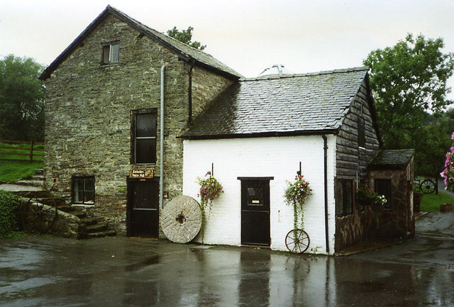
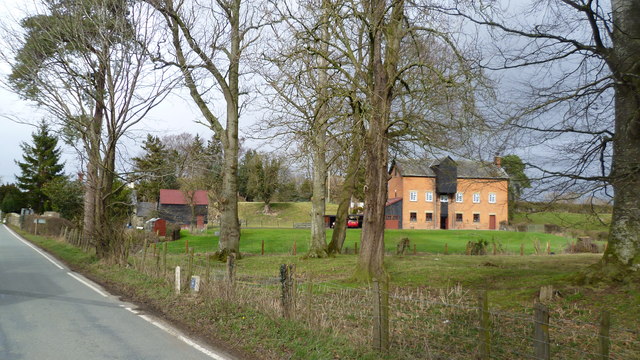
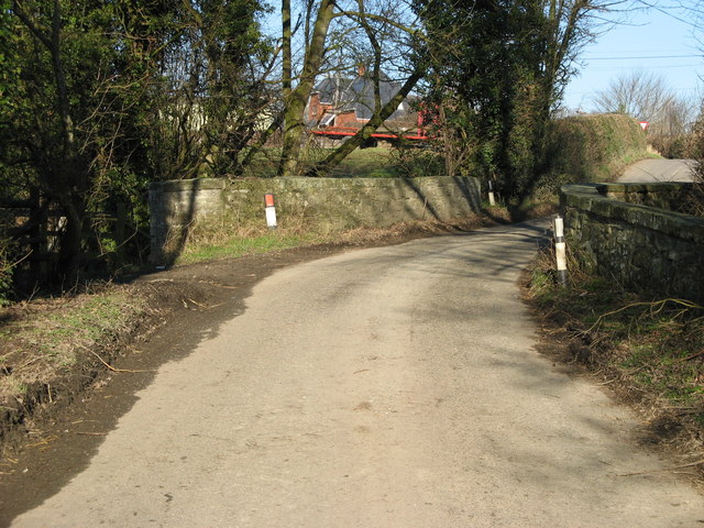
Castlewright, Lower Images

Images are sourced within 2km of 52.502857/-3.0915949 or Grid Reference SO2690. Thanks to Geograph Open Source API. All images are credited.

Cwmlladron dingle The wooded upper valley is like a notch in the side of the Shadwell Hill massif.
Cwmlladron dingle
The wooded upper valley is like a notch in the side of the Shadwell Hill massif.
Welsh borders The edge of Wales and Shropshire is typified by rolling hills with wooded valleys of dingles notched into the landscape.
Welsh borders
The edge of Wales and Shropshire is typified by rolling hills with wooded valleys of dingles notched into the landscape.
On Offa's Dyke Path in early spring Blowy, sunny and promising walking.
On Offa's Dyke Path in early spring
Blowy, sunny and promising walking.
Stile atop Offa's Dyke Path above Churchtown, Shrops Looking northwards.
Stile atop Offa's Dyke Path above Churchtown, Shrops
Looking northwards.
Stile atop Offa's Dyke Path above Churchtown, Shrops Looking southwards into morning sunshine.
Stile atop Offa's Dyke Path above Churchtown, Shrops
Looking southwards into morning sunshine.
Offa's Dyke Path crosses the lane Twin kissing gate crossing points. Replaced old stiles.
Offa's Dyke Path crosses the lane
Twin kissing gate crossing points. Replaced old stiles.
Twin kissing gates and fingerpost on Offa's Dyke Path Replacing old twin stiles.
Twin kissing gates and fingerpost on Offa's Dyke Path
Replacing old twin stiles.
On Offa's Dyke Path above Nut Wood A fave view on ODP.
On Offa's Dyke Path above Nut Wood
A fave view on ODP.
On ODP near Nut Wood Down in the deep valley.
On ODP near Nut Wood
Down in the deep valley.
On ODP below Nut Wood Nice steep pull.
On ODP below Nut Wood
Nice steep pull.
On ODP beside Nut Wood Kissing gate replacing old stiles.
On ODP beside Nut Wood
Kissing gate replacing old stiles.
Pond beside ODP A little man made pond I suspect.
Pond beside ODP
A little man made pond I suspect.
Gate on ODP where the Kerry Ridgeway crosses too The lane carries the Kerry Ridgeway I believe.
Gate on ODP where the Kerry Ridgeway crosses too
The lane carries the Kerry Ridgeway I believe.
On Offa's Dyke Path below Crowsnest Cottage Great ODP view towards lovely Corndon Hill.
On Offa's Dyke Path below Crowsnest Cottage
Great ODP view towards lovely Corndon Hill.
Upper Castlewright farm from Offa's Dyke Path Nice upland farm here.
Upper Castlewright farm from Offa's Dyke Path
Nice upland farm here.
Edenhope Hill Cerddwr yn dilyn Llwybr Clawdd Offa ar Fryn Edenhope.

Walker following Offa's Dyke Path on Edenhope Hill.
Edenhope Hill
Cerddwr yn dilyn Llwybr Clawdd Offa ar Fryn Edenhope. Walker following Offa's Dyke Path on Edenhope Hill.
Dog and Duck Cottage Viewed from the Welsh side of the border.
Dog and Duck Cottage
Viewed from the Welsh side of the border.
Welsh Sheep In The Meadow With Corndon Hill on the horizon.
Welsh Sheep In The Meadow
With Corndon Hill on the horizon.
Show me another place!

Castlewright, Lower is located at Grid Ref: SO2690 (Lat: 52.502857, Lng: -3.0915949)

Unitary Authority: Powys

Police Authority: Dyfed Powys

What 3 Words

///measuring.ended.loud. Near Mainstone, Shropshire

Related Wikis

Bacheldre

Bacheldre (Welsh: Bachelldref or Bachelldre) is a small settlement in Powys, Wales. It is near the A489 road and is 5 kilometres (3 mi) southeast of the...

Mainstone

Mainstone is a small village and civil parish in southwest Shropshire, England, near the border with Powys, Wales. The village lies approximately 1 mile...

Brompton, Shropshire

Brompton (Welsh: Brontyn) is a hamlet in Shropshire, England. It lies on the A489 between Church Stoke and Newtown (both in Powys) at its junction with...

Pentreheyling

Pentreheyling is a hamlet in Shropshire, England. It lies just west of Brompton on the A489 between Church Stoke and Newtown. The hamlet is notable for...

Nearby Amenities

Located within 500m of 52.502857,-3.0915949
Barrier: stile
Material: wood
Stile: stepover
Lat/Long: 52.5009299/-3.0947594
Place: farm
Lat/Long: 52.5015274/-3.0847376
Building: yes
Lat/Long: 52.5029119/-3.0851024
Barrier: stile
Foot: designated
Material: wood
Stile: stepover
Lat/Long: 52.4993244/-3.0942398
The data included in this document is from www.openstreetmap.org. The data is made available under ODbL.

Have you been to Castlewright, Lower?

Leave your review of Castlewright, Lower below (or comments, questions and feedback).