Brockholes, Lower

Settlement in Yorkshire

England

Brockholes, Lower

Bridges across Hebble Brook to the Golf Club House Assortment of bridges for golfers and groundsmen
Bridges across Hebble Brook to the Golf Club House Credit: Kevin Waterhouse

Brockholes is a small village located in the Holme Valley, within the metropolitan borough of Kirklees in West Yorkshire, England. Situated just 5 miles southwest of Huddersfield, it is nestled in the picturesque Pennine Hills, offering stunning views of the surrounding countryside.

The village is known for its charming and peaceful atmosphere, making it an attractive place for residents and visitors alike. It boasts a close-knit community that takes pride in maintaining the area's natural beauty and preserving its rich history. The traditional stone-built houses and well-kept gardens contribute to the village's characterful appeal.

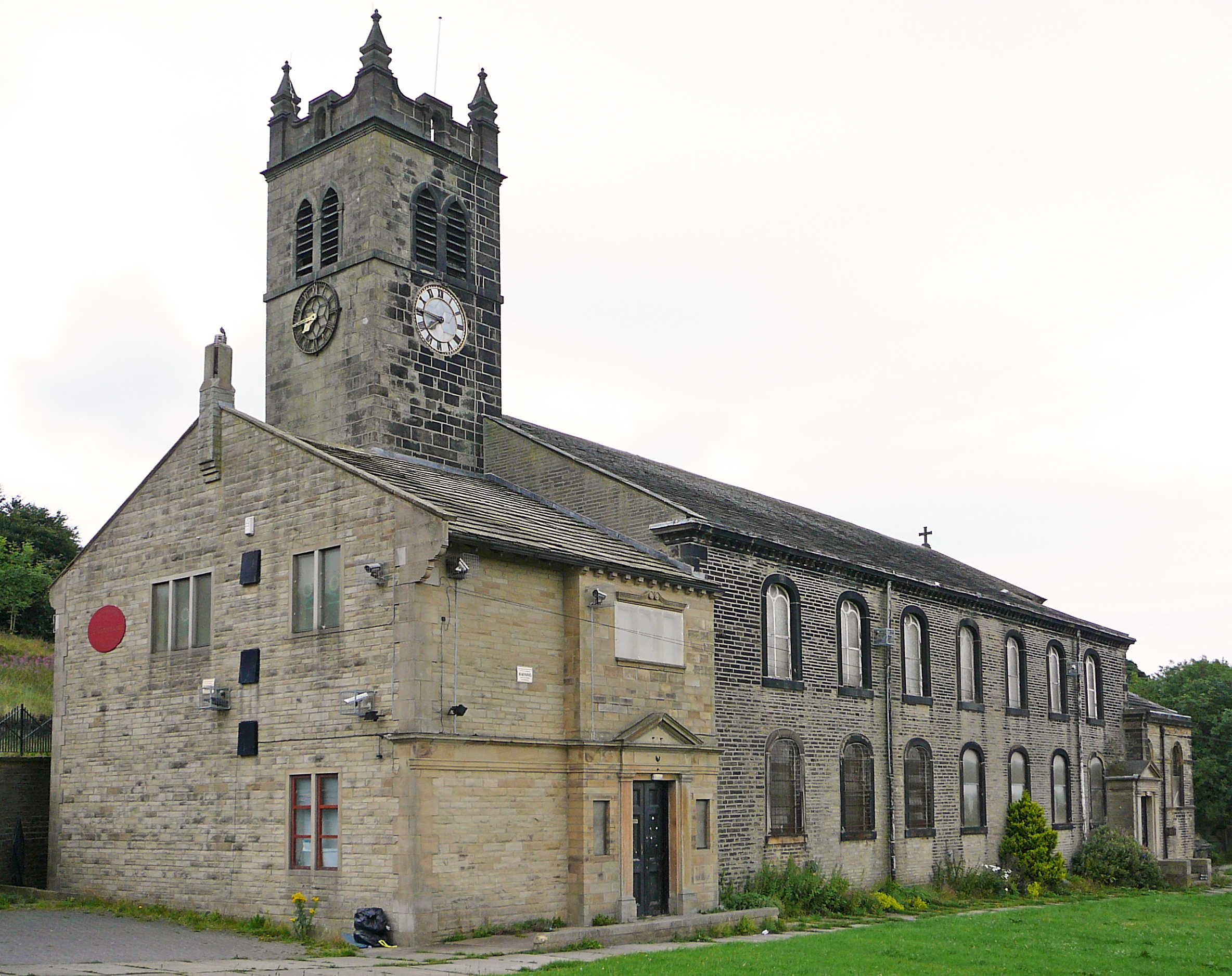
Brockholes is also home to St. George's Church, a beautiful Grade II listed building that dates back to the 18th century. The church serves as a focal point for various community events and gatherings throughout the year.

The village benefits from its proximity to some of Yorkshire's finest countryside, with ample opportunities for outdoor activities such as hiking, cycling, and horse riding. The nearby Holme Moss offers breathtaking panoramic views and is a popular spot for nature enthusiasts and photographers.

In terms of amenities, Brockholes has a few local shops and a welcoming village pub that serves as a social hub for residents. For further amenities and services, the larger town of Holmfirth is just a short drive away.

Overall, Brockholes is a delightful village that offers both tranquility and access to the stunning landscapes of the Holme Valley, making it an appealing destination for those seeking a peaceful retreat in the heart of Yorkshire.

If you have any feedback on the listing, please let us know in the comments section below.

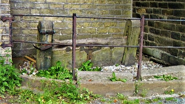
Brockholes, Lower Images

Images are sourced within 2km of 53.757327/-1.9104769 or Grid Reference SE0629. Thanks to Geograph Open Source API. All images are credited.

Bridges across Hebble Brook to the Golf Club House Assortment of bridges for golfers and groundsmen
Bridges across Hebble Brook to the Golf Club House
Assortment of bridges for golfers and groundsmen
Bridge over Hebble Brook off Union Lane A substantial stone bridge for a little used track
Bridge over Hebble Brook off Union Lane
A substantial stone bridge for a little used track
Halifax Golf Club Course above Temperature Inversion View from Calderdale Way at Lower Brockholes. Ovenden Moor Wind Farm on skyline
Halifax Golf Club Course above Temperature Inversion
View from Calderdale Way at Lower Brockholes. Ovenden Moor Wind Farm on skyline
Halifax Golf Club Course The course viewed from footpath above and East of Rocks Lane. Withins and Ovenden Moor wind farm on the skyline
Halifax Golf Club Course
The course viewed from footpath above and East of Rocks Lane. Withins and Ovenden Moor wind farm on the skyline
The Promenade Ogden Water The road on top of the dam of the reservoir shortly after it was made over as 'Victorian'
The Promenade Ogden Water
The road on top of the dam of the reservoir shortly after it was made over as 'Victorian'
Benchmark cut into gatepost near Ovenden Moor The slightly damaged benchmark is cut into a gatepost on the south side of Withens Road. Wider view <a href="https://www.geograph.org.uk/photo/7563020">SE0430 : Withens Gap Farm, Cold Edge, Ovenden Moor</a>
Benchmark cut into gatepost near Ovenden Moor
The slightly damaged benchmark is cut into a gatepost on the south side of Withens Road. Wider view SE0430 : Withens Gap Farm, Cold Edge, Ovenden Moor
Withens Gap Farm, Cold Edge, Ovenden Moor There is a slightly damaged benchmark is cut into the gatepost on the south side of Withens Road. Closer view <a href="https://www.geograph.org.uk/photo/7563019">SE0430 : Benchmark cut into gatepost near Ovenden Moor</a>
Withens Gap Farm, Cold Edge, Ovenden Moor
There is a slightly damaged benchmark is cut into the gatepost on the south side of Withens Road. Closer view SE0430 : Benchmark cut into gatepost near Ovenden Moor
High Rise Flats at Dodge Holme The high rise blocks viewed from Gibb Lane, Mount Tabor. The Rake Bank escarpment is behind the flats and some of the housing at Illingworth on the hill tops
High Rise Flats at Dodge Holme
The high rise blocks viewed from Gibb Lane, Mount Tabor. The Rake Bank escarpment is behind the flats and some of the housing at Illingworth on the hill tops
Riding & Gibralter Farms View over the farms to Broadley housing on the skyline and the new development at Fountainhead to the left
Riding & Gibralter Farms
View over the farms to Broadley housing on the skyline and the new development at Fountainhead to the left
Lower Brockholes & Temperature Inversion View from Calderdale Way hampered by colder air in the valley. Hunter Hill in the sunshine beyond
Lower Brockholes & Temperature Inversion
View from Calderdale Way hampered by colder air in the valley. Hunter Hill in the sunshine beyond
Demolition of Talbot Inn The middle part of the inn has gone apart from the steel beam that tied the outer wings together. Housing now occupies this site
Demolition of Talbot Inn
The middle part of the inn has gone apart from the steel beam that tied the outer wings together. Housing now occupies this site
Per Lane, Upper Brockholes in Winter View down Per Lane to Lane Head Lane/Field Head Lane junctions. Per Lane was not regularly gritted not being a bus route
Per Lane, Upper Brockholes in Winter
View down Per Lane to Lane Head Lane/Field Head Lane junctions. Per Lane was not regularly gritted not being a bus route
Former Lock Up A grade II* listing on Keighley Road and remarkably with no cars parked in front
Former Lock Up
A grade II* listing on Keighley Road and remarkably with no cars parked in front
Stocks next to Lock Up A grade II listing on Keighley Road. The stocks appear in a very tight space against the back wall for you to sit and be locked at the ankle.
Stocks next to Lock Up
A grade II listing on Keighley Road. The stocks appear in a very tight space against the back wall for you to sit and be locked at the ankle.
St John's Church Bradshaw A view from Pavement Lane of this small church
St John's Church Bradshaw
A view from Pavement Lane of this small church
Shaking House Crag The heather covered crag between Shaking House Farm on the right and Lower Brockholes on the left in this view from Mixenden Reservoir
Shaking House Crag
The heather covered crag between Shaking House Farm on the right and Lower Brockholes on the left in this view from Mixenden Reservoir
Gateway on Elland Footpath 73/3, Stainland This is as far as I had time to explore. Another visit is needed to find the connection between here and where I came to a halt walking from the other end: <a href="https://www.geograph.org.uk/photo/7157480">SE0718 : Elland footpath 73/3 apparently blocked</a>.
Gateway on Elland Footpath 73/3, Stainland
This is as far as I had time to explore. Another visit is needed to find the connection between here and where I came to a halt walking from the other end: SE0718 : Elland footpath 73/3 apparently blocked.
Bridge on Caty Well Brook The bridge in this view is upstream of the one in use near Cat i' th' Well Public House
Bridge on Caty Well Brook
The bridge in this view is upstream of the one in use near Cat i' th' Well Public House
Show me another place!

Brockholes, Lower is located at Grid Ref: SE0629 (Lat: 53.757327, Lng: -1.9104769)

Division: West Riding

Unitary Authority: Calderdale

Police Authority: West Yorkshire

What 3 Words

///format.cassettes.stockpile. Near Queensbury, West Yorkshire

Related Wikis

Mixenden

Mixenden is a district of Halifax, Calderdale, in the county of West Yorkshire, England. It lies on the outskirts of the town. The name Mixenden derives...

Wainstalls

Wainstalls is a village near Halifax, in the Calderdale district of West Yorkshire, England. The area is rural and much of the area is farmland. Wainstalls...

Illingworth, West Yorkshire

Illingworth is a village within the Metropolitan Borough of Calderdale, in West Yorkshire, England. The appropriate Calderdale Ward is called Illingworth...

North Halifax Grammar School

The North Halifax Grammar School (NHGS) is a state grammar school, and former specialist Science college (with academy status) in Illingworth, Halifax...

Nearby Amenities

Located within 500m of 53.757327,-1.9104769
Mini Roundabout
Direction: clockwise
Lat/Long: 53.7546312/-1.9085442
Bus Stop
Mixenden
Local Ref: 45017421
Naptan AtcoCode: 450017421
Naptan Bearing: SE
Naptan CommonName: Mixenden
Naptan Crossing: Longhouse Road
Naptan Indicator: Stop 45017421
Naptan Notes: New TF shelter and 3p case fitted awaiting survey
Naptan PlusbusZoneRef: LEEDS
Naptan ShortCommonName: Longhouse Road
Naptan Street: Mixenden Road
Naptan Verified: no
Source: naptan_import
Lat/Long: 53.7544236/-1.908
Bus Stop
Mixenden
Local Ref: 45017422
Naptan AtcoCode: 450017422
Naptan Bearing: SW
Naptan CommonName: Mixenden
Naptan Crossing: Mixenden Road
Naptan Indicator: Stop 45017422
Naptan Landmark: Community Centre
Naptan Notes: New TF Shelter and 3P case fitted awaiting survey
Naptan PlusbusZoneRef: LEEDS
Naptan ShortCommonName: Mixenden Road
Naptan Street: Clough Lane
Naptan Verified: no
Source: naptan_import
Lat/Long: 53.7542085/-1.9088953
Bus Stop
Clough Lane Hollins Lane
Local Ref: 45017423
Naptan AtcoCode: 450017423
Naptan Bearing: NE
Naptan CommonName: Clough Lane Hollins Lane
Naptan Crossing: Hollins Lane
Naptan Indicator: Stop 45017423
Naptan Landmark: Mixenden Community Primary School
Naptan PlusbusZoneRef: LEEDS
Naptan ShortCommonName: Mixenden School
Naptan Street: Clough Lane
Naptan Verified: no
Source: naptan_import
Lat/Long: 53.7530321/-1.910278
Bus Stop
Mixenden Clough Lane
Local Ref: 45018037
Naptan AtcoCode: 450018037
Naptan Bearing: NE
Naptan CommonName: Mixenden Clough Lane
Naptan Crossing: Mixenden Road
Naptan Indicator: Stop 45018037
Naptan PlusbusZoneRef: LEEDS
Naptan ShortCommonName: Mixenden Road
Naptan Street: Clough Lane
Naptan Verified: no
Source: naptan_import
Lat/Long: 53.7549901/-1.9083325
Bus Stop
Clough Lane Mill Lane
Local Ref: 45018038
Naptan AtcoCode: 450018038
Naptan Bearing: NE
Naptan CommonName: Clough Lane Mill Lane
Naptan Crossing: Clough Lane
Naptan Indicator: Stop 45018038
Naptan PlusbusZoneRef: LEEDS
Naptan ShortCommonName: Mill Lane
Naptan Street: Mill Lane
Naptan Verified: no
Source: naptan_import
Lat/Long: 53.7573334/-1.9063226
Bus Stop
Mill Lane Hays Lane
Local Ref: 45018039
Naptan AtcoCode: 450018039
Naptan Bearing: W
Naptan CommonName: Mill Lane Hays Lane
Naptan Crossing: Hays Lane
Naptan Indicator: Stop 45018039
Naptan Landmark: Unknown
Naptan Notes: OSR taken place 251005
Naptan PlusbusZoneRef: LEEDS
Naptan ShortCommonName: Hays Lane
Naptan Street: Mill Lane
Naptan Verified: no
Source: naptan_import
Lat/Long: 53.7572346/-1.9050211
Direction: both
Traffic Calming: cushion
Lat/Long: 53.7534072/-1.9097625
Direction: both
Traffic Calming: cushion
Lat/Long: 53.7529054/-1.9103085
Direction: both
Traffic Calming: cushion
Lat/Long: 53.7541108/-1.9090527
Direction: forward
Traffic Calming: choker
Lat/Long: 53.7533792/-1.9080072
The data included in this document is from www.openstreetmap.org. The data is made available under ODbL.

Have you been to Brockholes, Lower?

Leave your review of Brockholes, Lower below (or comments, questions and feedback).