Kellock Stone

Coastal Feature, Headland, Point in Aberdeenshire

Scotland

Kellock Stone

Pillbox at Cruden Beach
Pillbox at Cruden Beach Credit: Ralph Greig

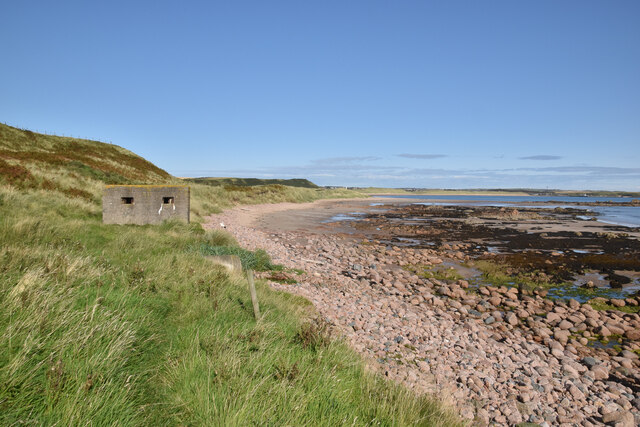
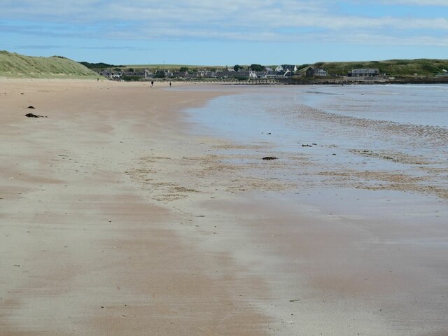
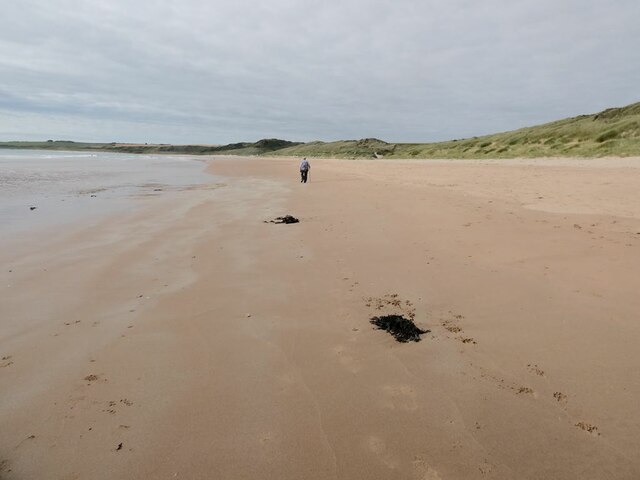
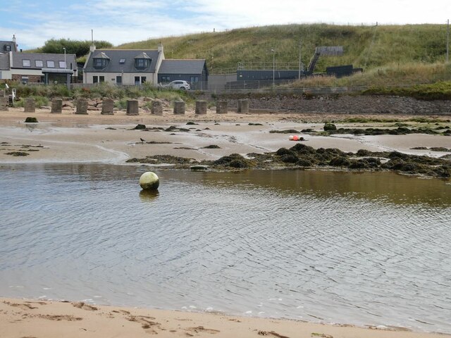
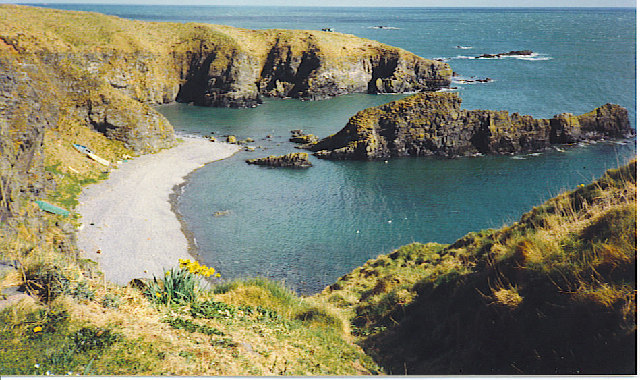
Kellock Stone is a prominent coastal feature located in Aberdeenshire, Scotland. It is a rugged headland that juts out into the North Sea, offering stunning views and a unique geological landscape. Situated near the village of Collieston, Kellock Stone is a popular destination for tourists and locals alike.

The headland is characterized by its towering cliffs, which reach heights of approximately 20 meters. These cliffs are composed of sedimentary rocks, including sandstone and shale, which provide a glimpse into the area's geological history. Fossilized remains of ancient marine life can often be found embedded within the rocks, further adding to the area's appeal for geology enthusiasts.

Kellock Stone is also known for its diverse wildlife. The surrounding coastal waters provide a rich feeding ground for various seabirds, including fulmars, kittiwakes, and guillemots. Visitors can often spot these birds nesting on the cliffs, particularly during the breeding season.

The headland offers several walking trails, allowing visitors to explore the area's natural beauty. These trails provide access to secluded beaches, hidden coves, and breathtaking viewpoints. The rugged terrain and crashing waves create a dramatic and picturesque atmosphere, making Kellock Stone a popular spot for photography enthusiasts.

Overall, Kellock Stone in Aberdeenshire is a captivating coastal feature that offers a unique blend of geological wonders, diverse wildlife, and stunning scenery. Whether you're interested in exploring the area's geological history, observing seabirds in their natural habitat, or simply enjoying a peaceful walk along the cliffs, Kellock Stone has something to offer for everyone.

If you have any feedback on the listing, please let us know in the comments section below.

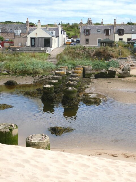
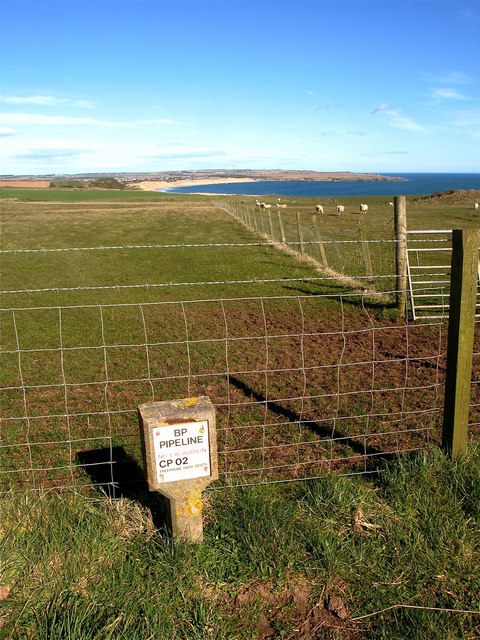
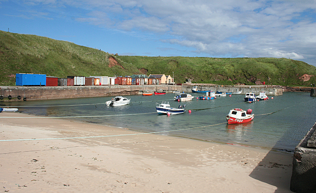
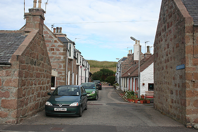
Kellock Stone Images

Images are sourced within 2km of 57.397597/-1.8572399 or Grid Reference NK0834. Thanks to Geograph Open Source API. All images are credited.

Pillbox at Cruden Beach
The beach at Cruden Bay Looking north-east towards the village.
The beach at Cruden Bay
Looking north-east towards the village.
The beach at Cruden Bay Looking south-west.
The beach at Cruden Bay
Looking south-west.
Mouth of the Water of Cruden A line of anti-tank blocks on the far bank.
Mouth of the Water of Cruden
A line of anti-tank blocks on the far bank.
Old bridge piers in the mouth of the Water of Cruden Piers  of an old bridge - although it is not clear what bridge this was. The houses of Port Erroll beyond.
Old bridge piers in the mouth of the Water of Cruden
Piers of an old bridge - although it is not clear what bridge this was. The houses of Port Erroll beyond.
Whinnyfold: Scotland's third oil boom Just under my feet there is a major pipeline bringing ashore Scotland's oil. The complex Forties pipeline system carries about 700 thousand barrels per day, 30% of the UK's oil. It is owned and operated by UK-based global energy company BP. The system, which consists of a 36-inch pipeline originating at the Forties Charlie platform, carries crude oil 169 kilometres to the Cruden Bay pumping station,  mile or so from here. From there, the crude flows a further 209 km south to the processing facility at Grangemouth on the Firth of Forth.

North Sea oil is in fact Scotland's third oil industry. The first was based not on petroleum oil but on whale oil. In the 18th and 19th centuries whalers sailed to Greenland from Scottish ports, particularly Dundee, Aberdeen and Peterhead. There they harpooned Bowhead whales and brought back their blubber in barrels. The blubber was boiled back in Scotland and the oil used for a range of purposes including street lighting and textile and jute manufacture. 

The second oil industry came about thanks to one James 'Paraffin' Young. In 1851 he began to distil oil, at first from coal and later from rock shales, near to Bathgate, in West Lothian. This was the foundation of the modern oil industry, providing the raw material for a new range of chemicals. His legacy can still be seen in the landscape of West Lothian in the form of huge red mounds or bings, of spent shale from which oil has been extracted <a href="https://www.geograph.org.uk/photo/1789176">NT0873 : Red bing and dark sky</a>.
Whinnyfold: Scotland's third oil boom
Just under my feet there is a major pipeline bringing ashore Scotland's oil. The complex Forties pipeline system carries about 700 thousand barrels per day, 30% of the UK's oil. It is owned and operated by UK-based global energy company BP. The system, which consists of a 36-inch pipeline originating at the Forties Charlie platform, carries crude oil 169 kilometres to the Cruden Bay pumping station, mile or so from here. From there, the crude flows a further 209 km south to the processing facility at Grangemouth on the Firth of Forth. North Sea oil is in fact Scotland's third oil industry. The first was based not on petroleum oil but on whale oil. In the 18th and 19th centuries whalers sailed to Greenland from Scottish ports, particularly Dundee, Aberdeen and Peterhead. There they harpooned Bowhead whales and brought back their blubber in barrels. The blubber was boiled back in Scotland and the oil used for a range of purposes including street lighting and textile and jute manufacture. The second oil industry came about thanks to one James 'Paraffin' Young. In 1851 he began to distil oil, at first from coal and later from rock shales, near to Bathgate, in West Lothian. This was the foundation of the modern oil industry, providing the raw material for a new range of chemicals. His legacy can still be seen in the landscape of West Lothian in the form of huge red mounds or bings, of spent shale from which oil has been extracted NT0873 : Red bing and dark sky.
Whinnyfold: the deadly Godman Whinnyfold is a tiny village sitting atop the cliffs at the southern end of the Bay of Cruden in Aberdeenshire. The village consists of a handful of old fisher cottages built in the 1860s. Whinnyfold has no harbour, just this natural haven and the fisherfolk had to scramble up and down a steep grass slope to reach their boats hauled up on the shingle beach and to land their catches. In the nineteenth century and early twentieth century the village housed a thriving fishing community, with some 200 fishermen operating around 20 boats. Today, however, there is no commercial fishing and no local amenities, and the houses are occupied by commuters and holiday makers.

The seas around Whinnyfold are treacherous with numerous rocky headlands and offshore a semi-submerged reef known as the Skares, the site of many shipwrecks. Little wonder that every rock and headland has its own name; the large rock in the foreground, for example is the Godman while the headland beyond is the Cruner.
Whinnyfold: the deadly Godman
Whinnyfold is a tiny village sitting atop the cliffs at the southern end of the Bay of Cruden in Aberdeenshire. The village consists of a handful of old fisher cottages built in the 1860s. Whinnyfold has no harbour, just this natural haven and the fisherfolk had to scramble up and down a steep grass slope to reach their boats hauled up on the shingle beach and to land their catches. In the nineteenth century and early twentieth century the village housed a thriving fishing community, with some 200 fishermen operating around 20 boats. Today, however, there is no commercial fishing and no local amenities, and the houses are occupied by commuters and holiday makers. The seas around Whinnyfold are treacherous with numerous rocky headlands and offshore a semi-submerged reef known as the Skares, the site of many shipwrecks. Little wonder that every rock and headland has its own name; the large rock in the foreground, for example is the Godman while the headland beyond is the Cruner.
Port Erroll Harbour The harbour was built by the Earl of Erroll, owner of nearby Slains Castle, in the late 1870s, at a cost of £14,000.
Port Erroll Harbour
The harbour was built by the Earl of Erroll, owner of nearby Slains Castle, in the late 1870s, at a cost of £14,000.
Nets and Boats These are bag-type nets used to catch salmon migrating along the shore. There is a good description of how these nets were used at <span class="nowrap"><a title="http://www.old-portlethen.co.uk/Salmon%20Fishing%20at%20Sea.htm" rel="nofollow ugc noopener" href="http://www.old-portlethen.co.uk/Salmon%20Fishing%20at%20Sea.htm">Link</a><img style="margin-left:2px;" alt="External link" title="External link - shift click to open in new window" src="https://s1.geograph.org.uk/img/external.png" width="10" height="10"/></span>
Nets and Boats
These are bag-type nets used to catch salmon migrating along the shore. There is a good description of how these nets were used at LinkExternal link
Drying the Salmon Nets The bag nets for catching migrating salmon need to be dried periodically to keep them in good condition. There is a good description of how these nets were used at <span class="nowrap"><a title="http://www.old-portlethen.co.uk/Salmon%20Fishing%20at%20Sea.htm" rel="nofollow ugc noopener" href="http://www.old-portlethen.co.uk/Salmon%20Fishing%20at%20Sea.htm">Link</a><img style="margin-left:2px;" alt="External link" title="External link - shift click to open in new window" src="https://s1.geograph.org.uk/img/external.png" width="10" height="10"/></span>
Drying the Salmon Nets
The bag nets for catching migrating salmon need to be dried periodically to keep them in good condition. There is a good description of how these nets were used at LinkExternal link
At Port Erroll Harbour From the sea wall behind the head of the harbour, looking along the drying salmon nets towards the mouth of the Cruden Water.
At Port Erroll Harbour
From the sea wall behind the head of the harbour, looking along the drying salmon nets towards the mouth of the Cruden Water.
North end of Cruden Bay That's Cruden Bay as in the curving sandy beach. The village of Cruden Bay is a little inland, hidden from here by the line of sand dunes. The Water of Cruden enters the bay between the cottage and the dunes.
North end of Cruden Bay
That's Cruden Bay as in the curving sandy beach. The village of Cruden Bay is a little inland, hidden from here by the line of sand dunes. The Water of Cruden enters the bay between the cottage and the dunes.
Boats and Nets Several boats lie high and dry on their trailers between the harbour head and the drying salmon nets at Port Erroll Harbour.
Boats and Nets
Several boats lie high and dry on their trailers between the harbour head and the drying salmon nets at Port Erroll Harbour.
Port Erroll The Ladies' Bridge over the Cruden Water is in the next square, but the foreground is in this square. I wonder how much was spent on the thousands upon thousands of concrete anti-tank blocks erected along the coast during the Second World War?
Port Erroll
The Ladies' Bridge over the Cruden Water is in the next square, but the foreground is in this square. I wonder how much was spent on the thousands upon thousands of concrete anti-tank blocks erected along the coast during the Second World War?
Port Erroll Port Erroll was established as a fishing station in the mid-1800s on the east bank of the Cruden Water. It takes its name from the Earl of Erroll, the local landowner. I wonder how long it will take the concrete tank traps to disappear completely through natural decay?
Port Erroll
Port Erroll was established as a fishing station in the mid-1800s on the east bank of the Cruden Water. It takes its name from the Earl of Erroll, the local landowner. I wonder how long it will take the concrete tank traps to disappear completely through natural decay?
Green Street Neat cottages, solidly built of local granite, in a side street in Port Erroll.
Green Street
Neat cottages, solidly built of local granite, in a side street in Port Erroll.
Port Erroll Harbour A few boats are moored in this harbour. Port Erroll is the harbour of Cruden Bay.
Port Erroll Harbour
A few boats are moored in this harbour. Port Erroll is the harbour of Cruden Bay.
Anti-tank blocks at Port Erroll
Show me another place!

Kellock Stone is located at Grid Ref: NK0834 (Lat: 57.397597, Lng: -1.8572399)

Unitary Authority: Aberdeenshire

Police Authority: North East

What 3 Words

///dignity.ranch.litigate. Near Port Erroll, Aberdeenshire

Related Wikis

Whinnyfold

Whinnyfold or Whinneyfold is a small coastal village at the southern end of the Bay of Cruden in Aberdeenshire, Scotland. Whinnyfold (locally pronounced...

Water of Cruden

The Water of Cruden is a short broadly east-flowing river in Buchan in northeast Scotland. Its headwaters streams rise in the countryside north of Ellon...

Cruden Bay Hotel

Cruden Bay Hotel was a hotel in Cruden Bay, Aberdeenshire, Scotland. Following the success of the Palace Hotel in Aberdeen, it was built between 1897 and...

Cruden Bay Hotel Tramway

The Cruden Bay Hotel Tramway operated an electric tramway service between the Cruden Bay Hotel and Cruden Bay railway station between 1899 and 1940....

Nearby Amenities

Located within 500m of 57.397597,-1.8572399
Source: OS7
Lat/Long: 57.4000225/-1.8640447
Source: OS7
Lat/Long: 57.399663/-1.863799
Source: OS7
Lat/Long: 57.3983779/-1.8631091
Source: OS7
Lat/Long: 57.3978982/-1.8628087
Source: OS7
Lat/Long: 57.3972623/-1.8624439
Source: OS7
Lat/Long: 57.3968287/-1.8628194
Source: OS7
Lat/Long: 57.3964391/-1.863019
Source: OS7
Lat/Long: 57.3959673/-1.8631306
Source: OS7
Lat/Long: 57.3955199/-1.8632808
Source: OS7
Lat/Long: 57.3949834/-1.8634481
Source: OS7
Lat/Long: 57.3945625/-1.8632432
Golf: pin
Lat/Long: 57.3972994/-1.8652762
The data included in this document is from www.openstreetmap.org. The data is made available under ODbL.

Have you been to Kellock Stone?

Leave your review of Kellock Stone below (or comments, questions and feedback).