Bradley, Lower

Settlement in Staffordshire

England

Bradley, Lower

Alice Street View The view from the Bilston Cul de Sac.
Alice Street View Credit: Gordon Griffiths

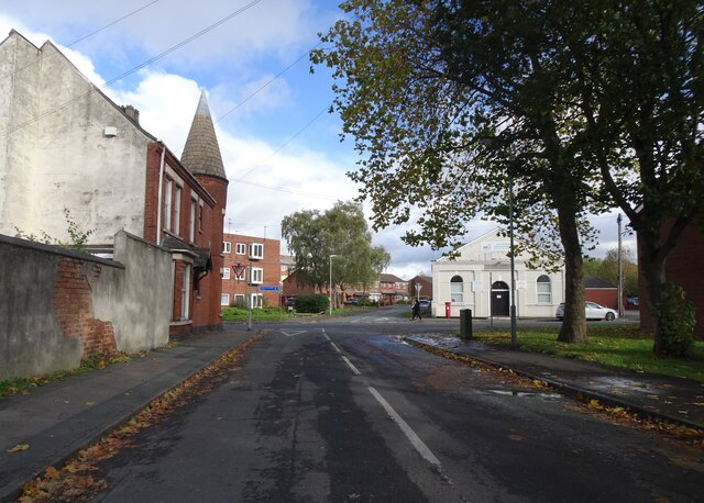
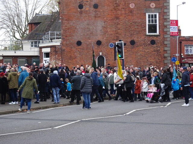
Bradley is a small village located in the county of Staffordshire, England. Situated in the southern part of the county, it lies approximately 9 miles northwest of the town of Stafford and 26 miles north of Birmingham. With a population of around 1,500 residents, Bradley is known for its picturesque rural setting and historic charm.

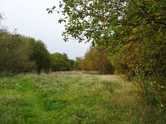
The village is characterized by its traditional English architecture, featuring a collection of quaint cottages, farmhouses, and a few larger estate houses. The surrounding countryside is predominantly agricultural, with lush green fields and rolling hills providing a scenic backdrop to the village.

Bradley is home to a few amenities that cater to the needs of its residents. These include a primary school, a village hall, and a local pub, which serves as a popular gathering spot for locals and visitors alike. The village also boasts a cricket club, offering recreational opportunities for sports enthusiasts.

In terms of transportation, Bradley is well-connected to neighboring towns and cities. The A518 road runs through the village, providing easy access to Stafford and the wider road network. The nearest railway station is Stafford, offering frequent train services to major cities such as Birmingham, Manchester, and London.

Overall, Bradley offers a tranquil and idyllic living environment, appealing to those seeking a peaceful rural lifestyle while remaining within reach of urban amenities. Its natural beauty, community spirit, and convenient location make it a desirable place to reside or visit in Staffordshire.

If you have any feedback on the listing, please let us know in the comments section below.

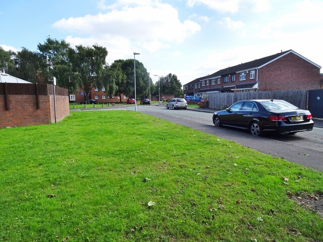
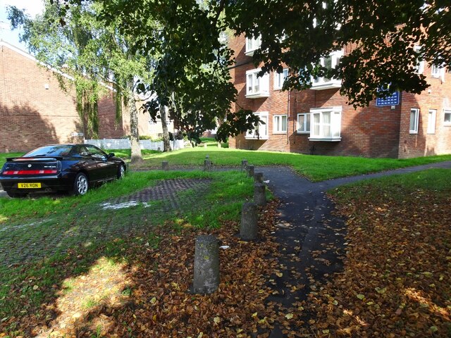
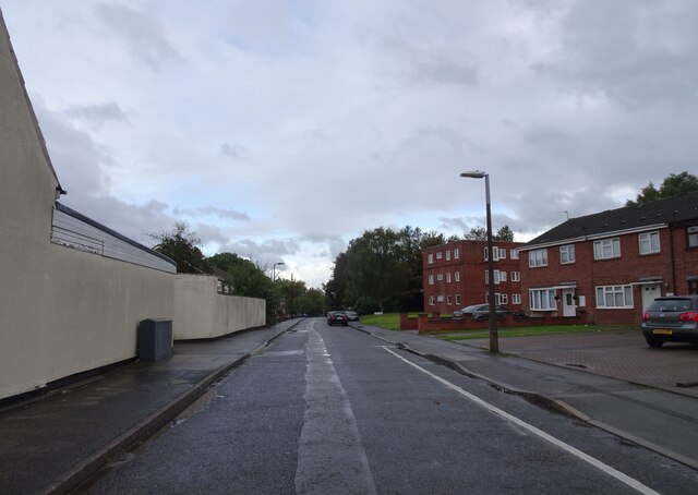
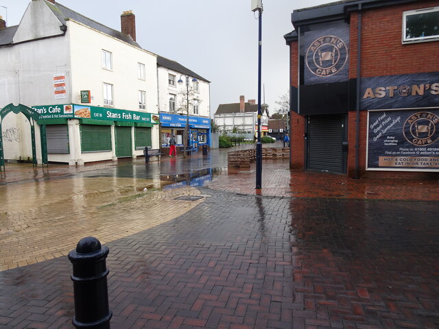
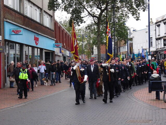
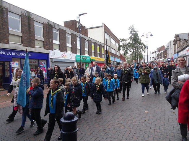
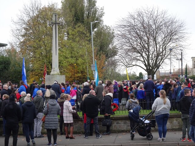
Bradley, Lower Images

Images are sourced within 2km of 52.555255/-2.058656 or Grid Reference SO9695. Thanks to Geograph Open Source API. All images are credited.

Alice Street View The view from the Bilston Cul de Sac.
Alice Street View
The view from the Bilston Cul de Sac.
Earl Street scene The view in the Bilston Cul de Sac.
Earl Street scene
The view in the Bilston Cul de Sac.
Greencroft  The view near Bilston Town centre.
Greencroft
The view near Bilston Town centre.
Wet High Street The view in Bilston Town on a rainy day.
Wet High Street
The view in Bilston Town on a rainy day.
Shale Street The view towards Broad Street in Bilston.
Shale Street
The view towards Broad Street in Bilston.
Daisy Bank Canal The view on the Bradley Leg Canal in Bilston.
Daisy Bank Canal
The view on the Bradley Leg Canal in Bilston.
Ladymoor Wood The view by the Bradley Leg Canal in Bilston.
Ladymoor Wood
The view by the Bradley Leg Canal in Bilston.
Dudley Street View The view by the Bradley Leg Canal in Bilston.
Dudley Street View
The view by the Bradley Leg Canal in Bilston.
Sankey Works Scene The view by the Bradley Leg Canal in Bilston with the former works on the right.
Sankey Works Scene
The view by the Bradley Leg Canal in Bilston with the former works on the right.
Path Wood The view from the Bankfield Road part the former Sankey Albert Street Works site in Bilston,
Path Wood
The view from the Bankfield Road part the former Sankey Albert Street Works site in Bilston,
Path Scene The view down the Bankfield Road part the former Sankey Albert Street Works site in Bilston.
Path Scene
The view down the Bankfield Road part the former Sankey Albert Street Works site in Bilston.
Art in Bilston The view of the Bilston Art Project by the University of Wolverhampton School of Art in The Orchard.
Art in Bilston
The view of the Bilston Art Project by the University of Wolverhampton School of Art in The Orchard.
Parade Muster The people of Bilston wait in the town centre for the start of the 2021  Remembrance Parade to the Cenotaph.
Parade Muster
The people of Bilston wait in the town centre for the start of the 2021 Remembrance Parade to the Cenotaph.
High Street Parade The people of Bilston march down the town centre for the 2021 Remembrance Parade to the Cenotaph.
High Street Parade
The people of Bilston march down the town centre for the 2021 Remembrance Parade to the Cenotaph.
Bilston Parade The youth of Bilston march down the town centre for the 2021 Remembrance Parade to the Cenotaph.
Bilston Parade
The youth of Bilston march down the town centre for the 2021 Remembrance Parade to the Cenotaph.
Bilston Remembers The people of Bilston mark the town centre for the 2021 Remembrance Day.
Bilston Remembers
The people of Bilston mark the town centre for the 2021 Remembrance Day.
Bilston Cenotaph The people of Bilston arrive for the 2021 Remembrance Parade at the Cenotaph.
Bilston Cenotaph
The people of Bilston arrive for the 2021 Remembrance Parade at the Cenotaph.
Parade Arrives The people of Bilston arrive at the Cenotaph for the 2021 Remembrance Service.
Parade Arrives
The people of Bilston arrive at the Cenotaph for the 2021 Remembrance Service.
Show me another place!

Bradley, Lower is located at Grid Ref: SO9695 (Lat: 52.555255, Lng: -2.058656)

Unitary Authority: Wolverhampton

Police Authority: West Midlands

What 3 Words

///votes.elder.pets. Near Bilston, West Midlands

Related Wikis

Bradley Lane tram stop

Bradley Lane tram stop is a tram stop in Bradley, Wolverhampton, England. It was opened on 31 May 1999 and is situated on West Midlands Metro Line 1. It...

Bradley and Moxley railway station

Bradley and Moxley railway station was a station on the Great Western Railway's London Paddington to Birkenhead via Birmingham Snow Hill line. It was opened...

Wednesbury Oak Loop

The Wednesbury Oak Loop, sometimes known as the Bradley Arm, is a canal in the West Midlands, England. It is part of the Birmingham Canal Navigations...

Moxley, West Midlands

Moxley is a village near Darlaston in the Metropolitan Borough of Walsall, West Midlands County, England. It was first developed during the early part...

Nearby Amenities

Located within 500m of 52.555255,-2.058656
Bradley Lane
Public Transport: stop_position
Railway: tram_stop
Tram: yes
Wheelchair: yes
Lat/Long: 52.5559816/-2.0576788
Turning Circle
Source: bing
Lat/Long: 52.5519875/-2.0610979
Turning Circle
Source: bing
Lat/Long: 52.5565534/-2.0527528
Bus Stop
Bradley Lane / Stirling Rd
Bus: yes
Naptan AtcoCode: 43000711701
Naptan Bearing: SW
Naptan BusStopType: MKD
Naptan CommonName: Stirling Rd
Naptan Indicator: adj
Naptan NaptanCode: nwmwajgw
Naptan PlusbusZoneRef: BHAMNWS
Naptan Status: ACT
Naptan StopType: BCT
Naptan Street: BRADLEY LANE
Naptan Towards: Rocket Pool
Naptan Verified: no
Public Transport: platform
Route Ref: 80;530
Source: WMCA
Lat/Long: 52.5535587/-2.062787
Bus Stop
Bradley Lane / Stirling Rd
Bus: yes
Naptan AtcoCode: 43000711702
Naptan Bearing: NE
Naptan BusStopType: MKD
Naptan CommonName: Stirling Rd
Naptan Indicator: opp
Naptan NaptanCode: nwmwajtp
Naptan PlusbusZoneRef: BHAMNWS
Naptan Status: ACT
Naptan StopType: BCT
Naptan Street: BRADLEY LANE
Naptan Towards: Bilston
Naptan Verified: no
Public Transport: platform
Route Ref: 80;530
Source: WMCA
Lat/Long: 52.5536126/-2.0628461
Wallace Rd / Ashfield Rd
Naptan AtcoCode: 43000680901
Naptan Bearing: SW
Naptan BusStopType: CUS
Naptan CommonName: Ashfield Rd
Naptan Indicator: after
Naptan NaptanCode: nwmtatwt
Naptan PlusbusZoneRef: BHAMNWS
Naptan Status: ACT
Naptan StopType: BCT
Naptan Street: WALLACE RD
Naptan Towards: Moxley
Naptan Verified: no
Source: WMCA
Lat/Long: 52.5520417/-2.0583603
Wallace Rd / Ashfield Rd
Naptan AtcoCode: 43000680902
Naptan Bearing: NE
Naptan BusStopType: CUS
Naptan CommonName: Ashfield Rd
Naptan Indicator: before
Naptan NaptanCode: nwmtawad
Naptan PlusbusZoneRef: BHAMNWS
Naptan Status: ACT
Naptan StopType: BCT
Naptan Street: WALLACE RD
Naptan Towards: Bilston
Naptan Verified: no
Public Transport: platform
Route Ref: 80
Source: WMCA
Lat/Long: 52.5523745/-2.0578593
Elizabeth Ave / Edinburgh Rd
Naptan AtcoCode: 43000681001
Naptan Bearing: SW
Naptan BusStopType: CUS
Naptan CommonName: Edinburgh Rd
Naptan Indicator: after
Naptan NaptanCode: nwmtawag
Naptan PlusbusZoneRef: BHAMNWS
Naptan Status: ACT
Naptan StopType: BCT
Naptan Street: ELIZABETH AVE
Naptan Towards: Bilston
Naptan Verified: no
Public Transport: platform
Route Ref: 80
Source: WMCA
Lat/Long: 52.5564852/-2.0626825
Elizabeth Ave / Edinburgh Rd
Naptan AtcoCode: 43000681002
Naptan Bearing: NE
Naptan BusStopType: CUS
Naptan CommonName: Edinburgh Rd
Naptan Indicator: before
Naptan NaptanCode: nwmtawaj
Naptan PlusbusZoneRef: BHAMNWS
Naptan Status: ACT
Naptan StopType: BCT
Naptan Street: ELIZABETH AVE
Naptan Towards: Moxley
Naptan Verified: no
Public Transport: platform
Route Ref: 80
Source: WMCA
Lat/Long: 52.5565189/-2.0627088
Lees Rd / Lees Terrace
Naptan AtcoCode: 43000681701
Naptan Bearing: SE
Naptan BusStopType: CUS
Naptan CommonName: Lees Terrace
Naptan Indicator: opp
Naptan NaptanCode: nwmtawam
Naptan PlusbusZoneRef: BHAMNWS
Naptan Status: ACT
Naptan StopType: BCT
Naptan Street: LEES RD
Naptan Towards: Bilston
Naptan Verified: no
Public Transport: platform
Route Ref: 80
Source: WMCA
Lat/Long: 52.5538284/-2.0628759
Lees Rd / Lees Terrace
Naptan AtcoCode: 43000681702
Naptan Bearing: NW
Naptan BusStopType: CUS
Naptan CommonName: Lees Terrace
Naptan Indicator: adj
Naptan NaptanCode: nwmtawap
Naptan PlusbusZoneRef: BHAMNWS
Naptan Status: ACT
Naptan StopType: BCT
Naptan Street: LEES RD
Naptan Towards: Moxley
Naptan Verified: no
Public Transport: platform
Route Ref: 80
Source: WMCA
Lat/Long: 52.5539271/-2.0632153
Bus Stop
Bradley Lane / Wallace Rd
Bus: yes
Naptan AtcoCode: 43000719101
Naptan Bearing: SW
Naptan BusStopType: MKD
Naptan CommonName: Wallace Rd
Naptan Indicator: adj
Naptan NaptanCode: nwmjgjaj
Naptan PlusbusZoneRef: BHAMNWS
Naptan Status: ACT
Naptan StopType: BCT
Naptan Street: BRADLEY LANE
Naptan Towards: Rocket Pool
Naptan Verified: no
Public Transport: platform
Route Ref: 530
Source: WMCA
Lat/Long: 52.5549184/-2.0584968
Bus Stop
Bradley Lane / Wallace Rd
Bus: yes
Naptan AtcoCode: 43000719102
Naptan Bearing: NE
Naptan BusStopType: MKD
Naptan CommonName: Wallace Rd
Naptan Indicator: before
Naptan NaptanCode: nwmtpwtm
Naptan PlusbusZoneRef: BHAMNWS
Naptan Status: ACT
Naptan StopType: BCT
Naptan Street: BRADLEY LANE
Naptan Towards: Bilston
Naptan Verified: no
Public Transport: platform
Route Ref: 530
Source: WMCA
Lat/Long: 52.5549092/-2.0589393
Bus Stop
Bradley Lane / Edinburgh Rd
Bus: yes
Naptan AtcoCode: 43000719201
Naptan Bearing: NE
Naptan BusStopType: MKD
Naptan CommonName: Edinburgh Rd
Naptan Indicator: adj
Naptan NaptanCode: nwmjgjam
Naptan PlusbusZoneRef: BHAMNWS
Naptan Status: ACT
Naptan StopType: BCT
Naptan Street: BRADLEY LANE
Naptan Towards: Bilston
Naptan Verified: no
Public Transport: platform
Route Ref: 530
Source: WMCA
Lat/Long: 52.5545129/-2.060399
Bus Stop
Bradley Lane / Edinburgh Rd
Bus: yes
Naptan AtcoCode: 43000719202
Naptan Bearing: SW
Naptan BusStopType: MKD
Naptan CommonName: Edinburgh Rd
Naptan Indicator: opp
Naptan NaptanCode: nwmtpmpa
Naptan PlusbusZoneRef: BHAMNWS
Naptan Status: ACT
Naptan StopType: BCT
Naptan Street: BRADLEY LANE
Naptan Towards: Rocket Pool
Naptan Verified: no
Public Transport: platform
Route Ref: 530
Source: WMCA
Lat/Long: 52.554306/-2.0607232
Bus Stop
Stirling Rd / Bradley Lane
Bus: yes
Naptan AtcoCode: 43000719301
Naptan Bearing: N
Naptan BusStopType: MKD
Naptan CommonName: Bradley Lane
Naptan Indicator: before
Naptan NaptanCode: nwmjgjap
Naptan PlusbusZoneRef: BHAMNWS
Naptan Status: ACT
Naptan StopType: BCT
Naptan Street: STIRLING RD
Naptan Towards: Bilston
Naptan Verified: no
Public Transport: platform
Route Ref: 53;80;530
Source: WMCA
Lat/Long: 52.5529741/-2.0632287
Bus Stop
Stirling Rd / Bradley Lane
Bus: yes
Naptan AtcoCode: 43000719302
Naptan Bearing: S
Naptan BusStopType: MKD
Naptan CommonName: Bradley Lane
Naptan Indicator: after
Naptan NaptanCode: nwmtpagt
Naptan PlusbusZoneRef: BHAMNWS
Naptan Status: ACT
Naptan StopType: BCT
Naptan Street: STIRLING RD
Naptan Towards: Rocket Pool
Naptan Verified: no
Public Transport: platform
Route Ref: 53;80
Source: WMCA
Lat/Long: 52.5531229/-2.0632329
Bus Stop
Great Bridge Rd / Coles Of Bilston
Bus: yes
Naptan AtcoCode: 43000689101
Naptan Bearing: NW
Naptan BusStopType: MKD
Naptan CommonName: Coles Of Bilston
Naptan Indicator: adj
Naptan NaptanCode: nwmdjawp
Naptan PlusbusZoneRef: BHAMNWS
Naptan Status: ACT
Naptan StopType: BCT
Naptan Street: GREAT BRIDGE RD
Naptan Towards: Bilston
Public Transport: platform
Route Ref: 23;530
Source: WMCA
Lat/Long: 52.5591976/-2.0569375
Bus Stop
Great Bridge Rd / Coles Of Bilston
Bus: yes
Naptan AtcoCode: 43000689102
Naptan Bearing: SE
Naptan BusStopType: MKD
Naptan CommonName: Coles Of Bilston
Naptan Indicator: opp
Naptan NaptanCode: nwmdjawt
Naptan PlusbusZoneRef: BHAMNWS
Naptan Status: ACT
Naptan StopType: BCT
Naptan Street: GREAT BRIDGE RD
Naptan Towards: Wednesbury
Public Transport: platform
Route Ref: 23;530
Source: WMCA
Lat/Long: 52.559558/-2.0571607
Bus Stop
Great Bridge Rd / Bradley Lane
NaPTANAreaCode: 43000689201
Bus: yes
Naptan AtcoCode: 43000689201
Naptan Bearing: NW
Naptan BusStopType: MKD
Naptan CommonName: Bradley Lane
Naptan Indicator: opp
Naptan NaptanCode: nwmdjdad
Naptan PlusbusZoneRef: BHAMNWS
Naptan Status: ACT
Naptan StopType: BCT
Naptan Street: GREAT BRIDGE RD
Naptan Towards: Bilston
Public Transport: platform
Route Ref: 23;530
Shelter: yes
Shelter Ref: 204301
Source: WMCA
Lat/Long: 52.556929/-2.0541078
Bus Stop
Great Bridge Rd / Bradley Lane
Bus: yes
Naptan AtcoCode: 43000689202
Naptan Bearing: SE
Naptan BusStopType: MKD
Naptan CommonName: Bradley Lane
Naptan Indicator: adj
Naptan NaptanCode: nwmdjdag
Naptan PlusbusZoneRef: BHAMNWS
Naptan Status: ACT
Naptan StopType: BCT
Naptan Street: GREAT BRIDGE RD
Naptan Towards: Wednesbury
Naptan Verified: no
Public Transport: platform
Route Ref: 23;80;530
Source: WMCA
Lat/Long: 52.5576083/-2.05468
Bus Stop
Bradley Lane / Hannah Rd
Bus: yes
Naptan AtcoCode: 43000689301
Naptan Bearing: SW
Naptan BusStopType: MKD
Naptan CommonName: Hannah Rd
Naptan Indicator: opp
Naptan NaptanCode: nwmjdtad
Naptan PlusbusZoneRef: BHAMNWS
Naptan Status: ACT
Naptan StopType: BCT
Naptan Street: BRADLEY LANE
Naptan Towards: Rocket Pool
Public Transport: platform
Route Ref: 80;530
Shelter: no
Source: WMCA
Lat/Long: 52.5560208/-2.0551849
Bus Stop
Bradley Lane / Hannah Rd
Bus: yes
Naptan AtcoCode: 43000689302
Naptan Bearing: NE
Naptan BusStopType: CUS
Naptan CommonName: Hannah Rd
Naptan Indicator: adj
Naptan NaptanCode: nwmtpgwj
Naptan PlusbusZoneRef: BHAMNWS
Naptan Status: ACT
Naptan StopType: BCT
Naptan Street: BRADLEY LANE
Naptan Towards: Bilston
Public Transport: platform
Route Ref: 80;530
Shelter: no
Source: WMCA
Lat/Long: 52.5562946/-2.0547288
Bus Stop
Great Bridge Rd / Bull Lane
Bus: yes
Naptan AtcoCode: 43000689401
Naptan Bearing: SE
Naptan BusStopType: MKD
Naptan CommonName: Bull Lane
Naptan Indicator: adj
Naptan NaptanCode: nwmdjdaj
Naptan PlusbusZoneRef: BHAMNWS
Naptan Status: ACT
Naptan StopType: BCT
Naptan Street: GREAT BRIDGE RD
Naptan Towards: Wednesbury
Naptan Verified: no
Public Transport: platform
Route Ref: 23;80
Source: WMCA
Lat/Long: 52.5550293/-2.0520809
Great Bridge Rd / Bull Lane
Naptan AtcoCode: 43000689402
Naptan Bearing: NW
Naptan BusStopType: CUS
Naptan CommonName: Bull Lane
Naptan Indicator: opp
Naptan NaptanCode: nwmdjdam
Naptan PlusbusZoneRef: BHAMNWS
Naptan Status: DEL
Naptan StopType: BCT
Naptan Street: GREAT BRIDGE RD
Naptan Towards: Bilston
Naptan Verified: no
Note: removed between initial NaPTAN import 2009 and WMCA refresh 2017. Any errors just re-instate bus_stop tag
Source: WMCA
Lat/Long: 52.5556376/-2.0527751
Lower Bradley
Place: locality
Source: OS_OpenData_StreetView
Lat/Long: 52.5566074/-2.0566551
Mini Roundabout
Direction: clockwise
Junction: roundabout
Lat/Long: 52.5559225/-2.0617517
Source: bing
Traffic Calming: bump
Lat/Long: 52.5553993/-2.0599941
Turning Circle
Source: bing
Lat/Long: 52.5544614/-2.0642245
Source: bing
Traffic Calming: bump
Lat/Long: 52.5560833/-2.0610741
Source: bing
Traffic Calming: bump
Lat/Long: 52.5543111/-2.0633954
Source: bing
Traffic Calming: bump
Lat/Long: 52.5553475/-2.061371
Traffic Calming: bump
Lat/Long: 52.5553912/-2.06402
Source: bing
Traffic Calming: bump
Lat/Long: 52.5557516/-2.0627208
Source: bing
Traffic Calming: bump
Lat/Long: 52.5559533/-2.0591293
Source: bing
Traffic Calming: bump
Lat/Long: 52.5562417/-2.0637004
Source: bing
Traffic Calming: bump
Lat/Long: 52.556753/-2.0606821
Source: bing
Traffic Calming: bump
Lat/Long: 52.5561865/-2.0619521
Source: bing
Traffic Calming: bump
Lat/Long: 52.5546376/-2.0576996
Bradley Lane
Public Transport: stop_position
Railway: tram_stop
Tram: yes
Wheelchair: yes
Lat/Long: 52.5559222/-2.0577515
Bicycle Parking
Bicycle Parking: stands
Capacity: 10
Covered: no
Source: survey
Lat/Long: 52.5559895/-2.0575161
Man Made: surveillance
Source: visual survey;estimate
Lat/Long: 52.5560034/-2.0575215
Man Made: surveillance
Source: visual survey;estimate
Lat/Long: 52.5560311/-2.0575752
Give Way
Source: survey
Lat/Long: 52.5566165/-2.0537631
Man Made: street_cabinet
Source: survey
Street Cabinet: communications
Lat/Long: 52.5566512/-2.0539039
Crossing
Crossing: uncontrolled
Lat/Long: 52.5568367/-2.0538704
Man Made: street_cabinet
Source: survey
Street Cabinet: communications
Lat/Long: 52.5570996/-2.0540299
Man Made: street_cabinet
Source: survey
Street Cabinet: communications
Lat/Long: 52.5571322/-2.0540729
Man Made: street_cabinet
Source: survey
Street Cabinet: communications
Lat/Long: 52.5571567/-2.0538127
Source: survey
Lat/Long: 52.5586096/-2.0589773
Man Made: street_cabinet
Source: survey
Street Cabinet: communications
Lat/Long: 52.5587451/-2.061016
Bicycle Parking
Covered: yes
Source: survey
Lat/Long: 52.5588306/-2.0606577
Power: substation
Ref: 13651
Source: survey
Lat/Long: 52.5597111/-2.058009
Man Made: street_cabinet
Source: survey
Street Cabinet: communications
Lat/Long: 52.5585737/-2.0597297
Communication Mobile Phone: yes
Man Made: mast
Source: survey
Tower Type: communication
Lat/Long: 52.5596451/-2.0601159
Generator Method: photovoltaic
Generator Output Electricity: yes
Generator Source: solar
Generator Type: solar_photovoltaic_panel
Power: generator
Lat/Long: 52.5529012/-2.0544487
Generator Method: photovoltaic
Generator Output Electricity: yes
Generator Source: solar
Generator Type: solar_photovoltaic_panel
Power: generator
Lat/Long: 52.5531393/-2.0541349
Generator Method: photovoltaic
Generator Output Electricity: yes
Generator Source: solar
Generator Type: solar_photovoltaic_panel
Power: generator
Lat/Long: 52.552712/-2.0540786
Bradley Lane
Public Transport: station
Tram: yes
Wheelchair: yes
Lat/Long: 52.5560046/-2.0577995
Generator Method: photovoltaic
Generator Output Electricity: yes
Generator Source: solar
Generator Type: solar_photovoltaic_panel
Location: roof
Power: generator
Source: Maxar imagery
Lat/Long: 52.5532975/-2.0628199
Generator Method: photovoltaic
Generator Output Electricity: yes
Generator Source: solar
Generator Type: solar_photovoltaic_panel
Location: roof
Power: generator
Source: Maxar imagery
Lat/Long: 52.551316/-2.0598158
Generator Method: photovoltaic
Generator Output Electricity: yes
Generator Source: solar
Generator Type: solar_photovoltaic_panel
Location: roof
Power: generator
Source: Maxar imagery
Lat/Long: 52.5515394/-2.0578149
Generator Method: photovoltaic
Generator Output Electricity: yes
Generator Source: solar
Generator Type: solar_photovoltaic_panel
Location: roof
Power: generator
Source: Maxar imagery
Lat/Long: 52.5516568/-2.0568144
Generator Method: photovoltaic
Generator Output Electricity: yes
Generator Source: solar
Generator Type: solar_photovoltaic_panel
Location: roof
Power: generator
Source: Maxar imagery
Lat/Long: 52.5517726/-2.0561251
Generator Method: photovoltaic
Generator Output Electricity: yes
Generator Source: solar
Generator Type: solar_photovoltaic_panel
Location: roof
Power: generator
Source: Maxar imagery
Lat/Long: 52.5522896/-2.0536548
Bradley and Moxley
Abandoned Railway: station
Railway: site
Wikidata: Q4955071
Wikipedia: en:Bradley and Moxley railway station
Lat/Long: 52.5548128/-2.055474
Generator Method: photovoltaic
Generator Output Electricity: yes
Generator Source: solar
Generator Type: solar_photovoltaic_panel
Location: roof
Power: generator
Lat/Long: 52.5563715/-2.0627931
Generator Method: photovoltaic
Generator Output Electricity: yes
Generator Source: solar
Generator Type: solar_photovoltaic_panel
Location: roof
Power: generator
Lat/Long: 52.556608/-2.0618221
Generator Method: photovoltaic
Generator Output Electricity: yes
Generator Source: solar
Generator Type: solar_photovoltaic_panel
Location: roof
Power: generator
Lat/Long: 52.5566324/-2.0616585
The data included in this document is from www.openstreetmap.org. The data is made available under ODbL.

Have you been to Bradley, Lower?

Leave your review of Bradley, Lower below (or comments, questions and feedback).