Lower Bourne

Settlement in Surrey Waverley

England

Lower Bourne

Oast House
Oast House Credit: Oast House Archive

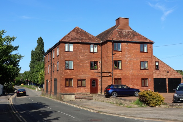
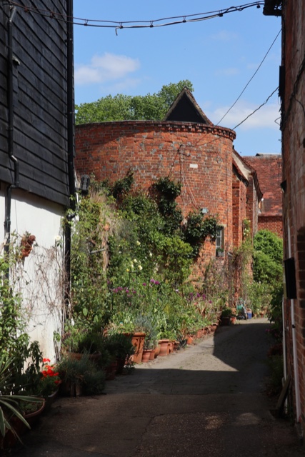
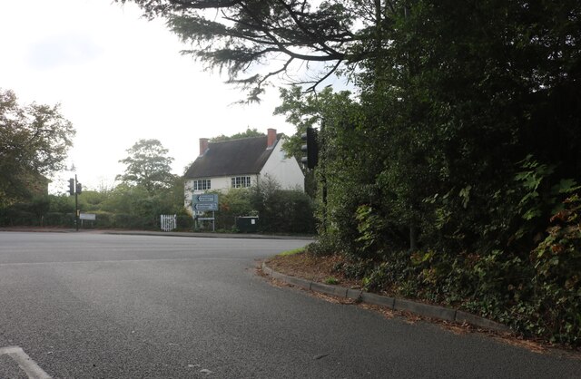
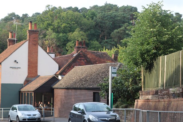
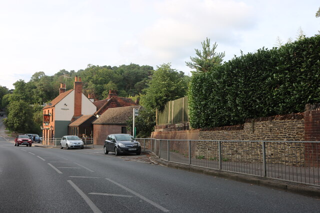
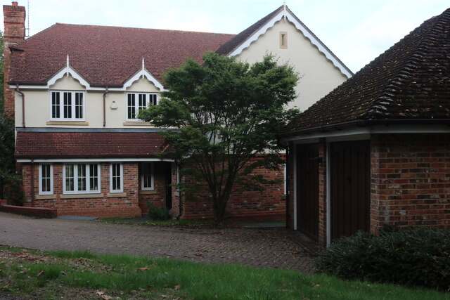
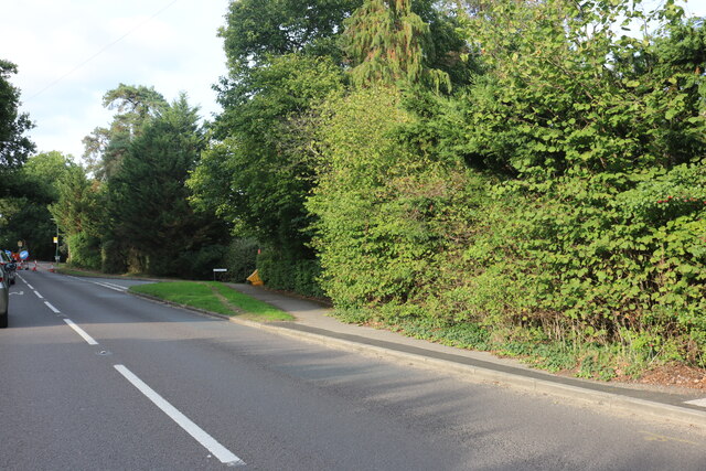
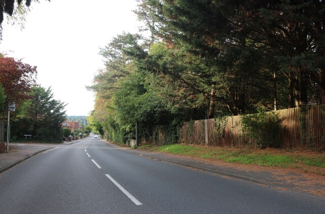
Lower Bourne is a small village located in the county of Surrey, England. Situated on the outskirts of Farnham, it is nestled in the beautiful countryside of the South East of England. The village is known for its idyllic setting, with rolling hills, lush green meadows, and charming traditional houses.

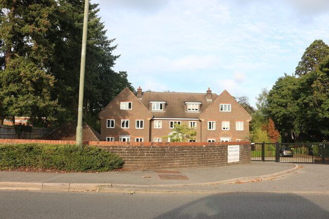
Lower Bourne has a rich history dating back to the medieval era, and this is evident in the architecture and layout of the village. Many of the buildings have retained their original features, giving the area a timeless and picturesque feel. The village also boasts a number of listed buildings, including the historic St. Martin's Church, which adds to its cultural and historical significance.

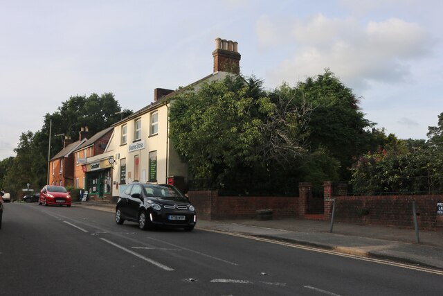
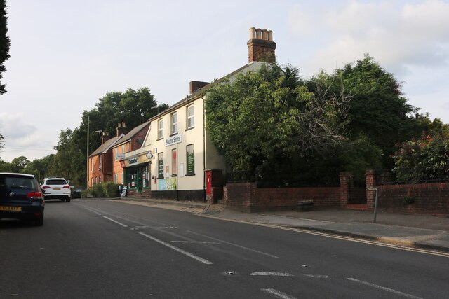
Despite its rural location, Lower Bourne offers a range of amenities for its residents. The village has a local convenience store, post office, and a few small shops, providing essential goods and services. There are also a couple of traditional pubs, where locals and visitors can enjoy a meal or a drink in a cozy and welcoming atmosphere.

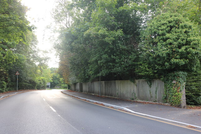
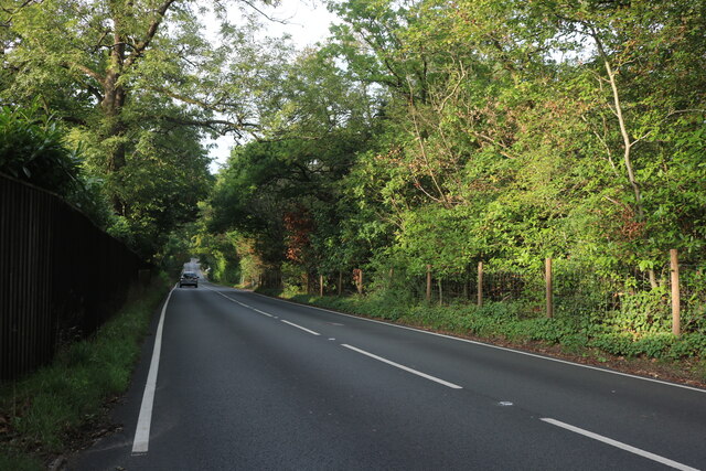
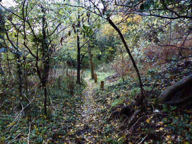
Nature lovers will appreciate the abundance of green spaces in and around Lower Bourne. The village is surrounded by stunning countryside, making it an ideal location for outdoor activities such as hiking, cycling, and horse riding. The Bourne Woods, a nearby nature reserve, offers picturesque walking trails and is home to a diverse range of wildlife.

Overall, Lower Bourne offers a tranquil and picturesque setting, with its rich history, stunning countryside, and range of amenities. It is a charming village that attracts those seeking a peaceful and idyllic lifestyle in the heart of the Surrey countryside.

If you have any feedback on the listing, please let us know in the comments section below.

Lower Bourne Images

Images are sourced within 2km of 51.196464/-0.790334 or Grid Reference SU8444. Thanks to Geograph Open Source API. All images are credited.

Oast House Single round kiln oast house (hop kiln). Missing kiln roof.

Grade II listed.
Oast House
Single round kiln oast house (hop kiln). Missing kiln roof. Grade II listed.
Great Austins, Farnham
Old Farnham Lane at the junction of Frensham Road
View by Frensham Road, Bourne Looking towards The Fox pub.
View by Frensham Road, Bourne
Looking towards The Fox pub.
Frensham Road, Bourne Looking towards The Fox pub.
Frensham Road, Bourne
Looking towards The Fox pub.
House on Frensham Road, Bourne
Gong Hill north of Millbridge At the entrance to Edgeborough School
Gong Hill north of Millbridge
At the entrance to Edgeborough School
Gong Hill north of Millbridge
Frensham Road, Millbridge
View towards Gong Hill, Millbridge
Gong Hill entering Farnham
Temporary lights on Frensham Road, Bourne
Frensham Road, Bourne
Priory Court, Farnham
Firgrove Hill, Farnham
End of the North Downs Way at Farnham
Show me another place!

Lower Bourne is located at Grid Ref: SU8444 (Lat: 51.196464, Lng: -0.790334)

Administrative County: Surrey

District: Waverley

Police Authority: Surrey

What 3 Words

///slug.crust.workbook. Near Farnham, Surrey

Related Wikis

Bourne Wood

Bourne Wood (also known as Bourne Woods) is an area of predominantly coniferous woodland just south of Farnham, Surrey, England and a film location, under...

Farnham Grammar School

Farnham Grammar School is now called Farnham College which is located in Farnham, Surrey, southern England. == History == The grammar school was created...

Farnham College

Farnham College is a coeducational sixth form college in Farnham in the English county of Surrey. It has a single campus in a residential area just to...

Green Lane Cemetery, Farnham

Green Lane Cemetery is a small cemetery on Green Lane in Farnham in Surrey, one of four cemeteries owned and maintained by Farnham Town Council. The Chapel...

Underdown nature reserve

Underdown is a 1-hectare (2.5-acre) nature reserve in Farnham in Surrey. It is owned and managed by the Surrey Wildlife Trust.This reserve was donated...

Gong Hill

Gong Hill is a 5.9-hectare (15-acre) biological Site of Special Scientific Interest south of Farnham in Surrey.This heathland site is dominated by ling...

Edgeborough School

Edgeborough School is a prep school near Farnham, Surrey in England. It is currently attended by ~360 kids between 2 and 13. The Head is Daniel Cox, former...

South Farnham School

South Farnham School is a coeducational academy in Farnham, Surrey, England. It is located on two separate sites, with the Infants Section for children...

Nearby Amenities

Located within 500m of 51.196464,-0.790334
Turning Circle
Lat/Long: 51.1978608/-0.7945274
Bus Stop
Black Pond Lane
Naptan AtcoCode: 40004411227A
Naptan Bearing: W
Naptan CommonName: Black Pond Lane
Naptan Indicator: W-bound
Naptan Landmark: Longdown Road
Naptan NaptanCode: surdwawm
Naptan PlusbusZoneRef: ALDRSHT
Naptan Street: Burnt Hill Road
Naptan Verified: no
Source: naptan_import
Lat/Long: 51.1957319/-0.7948983
Bus Stop
Beech Avenue
Naptan AtcoCode: 40004411332B
Naptan Bearing: S
Naptan CommonName: Beech Avenue
Naptan Indicator: Opp
Naptan Landmark: Eldon Drive
Naptan NaptanCode: surdwmgj
Naptan PlusbusZoneRef: ALDRSHT
Naptan Street: Frensham Road
Naptan Verified: no
Shelter: no
Source: naptan_import
Lat/Long: 51.1927136/-0.7891095
Bus Stop
Lower Bourne
Naptan AtcoCode: 40004411333A
Naptan Bearing: NW
Naptan BusStopType: CUS
Naptan Indicator: Just Before
Naptan Landmark: Old Frensham Road
Naptan NaptanCode: surdwmgm
Naptan PlusbusZoneRef: ALDRSHT
Naptan Street: Frensham Road
Source: naptan_import
Lat/Long: 51.1955051/-0.78948
Bus Stop
Lower Bourne
Bench: no
Naptan AtcoCode: 40004411333B
Naptan Bearing: SE
Naptan CommonName: Lower Bourne
Naptan Indicator: Just after
Naptan Landmark: Old Frensham Road
Naptan NaptanCode: surdwmgt
Naptan PlusbusZoneRef: ALDRSHT
Naptan Street: Frensham Road
Shelter: no
Lat/Long: 51.1957035/-0.789532
Bus Stop
Naptan AtcoCode: 40004411334A
Naptan Bearing: S
Naptan BusStopType: CUS
Naptan CommonName: Fox Road
Naptan Indicator: Just after
Naptan Landmark: Fox Road
Naptan NaptanCode: surdwmgw
Naptan PlusbusZoneRef: ALDRSHT
Naptan Street: Frensham Road
Naptan Verified: no
Source: naptan_import
Lat/Long: 51.1982165/-0.7910638
Bus Stop
Fox Road
Naptan AtcoCode: 40004411334B
Naptan Bearing: N
Naptan CommonName: Fox Road
Naptan Indicator: Just Before
Naptan Landmark: Fox Road
Naptan NaptanCode: surdwmja
Naptan PlusbusZoneRef: ALDRSHT
Naptan Street: Frensham Road
Naptan Verified: no
Source: naptan_import
Lat/Long: 51.1984921/-0.7913626
Bus Stop
Beech Avenue
Naptan AtcoCode: 40004411455A
Naptan Bearing: N
Naptan CommonName: Beech Avenue
Naptan Indicator: adj
Naptan Landmark: Beech Avenue
Naptan NaptanCode: surgjmwg
Naptan PlusbusZoneRef: ALDRSHT
Naptan Street: Frensham Road
Naptan Verified: no
Source: naptan_import
Lat/Long: 51.1928054/-0.7892931
Bus Stop
Black Pond Lane
Naptan AtcoCode: 40004411485B
Naptan Bearing: NE
Naptan CommonName: Black Pond Lane
Naptan Indicator: adj
Naptan Landmark: Black Pond Lane
Naptan NaptanCode: surgjpjd
Naptan PlusbusZoneRef: ALDRSHT
Naptan Street: Burnt Hill Road
Naptan Verified: no
Source: naptan_import
Lat/Long: 51.195827/-0.7945238
Crossing: informal
Lat/Long: 51.1988153/-0.7915178
Was Barrier: gate
Lat/Long: 51.1962398/-0.7883203
Crossing
Crossing: unmarked
Kerb: lowered
Tactile Paving: yes
Lat/Long: 51.1964907/-0.7902111
Waste Basket
Lat/Long: 51.1966684/-0.7901752
Bench
Lat/Long: 51.1967154/-0.7902758
Tourism: information
Lat/Long: 51.1966793/-0.7902168
Parking
Capacity: 3
Lat/Long: 51.1964668/-0.7896569
Crossing
Crossing: uncontrolled
Crossing Ref: zebra
Kerb: lowered
Tactile Paving: yes
Lat/Long: 51.1966639/-0.7904039
Post Box
Postal Code: GU10
Ref: GU10 66
Lat/Long: 51.1962497/-0.7898859
Removed Amenity: telephone
Lat/Long: 51.1959842/-0.7895748
Post Box
Brand: Royal Mail
Brand Wikidata: Q638098
Collection Times: Mo-Fr 17:15; Sa 08:00
Drive Through: no
Mapillary: 1451961738519579
Operator: Royal Mail
Operator Wikidata: Q638098
Post Box Mounting: pier
Post Box Type: lamp
Postal Code: GU10
Ref: GU10 85
Royal Cypher: EIIR
Royal Cypher Wikidata: Q33102113
Survey Date: 2021-09-05
Lat/Long: 51.1956093/-0.7952873
Lower Bourne
Place: neighbourhood
Lat/Long: 51.1965965/-0.7898257
Post Office
Lower Bourne Post Office
Addr Housenumber: 31
Addr Postcode: GU10 3PY
Addr Street: Frensham Road
Branch: Lower Bourne
Brand: Post Office
Brand Wikidata: Q1783168
Check Date: 2020-02-20
Contact Website: https://www.postoffice.co.uk/branch-finder/1179004/lower-bourne
Ref Pol Id: 1862
Lat/Long: 51.1963186/-0.7898837
Parking
Capacity: 4
Fee: no
Parking: layby
Lat/Long: 51.1972191/-0.7908319
Give Way
Direction: backward
Source: Bing
Lat/Long: 51.1965631/-0.7903859
Haydon Computer Solutions
Office: it
Website: http://haydoncs.co.uk/
Lat/Long: 51.1979768/-0.7930017
Bench
Backrest: yes
Lat/Long: 51.1993227/-0.7905536
Restaurant
Yiayia's kitchen
Addr City: Farnham
Addr Housename: Yiayias @ The Fox
Addr Housenumber: 21
Addr Postcode: GU10 3PH
Addr Street: Frensham Road
Cuisine: greek;traditional;pub
Fhrs Id: 1108424
Phone: +44 1252 716395
Website: https://www.yiayias.co.uk/
Lat/Long: 51.1984177/-0.7910513
Give Way
Direction: backward
Source: Bing
Lat/Long: 51.1965607/-0.7902382
Crossing
Crossing: unmarked
Kerb: lowered
Lat/Long: 51.1965641/-0.7904557
Crossing
Crossing: unmarked
Kerb: lowered
Lat/Long: 51.1965626/-0.7901337
Give Way
Direction: forward
Lat/Long: 51.1956201/-0.7953702
Defibrillator
Defibrillator Location: In Yellow and Green box on front outside of scout building facing the road
Emergency: defibrillator
Indoor: no
Lat/Long: 51.1985088/-0.7914076
Direction: 145
Generator Method: photovoltaic
Generator Output Electricity: yes
Generator Solar Modules: 16
Generator Source: solar
Generator Type: solar_photovoltaic_panel
Location: roof
Power: generator
Lat/Long: 51.1980721/-0.7948302
Direction: 140
Generator Method: photovoltaic
Generator Output Electricity: yes
Generator Solar Modules: 12
Generator Source: solar
Generator Type: solar_photovoltaic_panel
Location: roof
Power: generator
Lat/Long: 51.1990241/-0.7924287
Addr Housename: Badgers Way
Addr Housenumber: 107A
Addr Street: Burnt Hill Road
Lat/Long: 51.1965543/-0.7923503
Addr Housename: Badgers Hollow
Addr Housenumber: 107B
Addr Street: Burnt Hill Road
Lat/Long: 51.196576/-0.792252
Bench: yes
Colour: black
Leisure: picnic_table
Lit: no
Material: plastic
Lat/Long: 51.1962299/-0.7885594
Backrest: yes
Bench: yes
Colour: grey
Direction: 127
Leisure: picnic_table
Lit: no
Material: wood
Seats: 3
Lat/Long: 51.1957988/-0.7887705
Bench
Backrest: yes
Material: wood
Lat/Long: 51.1961452/-0.7890904
Bench
Backrest: yes
Material: wood
Lat/Long: 51.1959461/-0.7887148
The data included in this document is from www.openstreetmap.org. The data is made available under ODbL.

Have you been to Lower Bourne?

Leave your review of Lower Bourne below (or comments, questions and feedback).