Lackie Head

Coastal Feature, Headland, Point in Aberdeenshire

Scotland

Lackie Head

Library, King Edward Street, Fraserburgh, Aberdeenshire The building was designed by architect William Stephen Ferguson Wilson and opened in 1905 by Lord Saltoun.  On 20th December 1904 an article in the Fraserburgh Herald and Northern Counties' Advertiser said,

"Thanks to the generosity of that multi-millionaire, Dr Andrew Carnegie, Fraserburgh will soon be the possessor one of the best equipped public libraries in the North of Scotland. It is sure to prove a distinct boon to the community. A commencement with the work of erection was made last month, and it is expected the building will be open to the public towards the close of the ensuing herring fishing season. The total cost will amount to £3400 of which sum Dr Carnegie has contributed £3000."
Library, King Edward Street, Fraserburgh, Aberdeenshire Credit: Claire Pegrum

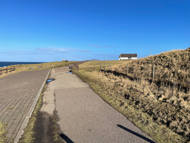
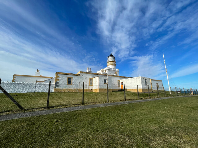
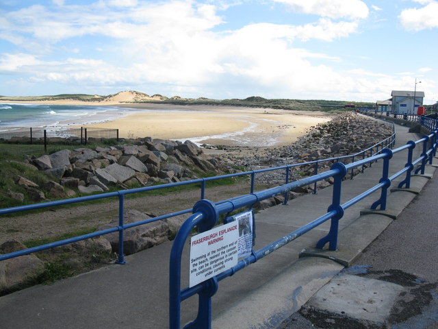
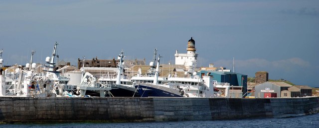
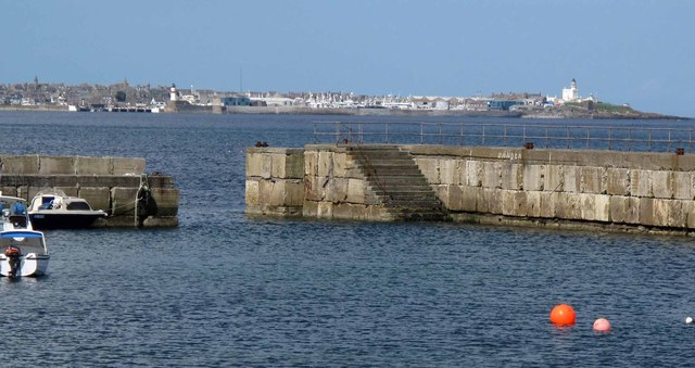
Lackie Head is a prominent headland located in Aberdeenshire, Scotland. Situated along the scenic northeastern coast, it is known for its stunning natural beauty and dramatic cliffs that overlook the North Sea. The headland offers breathtaking panoramic views of the surrounding landscape, making it a popular destination for tourists and nature enthusiasts.

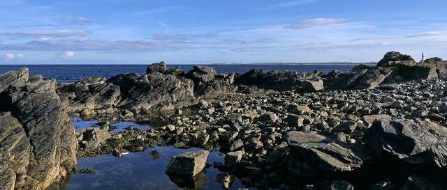
At approximately 60 meters in height, Lackie Head provides a commanding presence along the coastline. Its rocky cliffs are composed of sandstone and are often adorned with seabirds, including puffins, guillemots, and kittiwakes. The headland also features an array of caves and rocky outcrops, adding to its charm and allure.

Visitors to Lackie Head can explore the area via various walking trails that wind their way through the rugged terrain. These paths offer the opportunity to witness the diverse plant and animal life that call the headland home. Wildflowers such as sea thrift and rock samphire can be observed in abundance, adding vibrant splashes of color to the landscape.

In addition to its natural wonders, Lackie Head has historical significance. The remains of an Iron Age fort can be found atop the headland, serving as a reminder of the area's ancient past. This archaeological site offers a glimpse into the lives of the people who once inhabited the region.

Overall, Lackie Head is a captivating coastal feature that showcases the beauty and majesty of Aberdeenshire's coastline. With its stunning cliffs, diverse wildlife, and rich history, it is a must-visit destination for anyone seeking a true Scottish coastal experience.

If you have any feedback on the listing, please let us know in the comments section below.
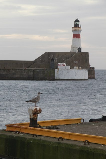
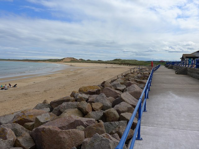
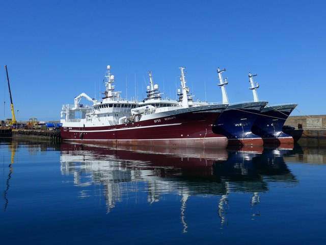
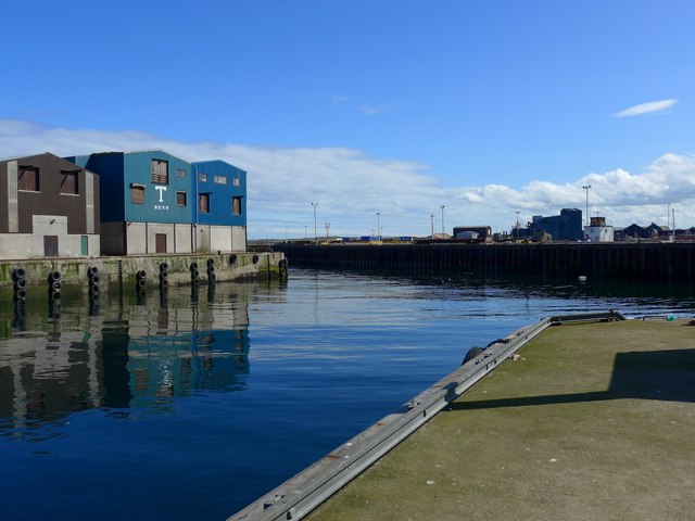
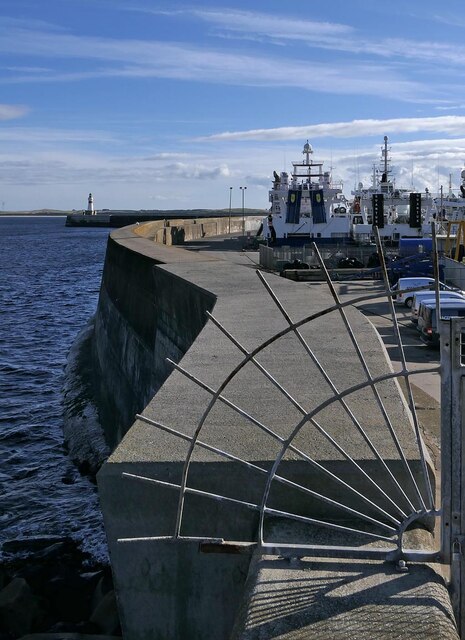
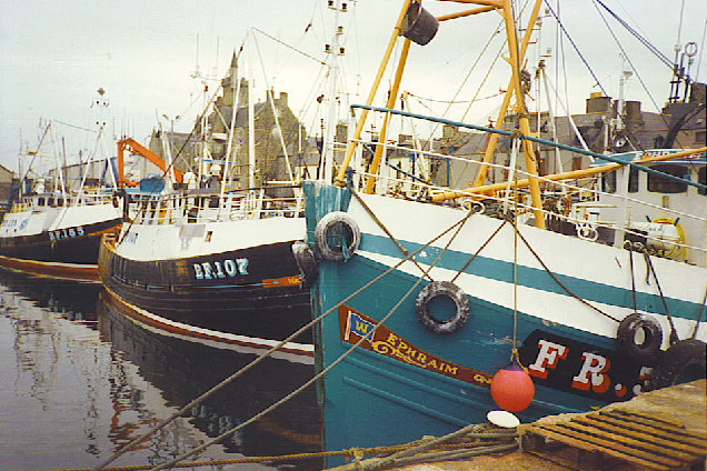
Lackie Head Images

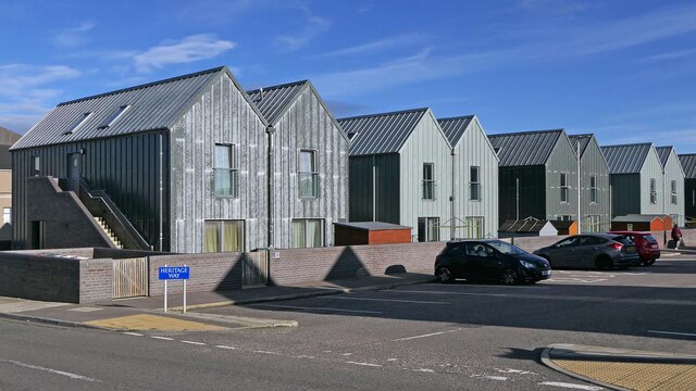
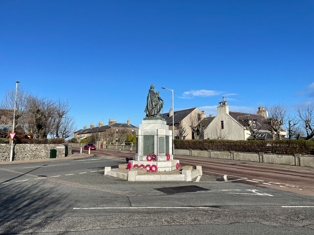
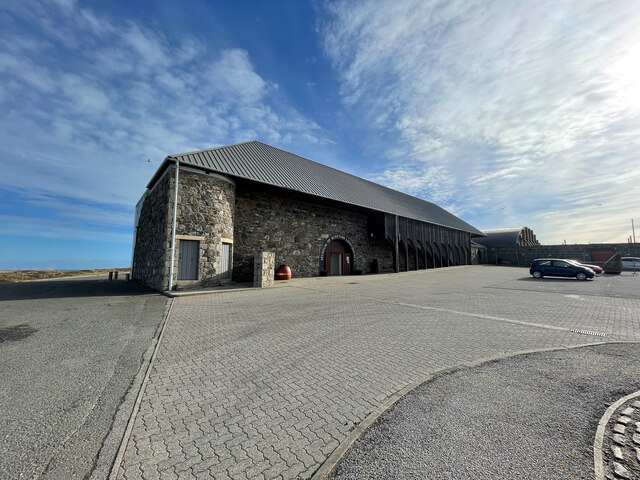
Images are sourced within 2km of 57.697322/-1.9994832 or Grid Reference NK0067. Thanks to Geograph Open Source API. All images are credited.

Library, King Edward Street, Fraserburgh, Aberdeenshire The building was designed by architect William Stephen Ferguson Wilson and opened in 1905 by Lord Saltoun.  On 20th December 1904 an article in the Fraserburgh Herald and Northern Counties' Advertiser said,

"Thanks to the generosity of that multi-millionaire, Dr Andrew Carnegie, Fraserburgh will soon be the possessor one of the best equipped public libraries in the North of Scotland. It is sure to prove a distinct boon to the community. A commencement with the work of erection was made last month, and it is expected the building will be open to the public towards the close of the ensuing herring fishing season. The total cost will amount to £3400 of which sum Dr Carnegie has contributed £3000."
Library, King Edward Street, Fraserburgh, Aberdeenshire
The building was designed by architect William Stephen Ferguson Wilson and opened in 1905 by Lord Saltoun. On 20th December 1904 an article in the Fraserburgh Herald and Northern Counties' Advertiser said, "Thanks to the generosity of that multi-millionaire, Dr Andrew Carnegie, Fraserburgh will soon be the possessor one of the best equipped public libraries in the North of Scotland. It is sure to prove a distinct boon to the community. A commencement with the work of erection was made last month, and it is expected the building will be open to the public towards the close of the ensuing herring fishing season. The total cost will amount to £3400 of which sum Dr Carnegie has contributed £3000."
Memorial, Fraserburgh Harbour, Aberdeenshire The memorial commemorates 13 Fraserburgh lifeboat crew who have died in three separate incidents.  Behind is the lifeboat station with an Ordnance Survey active station on it (the white dome).  In the background is fishing boat FR226 Challenge.
Memorial, Fraserburgh Harbour, Aberdeenshire
The memorial commemorates 13 Fraserburgh lifeboat crew who have died in three separate incidents. Behind is the lifeboat station with an Ordnance Survey active station on it (the white dome). In the background is fishing boat FR226 Challenge.
Fishing boats, Farserburgh Harbour, Aberdeenshire Something of a contrast in size between the potter Melita FR27 and the pelagic trawler Challenge FR226.
Fishing boats, Farserburgh Harbour, Aberdeenshire
Something of a contrast in size between the potter Melita FR27 and the pelagic trawler Challenge FR226.
Balaclava Harbour, Fraserburgh, Aberdeenshire Balaclava Harbour is the northernmost area of Fraserburgh Harbour.  Work started on it in 1851 and it was named after the battle of 1854.
Balaclava Harbour, Fraserburgh, Aberdeenshire
Balaclava Harbour is the northernmost area of Fraserburgh Harbour. Work started on it in 1851 and it was named after the battle of 1854.
Heritage Way, Fraserburgh, Aberdeenshire Heritage Way is an Aberdeenshire Council development of 14 houses and 16 flats which was completed in 2017.  It received funding from the Scottish Government's Greener Homes Innovation Scheme, the aim of which was to find new ways of producing energy efficient affordable housing using innovative methods of construction.  The roofs are zinc and the cladding is zinc and fibre slates.  The grey tones are intended to echo the sea, sky and neighbouring industrial buildings.
Heritage Way, Fraserburgh, Aberdeenshire
Heritage Way is an Aberdeenshire Council development of 14 houses and 16 flats which was completed in 2017. It received funding from the Scottish Government's Greener Homes Innovation Scheme, the aim of which was to find new ways of producing energy efficient affordable housing using innovative methods of construction. The roofs are zinc and the cladding is zinc and fibre slates. The grey tones are intended to echo the sea, sky and neighbouring industrial buildings.
Broadsea Prom An area of Fraserburgh called Broadsea and the sea path which follows the coast.
Broadsea Prom
An area of Fraserburgh called Broadsea and the sea path which follows the coast.
Fraserburgh War Memorial
Lighthouse Museum
Lighthouse Museum
Kinnard Head Lighthouse
Fraserburgh Esplanade and beach The beach to the south of Fraserburgh harbour is sheltered and the sand stretches for miles.
Fraserburgh Esplanade and beach
The beach to the south of Fraserburgh harbour is sheltered and the sand stretches for miles.
Fraserburgh breakwater and lighthouse The fishing vessels in this picture are pelagic trawlers.  They fish for mackerel and other pelagic species
Fraserburgh breakwater and lighthouse
The fishing vessels in this picture are pelagic trawlers. They fish for mackerel and other pelagic species
Fraserburgh from Cairnbulg Cairnbulg harbour in the foreground is mainly for pleasure craft.  Fraserburgh harbour is one of Scotland's main fishing ports with a distant water pelagic trawler fleet (the largest fishing vessels in Britain), a near water seine net fleet, and a local shell fish fleet.
Fraserburgh from Cairnbulg
Cairnbulg harbour in the foreground is mainly for pleasure craft. Fraserburgh harbour is one of Scotland's main fishing ports with a distant water pelagic trawler fleet (the largest fishing vessels in Britain), a near water seine net fleet, and a local shell fish fleet.
Fraserburgh Lighthouse One of the Lighthouses at Fraserburgh
Fraserburgh Lighthouse
One of the Lighthouses at Fraserburgh
The esplanade at Fraserburgh
Modern fishing The huge pelagic trawler Resolute and two of her sisters lie in Balaclava Harbour, Fraserburgh.  Resolute is 65 metres in length.
Modern fishing
The huge pelagic trawler Resolute and two of her sisters lie in Balaclava Harbour, Fraserburgh. Resolute is 65 metres in length.
Way to the entrance to Fraserburgh Harbour
Balaclava Pier, Fraserburgh, Aberdeenshire Work originally began on this area of Fraserburgh Harbour in 1851 and it was named after the battle of 1854.
Balaclava Pier, Fraserburgh, Aberdeenshire
Work originally began on this area of Fraserburgh Harbour in 1851 and it was named after the battle of 1854.
Lackie Head, Aberdeenshire Looking across Fraserburgh Bay towards Inverallochy.
Lackie Head, Aberdeenshire
Looking across Fraserburgh Bay towards Inverallochy.
Show me another place!

Lackie Head is located at Grid Ref: NK0067 (Lat: 57.697322, Lng: -1.9994832)

Unitary Authority: Aberdeenshire

Police Authority: North East

What 3 Words

///paramedic.employer.purist. Near Fraserburgh, Aberdeenshire

Related Wikis

Kinnaird Head

Kinnaird Head (Scottish Gaelic: An Ceann Àrd, "high headland") is a headland projecting into the North Sea, within the town of Fraserburgh, Aberdeenshire...

German submarine U-3 (1935)

German submarine U-3 was a Type IIA U-boat laid down at the Deutsche Werke in Kiel on 11 February 1935 as yard number 238. She was commissioned into the...

Fraserburgh Town House

Fraserburgh Town House is a municipal building in Saltoun Square, Fraserburgh, Scotland. The building, which was the headquarters of Fraserburgh Burgh...

Fraserburgh

Fraserburgh (; Scottish Gaelic: Baile nam Frisealach), locally known as the Broch, is a town in Aberdeenshire, Scotland, with a population recorded in...

Nearby Amenities

Located within 500m of 57.697322,-1.9994832
Source: Old Landsat image trace
Lat/Long: 57.6970778/-2.0016045
Hoza Head Lighthouse
Note: Top of lighthouse
Lat/Long: 57.6971652/-2.0062946
Wine Tower
Building: yes
Man Made: tower
Tourism: attraction
Tower Type: wine
Lat/Long: 57.6974309/-2.0027676
Parking
Parking: surface
Lat/Long: 57.6968404/-2.0016672
Foghorn
Disused Seamark Type: fog_signal
Seamark Fog Signal Category: horn
Start Date: 1903
Lat/Long: 57.6983399/-2.0046267
Nickel & Dime
Addr City: Fraserburgh
Addr Housenumber: 18
Addr Postcode: AB43 9DA
Addr Street: Saltoun Square
Opening Hours: Mo-Sa 09:00-17:30; Su 11:00-17:00
Phone: +44 1346 515888
Shop: variety_store
Lat/Long: 57.6941336/-2.0049774
New Kinnaird Head Lighthouse
Man Made: lighthouse
Wikidata: Q31317078
Wikipedia: en:Kinnaird Head Lighthouse
Lat/Long: 57.6979149/-2.0043852
Old Kinnaird Head Lighthouse
Man Made: lighthouse
Wikidata: Q2514051
Lat/Long: 57.6975774/-2.0039019
Balaclava Harbour
Harbour: yes
Lat/Long: 57.6946149/-2.0009263
Kinnaird Head
Name Sco: Kinnairds Heid
Natural: cape
Place: locality
Wikidata: Q31312419
Wikipedia: en:Kinnaird Head
Lat/Long: 57.698712/-2.0042924
Balaclava Outer Harbour
Harbour: yes
Lat/Long: 57.6936126/-2.0010373
Lackie Head
Natural: cape
Lat/Long: 57.69725/-1.99959
Balaclava Inner Harbour
Harbour: yes
Lat/Long: 57.6955626/-2.0017529
Artwork Type: sculpture
Tourism: artwork
Lat/Long: 57.6934592/-2.0027773
Willie and May Gall
Water Rescue
Emergency: water_rescue
Operator: Royal National Lifeboat Institution
Operator Short: RNLI
Operator Wikidata: Q2166873
Ref: 14-34
Seamark Name: Willie and May Gall
Seamark Radio Station Category: ais
Seamark Radio Station Mmsi: 235005113
Seamark Rescue Station Category: lifeboat_on_mooring
Seamark Source: Bing; https://rnli.org/find-my-nearest
Seamark Type: rescue_station
Website: https://rnli.org/find-my-nearest/lifeboat-stations/fraserburgh-lifeboat-station/fraserburgh-lifeboat
Lat/Long: 57.6934839/-2.0020933
Seamark Mooring Category: buoy
Seamark Mooring Colour: orange
Seamark Name: RNLI
Seamark Type: mooring
Lat/Long: 57.6934871/-2.0019317
Seamark Mooring Category: buoy
Seamark Mooring Colour: orange
Seamark Name: RNLI
Seamark Type: mooring
Lat/Long: 57.6934853/-2.0022529
Generator Method: photovoltaic
Generator Output Electricity: small_installation
Generator Source: solar
Generator Type: solar_photovoltaic_panel
Location: roof
Power: generator
Lat/Long: 57.6949514/-2.0041124
Generator Method: photovoltaic
Generator Output Electricity: small_installation
Generator Source: solar
Generator Type: solar_photovoltaic_panel
Location: roof
Power: generator
Lat/Long: 57.6960501/-2.0045543
Generator Method: photovoltaic
Generator Output Electricity: small_installation
Generator Source: solar
Generator Type: solar_photovoltaic_panel
Location: roof
Power: generator
Lat/Long: 57.6958745/-2.0048446
Generator Method: photovoltaic
Generator Output Electricity: small_installation
Generator Source: solar
Generator Type: solar_photovoltaic_panel
Location: roof
Power: generator
Lat/Long: 57.6958333/-2.0048352
Crossing
Crossing: unmarked
Crossing Island: no
Crossing Markings: no
Tactile Paving: yes
Lat/Long: 57.6966656/-2.0070518
Crossing
Crossing: unmarked
Crossing Island: no
Crossing Markings: no
Tactile Paving: yes
Lat/Long: 57.6962337/-2.0059491
Traffic Calming: hump
Lat/Long: 57.6964759/-2.0066677
Stop
Direction: backward
Lat/Long: 57.6948912/-2.0036598
Bench
Lat/Long: 57.697983/-2.0051591
Parking
Parking: surface
Lat/Long: 57.6964966/-2.0024514
The data included in this document is from www.openstreetmap.org. The data is made available under ODbL.

Have you been to Lackie Head?

Leave your review of Lackie Head below (or comments, questions and feedback).