Bridge of One Hair

Coastal Feature, Headland, Point in Kincardineshire

Scotland

Bridge of One Hair

Depot of oil drilling pipes
Depot of oil drilling pipes Credit: Alex McGregor

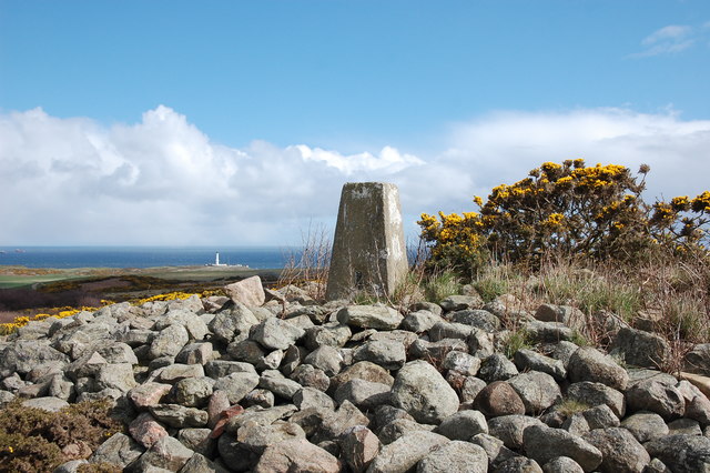
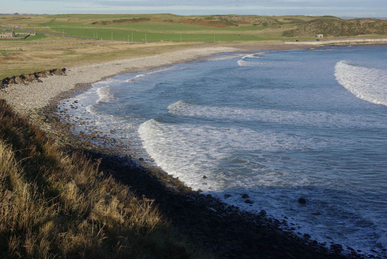
Bridge of One Hair is a prominent coastal feature located in Kincardineshire, Scotland. Situated on the east coast of the country, it is specifically found on a headland jutting out into the North Sea. The headland is known as Bridge of One Hair Point, owing to its distinctive shape that resembles a bridge with a single strand of hair.

The headland is composed of rugged cliffs, rising to a height of approximately 50 meters above sea level. These cliffs are formed from layers of sandstone and shale, displaying a variety of colors ranging from deep red to light brown. The exposed rock formations provide a unique opportunity for geological enthusiasts to observe and study the region's ancient geological history.

Bridge of One Hair Point is renowned for its stunning panoramic views of the North Sea and the surrounding coastal landscape. On clear days, visitors can see as far as the horizon, with the shimmering blue waters stretching out endlessly. The headland is also a popular spot for birdwatchers, as it serves as a nesting site for several seabird species, including gannets, puffins, and kittiwakes.

Access to Bridge of One Hair is facilitated by a well-maintained footpath that winds along the cliff edge. However, caution is advised when exploring the area, as the cliffs can be unstable and prone to erosion. Visitors are encouraged to stay on the designated paths and abide by any safety signs or guidelines provided.

Overall, Bridge of One Hair in Kincardineshire is a captivating coastal feature that offers breathtaking views, rich geological formations, and abundant wildlife, making it a must-visit destination for nature enthusiasts and outdoor adventurers alike.

If you have any feedback on the listing, please let us know in the comments section below.

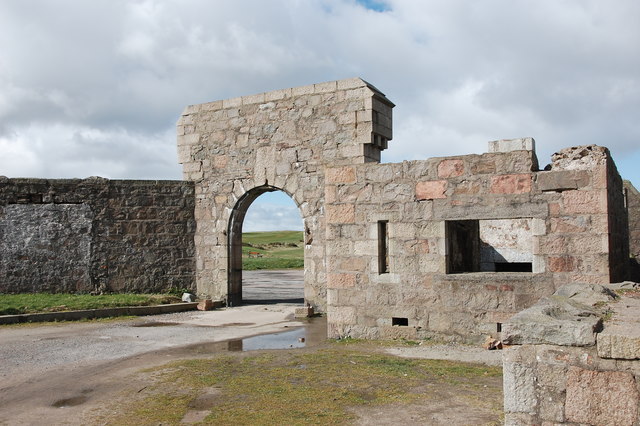
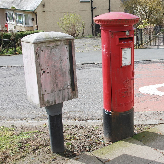
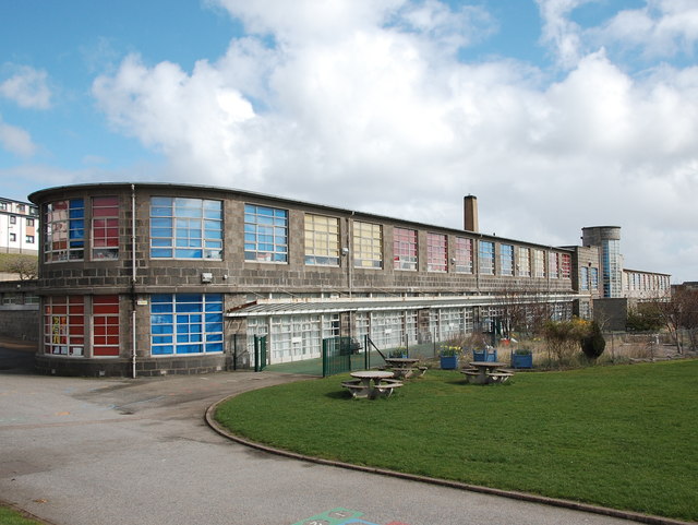
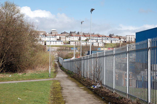
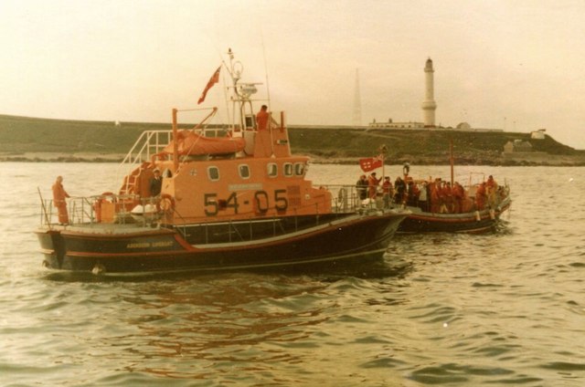
Bridge of One Hair Images

Images are sourced within 2km of 57.124641/-2.0528843 or Grid Reference NJ9603. Thanks to Geograph Open Source API. All images are credited.

Depot of oil drilling pipes
Aberdeen South Breakwater in heavy seas Waves breaking over the South breakwater.
Aberdeen South Breakwater in heavy seas
Waves breaking over the South breakwater.
Torry Battery The former gun emplacement that protected Aberdeen harbour until WWII: <span class="nowrap"><a title="https://www.aberdeencity.gov.uk/web/files/LocalHistory/torry_battery.pdf" rel="nofollow ugc noopener" href="https://www.aberdeencity.gov.uk/web/files/LocalHistory/torry_battery.pdf">Link</a><img style="margin-left:2px;" alt="External link" title="External link - shift click to open in new window" src="https://s1.geograph.org.uk/img/external.png" width="10" height="10"/></span> .
Torry Battery
The former gun emplacement that protected Aberdeen harbour until WWII: LinkExternal link .
Entrance to Torry Battery
Edward VIII pillar box... ...at the junction of Gregness Gardens and Girdleness Road.  One of only two to be found in Aberdeen and 136 nationwide.
Edward VIII pillar box...
...at the junction of Gregness Gardens and Girdleness Road. One of only two to be found in Aberdeen and 136 nationwide.
Tullos Primary School The classroom blinds add a nice bit of colour to this iconic 1930s art deco building, but the rusting metal and crumbling mortar are concerning...   B-listed: <span class="nowrap"><a title="http://www.britishlistedbuildings.co.uk/sc-49995-tullos-primary-school-girdleness-road-#.VxNisaT2amQ" rel="nofollow ugc noopener" href="http://www.britishlistedbuildings.co.uk/sc-49995-tullos-primary-school-girdleness-road-#.VxNisaT2amQ">Link</a><img style="margin-left:2px;" alt="External link" title="External link - shift click to open in new window" src="https://s1.geograph.org.uk/img/external.png" width="10" height="10"/></span> .
Tullos Primary School
The classroom blinds add a nice bit of colour to this iconic 1930s art deco building, but the rusting metal and crumbling mortar are concerning... B-listed: LinkExternal link .
Path... ...through Greenbank industrial estate.  The fly tipping and rotting rubbish absolutely everywhere make it look like a third-world slum.  In the background rather 'boxy' 1960s houses on the steep hillside of Balnagask and behind them, Victorian villas in Torry.
Path...
...through Greenbank industrial estate. The fly tipping and rotting rubbish absolutely everywhere make it look like a third-world slum. In the background rather 'boxy' 1960s houses on the steep hillside of Balnagask and behind them, Victorian villas in Torry.
Beech grove... ...on the hillside above Greenbank industrial estate.
Beech grove...
...on the hillside above Greenbank industrial estate.
Baron's Cairn... ...at the top of Tullos Hill: <span class="nowrap"><a title="https://canmore.org.uk/site/20242/barons-cairn-tullos-hill" rel="nofollow ugc noopener" href="https://canmore.org.uk/site/20242/barons-cairn-tullos-hill">Link</a><img style="margin-left:2px;" alt="External link" title="External link - shift click to open in new window" src="https://s1.geograph.org.uk/img/external.png" width="10" height="10"/></span> .  Girdleness Lighthouse is just visible in the distance.
Baron's Cairn...
...at the top of Tullos Hill: LinkExternal link . Girdleness Lighthouse is just visible in the distance.
Torry Battery General view from the south-east.  

'In 1858 agreement was reached to build coastal batteries on the beach and on Torry Point, in part against the background of the perceived threat of Napoleon III of France. Construction of the Torry Point Battery began in 1859 and was completed in March 1861. It was to be manned by a unit of the new volunteer defence forces, the 1st Aberdeenshire Royal Garrison Artillery (Volunteers) being formed for the purpose on 24 October 1860. The battery was initially armed with nine heavy guns (six 68-pounders and three 10-inch shell guns) but in September 1861 two 200-pound Armstrong guns (the heaviest of the day) were added. Drill formally began the same month.

In 1895 the battery was partially dismantled, the guns and mountings being returned to store in Leith. The battery remained in use for volunteer training until 1904 when it was reconstructed, two new 6-inch mark VII guns on CP mark II mountings being installed. This work took two years, at a cost of £5640. The battery was permanently occupied during both world wars, and retained its guns throughout the interwar period, when it was also used as temporary accommodation during periods of housing shortage.

During the Second World War, the battery was manned by army and Home Guard personnel of various units. The guns were given concrete overhead protection against air attack, while anti-aircraft gins and searchlights were also installed, while a combined military and naval plotting room was constructed in 1943. The heavy guns were used just once, against two vessels later found to be friendly, on the night of 3 June 1941, while the machine guns of the battery engaged an enemy aircraft later in the same year.

Between 1945 and 1953, the battery was again used as temporary accommodation. The guns were removed in 1956 and the battery fell into disrepair. Demolition was proposed, as was conversion into a hotel, but neither scheme was implemented. Comprehensive renovation works were carried out in the early 1970's, a car park being laid out and the retaining walls reinstated. The battery and surrounding area are of considerable ornithological interest.'

(Information from Aberdeen City Council)
Torry Battery
General view from the south-east. 'In 1858 agreement was reached to build coastal batteries on the beach and on Torry Point, in part against the background of the perceived threat of Napoleon III of France. Construction of the Torry Point Battery began in 1859 and was completed in March 1861. It was to be manned by a unit of the new volunteer defence forces, the 1st Aberdeenshire Royal Garrison Artillery (Volunteers) being formed for the purpose on 24 October 1860. The battery was initially armed with nine heavy guns (six 68-pounders and three 10-inch shell guns) but in September 1861 two 200-pound Armstrong guns (the heaviest of the day) were added. Drill formally began the same month. In 1895 the battery was partially dismantled, the guns and mountings being returned to store in Leith. The battery remained in use for volunteer training until 1904 when it was reconstructed, two new 6-inch mark VII guns on CP mark II mountings being installed. This work took two years, at a cost of £5640. The battery was permanently occupied during both world wars, and retained its guns throughout the interwar period, when it was also used as temporary accommodation during periods of housing shortage. During the Second World War, the battery was manned by army and Home Guard personnel of various units. The guns were given concrete overhead protection against air attack, while anti-aircraft gins and searchlights were also installed, while a combined military and naval plotting room was constructed in 1943. The heavy guns were used just once, against two vessels later found to be friendly, on the night of 3 June 1941, while the machine guns of the battery engaged an enemy aircraft later in the same year. Between 1945 and 1953, the battery was again used as temporary accommodation. The guns were removed in 1956 and the battery fell into disrepair. Demolition was proposed, as was conversion into a hotel, but neither scheme was implemented. Comprehensive renovation works were carried out in the early 1970's, a car park being laid out and the retaining walls reinstated. The battery and surrounding area are of considerable ornithological interest.' (Information from Aberdeen City Council)
Oil company office, Altens industrial estate
Girdleness Lighthouse, Aberdeen, from the sea
Torry Point Battery, Aberdeen Looking down onto the parade ground of the battery with, from left to right, the gateway, the guard room and gun emplacements.
Built in 1860, it was to defend Aberdeen, and up until 1953 it was it was the main coastal defence for Aberdeen from its natural vantage point. During World War I, it was manned on a permanent basis and this continued during the inter-war years. In World War II it was adapted for modern warfare. Concrete covers for the guns were constructed over the guns to protect from dive bombers. Anti-aircraft guns and searchlights were installed and it was staffed by City of Liverpool Battalion of the Royal Artillery. In 1941, two direct hits from 500lb bombs killed two soldiers. The battery guns engaged a German fighter plane which came down in flames over St Cyrus. Heavy guns opened fire on an unidentified ship entering the harbour, but this turned out to be a friendly vessel and was luckily unharmed.
After the war the battery and the surrounding nissen huts were used as emergency accommodation for a number of homeless families. The last family left in 1953. After this the battery was abandoned.
Torry Point Battery, Aberdeen
Looking down onto the parade ground of the battery with, from left to right, the gateway, the guard room and gun emplacements. Built in 1860, it was to defend Aberdeen, and up until 1953 it was it was the main coastal defence for Aberdeen from its natural vantage point. During World War I, it was manned on a permanent basis and this continued during the inter-war years. In World War II it was adapted for modern warfare. Concrete covers for the guns were constructed over the guns to protect from dive bombers. Anti-aircraft guns and searchlights were installed and it was staffed by City of Liverpool Battalion of the Royal Artillery. In 1941, two direct hits from 500lb bombs killed two soldiers. The battery guns engaged a German fighter plane which came down in flames over St Cyrus. Heavy guns opened fire on an unidentified ship entering the harbour, but this turned out to be a friendly vessel and was luckily unharmed. After the war the battery and the surrounding nissen huts were used as emergency accommodation for a number of homeless families. The last family left in 1953. After this the battery was abandoned.
Girdleness Lighthouse, Aberdeen Built in 1833 by Robert Stevenson, Girdleness Lighthouse is a handsome tapering tower and was considered the best lighthouse seen by the Royal Commission in their report of 1860. It is a Category A listed building. <span class="nowrap"><a title="https://www.britishlistedbuildings.co.uk/200354524-aberdeen-greyhope-road-girdleness-lighthouse-aberdeen#.WW5jnjGWw5s" rel="nofollow ugc noopener" href="https://www.britishlistedbuildings.co.uk/200354524-aberdeen-greyhope-road-girdleness-lighthouse-aberdeen#.WW5jnjGWw5s">Link</a><img style="margin-left:2px;" alt="External link" title="External link - shift click to open in new window" src="https://s1.geograph.org.uk/img/external.png" width="10" height="10"/></span>
Girdleness Lighthouse, Aberdeen
Built in 1833 by Robert Stevenson, Girdleness Lighthouse is a handsome tapering tower and was considered the best lighthouse seen by the Royal Commission in their report of 1860. It is a Category A listed building. LinkExternal link
Greyhope Bay, Girdle Ness, Aberdeen Also looking towards the south breakwater of Aberdeen Harbour.
Greyhope Bay, Girdle Ness, Aberdeen
Also looking towards the south breakwater of Aberdeen Harbour.
St Fittick's Church, Aberdeen The church was consecrated in 1242 and the ruins we see today probably contain elements of that earlier church as well as evidence of later 17th and 18th century rebuilding. None of the gravestones are earlier than the 17th century. St Fittick's Church was last used in 1829.
St Fittick's Church, Aberdeen
The church was consecrated in 1242 and the ruins we see today probably contain elements of that earlier church as well as evidence of later 17th and 18th century rebuilding. None of the gravestones are earlier than the 17th century. St Fittick's Church was last used in 1829.
Road Bridge at Rare Breeds Farm The bridge carries a minor road across the railway between Aberdeen and Stonehaven railway stations. Someone seems to believe this is a peace bridge!
Road Bridge at Rare Breeds Farm
The bridge carries a minor road across the railway between Aberdeen and Stonehaven railway stations. Someone seems to believe this is a peace bridge!
Aberdeen lifeboats The RNLB 'BP Forties' 54-05, a 54ft Arun Class lifeboat, with the previous lifeboat, RNLB 'Ramsey – Dyce', a 52ft Barnett Class lifeboat behind. This was the day of the inauguration of the new boat in 1976.

The Category A listed Girdleness Lighthouse, dating from 1833 is in the distance.
Aberdeen lifeboats
The RNLB 'BP Forties' 54-05, a 54ft Arun Class lifeboat, with the previous lifeboat, RNLB 'Ramsey – Dyce', a 52ft Barnett Class lifeboat behind. This was the day of the inauguration of the new boat in 1976. The Category A listed Girdleness Lighthouse, dating from 1833 is in the distance.
Show me another place!

Bridge of One Hair is located at Grid Ref: NJ9603 (Lat: 57.124641, Lng: -2.0528843)

Unitary Authority: City of Aberdeen

Police Authority: North East

What 3 Words

///master.saves.indeed. Near Cove, Aberdeen

Related Wikis

Doonies Farm

Doonies Rare Breeds Farm was a farm in Aberdeen, Scotland. Doonies Farm had one of Scotland's largest collections of rare and endangered farm animal breeds...

Nigg Bay, Aberdeen

Nigg Bay is a cove to the east of Aberdeen, between Girdle Ness and Greg Ness, in the old parish of Nigg. In 2017, work began to develop the bay into a...

Balnagask

Balnagask is an area of Torry, a burgh of Aberdeen in Scotland. Balnagask is said to mean "the village in the hollow" in Gaelic. The Balnagask Estate...

NESS Energy Project

The NESS Energy Project is an incinerator currently under construction in Aberdeen, UK. It is situated in East Tullos Industrial Estate on a site formerly...

Nearby Amenities

Located within 500m of 57.124641,-2.0528843
Source: PGS
Lat/Long: 57.125358/-2.0512304
Source: PGS
Lat/Long: 57.125563/-2.0511124
Source: PGS
Lat/Long: 57.126/-2.0511087
Source: PGS
Lat/Long: 57.1263882/-2.0512626
Source: PGS
Lat/Long: 57.1266744/-2.0508222
Source: PGS
Lat/Long: 57.1273263/-2.0506972
Source: PGS
Lat/Long: 57.127552/-2.0498952
Source: PGS
Lat/Long: 57.128212/-2.049661
Greg Ness
Natural: cape
Source: PGS
Lat/Long: 57.128333/-2.048717
Traffic Signals
Traffic Signals: signal
Traffic Signals Direction: backward
Lat/Long: 57.125891/-2.0541407
Traffic Signals
Traffic Signals: signal
Traffic Signals Direction: forward
Lat/Long: 57.1250318/-2.0550649
Man Made: tower
Tower Type: communication
Lat/Long: 57.127501/-2.0537371
Power: pole
Lat/Long: 57.1219545/-2.0584138
Power: pole
Lat/Long: 57.1219244/-2.0581587
Man Made: tower
Tower Type: communication
Lat/Long: 57.1273896/-2.0539693
Crossing
Crossing: unmarked
Crossing Island: no
Tactile Paving: no
Lat/Long: 57.1272764/-2.0541579
The data included in this document is from www.openstreetmap.org. The data is made available under ODbL.

Have you been to Bridge of One Hair?

Leave your review of Bridge of One Hair below (or comments, questions and feedback).