Doonies Yawns

Sea, Estuary, Creek in Kincardineshire

Scotland

Doonies Yawns

Depot of oil drilling pipes
Depot of oil drilling pipes Credit: Alex McGregor

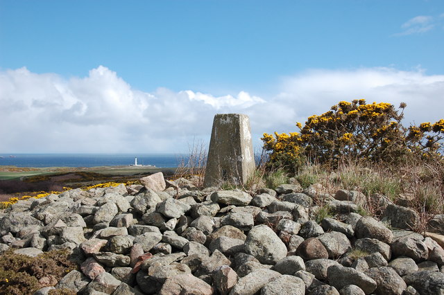
Doonies Yawns is a picturesque coastal area located in Kincardineshire, Scotland, known for its stunning sea, estuary, and creek. Nestled between the North Sea and the River Dee, this natural haven offers a diverse range of landscapes and habitats.

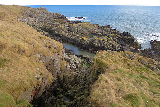
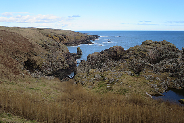
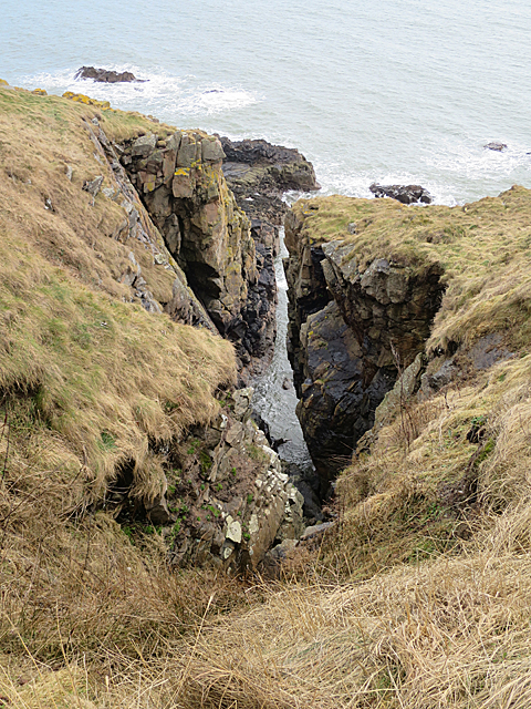
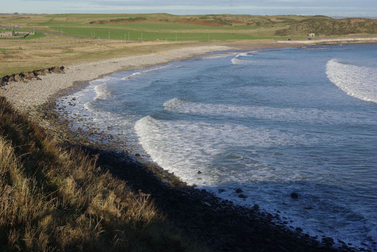
The area's most prominent feature is the expansive sea, which stretches out into the horizon, providing breathtaking views and a sense of tranquility. The pristine beaches are a haven for nature lovers and beachcombers, with golden sands and crystal-clear waters. The rugged cliffs that line the coast add drama and charm to the scenery.

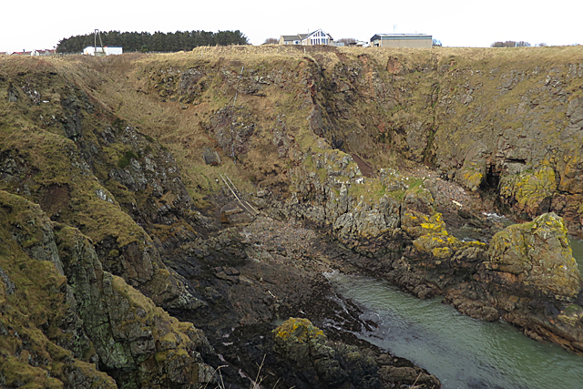
The estuary at Doonies Yawns is a sight to behold, where the River Dee meets the sea. This unique blend of fresh and saltwater creates a rich and diverse ecosystem, attracting a wide variety of birds, fish, and marine life. The estuary serves as an important feeding and breeding ground for many species, making it a haven for birdwatchers and wildlife enthusiasts.

Nestled within this coastal paradise, a tranquil creek meanders through the landscape, providing a peaceful retreat for visitors. The creek's calm waters and lush vegetation create a picturesque setting, ideal for relaxation and exploration.

Doonies Yawns offers a range of outdoor activities, including hiking, birdwatching, fishing, and boating. The area is also home to a variety of plant species, including wildflowers and coastal grasses, which add color and beauty to the surroundings.

Overall, Doonies Yawns, with its stunning sea, estuary, and creek, is a natural gem that showcases the beauty and diversity of the Scottish coastline. Whether seeking adventure or simply looking to unwind, this coastal haven offers something for everyone to enjoy.

If you have any feedback on the listing, please let us know in the comments section below.

Doonies Yawns Images

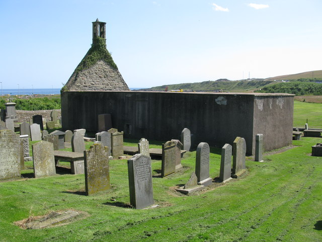
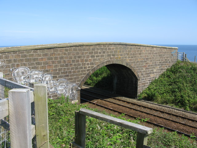
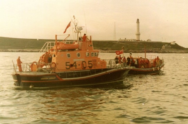
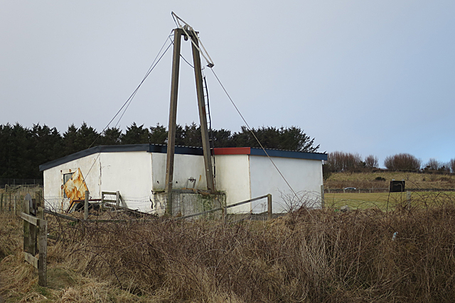
Images are sourced within 2km of 57.122197/-2.0544167 or Grid Reference NJ9603. Thanks to Geograph Open Source API. All images are credited.

Depot of oil drilling pipes
Edward VIII pillar box... ...at the junction of Gregness Gardens and Girdleness Road.  One of only two to be found in Aberdeen and 136 nationwide.
Edward VIII pillar box...
...at the junction of Gregness Gardens and Girdleness Road. One of only two to be found in Aberdeen and 136 nationwide.
Tullos Primary School The classroom blinds add a nice bit of colour to this iconic 1930s art deco building, but the rusting metal and crumbling mortar are concerning...   B-listed: <span class="nowrap"><a title="http://www.britishlistedbuildings.co.uk/sc-49995-tullos-primary-school-girdleness-road-#.VxNisaT2amQ" rel="nofollow ugc noopener" href="http://www.britishlistedbuildings.co.uk/sc-49995-tullos-primary-school-girdleness-road-#.VxNisaT2amQ">Link</a><img style="margin-left:2px;" alt="External link" title="External link - shift click to open in new window" src="https://s1.geograph.org.uk/img/external.png" width="10" height="10"/></span> .
Tullos Primary School
The classroom blinds add a nice bit of colour to this iconic 1930s art deco building, but the rusting metal and crumbling mortar are concerning... B-listed: LinkExternal link .
Path... ...through Greenbank industrial estate.  The fly tipping and rotting rubbish absolutely everywhere make it look like a third-world slum.  In the background rather 'boxy' 1960s houses on the steep hillside of Balnagask and behind them, Victorian villas in Torry.
Path...
...through Greenbank industrial estate. The fly tipping and rotting rubbish absolutely everywhere make it look like a third-world slum. In the background rather 'boxy' 1960s houses on the steep hillside of Balnagask and behind them, Victorian villas in Torry.
Beech grove... ...on the hillside above Greenbank industrial estate.
Beech grove...
...on the hillside above Greenbank industrial estate.
Baron's Cairn... ...at the top of Tullos Hill: <span class="nowrap"><a title="https://canmore.org.uk/site/20242/barons-cairn-tullos-hill" rel="nofollow ugc noopener" href="https://canmore.org.uk/site/20242/barons-cairn-tullos-hill">Link</a><img style="margin-left:2px;" alt="External link" title="External link - shift click to open in new window" src="https://s1.geograph.org.uk/img/external.png" width="10" height="10"/></span> .  Girdleness Lighthouse is just visible in the distance.
Baron's Cairn...
...at the top of Tullos Hill: LinkExternal link . Girdleness Lighthouse is just visible in the distance.
Oil company office, Altens industrial estate
Wood Group offices, Altens industrial estate
Girdleness Lighthouse, Aberdeen, from the sea
Girdleness Lighthouse, Aberdeen Built in 1833 by Robert Stevenson, Girdleness Lighthouse is a handsome tapering tower and was considered the best lighthouse seen by the Royal Commission in their report of 1860. It is a Category A listed building. <span class="nowrap"><a title="https://www.britishlistedbuildings.co.uk/200354524-aberdeen-greyhope-road-girdleness-lighthouse-aberdeen#.WW5jnjGWw5s" rel="nofollow ugc noopener" href="https://www.britishlistedbuildings.co.uk/200354524-aberdeen-greyhope-road-girdleness-lighthouse-aberdeen#.WW5jnjGWw5s">Link</a><img style="margin-left:2px;" alt="External link" title="External link - shift click to open in new window" src="https://s1.geograph.org.uk/img/external.png" width="10" height="10"/></span>
Girdleness Lighthouse, Aberdeen
Built in 1833 by Robert Stevenson, Girdleness Lighthouse is a handsome tapering tower and was considered the best lighthouse seen by the Royal Commission in their report of 1860. It is a Category A listed building. LinkExternal link
St Fittick's Church, Aberdeen The church was consecrated in 1242 and the ruins we see today probably contain elements of that earlier church as well as evidence of later 17th and 18th century rebuilding. None of the gravestones are earlier than the 17th century. St Fittick's Church was last used in 1829.
St Fittick's Church, Aberdeen
The church was consecrated in 1242 and the ruins we see today probably contain elements of that earlier church as well as evidence of later 17th and 18th century rebuilding. None of the gravestones are earlier than the 17th century. St Fittick's Church was last used in 1829.
Road Bridge at Rare Breeds Farm The bridge carries a minor road across the railway between Aberdeen and Stonehaven railway stations. Someone seems to believe this is a peace bridge!
Road Bridge at Rare Breeds Farm
The bridge carries a minor road across the railway between Aberdeen and Stonehaven railway stations. Someone seems to believe this is a peace bridge!
Aberdeen lifeboats The RNLB 'BP Forties' 54-05, a 54ft Arun Class lifeboat, with the previous lifeboat, RNLB 'Ramsey – Dyce', a 52ft Barnett Class lifeboat behind. This was the day of the inauguration of the new boat in 1976.

The Category A listed Girdleness Lighthouse, dating from 1833 is in the distance.
Aberdeen lifeboats
The RNLB 'BP Forties' 54-05, a 54ft Arun Class lifeboat, with the previous lifeboat, RNLB 'Ramsey – Dyce', a 52ft Barnett Class lifeboat behind. This was the day of the inauguration of the new boat in 1976. The Category A listed Girdleness Lighthouse, dating from 1833 is in the distance.
Unnamed Inlet The narrow inlet on the south side of Souter Head is not named on the maps. It is at a curious angle, being parallel to the coast rather than in the more usual angle to the coast.
Unnamed Inlet
The narrow inlet on the south side of Souter Head is not named on the maps. It is at a curious angle, being parallel to the coast rather than in the more usual angle to the coast.
Souter Head A patch of reeds on the slope down to a pool in the headland show that the ground here is very wet.
Souter Head
A patch of reeds on the slope down to a pool in the headland show that the ground here is very wet.
Burnbanks Haven This is one of very few places along this coast where it is possible both to beach a boat and to get up the cliff. It is, however, very exposed to the east so wouldn't provide much shelter in an easterly. There is a slipway of sorts, with a system of wires for hauling boats out of the water. See <a href="https://www.geograph.org.uk/photo/5702240">NJ9602 : A Contraption</a>
Burnbanks Haven
This is one of very few places along this coast where it is possible both to beach a boat and to get up the cliff. It is, however, very exposed to the east so wouldn't provide much shelter in an easterly. There is a slipway of sorts, with a system of wires for hauling boats out of the water. See NJ9602 : A Contraption
A Contraption The white building seems to be a store belonging to the house nearby, but beside it is what seems to be the top part of a system for hauling boats out of the sea below. See <a href="https://www.geograph.org.uk/photo/5702238">NJ9602 : Burnbanks Haven</a>.
A Contraption
The white building seems to be a store belonging to the house nearby, but beside it is what seems to be the top part of a system for hauling boats out of the sea below. See NJ9602 : Burnbanks Haven.
A Narrow Cleft A very narrow gully in the cliff just north of Burnbanks Haven.
A Narrow Cleft
A very narrow gully in the cliff just north of Burnbanks Haven.
Show me another place!

Doonies Yawns is located at Grid Ref: NJ9603 (Lat: 57.122197, Lng: -2.0544167)

Unitary Authority: City of Aberdeen

Police Authority: North East

What 3 Words

///daisy.larger.scouts. Near Cove, Aberdeen

Related Wikis

Doonies Farm

Doonies Rare Breeds Farm was a farm in Aberdeen, Scotland. Doonies Farm had one of Scotland's largest collections of rare and endangered farm animal breeds...

Nigg Bay, Aberdeen

Nigg Bay is a cove to the east of Aberdeen, between Girdle Ness and Greg Ness, in the old parish of Nigg. In 2017, work began to develop the bay into a...

NESS Energy Project

The NESS Energy Project is an incinerator currently under construction in Aberdeen, UK. It is situated in East Tullos Industrial Estate on a site formerly...

Balnagask

Balnagask is an area of Torry, a burgh of Aberdeen in Scotland. Balnagask is said to mean "the village in the hollow" in Gaelic. The Balnagask Estate...

Nearby Amenities

Located within 500m of 57.122197,-2.0544167
Source: PGS
Lat/Long: 57.125358/-2.0512304
Source: PGS
Lat/Long: 57.125563/-2.0511124
Source: PGS
Lat/Long: 57.126/-2.0511087
Traffic Signals
Traffic Signals: signal
Traffic Signals Direction: backward
Lat/Long: 57.125891/-2.0541407
Traffic Signals
Traffic Signals: signal
Traffic Signals Direction: forward
Lat/Long: 57.1250318/-2.0550649
Power: pole
Lat/Long: 57.1225042/-2.0622669
Power: pole
Lat/Long: 57.1223109/-2.0610397
Power: pole
Lat/Long: 57.122108/-2.0597823
Power: pole
Lat/Long: 57.1219545/-2.0584138
Power: pole
Lat/Long: 57.1219244/-2.0581587
The data included in this document is from www.openstreetmap.org. The data is made available under ODbL.

Have you been to Doonies Yawns?

Leave your review of Doonies Yawns below (or comments, questions and feedback).