Downie Point

Coastal Feature, Headland, Point in Kincardineshire

Scotland

Downie Point

Allerdyce Street (A957), Stonehaven Looking southward.
Allerdyce Street (A957), Stonehaven Credit: Peter Wood

Downie Point is a prominent headland located in Kincardineshire, a historical maritime county in northeast Scotland. Situated on the eastern coast of Scotland, this coastal feature is renowned for its rugged beauty and breathtaking views of the North Sea.

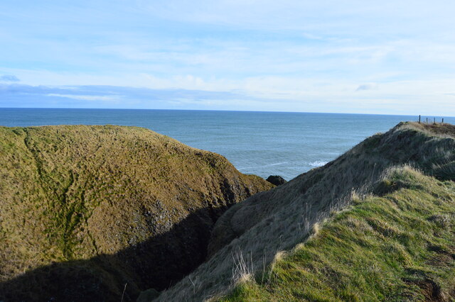
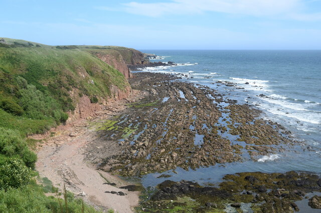
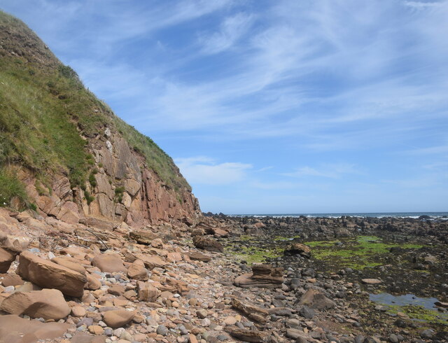
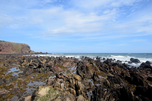
The point itself extends into the sea, forming a distinct headland that juts out into the water. It is composed primarily of sandstone cliffs, which rise dramatically from the shoreline to a height of approximately 100 feet. These cliffs are weathered and eroded, displaying fascinating geological formations and providing a nesting site for seabirds such as kittiwakes and guillemots.

At low tide, a rocky platform is exposed, revealing an abundance of rock pools teeming with marine life. These pools are an attraction for visitors, particularly children who enjoy exploring the diverse array of creatures that inhabit them, including crabs, sea anemones, and small fish.

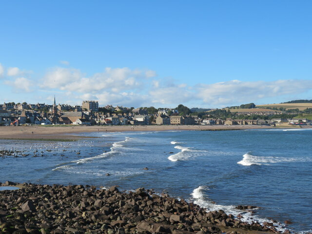
Downie Point is a popular spot for outdoor enthusiasts and nature lovers alike. The headland offers panoramic views of the surrounding coastline, with the picturesque fishing village of Stonehaven visible to the south. On clear days, visitors can even catch a glimpse of Dunnottar Castle, a medieval fortress perched on a nearby cliff.

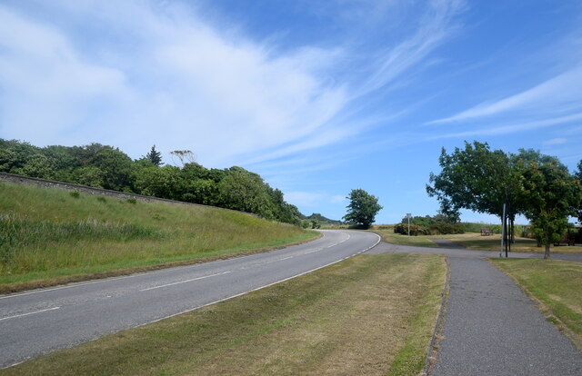
Access to Downie Point is relatively easy, with a footpath leading from the nearby car park to the headland. The area is well-maintained and features interpretive signs to provide information about the local flora, fauna, and geology.

Overall, Downie Point is a captivating coastal feature, offering stunning natural scenery, abundant wildlife, and a peaceful retreat for those seeking to connect with the beauty of Scotland's rugged shoreline.

If you have any feedback on the listing, please let us know in the comments section below.
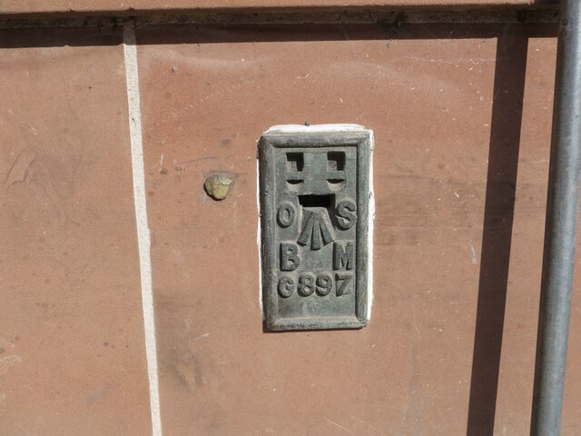
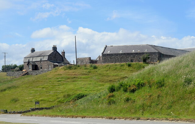
Downie Point Images

Images are sourced within 2km of 56.958825/-2.1939908 or Grid Reference NO8885. Thanks to Geograph Open Source API. All images are credited.

Allerdyce Street (A957), Stonehaven Looking southward.
Allerdyce Street (A957), Stonehaven
Looking southward.
Stonehaven Bay A view across the bay from the harbour area towards the newer part of  the town.
Stonehaven Bay
A view across the bay from the harbour area towards the newer part of the town.
Aircraft sculpture at Stonehaven There are five such superb sculptures along the sea wall at Stonehaven. This one has a small plaque attached to the rock to say that this is a model of a Norwegian Seaplane which landed in the bay in April 1940, thus escaping the German invasion of Norway. The plane was piloted by Stein Gustavvson Abildso.
Aircraft sculpture at Stonehaven
There are five such superb sculptures along the sea wall at Stonehaven. This one has a small plaque attached to the rock to say that this is a model of a Norwegian Seaplane which landed in the bay in April 1940, thus escaping the German invasion of Norway. The plane was piloted by Stein Gustavvson Abildso.
Viking boat sculpture, Stonehaven One of five beautiful sculptures on the sea wall at Stonehaven. This one depicts a Viking boat of the type that might have once headed this way from Norway.
Viking boat sculpture, Stonehaven
One of five beautiful sculptures on the sea wall at Stonehaven. This one depicts a Viking boat of the type that might have once headed this way from Norway.
A Scottish delicacy You may have thought that reports of the deep fried Mars bar being a delicacy in Scotland was a mere myth, but this sign on the wall of a chip shop in Stonehaven would confirm the truth. This contributor wasn't brave enough to try the dish.
A Scottish delicacy
You may have thought that reports of the deep fried Mars bar being a delicacy in Scotland was a mere myth, but this sign on the wall of a chip shop in Stonehaven would confirm the truth. This contributor wasn't brave enough to try the dish.
Old milestone John Briggs used this 'C listed' property at 19 Bridgfield until earlier in 2021.   It is at the south side of the bridge over Carron Water which is undergoing some flood defence works.  In the recess near the blue hoarding is a milestone and below it a slightly recessed stone plaque.   The bridge was built in 1781, widened in 1885 and rebuilt in 1973.
Old milestone
John Briggs used this 'C listed' property at 19 Bridgfield until earlier in 2021. It is at the south side of the bridge over Carron Water which is undergoing some flood defence works. In the recess near the blue hoarding is a milestone and below it a slightly recessed stone plaque. The bridge was built in 1781, widened in 1885 and rebuilt in 1973.
Old milestone A close up of the milestone in the niche at the corner of the building to the south of the bridge over Carron Water.  Inscribed on the left-hand face L/14 (for Laurencekirk), A/14 (Aberdeen) on the right and BERVIE/10 on the bevel.  The vertical plaque below is inscribed THEOBALD/BARCLAY/1150 (the first Barclays ancestor in Scotland 1150), MATHERS/1351 (Barclays acquired the Mathers estate in 1351), URIE/1647 (Barclays bought Urie estate 1647),COND/1781.  This stone was copied from the keystone on the 1781 bridge which was concealed by the 1885 widening.
Old milestone
A close up of the milestone in the niche at the corner of the building to the south of the bridge over Carron Water. Inscribed on the left-hand face L/14 (for Laurencekirk), A/14 (Aberdeen) on the right and BERVIE/10 on the bevel. The vertical plaque below is inscribed THEOBALD/BARCLAY/1150 (the first Barclays ancestor in Scotland 1150), MATHERS/1351 (Barclays acquired the Mathers estate in 1351), URIE/1647 (Barclays bought Urie estate 1647),COND/1781. This stone was copied from the keystone on the 1781 bridge which was concealed by the 1885 widening.
Ordnance Survey Flush Bracket G896 This bracket can be found on the wall of the Police Station, Stonehaven.
The recorded details give a height of 4.1664 metres above sea level.
For more details see : <span class="nowrap"><a title="https://www.bench-marks.org.uk/bm356" rel="nofollow ugc noopener" href="https://www.bench-marks.org.uk/bm356">Link</a><img style="margin-left:2px;" alt="External link" title="External link - shift click to open in new window" src="https://s1.geograph.org.uk/img/external.png" width="10" height="10"/></span>
Ordnance Survey Flush Bracket G896
This bracket can be found on the wall of the Police Station, Stonehaven. The recorded details give a height of 4.1664 metres above sea level. For more details see : LinkExternal link
Ordnance Survey Flush Bracket G897 This bracket can be found on the wall of the Town Hall, Stonehaven.
The recorded details give a height of 5.5802 metres above sea level.
For more details see : <span class="nowrap"><a title="https://www.bench-marks.org.uk/bm357" rel="nofollow ugc noopener" href="https://www.bench-marks.org.uk/bm357">Link</a><img style="margin-left:2px;" alt="External link" title="External link - shift click to open in new window" src="https://s1.geograph.org.uk/img/external.png" width="10" height="10"/></span>
Ordnance Survey Flush Bracket G897
This bracket can be found on the wall of the Town Hall, Stonehaven. The recorded details give a height of 5.5802 metres above sea level. For more details see : LinkExternal link
Downie Point This is the 'island' forming the end of Downie Point.  The flat topped island-like end of the headland isn't easily reachable on foot due to the steep gorge.
Downie Point
This is the 'island' forming the end of Downie Point. The flat topped island-like end of the headland isn't easily reachable on foot due to the steep gorge.
Mains of Cowie The home farm for Cowie House, about 500 metres to the north east.  The farmhouse (LB9387 <span class="nowrap"><a title="http://portal.historicenvironment.scot/designation/LB9387" rel="nofollow ugc noopener" href="http://portal.historicenvironment.scot/designation/LB9387">Link</a><img style="margin-left:2px;" alt="External link" title="External link - shift click to open in new window" src="https://s1.geograph.org.uk/img/external.png" width="10" height="10"/></span> ) and extensive steadings to the right (LB9349 <span class="nowrap"><a title="http://portal.historicenvironment.scot/designation/LB9349" rel="nofollow ugc noopener" href="http://portal.historicenvironment.scot/designation/LB9349">Link</a><img style="margin-left:2px;" alt="External link" title="External link - shift click to open in new window" src="https://s1.geograph.org.uk/img/external.png" width="10" height="10"/></span> ) have separate C-listings.   In the foreground is the former A92 main road to Aberdeen.
Mains of Cowie
The home farm for Cowie House, about 500 metres to the north east. The farmhouse (LB9387 LinkExternal link ) and extensive steadings to the right (LB9349 LinkExternal link ) have separate C-listings. In the foreground is the former A92 main road to Aberdeen.
Former A92 road This was once the main road from Stonehaven to Aberdeen but has been downgraded since the Stonehaven by-pass was built.
Former A92 road
This was once the main road from Stonehaven to Aberdeen but has been downgraded since the Stonehaven by-pass was built.
Geological interest at Cowie Cliffs of the Cowie red sandstone formation (sedimentary bedrock formed approximately 426 to 431 million years ago in the Silurian Period) face onto a wave-cut platform of interbedded Castle Of Cowie sandstone and siltstone, formed at the same time.  In the foreground, much darker rocks of an intrusion of igneous magma, being part of the North Britain Siluro-Devonian calc-alkaline dyke suite: quartz, feldspar and porphyry formed approximately 359 to 444 million years ago in the Devonian and Silurian Periods.  All this happened when the land mass that was to become Scotland was south of the equator.
Geological interest at Cowie
Cliffs of the Cowie red sandstone formation (sedimentary bedrock formed approximately 426 to 431 million years ago in the Silurian Period) face onto a wave-cut platform of interbedded Castle Of Cowie sandstone and siltstone, formed at the same time. In the foreground, much darker rocks of an intrusion of igneous magma, being part of the North Britain Siluro-Devonian calc-alkaline dyke suite: quartz, feldspar and porphyry formed approximately 359 to 444 million years ago in the Devonian and Silurian Periods. All this happened when the land mass that was to become Scotland was south of the equator.
Scene at the Old Kirk Shore Red sandstone cliffs and boulders and a wave-cut platform of interbedded sandstone and mudstone.
Scene at the Old Kirk Shore
Red sandstone cliffs and boulders and a wave-cut platform of interbedded sandstone and mudstone.
Eroded sandstone cliff at the Old Kirk Shore
Wave-cut platform, Old Kirk Shore The interbedded sandstone and mudstone strata have been turned by 90 degrees and eroded to give a striking effect.
Wave-cut platform, Old Kirk Shore
The interbedded sandstone and mudstone strata have been turned by 90 degrees and eroded to give a striking effect.
Colourful sandstone cliff, Old Kirk Shore The ruin of St Mary's Church can just be seen on the hill in the background.
Colourful sandstone cliff, Old Kirk Shore
The ruin of St Mary's Church can just be seen on the hill in the background.
Wave-cut platform The vertical strata of sandstone and mudstone can be clearly seen in the blown-up photo.
Wave-cut platform
The vertical strata of sandstone and mudstone can be clearly seen in the blown-up photo.
Show me another place!

Downie Point is located at Grid Ref: NO8885 (Lat: 56.958825, Lng: -2.1939908)

Unitary Authority: Aberdeenshire

Police Authority: North East

What 3 Words

///oxidation.shorts.loosed. Near Stonehaven, Aberdeenshire

Related Wikis

Downie Point

Downie Point is a prominent headland located at the southern edge of Stonehaven Bay in Aberdeenshire, Scotland. (United Kingdom, 2004) From the Stonehaven...

Strathlethan Bay

Strathlethan Bay is on the North Sea coast of Aberdeenshire, Scotland just south of Stonehaven. To the north is Downie Point near which lies Stonehaven...

Bellman's Head

Bellman's Head is a headland point comprising the northern boundary of Stonehaven Bay in Stonehaven, Scotland. The corresponding headland at the south...

Stonehaven Tolbooth

The Stonehaven Tolbooth is a late 16th-century stone building originally used as a courthouse and a prison in the town of Stonehaven, Aberdeenshire, Scotland...

Nearby Amenities

Located within 500m of 56.958825,-2.1939908
Source: PGS
Lat/Long: 56.9549615/-2.1978163
Source: PGS
Lat/Long: 56.9552254/-2.1979591
Source: PGS
Lat/Long: 56.9554405/-2.1976989
Source: PGS
Lat/Long: 56.955826/-2.1976154
Source: PGS
Lat/Long: 56.9558654/-2.1971092
Source: PGS
Lat/Long: 56.9561912/-2.1967558
Source: PGS
Lat/Long: 56.9565673/-2.1952188
Source: PGS
Lat/Long: 56.9568031/-2.1948978
Source: PGS
Lat/Long: 56.9589523/-2.1935278
Source: PGS
Lat/Long: 56.9591353/-2.1942753
Source: PGS
Lat/Long: 56.9610029/-2.1983088
Seamark Light 1 Character: Iso
Seamark Light 1 Colour: green
Seamark Light 1 Height: 7
Seamark Light 1 Period: 4
Seamark Light 1 Range: 8
Seamark Light 1 Sector End: 246
Seamark Light 1 Sector Start: 214
Seamark Light 2 Character: Iso
Seamark Light 2 Colour: white
Seamark Light 2 Height: 7
Seamark Light 2 Period: 4
Seamark Light 2 Range: 11
Seamark Light 2 Sector End: 268
Seamark Light 2 Sector Start: 246
Seamark Light 3 Character: Iso
Seamark Light 3 Colour: red
Seamark Light 3 Height: 7
Seamark Light 3 Period: 4
Seamark Light 3 Range: 7
Seamark Light 3 Sector End: 280
Seamark Light 3 Sector Start: 268
Seamark Light Reference: A 3238
Seamark Type: light_major
Source: US NGA Pub. 114. 2011-05-26.
Lat/Long: 56.9597247/-2.1998927
Leisure: slipway
Lat/Long: 56.958197/-2.2020122
Source: PGS
Lat/Long: 56.9590549/-2.1946722
Bellman's Head
Natural: cape
Wikidata: Q4884064
Wikipedia: en:Bellman's Head
Lat/Long: 56.9610326/-2.1990078
Source: PGS
Lat/Long: 56.9573578/-2.1954754
Source: PGS
Lat/Long: 56.959078/-2.1964613
Source: PGS
Lat/Long: 56.9589317/-2.1987251
Source: PGS
Lat/Long: 56.9582824/-2.1944443
Source: PGS
Lat/Long: 56.9585047/-2.2019652
Source: PGS
Lat/Long: 56.9586217/-2.1997336
Source: PGS
Lat/Long: 56.9574491/-2.1957644
Source: PGS
Lat/Long: 56.9592128/-2.1949619
Source: PGS
Lat/Long: 56.9575219/-2.1953562
Source: PGS
Lat/Long: 56.95909/-2.1974939
Downie Point
Natural: cape
Lat/Long: 56.9588419/-2.1944781
Strathlethan Bay
Natural: bay
Lat/Long: 56.9550979/-2.1956582
Source: PGS
Lat/Long: 56.9576916/-2.1950665
Source: PGS
Lat/Long: 56.9608523/-2.2009474
Source: PGS
Lat/Long: 56.960698/-2.200653
Source: PGS
Lat/Long: 56.958798/-2.197253
The data included in this document is from www.openstreetmap.org. The data is made available under ODbL.

Have you been to Downie Point?

Leave your review of Downie Point below (or comments, questions and feedback).