Michael's Pot

Coastal Feature, Headland, Point in Kincardineshire

Scotland

Michael's Pot

Old milestone John Briggs used this 'C listed' property at 19 Bridgfield until earlier in 2021.   It is at the south side of the bridge over Carron Water which is undergoing some flood defence works.  In the recess near the blue hoarding is a milestone and below it a slightly recessed stone plaque.   The bridge was built in 1781, widened in 1885 and rebuilt in 1973.
Old milestone Credit: John Riddell

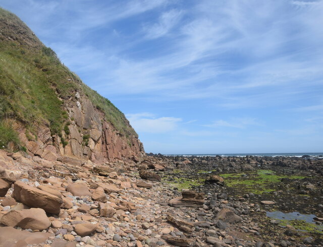
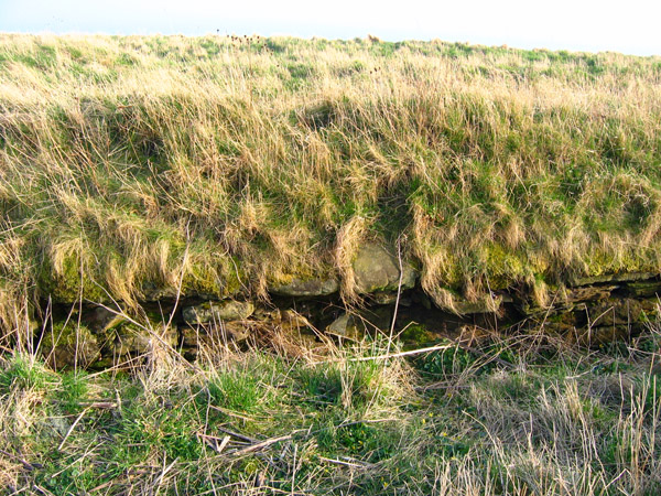
Michael's Pot is a prominent coastal feature located in Kincardineshire, Scotland. Situated on the east coast, it is a headland that juts out into the North Sea, forming a distinctive point along the rugged coastline.

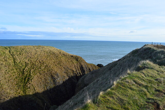
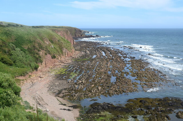
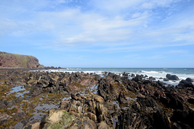
The headland is characterized by its steep cliffs, which rise dramatically from the sea, reaching heights of approximately 100 feet in some areas. These cliffs are composed of layers of sedimentary rocks, including sandstone and shale, which have been shaped by the erosive forces of wind and waves over centuries. The exposed rock faces display a variety of colors, ranging from sandy browns to deep reds, creating a visually striking landscape.

At the tip of Michael's Pot, there is a small, sheltered cove that is accessible during low tide. This cove is a popular spot for beachcombing, as it accumulates an assortment of seashells, pebbles, and sometimes even small fossils. The surrounding waters are known for their rich marine life, with occasional sightings of seals, dolphins, and various seabirds.

The headland offers breathtaking views of the North Sea and the rugged coastline, attracting many visitors who come to appreciate the natural beauty and tranquility of the area. It is also a popular spot for outdoor activities such as hiking and photography, with several walking trails that wind along the cliffs, providing stunning vistas at every turn.

Overall, Michael's Pot is a captivating coastal feature that showcases the raw power of nature and offers an immersive experience in Scotland's scenic beauty.

If you have any feedback on the listing, please let us know in the comments section below.

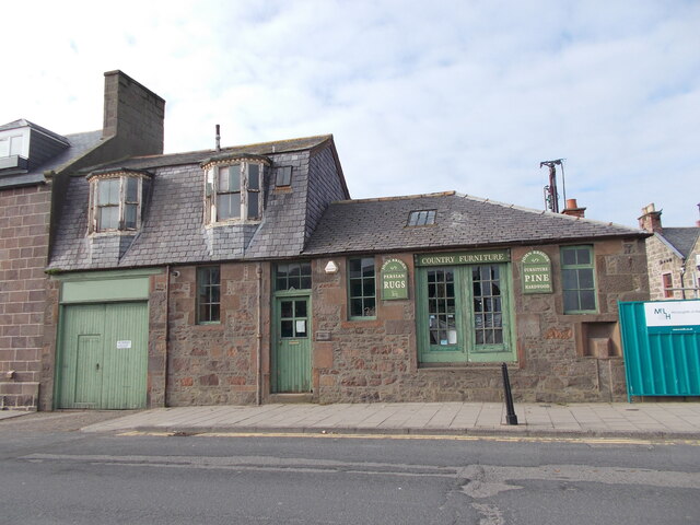
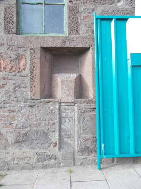
Michael's Pot Images

Images are sourced within 2km of 56.973976/-2.1969483 or Grid Reference NO8886. Thanks to Geograph Open Source API. All images are credited.

Old milestone John Briggs used this 'C listed' property at 19 Bridgfield until earlier in 2021.   It is at the south side of the bridge over Carron Water which is undergoing some flood defence works.  In the recess near the blue hoarding is a milestone and below it a slightly recessed stone plaque.   The bridge was built in 1781, widened in 1885 and rebuilt in 1973.
Old milestone
John Briggs used this 'C listed' property at 19 Bridgfield until earlier in 2021. It is at the south side of the bridge over Carron Water which is undergoing some flood defence works. In the recess near the blue hoarding is a milestone and below it a slightly recessed stone plaque. The bridge was built in 1781, widened in 1885 and rebuilt in 1973.
Old milestone A close up of the milestone in the niche at the corner of the building to the south of the bridge over Carron Water.  Inscribed on the left-hand face L/14 (for Laurencekirk), A/14 (Aberdeen) on the right and BERVIE/10 on the bevel.  The vertical plaque below is inscribed THEOBALD/BARCLAY/1150 (the first Barclays ancestor in Scotland 1150), MATHERS/1351 (Barclays acquired the Mathers estate in 1351), URIE/1647 (Barclays bought Urie estate 1647),COND/1781.  This stone was copied from the keystone on the 1781 bridge which was concealed by the 1885 widening.
Old milestone
A close up of the milestone in the niche at the corner of the building to the south of the bridge over Carron Water. Inscribed on the left-hand face L/14 (for Laurencekirk), A/14 (Aberdeen) on the right and BERVIE/10 on the bevel. The vertical plaque below is inscribed THEOBALD/BARCLAY/1150 (the first Barclays ancestor in Scotland 1150), MATHERS/1351 (Barclays acquired the Mathers estate in 1351), URIE/1647 (Barclays bought Urie estate 1647),COND/1781. This stone was copied from the keystone on the 1781 bridge which was concealed by the 1885 widening.
Ordnance Survey Flush Bracket G896 This bracket can be found on the wall of the Police Station, Stonehaven.
The recorded details give a height of 4.1664 metres above sea level.
For more details see : <span class="nowrap"><a title="https://www.bench-marks.org.uk/bm356" rel="nofollow ugc noopener" href="https://www.bench-marks.org.uk/bm356">Link</a><img style="margin-left:2px;" alt="External link" title="External link - shift click to open in new window" src="https://s1.geograph.org.uk/img/external.png" width="10" height="10"/></span>
Ordnance Survey Flush Bracket G896
This bracket can be found on the wall of the Police Station, Stonehaven. The recorded details give a height of 4.1664 metres above sea level. For more details see : LinkExternal link
Ordnance Survey Flush Bracket G897 This bracket can be found on the wall of the Town Hall, Stonehaven.
The recorded details give a height of 5.5802 metres above sea level.
For more details see : <span class="nowrap"><a title="https://www.bench-marks.org.uk/bm357" rel="nofollow ugc noopener" href="https://www.bench-marks.org.uk/bm357">Link</a><img style="margin-left:2px;" alt="External link" title="External link - shift click to open in new window" src="https://s1.geograph.org.uk/img/external.png" width="10" height="10"/></span>
Ordnance Survey Flush Bracket G897
This bracket can be found on the wall of the Town Hall, Stonehaven. The recorded details give a height of 5.5802 metres above sea level. For more details see : LinkExternal link
Downie Point This is the 'island' forming the end of Downie Point.  The flat topped island-like end of the headland isn't easily reachable on foot due to the steep gorge.
Downie Point
This is the 'island' forming the end of Downie Point. The flat topped island-like end of the headland isn't easily reachable on foot due to the steep gorge.
Mains of Cowie The home farm for Cowie House, about 500 metres to the north east.  The farmhouse (LB9387 <span class="nowrap"><a title="http://portal.historicenvironment.scot/designation/LB9387" rel="nofollow ugc noopener" href="http://portal.historicenvironment.scot/designation/LB9387">Link</a><img style="margin-left:2px;" alt="External link" title="External link - shift click to open in new window" src="https://s1.geograph.org.uk/img/external.png" width="10" height="10"/></span> ) and extensive steadings to the right (LB9349 <span class="nowrap"><a title="http://portal.historicenvironment.scot/designation/LB9349" rel="nofollow ugc noopener" href="http://portal.historicenvironment.scot/designation/LB9349">Link</a><img style="margin-left:2px;" alt="External link" title="External link - shift click to open in new window" src="https://s1.geograph.org.uk/img/external.png" width="10" height="10"/></span> ) have separate C-listings.   In the foreground is the former A92 main road to Aberdeen.
Mains of Cowie
The home farm for Cowie House, about 500 metres to the north east. The farmhouse (LB9387 LinkExternal link ) and extensive steadings to the right (LB9349 LinkExternal link ) have separate C-listings. In the foreground is the former A92 main road to Aberdeen.
Former A92 road This was once the main road from Stonehaven to Aberdeen but has been downgraded since the Stonehaven by-pass was built.
Former A92 road
This was once the main road from Stonehaven to Aberdeen but has been downgraded since the Stonehaven by-pass was built.
Geological interest at Cowie Cliffs of the Cowie red sandstone formation (sedimentary bedrock formed approximately 426 to 431 million years ago in the Silurian Period) face onto a wave-cut platform of interbedded Castle Of Cowie sandstone and siltstone, formed at the same time.  In the foreground, much darker rocks of an intrusion of igneous magma, being part of the North Britain Siluro-Devonian calc-alkaline dyke suite: quartz, feldspar and porphyry formed approximately 359 to 444 million years ago in the Devonian and Silurian Periods.  All this happened when the land mass that was to become Scotland was south of the equator.
Geological interest at Cowie
Cliffs of the Cowie red sandstone formation (sedimentary bedrock formed approximately 426 to 431 million years ago in the Silurian Period) face onto a wave-cut platform of interbedded Castle Of Cowie sandstone and siltstone, formed at the same time. In the foreground, much darker rocks of an intrusion of igneous magma, being part of the North Britain Siluro-Devonian calc-alkaline dyke suite: quartz, feldspar and porphyry formed approximately 359 to 444 million years ago in the Devonian and Silurian Periods. All this happened when the land mass that was to become Scotland was south of the equator.
Scene at the Old Kirk Shore Red sandstone cliffs and boulders and a wave-cut platform of interbedded sandstone and mudstone.
Scene at the Old Kirk Shore
Red sandstone cliffs and boulders and a wave-cut platform of interbedded sandstone and mudstone.
Eroded sandstone cliff at the Old Kirk Shore
Wave-cut platform, Old Kirk Shore The interbedded sandstone and mudstone strata have been turned by 90 degrees and eroded to give a striking effect.
Wave-cut platform, Old Kirk Shore
The interbedded sandstone and mudstone strata have been turned by 90 degrees and eroded to give a striking effect.
Colourful sandstone cliff, Old Kirk Shore The ruin of St Mary's Church can just be seen on the hill in the background.
Colourful sandstone cliff, Old Kirk Shore
The ruin of St Mary's Church can just be seen on the hill in the background.
Wave-cut platform The vertical strata of sandstone and mudstone can be clearly seen in the blown-up photo.
Wave-cut platform
The vertical strata of sandstone and mudstone can be clearly seen in the blown-up photo.
Clubhouse, Stonehaven Golf Club
Ruin of St Mary's Chapel, Cowie The chapel associated with Cowie Castle was built in the 13th Century and suppressed after the Reformation although burials continued until the 20th Century.  Scheduled Monument SM5584 <span class="nowrap"><a title="http://portal.historicenvironment.scot/designation/SM5584" rel="nofollow ugc noopener" href="http://portal.historicenvironment.scot/designation/SM5584">Link</a><img style="margin-left:2px;" alt="External link" title="External link - shift click to open in new window" src="https://s1.geograph.org.uk/img/external.png" width="10" height="10"/></span>
Ruin of St Mary's Chapel, Cowie
The chapel associated with Cowie Castle was built in the 13th Century and suppressed after the Reformation although burials continued until the 20th Century. Scheduled Monument SM5584 LinkExternal link
Dead-house, St Mary's Chapel, Cowie The vaulted structure (also called a mort house) in the foreground was built to foil body snatchers supplying corpses to the anatomy schools at the universities in Aberdeen in the early 19th Century. B-listed: LB9383 <span class="nowrap"><a title="http://portal.historicenvironment.scot/designation/LB9383" rel="nofollow ugc noopener" href="http://portal.historicenvironment.scot/designation/LB9383">Link</a><img style="margin-left:2px;" alt="External link" title="External link - shift click to open in new window" src="https://s1.geograph.org.uk/img/external.png" width="10" height="10"/></span> .
Dead-house, St Mary's Chapel, Cowie
The vaulted structure (also called a mort house) in the foreground was built to foil body snatchers supplying corpses to the anatomy schools at the universities in Aberdeen in the early 19th Century. B-listed: LB9383 LinkExternal link .
Memorial to the Stonehaven lifeboat disaster Four of the crew of the lifeboat St George drowned while trying to enter Aberdeen Harbour after going to assist Grace Darling of Blyth, which foundered between Stonehaven and Aberdeen on 27 February 1874.
Memorial to the Stonehaven lifeboat disaster
Four of the crew of the lifeboat St George drowned while trying to enter Aberdeen Harbour after going to assist Grace Darling of Blyth, which foundered between Stonehaven and Aberdeen on 27 February 1874.
Stonehaven railway station
Show me another place!

Michael's Pot is located at Grid Ref: NO8886 (Lat: 56.973976, Lng: -2.1969483)

Unitary Authority: Aberdeenshire

Police Authority: North East

What 3 Words

///straying.height.ready. Near Stonehaven, Aberdeenshire

Related Wikis

Cowie Castle

Cowie Castle is a ruined fortress in Aberdeenshire, Scotland. The site lies at the northern end of Stonehaven on the North Sea coast. To the immediate...

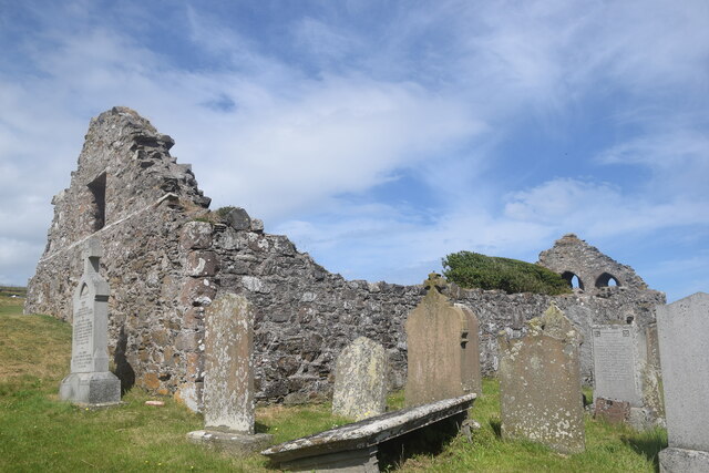
Chapel of St Mary and St Nathalan

The Chapel of St. Mary and St. Nathalan is a ruined chapel overlooking the North Sea immediately north of Stonehaven, in the Mearns of Scotland, along...

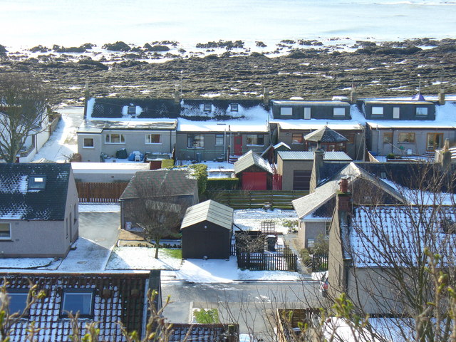
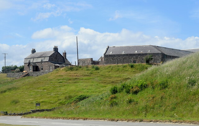
Cowie, Aberdeenshire

Cowie is an historic fishing village in Kincardineshire, Scotland. This village has existed since the Middle Ages, but in current times it is effectively...

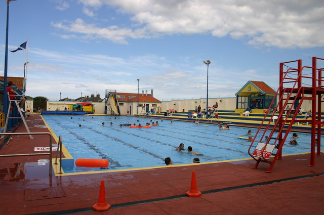
Stonehaven Open Air Pool

Stonehaven Open Air Swimming Pool, Queen Elizabeth Park, Stonehaven, Aberdeenshire, is an Olympic sized heated open air public pool opened in 1934. It...

Nearby Amenities

Located within 500m of 56.973976,-2.1969483
Source: PGS
Lat/Long: 56.9706207/-2.201503
Source: PGS
Lat/Long: 56.9707219/-2.2012577
Source: PGS
Lat/Long: 56.9708685/-2.2007653
Source: PGS
Lat/Long: 56.9714933/-2.1995632
Source: PGS
Lat/Long: 56.9716582/-2.199348
Source: PGS
Lat/Long: 56.9716554/-2.1992907
Source: PGS
Lat/Long: 56.9718203/-2.1991728
Source: PGS
Lat/Long: 56.9721242/-2.1988583
Source: PGS
Lat/Long: 56.9722929/-2.1986839
Source: PGS
Lat/Long: 56.9726951/-2.1981206
Source: PGS
Lat/Long: 56.9727689/-2.197953
Source: PGS
Lat/Long: 56.9728769/-2.1977507
Source: PGS
Lat/Long: 56.9729234/-2.1977003
Source: PGS
Lat/Long: 56.9731792/-2.1972767
Source: PGS
Lat/Long: 56.9735323/-2.1970873
Source: PGS
Lat/Long: 56.9736858/-2.1968791
Source: PGS
Lat/Long: 56.973926/-2.1964894
Source: PGS
Lat/Long: 56.9741277/-2.1958346
Source: PGS
Lat/Long: 56.9741979/-2.1953138
Source: PGS
Lat/Long: 56.9742634/-2.1951869
Source: PGS
Lat/Long: 56.9745437/-2.1941814
Source: PGS
Lat/Long: 56.9747653/-2.1939097
Source: PGS
Lat/Long: 56.9749715/-2.1934825
Source: PGS
Lat/Long: 56.9750279/-2.1933132
Source: PGS
Lat/Long: 56.9751321/-2.1927739
Source: PGS
Lat/Long: 56.9751407/-2.1924635
Source: PGS
Lat/Long: 56.9753696/-2.1921892
Source: PGS
Lat/Long: 56.9755817/-2.1919447
Source: PGS
Lat/Long: 56.9759248/-2.1916543
Source: PGS
Lat/Long: 56.9762232/-2.1911222
Crossing
Crossing: unmarked
Tactile Paving: no
Lat/Long: 56.9726962/-2.2006402
Source: PGS
Lat/Long: 56.9703827/-2.1946168
Source: PGS
Lat/Long: 56.9714357/-2.1962523
Parking
Lat/Long: 56.9722111/-2.2013144
Crossing
Crossing: unmarked
Tactile Paving: no
Lat/Long: 56.9721892/-2.2022846
Post Box
Collection Times: Mo-Fr 11:45; Sa 12:00
Post Box Type: wall
Ref: AB39 366
Royal Cypher: GR
Royal Cypher Wikidata: Q33102273
Lat/Long: 56.9707702/-2.202317
Site of Cowie Castle
Historic: ruins
Wikidata: Q1138213
Wikipedia: en:Cowie Castle
Lat/Long: 56.975315/-2.1929822
Cowie
Place: neighbourhood
Lat/Long: 56.9714413/-2.2020045
Source: PGS
Lat/Long: 56.9709303/-2.1947774
Source: PGS
Lat/Long: 56.969592/-2.1987
Source: PGS
Lat/Long: 56.9699479/-2.1979102
Source: PGS
Lat/Long: 56.9712789/-2.1952516
Bus Stop
Cowie
Bench: no
Bin: no
Bus: yes
Lit: no
Naptan AtcoCode: 630045751
Naptan Bearing: SW
Naptan CommonName: Cowie
Naptan Indicator: at
Naptan Landmark: Cowie Steps
Naptan NaptanCode: 23629327
Naptan Street: Unclassified Road
Naptan Verified: no
Operator: Stagecoach
Public Transport: platform
Ref: 23629327
Shelter: no
Tactile Paving: no
Lat/Long: 56.9728846/-2.2003969
Source: survey
Lat/Long: 56.9719182/-2.2000578
Source: survey
Lat/Long: 56.9718687/-2.2001336
Barrier: height_restrictor
Maxheight: 2
Lat/Long: 56.9721576/-2.2022153
Power: pole
Lat/Long: 56.9730813/-2.2043248
Power: pole
Lat/Long: 56.9734831/-2.2036739
Power: pole
Lat/Long: 56.9737989/-2.2031662
Power: pole
Lat/Long: 56.9741594/-2.20245
Power: pole
Lat/Long: 56.9745118/-2.2017653
Power: pole
Lat/Long: 56.9752902/-2.2010618
Communication Mobile Phone: yes
Man Made: mast
Tower Type: communication
Lat/Long: 56.9772052/-2.1959813
Barrier: height_restrictor
Maxheight: 2
Lat/Long: 56.9726741/-2.2006307
The data included in this document is from www.openstreetmap.org. The data is made available under ODbL.

Have you been to Michael's Pot?

Leave your review of Michael's Pot below (or comments, questions and feedback).