Geo of Coorse

Coastal Feature, Headland, Point in Orkney

Scotland

Geo of Coorse

North Ronaldsay: the lighthouse The lighthouse was built after a complicated history of lighthouse arrangements in Orkney. The first beacon here was the Old Beacon, which survives to the southeast, built in 1789. It was extinguished in 1809 after Start Point lighthouse (on Sanday) had begun operation as it was considered superfluous. However, this proved inauspicious and the present lighthouse was constructed in 1852. 

Thanks to the low-lying nature of North Ronaldsay, the lighthouse is the tallest land-based one in Britain, standing 42m in height to reach the 43m elevation of the light above sea level.

The lighthouse was automated in 1998, since when the various outbuildings have been converted to holiday accommodation, a café/small museum, and a wool mill.
North Ronaldsay: the lighthouse Credit: Chris Downer

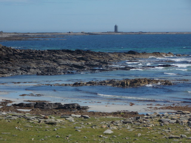
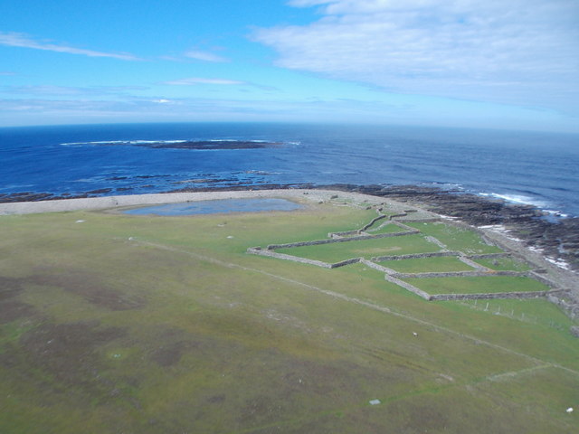
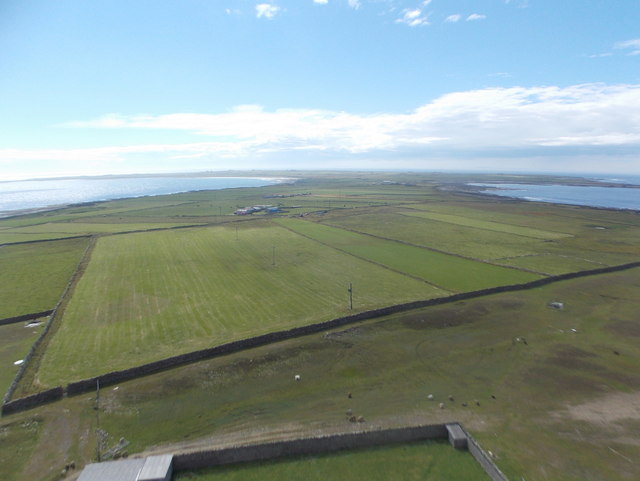
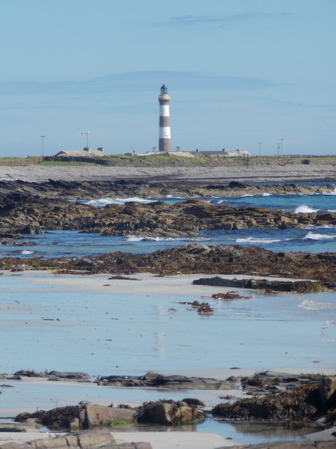
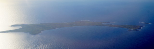
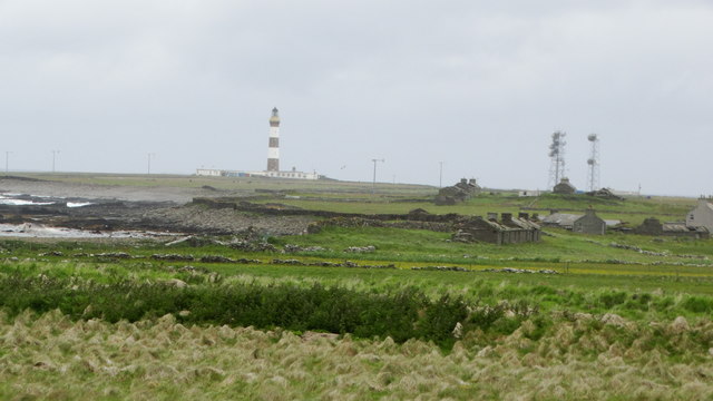
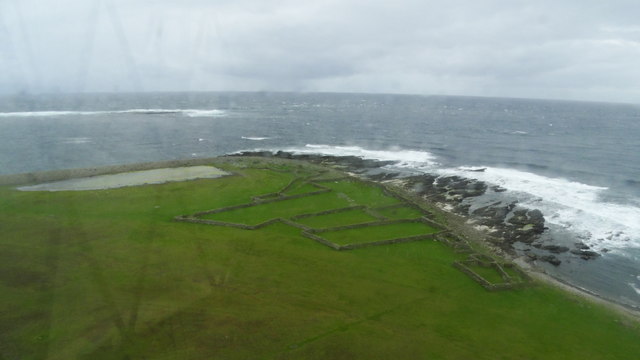
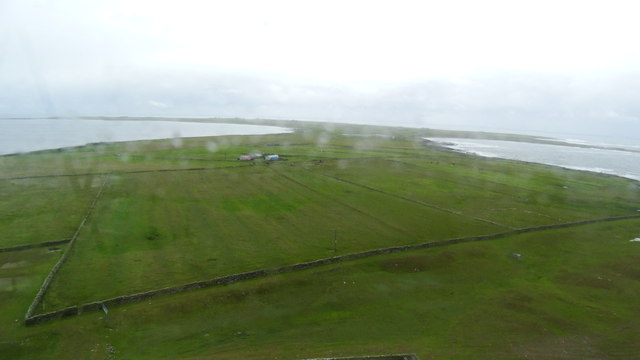
Geo of Coorse is a remarkable coastal feature located in Orkney, an archipelago situated off the northeastern coast of Scotland. Known for its breathtaking beauty and geological significance, Geo of Coorse is a prominent headland that extends into the North Sea, forming a distinctive point along the coastline.

This coastal formation is characterized by its steep cliffs, which reach impressive heights and are composed of layers of sedimentary rock, mainly sandstone and shale. These layers provide a glimpse into the ancient geological history of the area, dating back millions of years. Fossilized remains of marine life, such as ammonites and sea urchins, can often be found embedded within the rocks, adding to the area's scientific importance.

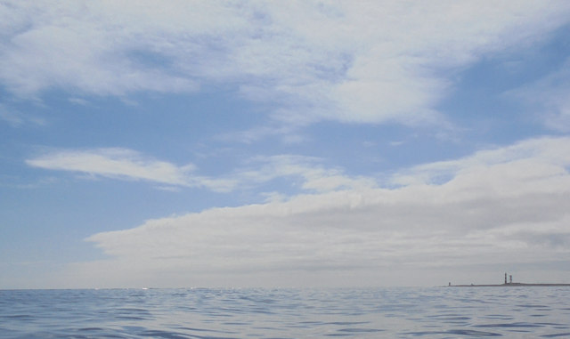
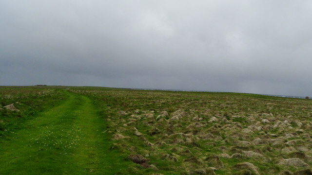
The rugged cliffs of Geo of Coorse offer a stunning panoramic view of the surrounding landscape and the vast expanse of the North Sea. The deep blue waters crashing against the cliffs create an awe-inspiring spectacle, especially during stormy weather when waves surge with immense power.

The site is also a haven for birdwatchers, as it provides nesting grounds for various seabirds, including puffins, guillemots, and fulmars. These birds can be observed perched on the cliffs or diving into the sea to catch fish, adding an element of wildlife biodiversity to the area.

Geo of Coorse is a popular destination for nature enthusiasts and hikers, attracting visitors from around the world who come to appreciate the unique geological formations and enjoy the tranquility of the coastal environment. It is a testament to the raw beauty and geological diversity of Orkney's coastal landscape.

If you have any feedback on the listing, please let us know in the comments section below.

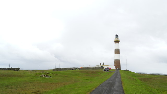
Geo of Coorse Images

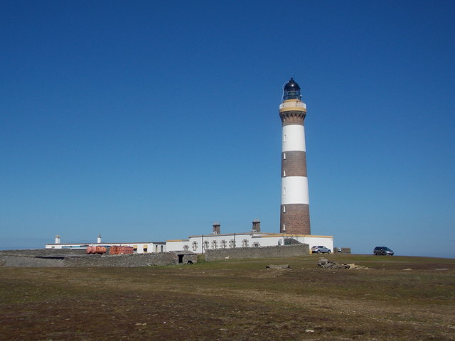
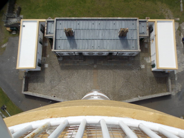
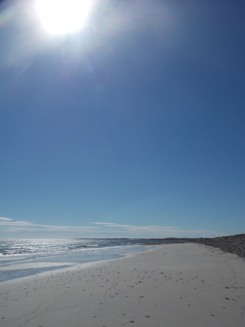
Images are sourced within 2km of 59.388353/-2.4153811 or Grid Reference HY7655. Thanks to Geograph Open Source API. All images are credited.

North Ronaldsay: the lighthouse The lighthouse was built after a complicated history of lighthouse arrangements in Orkney. The first beacon here was the Old Beacon, which survives to the southeast, built in 1789. It was extinguished in 1809 after Start Point lighthouse (on Sanday) had begun operation as it was considered superfluous. However, this proved inauspicious and the present lighthouse was constructed in 1852. 

Thanks to the low-lying nature of North Ronaldsay, the lighthouse is the tallest land-based one in Britain, standing 42m in height to reach the 43m elevation of the light above sea level.

The lighthouse was automated in 1998, since when the various outbuildings have been converted to holiday accommodation, a café/small museum, and a wool mill.
North Ronaldsay: the lighthouse
The lighthouse was built after a complicated history of lighthouse arrangements in Orkney. The first beacon here was the Old Beacon, which survives to the southeast, built in 1789. It was extinguished in 1809 after Start Point lighthouse (on Sanday) had begun operation as it was considered superfluous. However, this proved inauspicious and the present lighthouse was constructed in 1852. Thanks to the low-lying nature of North Ronaldsay, the lighthouse is the tallest land-based one in Britain, standing 42m in height to reach the 43m elevation of the light above sea level. The lighthouse was automated in 1998, since when the various outbuildings have been converted to holiday accommodation, a café/small museum, and a wool mill.
North Ronaldsay: looking down from the lighthouse A vertical view from the balcony of <a href="https://www.geograph.org.uk/photo/4705846">HY7855 : North Ronaldsay: the lighthouse</a>, on some of the associated buildings; those in the picture have been converted to holiday accommodation since the lighthouse's automation in 1998.
North Ronaldsay: looking down from the lighthouse
A vertical view from the balcony of HY7855 : North Ronaldsay: the lighthouse, on some of the associated buildings; those in the picture have been converted to holiday accommodation since the lighthouse's automation in 1998.
North Ronaldsay: the light in the lighthouse A closer look at the light and lenses at the top of <a href="https://www.geograph.org.uk/photo/4705846">HY7855 : North Ronaldsay: the lighthouse</a>.

The light here is surrounded by lenses and the whole apparatus revolves at a speed such that the lenses are ten seconds apart from any given viewpoint. This gives the appearance of the light flashing every ten seconds, which is the distinctive 'character' of this particular light, although the light itself does not physically flash.
North Ronaldsay: the light in the lighthouse
A closer look at the light and lenses at the top of HY7855 : North Ronaldsay: the lighthouse. The light here is surrounded by lenses and the whole apparatus revolves at a speed such that the lenses are ten seconds apart from any given viewpoint. This gives the appearance of the light flashing every ten seconds, which is the distinctive 'character' of this particular light, although the light itself does not physically flash.
North Ronaldsay: Linklet Bay beach on a cloudless day A pristine view along the beach on this glorious summer's day.
North Ronaldsay: Linklet Bay beach on a cloudless day
A pristine view along the beach on this glorious summer's day.
North Ronaldsay: rocky coastline along Linklet Bay The fine sandy beach just off to our right gives way to this stretch of low rocks, as we look towards the Old Beacon at the distant Dennis Head.
North Ronaldsay: rocky coastline along Linklet Bay
The fine sandy beach just off to our right gives way to this stretch of low rocks, as we look towards the Old Beacon at the distant Dennis Head.
North Ronaldsay: workings in the wool mill The small yarn industry has been a reality on the island since the mid 1990s, and has been based here in one of the former lighthouse buildings since 2003. The visitor is guided around all the workings for a small additional charge to the lighthouse tour.

More information will be found on their website: <span class="nowrap"><a title="http://www.northronaldsayyarn.co.uk/about.asp" rel="nofollow ugc noopener" href="http://www.northronaldsayyarn.co.uk/about.asp">Link</a><img style="margin-left:2px;" alt="External link" title="External link - shift click to open in new window" src="https://s1.geograph.org.uk/img/external.png" width="10" height="10"/></span>

Such is the multi-tasking way of these island communities, I would see the same young lady who showed us round later in the day, donning a high-vis jacket marshalling at the airfield when the plane home came in.
North Ronaldsay: workings in the wool mill
The small yarn industry has been a reality on the island since the mid 1990s, and has been based here in one of the former lighthouse buildings since 2003. The visitor is guided around all the workings for a small additional charge to the lighthouse tour. More information will be found on their website: LinkExternal link Such is the multi-tasking way of these island communities, I would see the same young lady who showed us round later in the day, donning a high-vis jacket marshalling at the airfield when the plane home came in.
North Ronaldsay: Point of Sinsoss and Seal Skerry Looking north from the top of the lighthouse, across the headland at Point of Sinsoss. Seal Skerry is just an offshore rock but, from the map, it is clear that at higher tides it is larger and almost meets the island itself. The loch in front of the shore is the curiously named Trolla Vatn.
North Ronaldsay: Point of Sinsoss and Seal Skerry
Looking north from the top of the lighthouse, across the headland at Point of Sinsoss. Seal Skerry is just an offshore rock but, from the map, it is clear that at higher tides it is larger and almost meets the island itself. The loch in front of the shore is the curiously named Trolla Vatn.
North Ronaldsay: a view over the island Looking southwest across the whole island from the top of the lighthouse.
North Ronaldsay: a view over the island
Looking southwest across the whole island from the top of the lighthouse.
North Ronaldsay: a typical island croft house Many of the croft houses of North Ronaldsay have these flagstone roofs; it seems to be a particular feature of this island.
North Ronaldsay: a typical island croft house
Many of the croft houses of North Ronaldsay have these flagstone roofs; it seems to be a particular feature of this island.
North Ronaldsay: rocks, sand and a lighthouse view Looking across the northwest edge of Linklet Bay, the distant lighthouse faintly reflected in the sand between outcrops of rock.
North Ronaldsay: rocks, sand and a lighthouse view
Looking across the northwest edge of Linklet Bay, the distant lighthouse faintly reflected in the sand between outcrops of rock.
North Ronaldsay from the air
North Ronaldsay emerging from the gloom
North Ronaldsay lighthouse North Ronaldsay lighthouse at Dennis Head, an Alan Stevenson design (full details from the Northern Lighthouse Board at <span class="nowrap"><a title="https://www.nlb.org.uk/lighthouselibrary/lighthouse/north-ronaldsay/)" rel="nofollow ugc noopener" href="https://www.nlb.org.uk/lighthouselibrary/lighthouse/north-ronaldsay/)">Link</a><img style="margin-left:2px;" alt="External link" title="External link - shift click to open in new window" src="https://s1.geograph.org.uk/img/external.png" width="10" height="10"/></span>.

To the north, a strong tidal roost forms and a standing wave can be seen to the left in the photograph.
North Ronaldsay lighthouse
North Ronaldsay lighthouse at Dennis Head, an Alan Stevenson design (full details from the Northern Lighthouse Board at LinkExternal link. To the north, a strong tidal roost forms and a standing wave can be seen to the left in the photograph.
On North Ronaldsay - View along Garso Wick to Lighthouse
On North Ronaldsay - view W along track towards Ancumtoun
On North Ronaldsay - Point of Sinsoss & Trolla Vatn from top of lighthouse Photo quality poor due to a wet day and looking through glass.
On North Ronaldsay - Point of Sinsoss & Trolla Vatn from top of lighthouse
Photo quality poor due to a wet day and looking through glass.
On North Ronaldsay - View across Dennis Ness from top of lighthouse Photo quality poor due to wet day and looking through glass.
On North Ronaldsay - View across Dennis Ness from top of lighthouse
Photo quality poor due to wet day and looking through glass.
On North Ronaldsay - view N to Lighthouse
Show me another place!

Geo of Coorse is located at Grid Ref: HY7655 (Lat: 59.388353, Lng: -2.4153811)

Unitary Authority: Orkney Islands

Police Authority: Highlands and Islands

What 3 Words

///tragedy.witless.widgets. Near Hollandstoun, Orkney Islands

Related Wikis

Ancumtoun

Ancumtoun is a small settlement in the north of the island of North Ronaldsay, Orkney, Scotland. The settlement is within the parish of Cross and Burness...

North Ronaldsay Airport

North Ronaldsay Airport (IATA: NRL, ICAO: EGEN) is located on North Ronaldsay island, 28 NM (52 km; 32 mi) northeast by north of Kirkwall, Orkney Islands...

Bustatoun

Bustatoun is a village on the island of North Ronaldsay, in Orkney, Scotland. The settlement is within the parish of Cross and Burness. == References... ==

Broch of Burrian

The Broch of Burrian is an Iron Age broch located on North Ronaldsay in the Orkney Islands, in Scotland (grid reference HY76275138). == Location == The...

Nearby Amenities

Located within 500m of 59.388353,-2.4153811
Created By: almien_coastlines mod
Lat/Long: 59.386705/-2.4177
Lenswick
Natural: bay
Wikidata: Q24640535
Lat/Long: 59.3886046/-2.4204485
Geo of Coorse
Natural: bay
Lat/Long: 59.3880965/-2.4153415
North Geo of Hangie
Natural: bay
Lat/Long: 59.388582/-2.4086728
South Geo of Hangie
Natural: bay
Lat/Long: 59.3879482/-2.4081042
Material: wood
Power: pole
Lat/Long: 59.386164/-2.4110323
Material: wood
Power: pole
Lat/Long: 59.3854455/-2.4110645
Material: wood
Power: pole
Lat/Long: 59.384865/-2.411086
Man Made: water_well
Pump: no
Lat/Long: 59.385869/-2.4173681
Historic: memorial
Material: stone
Lat/Long: 59.3844721/-2.4127021
Man Made: water_well
Pump: no
Lat/Long: 59.3855597/-2.4106893
The data included in this document is from www.openstreetmap.org. The data is made available under ODbL.

Have you been to Geo of Coorse?

Leave your review of Geo of Coorse below (or comments, questions and feedback).