Hine Greenie

Coastal Feature, Headland, Point in Orkney

Scotland

Hine Greenie

Ruined buildings at Newbigging, Sanday
Ruined buildings at Newbigging, Sanday Credit: Alpin Stewart

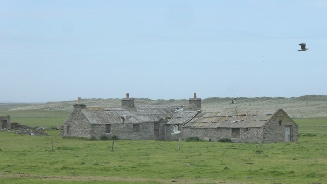
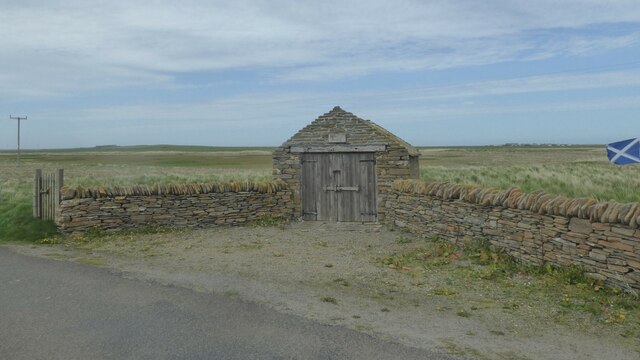
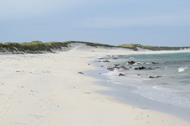
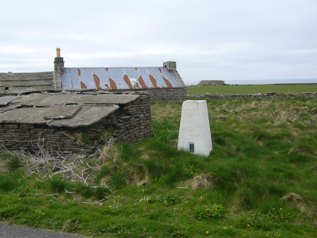
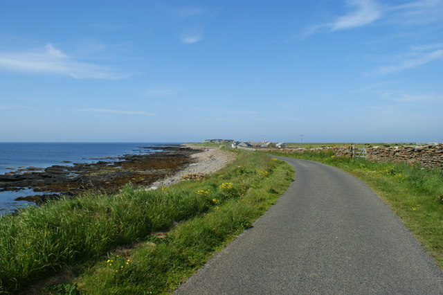
Hine Greenie is a prominent headland located on the northeast coast of Orkney, a group of islands in Scotland. Situated near the village of Birsay, this coastal feature offers breathtaking views of the North Atlantic Ocean and the surrounding rugged landscape.

The headland is characterized by its steep cliffs, which rise to a height of approximately 50 meters (164 feet) above sea level. The cliffs are composed of sedimentary rocks, including sandstone and shale, displaying distinct layers formed over millions of years.

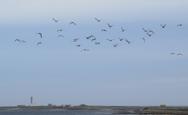
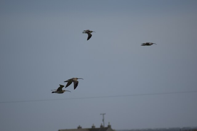
Hine Greenie is renowned for its rich biodiversity. The headland supports a diverse range of plant and animal species, including seabirds such as puffins, guillemots, and kittiwakes. The surrounding waters are also home to a variety of marine life, including seals, dolphins, and occasionally, whales.

The headland offers several walking trails, allowing visitors to explore its natural beauty. These trails take visitors along the cliff tops, providing stunning views of the coastline and the opportunity to observe the wildlife that inhabits the area. Hine Greenie is also a popular spot for birdwatching, as the cliffs provide excellent nesting sites for seabird colonies.

The location of Hine Greenie makes it susceptible to the harsh weather conditions of the North Atlantic. Strong winds and rough seas are common, especially during the winter months. As a result, the headland is an ideal spot for experiencing the power and beauty of nature.

Overall, Hine Greenie is a remarkable coastal feature that offers visitors a chance to immerse themselves in the stunning natural landscapes and diverse wildlife of Orkney's northeast coast.

If you have any feedback on the listing, please let us know in the comments section below.

Hine Greenie Images

Images are sourced within 2km of 59.291901/-2.4145205 or Grid Reference HY7645. Thanks to Geograph Open Source API. All images are credited.

Ruined buildings at Newbigging, Sanday
Spit at Ayre Sound, Sanday
Lopness Trig Point, Sanday
Hearsie Hoose, Sanday Where the horse drawn hearse was (or is) kept.
Hearsie Hoose, Sanday
Where the horse drawn hearse was (or is) kept.
Sanday - Sand and dunes bordering Scuthvie Bay Beautiful white sands along the coast of Sanday bordering Scuthvie Bay.
The view in the opposite direction can be seen here  <a href="https://www.geograph.org.uk/photo/7550397">HY7843 : Sanday - Looking across Scuthvie Bay to Start Point lighthouse</a>
Sanday - Sand and dunes bordering Scuthvie Bay
Beautiful white sands along the coast of Sanday bordering Scuthvie Bay. The view in the opposite direction can be seen here HY7843 : Sanday - Looking across Scuthvie Bay to Start Point lighthouse
Sanday - Curlew over Scuthvie Bay A flock of curlew (Numenius arquata) in the sky over Scuthvie Bay on Sanday - I make it 34 of them in this picture. Start Point Lighthouse can be seen in the distance - see <a href="https://www.geograph.org.uk/photo/7550397">HY7843 : Sanday - Looking across Scuthvie Bay to Start Point lighthouse</a> for more information on this.
See <a href="https://www.geograph.org.uk/photo/7550420">HY7644 : Sanday - Curlew in flight</a> 
and <a href="https://www.geograph.org.uk/photo/7560814">HY7644 : Sanday - Two curlew in flight</a>
for closer views of the curlew and more details about this wader.
Sanday - Curlew over Scuthvie Bay
A flock of curlew (Numenius arquata) in the sky over Scuthvie Bay on Sanday - I make it 34 of them in this picture. Start Point Lighthouse can be seen in the distance - see HY7843 : Sanday - Looking across Scuthvie Bay to Start Point lighthouse for more information on this. See HY7644 : Sanday - Curlew in flight and HY7644 : Sanday - Two curlew in flight for closer views of the curlew and more details about this wader.
Sanday - Curlew in flight Four curlew (Numenius arquata) in flight inland from Scuthvie Bay on the island of Sanday in the Orkneys. Their distinctive long down-curved bill can be seen clearly here, though this is not a particularly good way of identifying them as several other waders also have such bills, however, the curlew is considerably larger than most other waders.
There were many more of these birds with their haunting and evocative call - see <a href="https://www.geograph.org.uk/photo/7550409">HY7644 : Sanday - Curlew over Scuthvie Bay</a> for a small flock of them.
For more information on the curlew, see the BTO page here - <span class="nowrap"><a title="https://www.bto.org/understanding-birds/birdfacts/curlew" rel="nofollow ugc noopener" href="https://www.bto.org/understanding-birds/birdfacts/curlew">Link</a><img style="margin-left:2px;" alt="External link" title="External link - shift click to open in new window" src="https://s1.geograph.org.uk/img/external.png" width="10" height="10"/></span>
See also <a href="https://www.geograph.org.uk/photo/7560814">HY7644 : Sanday - Two curlew in flight</a>
Sanday - Curlew in flight
Four curlew (Numenius arquata) in flight inland from Scuthvie Bay on the island of Sanday in the Orkneys. Their distinctive long down-curved bill can be seen clearly here, though this is not a particularly good way of identifying them as several other waders also have such bills, however, the curlew is considerably larger than most other waders. There were many more of these birds with their haunting and evocative call - see HY7644 : Sanday - Curlew over Scuthvie Bay for a small flock of them. For more information on the curlew, see the BTO page here - LinkExternal link See also HY7644 : Sanday - Two curlew in flight
Sanday - Two curlew in flight As with <a href="https://www.geograph.org.uk/photo/7550420">HY7644 : Sanday - Curlew in flight</a> these curlew (Numenius arquata) were flying inland from Scuthvie Bay on Sanday. The very long, slender curved bills can be seen clearly in this image along with the mottled plumage on the lower bird.
See also <a href="https://www.geograph.org.uk/photo/7550409">HY7644 : Sanday - Curlew over Scuthvie Bay</a>
Sanday - Two curlew in flight
As with HY7644 : Sanday - Curlew in flight these curlew (Numenius arquata) were flying inland from Scuthvie Bay on Sanday. The very long, slender curved bills can be seen clearly in this image along with the mottled plumage on the lower bird. See also HY7644 : Sanday - Curlew over Scuthvie Bay
Whalehead WWII Chain Home radar station Isle of Sanday, Orkney
Whalehead WWII Chain Home radar station
Isle of Sanday, Orkney
Whalehead WWII Chain Home radar station Isle of Sanday, Orkney
Whalehead WWII Chain Home radar station
Isle of Sanday, Orkney
Whalehead WWII Chain Home radar station (Reserve site) Isle of Sanday, Orkney
Whalehead WWII Chain Home radar station (Reserve site)
Isle of Sanday, Orkney
WW2 Mortuary on Sanday Only remaining building of the camp associated with the RAF Whalehead Chain Home radar station on Isle of Sanday in the Orkney Islands.
WW2 Mortuary on Sanday
Only remaining building of the camp associated with the RAF Whalehead Chain Home radar station on Isle of Sanday in the Orkney Islands.
Galilee Deserted houses in the north-east of Sanday
Galilee
Deserted houses in the north-east of Sanday
Lopness trig
Lopness trig
Irises growing on roadside, Eastern Sanday Yellow flag irises growing on the roadside at the eastern end of the B9069 on the island of Sanday.  Behind the house are sand dunes edging Scuthvie Bay.

The black on the road is tar, melting in the high temperatures (by local standards).
Irises growing on roadside, Eastern Sanday
Yellow flag irises growing on the roadside at the eastern end of the B9069 on the island of Sanday. Behind the house are sand dunes edging Scuthvie Bay. The black on the road is tar, melting in the high temperatures (by local standards).
Field roller at gateside, in the northwest of Sanday Sandy field in background shows why the Vikings named the island Sanday (= sand island)
Field roller at gateside, in the northwest of Sanday
Sandy field in background shows why the Vikings named the island Sanday (= sand island)
Road alongside Bay of Sandquoy Road runs alongside the eastern shore of the Bay of Sandquoy , only just above the high tide level on the island of Sanday.
Road alongside Bay of Sandquoy
Road runs alongside the eastern shore of the Bay of Sandquoy , only just above the high tide level on the island of Sanday.
Visitor Book Where, but on a remote Orkney island, would you find a visitor book? Carefully wrapped in plastic with a couple of pencils in case you forgot your own. Plenty of people make entries on the weather, bird life, etc. No idea who finally reads it all, but it would make an interesting publication.
Visitor Book
Where, but on a remote Orkney island, would you find a visitor book? Carefully wrapped in plastic with a couple of pencils in case you forgot your own. Plenty of people make entries on the weather, bird life, etc. No idea who finally reads it all, but it would make an interesting publication.
Show me another place!

Hine Greenie is located at Grid Ref: HY7645 (Lat: 59.291901, Lng: -2.4145205)

Unitary Authority: Orkney Islands

Police Authority: Highlands and Islands

What 3 Words

///perfumed.kindness.chef. Near Hollandstoun, Orkney Islands

Related Wikis

Broch of Burrian

The Broch of Burrian is an Iron Age broch located on North Ronaldsay in the Orkney Islands, in Scotland (grid reference HY76275138). == Location == The...

East Sanday Coast

The East Sanday Coast is a protected wetland area on and around the island of Sanday, the third-largest of the Orkney islands off the north coast of Scotland...

Bustatoun

Bustatoun is a village on the island of North Ronaldsay, in Orkney, Scotland. The settlement is within the parish of Cross and Burness. == References... ==

North Ronaldsay Airport

North Ronaldsay Airport (IATA: NRL, ICAO: EGEN) is located on North Ronaldsay island, 28 NM (52 km; 32 mi) northeast by north of Kirkwall, Orkney Islands...

Scar boat burial

The Scar boat burial is a Viking boat burial near the village of Scar, on Sanday, in Orkney, Scotland. The burial, which dates to between 875 and 950 AD...

Scar, Orkney

Scar is a village and farm complex on the island of Sanday in Orkney, Scotland. The B9068 road runs from Scar to Kettletoft. The Scar boat burial was found...

Sanday, Orkney

Sanday (, Scots: Sandee) is one of the inhabited islands of Orkney that lies off the north coast of mainland Scotland. With an area of 50.43 km2 (19.5...

Have you been to Hine Greenie?

Leave your review of Hine Greenie below (or comments, questions and feedback).