Palmer Cove

Coastal Feature, Headland, Point in Banffshire

Scotland

Palmer Cove

The road to Tarlair Looking towards Macduff. The building to the right of the road is the Well of Tarlair. It dates from c.1800. The chalybeate waters enjoyed considerable popularity for their medicinal and health giving properties in the NE during the 18th and 19th centuries.
The road to Tarlair Credit: Alan Murray-Rust

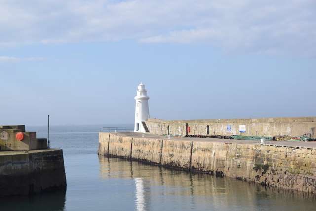
Palmer Cove is a picturesque coastal feature located in Banffshire, Scotland. It is a headland that juts out into the North Sea, forming a prominent point along the rugged coastline. The cove is known for its stunning natural beauty and unique geological formations.

The headland is characterized by its towering cliffs, which rise dramatically from the sea, offering breathtaking panoramic views of the surrounding area. These cliffs are composed of layers of sedimentary rocks, including sandstone and shale, which have been shaped by the relentless force of the ocean waves over millions of years.

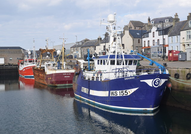
Palmer Cove is also home to a diverse range of marine and bird life, making it a popular spot for nature enthusiasts and wildlife photographers. Seals can often be spotted basking on the rocks, while seabirds, such as gulls and puffins, nest in the crevices of the cliffs.

Access to Palmer Cove is relatively easy, with a well-maintained footpath leading visitors down from the nearby coastal village. At low tide, it is possible to explore the small sandy beach that forms at the base of the cliffs, providing a tranquil spot for picnics or beachcombing.

The cove's location on the North Sea means that it experiences a dynamic coastal environment, with strong winds and ever-changing tide patterns. This makes it a popular destination for surfers, who are drawn to the challenging waves that crash against the cliffs.

Overall, Palmer Cove is a stunning coastal feature that offers visitors a unique blend of natural beauty, wildlife, and recreational opportunities. It is a must-visit destination for anyone exploring the scenic coastline of Banffshire.

If you have any feedback on the listing, please let us know in the comments section below.
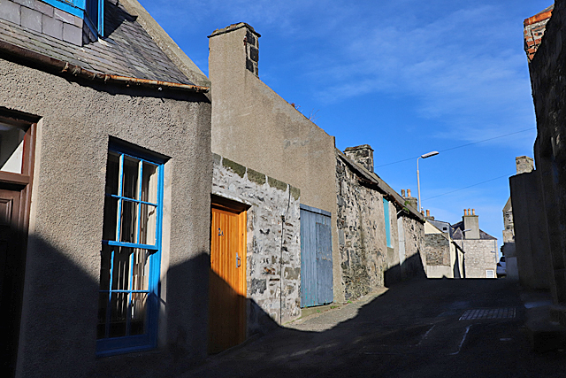
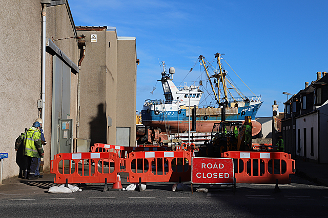
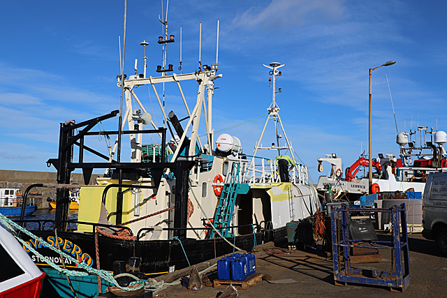
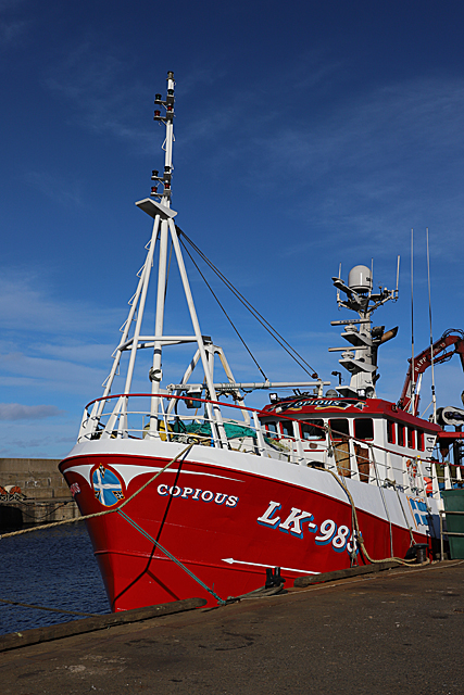
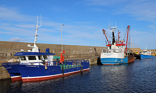
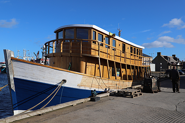
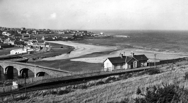
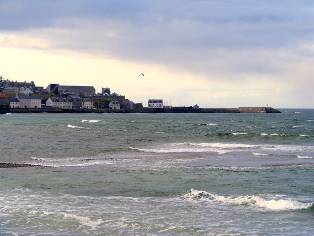
Palmer Cove Images

Images are sourced within 2km of 57.665373/-2.506548 or Grid Reference NJ6964. Thanks to Geograph Open Source API. All images are credited.

The road to Tarlair Looking towards Macduff. The building to the right of the road is the Well of Tarlair. It dates from c.1800. The chalybeate waters enjoyed considerable popularity for their medicinal and health giving properties in the NE during the 18th and 19th centuries.
The road to Tarlair
Looking towards Macduff. The building to the right of the road is the Well of Tarlair. It dates from c.1800. The chalybeate waters enjoyed considerable popularity for their medicinal and health giving properties in the NE during the 18th and 19th centuries.
Stagecoach Bluebird Macduff Bus Depot
Macduff: a view over the harbour Looking over the harbour from the grassy hilltop to the south, where an anchor is ... anchored, by the <a href="https://www.geograph.org.uk/photo/451242">NJ7064 : Macduff: parish church</a>.
Macduff: a view over the harbour
Looking over the harbour from the grassy hilltop to the south, where an anchor is ... anchored, by the NJ7064 : Macduff: parish church.
View towards Macduff from Banff beach Macduff parish kirk is prominent on the hill with the unusual war memorial tower to the right.
View towards Macduff from Banff beach
Macduff parish kirk is prominent on the hill with the unusual war memorial tower to the right.
Macduff parish kirk Built 1805 (remodelled 1865) on a dramatic hilltop site overlooking Macduff harbour.  B-listed (LB37616): <span class="nowrap"><a title="http://portal.historicenvironment.scot/designation/LB37616" rel="nofollow ugc noopener" href="http://portal.historicenvironment.scot/designation/LB37616">Link</a><img style="margin-left:2px;" alt="External link" title="External link - shift click to open in new window" src="https://s1.geograph.org.uk/img/external.png" width="10" height="10"/></span> .
Macduff parish kirk
Built 1805 (remodelled 1865) on a dramatic hilltop site overlooking Macduff harbour. B-listed (LB37616): LinkExternal link .
Macduff war memorial An unusual and striking war memorial tower erected in 1920 and B-listed (LB37681):  <span class="nowrap"><a title="http://portal.historicenvironment.scot/designation/LB37631" rel="nofollow ugc noopener" href="http://portal.historicenvironment.scot/designation/LB37631">Link</a><img style="margin-left:2px;" alt="External link" title="External link - shift click to open in new window" src="https://s1.geograph.org.uk/img/external.png" width="10" height="10"/></span> .
Macduff war memorial
An unusual and striking war memorial tower erected in 1920 and B-listed (LB37681): LinkExternal link .
View of Macduff harbour from Church Street
Macduff town hall, 17 Shore Street The Scottish baronial town hall facing the harbour was designed by Aberdeen architects Pirie and Clyne in 1884 and is B-listed (LB37634): <span class="nowrap"><a title="http://portal.historicenvironment.scot/designation/LB37634" rel="nofollow ugc noopener" href="http://portal.historicenvironment.scot/designation/LB37634">Link</a><img style="margin-left:2px;" alt="External link" title="External link - shift click to open in new window" src="https://s1.geograph.org.uk/img/external.png" width="10" height="10"/></span> . Next door is the former Clydesdale Bank and agent's house, also B-listed (LB37635): <span class="nowrap"><a title="http://portal.historicenvironment.scot/designation/LB37635" rel="nofollow ugc noopener" href="http://portal.historicenvironment.scot/designation/LB37635">Link</a><img style="margin-left:2px;" alt="External link" title="External link - shift click to open in new window" src="https://s1.geograph.org.uk/img/external.png" width="10" height="10"/></span> .
Macduff town hall, 17 Shore Street
The Scottish baronial town hall facing the harbour was designed by Aberdeen architects Pirie and Clyne in 1884 and is B-listed (LB37634): LinkExternal link . Next door is the former Clydesdale Bank and agent's house, also B-listed (LB37635): LinkExternal link .
Macduff harbour entrance and lighthouse The lighthouse dates from 1903 (Canmore record 81477: <span class="nowrap"><a title="https://canmore.org.uk/site/81447/macduff-harbour-entrance-lighthouse" rel="nofollow ugc noopener" href="https://canmore.org.uk/site/81447/macduff-harbour-entrance-lighthouse">Link</a><img style="margin-left:2px;" alt="External link" title="External link - shift click to open in new window" src="https://s1.geograph.org.uk/img/external.png" width="10" height="10"/></span> ).
Macduff harbour entrance and lighthouse
The lighthouse dates from 1903 (Canmore record 81477: LinkExternal link ).
Macduff harbour The harbour at Macduff, with its ocean-going trawlers, has a totally different feel to the gentrified Banff marina on the other side of the River Deveron estuary.  Here we see the smartly turned out Shekinah (registered to INV = Inverness) and the Reliance II (BF = Banff) sandwiching a rather rusty visitor from afar; the Glen Alvah from BM = Brixham (Devon).
Macduff harbour
The harbour at Macduff, with its ocean-going trawlers, has a totally different feel to the gentrified Banff marina on the other side of the River Deveron estuary. Here we see the smartly turned out Shekinah (registered to INV = Inverness) and the Reliance II (BF = Banff) sandwiching a rather rusty visitor from afar; the Glen Alvah from BM = Brixham (Devon).
Harbourside buildings, Macduff Most prominent is the Old Moray Inn.
Harbourside buildings, Macduff
Most prominent is the Old Moray Inn.
The Old Moray Inn, Macduff Next door is a chandler and the harbour master's office.
The Old Moray Inn, Macduff
Next door is a chandler and the harbour master's office.
School Lane School Lane climbs in both direction from its intersection with Duff Street. This is looking up the eastern part of it from near the corner of Duff Street.
School Lane
School Lane climbs in both direction from its intersection with Duff Street. This is looking up the eastern part of it from near the corner of Duff Street.
Road Closed As this is the signposted route to the Macduff Marine Aquarium, and no diversion is signposted, I have to hope that there have not been too many baffled visitors recently.
Road Closed
As this is the signposted route to the Macduff Marine Aquarium, and no diversion is signposted, I have to hope that there have not been too many baffled visitors recently.
Nova Spero 'Nova Spero', registered in Stornoway, is in Macduff for maintenance and a fresh coat of paint.
Nova Spero
'Nova Spero', registered in Stornoway, is in Macduff for maintenance and a fresh coat of paint.
Copious This Lerwick boat is looking very smart. Note the blue and white Shetland flag on the bow.
Copious
This Lerwick boat is looking very smart. Note the blue and white Shetland flag on the bow.
Boats in Macduff Harbour The grapevine tells me that 'Vertrouwen' is on the market, her licence and quota having been transferred to a new larger boat.
Boats in Macduff Harbour
The grapevine tells me that 'Vertrouwen' is on the market, her licence and quota having been transferred to a new larger boat.
'Highland Lassie' This is the former 'Frigate Bird' with only the hull and engine left from her days as a fishing boat. The new superstructure is of oak felled by a gale near Inverness, and was built in Inverness. She will have cabins on the top deck and in the fish hold, and will be moored at Dochgarroch on the Caledonian Canal at the north end of Loch Ness as additional accommodation for the hotel there. She will also be available for charter. 

See <span class="nowrap"><a title="https://www.pressandjournal.co.uk/fp/news/highlands/1651723/floating-hotel-takes-first-voyage-in-preparation-for-opening/" rel="nofollow ugc noopener" href="https://www.pressandjournal.co.uk/fp/news/highlands/1651723/floating-hotel-takes-first-voyage-in-preparation-for-opening/">Link</a><img style="margin-left:2px;" alt="External link" title="External link - shift click to open in new window" src="https://s1.geograph.org.uk/img/external.png" width="10" height="10"/></span>
'Highland Lassie'
This is the former 'Frigate Bird' with only the hull and engine left from her days as a fishing boat. The new superstructure is of oak felled by a gale near Inverness, and was built in Inverness. She will have cabins on the top deck and in the fish hold, and will be moored at Dochgarroch on the Caledonian Canal at the north end of Loch Ness as additional accommodation for the hotel there. She will also be available for charter. See LinkExternal link
Show me another place!

Palmer Cove is located at Grid Ref: NJ6964 (Lat: 57.665373, Lng: -2.506548)

Unitary Authority: Aberdeenshire

Police Authority: North East

What 3 Words

///flute.faded.contoured. Near Macduff, Aberdeenshire

Related Wikis

Macduff railway station

Macduff railway station was a railway station serving the settlements of Banff and Macduff, Aberdeenshire, Scotland. It was the terminus of a branch line...

Banff Bridge railway station

Banff Bridge railway station was a railway station in Banff Bridge, Banff, Aberdeenshire. It was the penultimate stop on a branch line from Inveramsay...

Banff Bay

Banff Bay (Scottish Gaelic: Bàgh Bhanbh) is a coastal embayment in Scotland situated between the towns of Banff, Aberdeenshire and Macduff, Aberdeenshire...

River Deveron

The River Deveron (Scottish Gaelic: Uisge Dubh Èireann) is a river in the north east of Scotland. The river has a length of 60 miles (97 km), and has a...

Macduff Town Hall

Macduff Town Hall is a municipal building in Shore Street, Macduff, Aberdeenshire, Scotland. The structure, which was the meeting place of Macduff Burgh...

Princess Royal Park

Princess Royal Park is a football ground in the town of Banff in the north-east of Scotland, which is the home ground of Highland Football League side...

Macduff, Aberdeenshire

Macduff (Scottish Gaelic: An Dùn) is a town in the Banff and Buchan area of Aberdeenshire, Scotland. It is situated on Banff Bay and faces the town of...

Banff Town House

Banff Town House is a municipal building in Low Street, Banff, Aberdeenshire, Scotland. The building, which is used as a customer service point and job...

Nearby Amenities

Located within 500m of 57.665373,-2.506548
Macduff
Historic Railway: station
Railway: site
Wikidata: Q6723009
Wikipedia: en:Macduff railway station
Lat/Long: 57.6668622/-2.5042278
Mobile Speed camera route 4 end
Website: http://www.nescamp.co.uk/details?cid=94
Lat/Long: 57.6628275/-2.5118829
Fuel
Operator: Gleaner
Source: survey
Lat/Long: 57.6671081/-2.50536
Man Made: tower
Lat/Long: 57.6648081/-2.4984344
Post Box
Post Box Type: wall
Ref: AB44 39D
Royal Cypher: GVIR
Royal Cypher Wikidata: Q33102169
Lat/Long: 57.667419/-2.4993331
Bus Stop
Union Road
Bus: yes
Naptan AtcoCode: 630021542
Naptan Bearing: SW
Naptan CommonName: Union Road
Naptan Indicator: SW bound
Naptan Landmark: Union Road
Naptan NaptanCode: 23624549
Naptan Street: Union Road
Naptan Verified: no
Public Transport: platform
Ref: 23624549
Lat/Long: 57.6684606/-2.5034707
Bus Stop
Union Road
Bus: yes
Naptan AtcoCode: 630021541
Naptan Bearing: NE
Naptan CommonName: Union Road
Naptan Indicator: NE bound
Naptan Landmark: Union Road
Naptan NaptanCode: 23627875
Naptan Street: Union Road
Naptan Verified: no
Public Transport: platform
Ref: 23627875
Lat/Long: 57.6685575/-2.5036542
Bus Depot
Lat/Long: 57.66907/-2.502769
Bus Depot
Operator: Stagecoach
Lat/Long: 57.6687013/-2.5036327
Man Made: tower
Lat/Long: 57.6630377/-2.5005373
Temple of Venus
Historic: monument
Lat/Long: 57.6628786/-2.5084519
Power: pole
Lat/Long: 57.6629127/-2.5100273
Power: pole
Lat/Long: 57.662762/-2.5086433
Power: pole
Lat/Long: 57.6625009/-2.5077286
Power: pole
Lat/Long: 57.6622384/-2.5068676
Power: pole
Lat/Long: 57.6619442/-2.5058404
Power: pole
Lat/Long: 57.6624364/-2.5046441
Power: pole
Lat/Long: 57.6626487/-2.5037348
Power: pole
Lat/Long: 57.6629658/-2.5025547
Power: pole
Lat/Long: 57.6633044/-2.5013235
Power: pole
Lat/Long: 57.6636637/-2.5001701
Power: pole
Lat/Long: 57.6632111/-2.5082275
Power: pole
Lat/Long: 57.6631881/-2.5074068
Power: pole
Lat/Long: 57.6635095/-2.5054783
Power: pole
Lat/Long: 57.6637721/-2.5039735
Power: pole
Lat/Long: 57.6641436/-2.5016856
Power: pole
Lat/Long: 57.6643789/-2.5004169
Power: pole
Lat/Long: 57.6639586/-2.4993548
Power: pole
Lat/Long: 57.6655926/-2.4994996
Power: pole
Lat/Long: 57.6648581/-2.4988666
Power: pole
Lat/Long: 57.6644507/-2.4985045
Generator Method: photovoltaic
Generator Output Electricity: yes
Generator Source: solar
Generator Type: solar_photovoltaic_panel
Location: roof
Power: generator
Lat/Long: 57.6640145/-2.5021523
Generator Method: photovoltaic
Generator Output Electricity: yes
Generator Source: solar
Generator Type: solar_photovoltaic_panel
Location: roof
Power: generator
Lat/Long: 57.664158/-2.501978
Generator Method: photovoltaic
Generator Output Electricity: yes
Generator Source: solar
Generator Type: solar_photovoltaic_panel
Location: roof
Power: generator
Lat/Long: 57.6653588/-2.498534
Generator Method: photovoltaic
Generator Output Electricity: yes
Generator Source: solar
Generator Type: solar_photovoltaic_panel
Location: roof
Power: generator
Lat/Long: 57.6665681/-2.501286
Generator Method: photovoltaic
Generator Output Electricity: yes
Generator Source: solar
Generator Type: solar_photovoltaic_panel
Location: roof
Power: generator
Lat/Long: 57.6674533/-2.5035954
Generator Method: photovoltaic
Generator Output Electricity: yes
Generator Source: solar
Generator Type: solar_photovoltaic_panel
Location: roof
Power: generator
Lat/Long: 57.6670817/-2.4993789
Power: pole
Lat/Long: 57.6638711/-2.4990986
Banff Bridge
Historic Railway: station
Wikidata: Q4854862
Wikipedia: en:Banff Bridge railway station
Lat/Long: 57.662475/-2.5107386
The data included in this document is from www.openstreetmap.org. The data is made available under ODbL.

Have you been to Palmer Cove?

Leave your review of Palmer Cove below (or comments, questions and feedback).