Badcall, Lower

Settlement in Sutherland

Scotland

Badcall, Lower

Badcall Bay
Badcall Bay Credit: Peter Jeffery

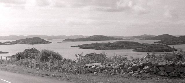
Badcall is a small village located in the northernmost region of Scotland known as Sutherland. It is situated in an isolated and rugged area, making it an ideal destination for those seeking tranquility and natural beauty. With a population of around 100 residents, Badcall offers a peaceful retreat from the hustle and bustle of larger towns and cities.

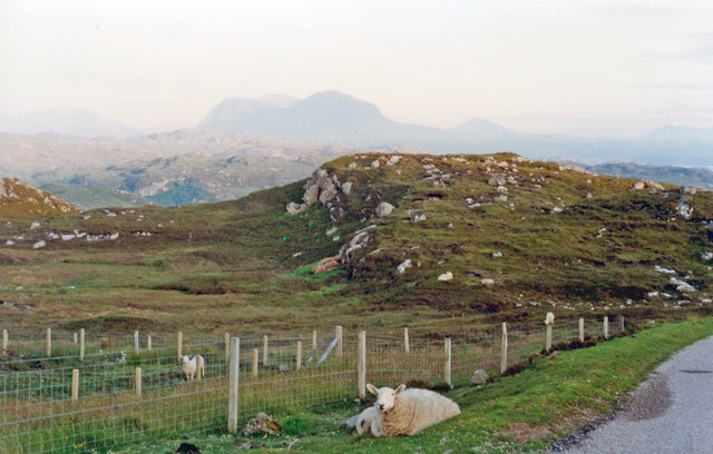
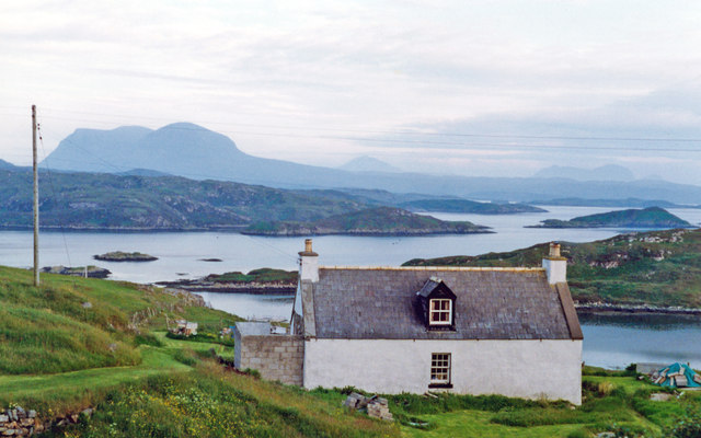
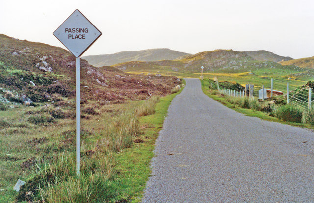
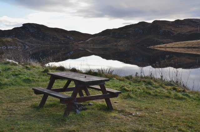
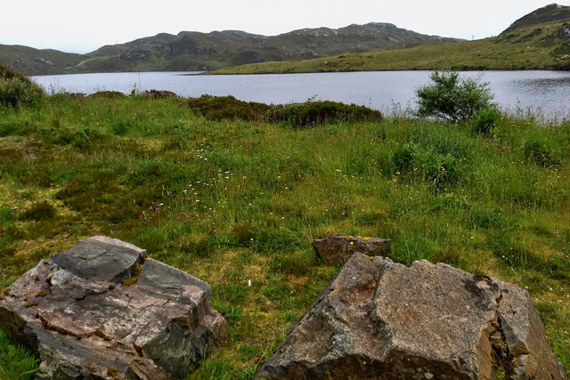
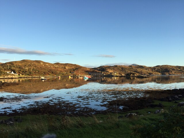
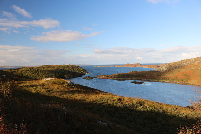
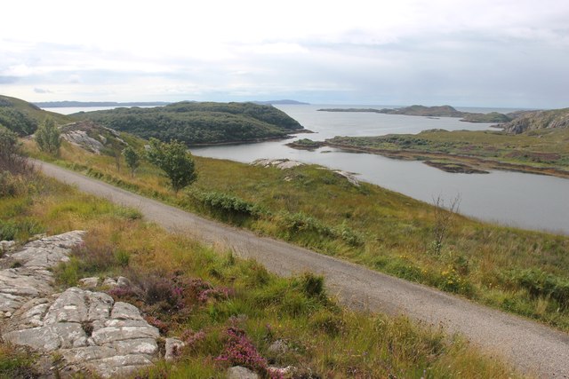
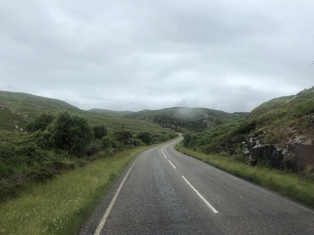
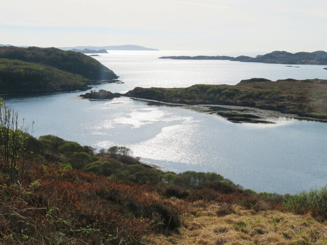
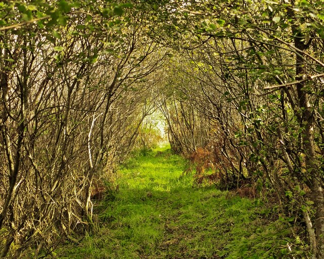
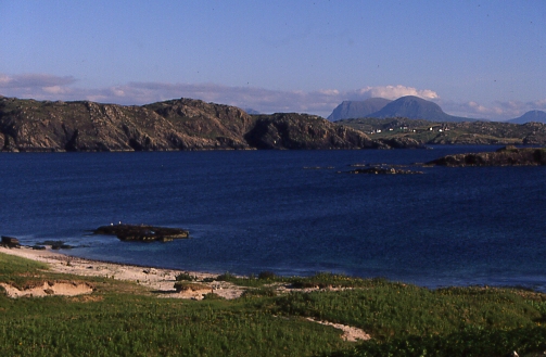
The village is nestled on the shores of Loch Inchard, a stunning sea loch that stretches out into the Atlantic Ocean. The surrounding landscape is characterized by dramatic cliffs, rolling hills, and picturesque beaches, providing visitors with breathtaking views and endless opportunities for outdoor activities such as hiking, fishing, and birdwatching.

The architecture of Badcall reflects its traditional Scottish heritage, with charming stone cottages and crofts dotting the landscape. The village is known for its friendly and welcoming atmosphere, where locals are often seen engaging in community events and gatherings.

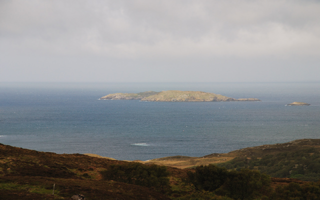
Despite its remote location, Badcall is within driving distance of several notable attractions. Nearby, visitors can explore the stunning Cape Wrath, the most north-westerly point of mainland Britain, or take a boat trip to the uninhabited Handa Island, a renowned nature reserve teeming with wildlife.

While amenities in Badcall are limited, the nearby town of Kinlochbervie offers a range of services including shops, cafes, and a primary school. For those seeking a peaceful and idyllic retreat immersed in the beauty of the Scottish Highlands, Badcall is an enchanting destination.

If you have any feedback on the listing, please let us know in the comments section below.

Badcall, Lower Images

Images are sourced within 2km of 58.325793/-5.134795 or Grid Reference NC1641. Thanks to Geograph Open Source API. All images are credited.

Badcall Bay
Badcall Bay
South view above Upper Badcall over Badcall Bay in late mid-summer evening, 1994 On the horizon are Canisp (2779ft/846m) and Suilven (2399ft/731m). It was after 10 p.m.
South view above Upper Badcall over Badcall Bay in late mid-summer evening, 1994
On the horizon are Canisp (2779ft/846m) and Suilven (2399ft/731m). It was after 10 p.m.
Late evening view to Quinag and Assynt mountains from above Badcall Taken on same road and direction as <a href="https://www.geograph.org.uk/photo/4762350">NC1542 : South view above Upper Badcall over Badcall Bay in late mid-summer evening, 1994</a>, but about 1/2 mile ahead; possibly zoomed in this case, with Badcall Bay hidden by the hillock on the right. (Cf. also <a href="https://www.geograph.org.uk/photo/2463952">NC1642 : A894 heads south, west of Loch a' Chreagain Theth</a>).
Late evening view to Quinag and Assynt mountains from above Badcall
Taken on same road and direction as NC1542 : South view above Upper Badcall over Badcall Bay in late mid-summer evening, 1994, but about 1/2 mile ahead; possibly zoomed in this case, with Badcall Bay hidden by the hillock on the right. (Cf. also NC1642 : A894 heads south, west of Loch a' Chreagain Theth).
Southward from Badcall in evening (21.30), 1994 Across Badcall Bay and its islets, over the Rubha Gisgil and then across Loch Cairnbawn (Loch a' Chàirn Bhàin) is the dramatic double peak of Quinag (2,550-2,653 ft.); beyond Quinag and south of Loch Assynt, can be seen Canisp (2779 ft.) and the double peak of Suilven (2399 ft.).
Southward from Badcall in evening (21.30), 1994
Across Badcall Bay and its islets, over the Rubha Gisgil and then across Loch Cairnbawn (Loch a' Chàirn Bhàin) is the dramatic double peak of Quinag (2,550-2,653 ft.); beyond Quinag and south of Loch Assynt, can be seen Canisp (2779 ft.) and the double peak of Suilven (2399 ft.).
Typical Highland minor road: northward towards Scourie from Upper Badcall NE view about a mile above Badcall. (There were/are millions of those 'Passing Place' signs in Scotland.)
Typical Highland minor road: northward towards Scourie from Upper Badcall
NE view about a mile above Badcall. (There were/are millions of those 'Passing Place' signs in Scotland.)
Picnic site by Loch an Daimh Mor 'Loch of the Big Stag' on the A894 1km south of Scourie.
Picnic site by Loch an Daimh Mor
'Loch of the Big Stag' on the A894 1km south of Scourie.
Islands in Badcall Bay Seen from the side of the A894.
Islands in Badcall Bay
Seen from the side of the A894.
A894 before Scourie
A894 before Scourie
Loch an Daimh Mòr
Loch an Daimh Mòr
Badcall Bay
Badcall Bay
Loch an Obain and the Minch Autumn
Road to Duartbeg
Road to Duartbeg
The A894 heading south
Loch an Obain Small sea loch which looks out into Eddrachillis Bay with various islands in the distance.
Loch an Obain
Small sea loch which looks out into Eddrachillis Bay with various islands in the distance.
The A894 at Lower Badcall The islands and waters of Badcall Bay ahead.
The A894 at Lower Badcall
The islands and waters of Badcall Bay ahead.
Waymarker to Loch nan Uidh After many years of the route from the road to Scourie Hotel's Loch nan Uidh beat being marked by oars pushed into the peat, these have now been replaced with a series of posts topped with white or red cylinders. Surely there's no excuse for being late for dinner now.
Waymarker to Loch nan Uidh
After many years of the route from the road to Scourie Hotel's Loch nan Uidh beat being marked by oars pushed into the peat, these have now been replaced with a series of posts topped with white or red cylinders. Surely there's no excuse for being late for dinner now.
Foreshore with folded layers in Lewisian Gneiss The peninsula of Rubha na Faraid is made of Lewisian Gneiss, cut by a Laxfordian age shear zone. The shoals have a curved shape, caused by the flat early layering being bent into the later shear zone.
Foreshore with folded layers in Lewisian Gneiss
The peninsula of Rubha na Faraid is made of Lewisian Gneiss, cut by a Laxfordian age shear zone. The shoals have a curved shape, caused by the flat early layering being bent into the later shear zone.
Geisgeil hill path access, Assynt Anyone hoping to reach the waymarked hill path <a href="https://www.geograph.org.uk/photo/7297537">NC1741 : Waymarker to Loch nan Uidh</a> from the bothy at Geisgill must not be tempted by what seems to be an obvious track through the scrub immediately to the south of the bothy. This leads you into a thicket of alder, willow and briar with no clear way through. Heading 100 yards or so south on the grass verge of the roadside will bring you to a grass path which heads off east through this cleared route through the vegetation. This saves you torn clothing and frayed nerves.
Geisgeil hill path access, Assynt
Anyone hoping to reach the waymarked hill path NC1741 : Waymarker to Loch nan Uidh from the bothy at Geisgill must not be tempted by what seems to be an obvious track through the scrub immediately to the south of the bothy. This leads you into a thicket of alder, willow and briar with no clear way through. Heading 100 yards or so south on the grass verge of the roadside will bring you to a grass path which heads off east through this cleared route through the vegetation. This saves you torn clothing and frayed nerves.
Show me another place!

Badcall, Lower is located at Grid Ref: NC1641 (Lat: 58.325793, Lng: -5.134795)

Unitary Authority: Highland

Police Authority: Highlands and Islands

What 3 Words

///fluffed.mull.reclusive. Near Oldshoremore, Highland

Related Wikis

Badcall, Scourie

Badcall comprises two remote hamlets, called Lower Badcall and Upper Badcall. Upper Badcall, a crofting township, is the larger of the two and is situated...

Scourie F.C.

Scourie Football Club were a senior association football club from the village of Scourie in the Scottish Highlands. They competed in the North Caledonian...

Scourie

Scourie (Scottish Gaelic: Sgobhairigh), historically spelled "Scoury", is a village on the north west coast of Scotland, about halfway between Ullapool...

Calbha Mòr

Calbha Mòr is a tidal islet in Eddrachillis Bay, Sutherland, Scotland. == Geography == Calbha Mòr lies north of the Kylesku Bridge and west of the Duartmore...

Calbha Beag

Calbha Beag is an uninhabited island in Eddrachillis Bay, off Sutherland, Highland, Scotland. It is immediately to the west of Calbha Mor. An estimate...

Handa Island

Handa Island (Scottish Gaelic: Eilean Shannda) or simply Handa is an island off the west coast of Sutherland, Scotland. It is 309 hectares (760 acres)...

Tarbet, Sutherland

Tarbet (Scottish Gaelic, An Tairbeart) is a hamlet in Sutherland, on the west coast of Scotland. It is the nearest port of contact to the Scottish Wildlife...

Eddrachillis Bay

Eddrachillis Bay (Scottish Gaelic: Eadar Dà Chaolas- "between two kyles", Kylesku and Laxford) is a bay on the north-west coast of Sutherland, Scotland...

Nearby Amenities

Located within 500m of 58.325793,-5.134795
Source: PGS
Lat/Long: 58.3264492/-5.1426874
Source: PGS
Lat/Long: 58.326619/-5.1405115
Source: PGS
Lat/Long: 58.3268886/-5.1404912
Source: PGS
Lat/Long: 58.3270528/-5.1402112
Source: PGS
Lat/Long: 58.3270721/-5.1398218
Source: PGS
Lat/Long: 58.3268658/-5.1393567
Source: PGS
Lat/Long: 58.326877/-5.1391361
Source: PGS
Lat/Long: 58.3268608/-5.138466
Source: PGS
Lat/Long: 58.3268204/-5.1380298
Source: PGS
Lat/Long: 58.3271095/-5.1361407
Source: PGS
Lat/Long: 58.3261558/-5.1366778
Source: PGS
Lat/Long: 58.3247629/-5.1362445
Source: PGS
Lat/Long: 58.3240978/-5.1365059
Source: PGS
Lat/Long: 58.3240466/-5.1366329
Source: PGS
Lat/Long: 58.3240172/-5.136769
Source: PGS
Lat/Long: 58.3232388/-5.1374328
Created By: almien_coastlines
Source: PGS
Lat/Long: 58.323175/-5.137323
Created By: almien_coastlines
Source: PGS
Lat/Long: 58.322943/-5.135849
Created By: almien_coastlines
Source: PGS
Lat/Long: 58.322704/-5.134861
Created By: almien_coastlines
Source: PGS
Lat/Long: 58.32258/-5.134611
Source: PGS
Lat/Long: 58.32256/-5.1339452
Source: PGS
Lat/Long: 58.3222371/-5.1335985
Source: PGS
Lat/Long: 58.3219498/-5.1334297
Source: PGS
Lat/Long: 58.3217263/-5.1327053
Source: PGS
Lat/Long: 58.3214887/-5.1324823
Eddrachilles Hotel
Tourism: hotel
Lat/Long: 58.3277647/-5.1369106
Leisure: slipway
Lat/Long: 58.323656/-5.1379022
Parking
Source: survey
Lat/Long: 58.3296754/-5.1339201
Power: pole
Lat/Long: 58.3252322/-5.1342039
Power: pole
Lat/Long: 58.3249194/-5.1336744
Power: pole
Lat/Long: 58.3245821/-5.1331469
Power: pole
Lat/Long: 58.3236457/-5.1313578
Power: pole
Lat/Long: 58.3232521/-5.1304448
Power: pole
Lat/Long: 58.3227808/-5.1293858
Power: pole
Lat/Long: 58.3280386/-5.1410467
Power: pole
Lat/Long: 58.3280539/-5.1395516
Power: pole
Lat/Long: 58.3281909/-5.1381772
The data included in this document is from www.openstreetmap.org. The data is made available under ODbL.

Have you been to Badcall, Lower?

Leave your review of Badcall, Lower below (or comments, questions and feedback).