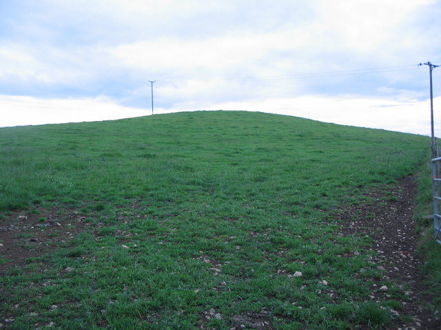
Beard Hill

Settlement in Somerset Mendip

England

Beard Hill

Old Milestone by A37, North of Beard Hill and South of junction with A361 The Milestone is located beside the road in front of the hedge on the West of the road.  Parish of Pilton (Mendip District). Cast iron post, plated iron casting design, erected by the Shepton Mallet turnpike trust in the 19th Century. An earlier photograph can be found here: <a title="https://www.geograph.org.uk/photo/6045080" href="https://www.geograph.org.uk/photo/6045080">Link</a>

Inscription reads:-  
SHEPTON / MALLET / 2 : : ILCHEST.R / 13 : : EXETER / 60

Milestone Society National ID: SO_SMIC02
Old Milestone by A37, North of Beard Hill and South of junction with A361 Credit: JR Dowding

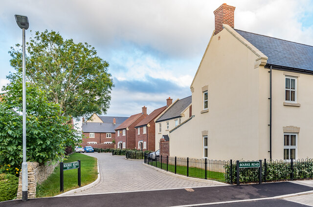
Beard Hill is a small village located in the county of Somerset, England. Situated approximately 5 miles southeast of the town of Taunton, it is nestled amidst picturesque countryside, offering its residents a peaceful and idyllic setting.

The village is home to a close-knit community, with a population of around 400 people. It boasts a charming mix of traditional stone cottages and more modern houses, creating a unique blend of architectural styles. The village center is characterized by a quaint village green, surrounded by a handful of local amenities, including a post office, a small convenience store, and a local pub.

Surrounded by rolling hills and farmland, Beard Hill offers its residents a range of outdoor activities. The nearby countryside provides ample opportunities for hiking, cycling, and horse-riding, with numerous scenic routes and trails to explore. The village is also conveniently located near the Quantock Hills, an Area of Outstanding Natural Beauty, which is a haven for nature enthusiasts and offers stunning panoramic views.

Beard Hill has a strong sense of community spirit, with various events and activities organized throughout the year. The village hall serves as a hub for social gatherings and hosts a range of clubs and societies, catering to diverse interests and age groups.

Overall, Beard Hill is a charming and tranquil village, offering a peaceful countryside lifestyle while still providing convenient access to nearby towns and amenities.

If you have any feedback on the listing, please let us know in the comments section below.

Beard Hill Images

Images are sourced within 2km of 51.164779/-2.540721 or Grid Reference ST6240. Thanks to Geograph Open Source API. All images are credited.

Old Milestone by A37, North of Beard Hill and South of junction with A361 The Milestone is located beside the road in front of the hedge on the West of the road.  Parish of Pilton (Mendip District). Cast iron post, plated iron casting design, erected by the Shepton Mallet turnpike trust in the 19th Century. An earlier photograph can be found here: <a title="https://www.geograph.org.uk/photo/6045080" href="https://www.geograph.org.uk/photo/6045080">Link</a>

Inscription reads:-  
SHEPTON / MALLET / 2 : : ILCHEST.R / 13 : : EXETER / 60

Milestone Society National ID: SO_SMIC02
Old Milestone by A37, North of Beard Hill and South of junction with A361
The Milestone is located beside the road in front of the hedge on the West of the road.  Parish of Pilton (Mendip District). Cast iron post, plated iron casting design, erected by the Shepton Mallet turnpike trust in the 19th Century. An earlier photograph can be found here: Link Inscription reads:- SHEPTON / MALLET / 2 : : ILCHEST.R / 13 : : EXETER / 60 Milestone Society National ID: SO_SMIC02
Old Milepost by A371, top of hill by Prestleigh Welcome sign The Milepost is located in hedge, on verge by West side of the road.  Parish of Doulting (Mendip District). Cast iron post, plated iron casting design, erected by the Shepton Mallet turnpike trust in the 19th Century, piece broken off north face; fractures. An earlier photograph can be found here: <a title="https://www.geograph.org.uk/photo/6037504" href="https://www.geograph.org.uk/photo/6037504">Link</a> 

Inscription reads:-  
SHEPTON / MALLET / 2 : : CASTLE / CARY / 6 : : BRUTON / 5  

Grade II listed. List Entry Number: 1217657 <span class="nowrap"><a title="https://historicengland.org.uk/listing/the-list/list-entry/1217657" rel="nofollow ugc noopener" href="https://historicengland.org.uk/listing/the-list/list-entry/1217657">Link</a><img style="margin-left:2px;" alt="External link" title="External link - shift click to open in new window" src="https://s1.geograph.org.uk/img/external.png" width="10" height="10"/></span> 

Milestone Society National ID: SO_SMCC02
Old Milepost by A371, top of hill by Prestleigh Welcome sign
The Milepost is located in hedge, on verge by West side of the road.  Parish of Doulting (Mendip District). Cast iron post, plated iron casting design, erected by the Shepton Mallet turnpike trust in the 19th Century, piece broken off north face; fractures. An earlier photograph can be found here: Link  Inscription reads:- SHEPTON / MALLET / 2 : : CASTLE / CARY / 6 : : BRUTON / 5 Grade II listed. List Entry Number: 1217657 LinkExternal link Milestone Society National ID: SO_SMCC02
Doulting : Prestleigh : Royal Bath & West Showground Looking across the avenues at the showground.
Doulting : Prestleigh : Royal Bath & West Showground
Looking across the avenues at the showground.
Doulting : Prestleigh : Royal Bath & West Showground A busy scene at the Royal Bath & West Show.
Doulting : Prestleigh : Royal Bath & West Showground
A busy scene at the Royal Bath & West Show.
Field A field with a solitary tree off Compton Lane.
Field
A field with a solitary tree off Compton Lane.
Compton Road Lane south of Shepton Mallet.
Compton Road
Lane south of Shepton Mallet.
Ridge Lane Lane south of Shepton Mallet, seen here by its junction with Compton Road (on the left) and Compton Lane (on the right).
Ridge Lane
Lane south of Shepton Mallet, seen here by its junction with Compton Road (on the left) and Compton Lane (on the right).
Track Overgrown track off Compton Lane.
Track
Overgrown track off Compton Lane.
Field Field off Compton Road with houses in the Field Farm development in the background.
Field
Field off Compton Road with houses in the Field Farm development in the background.
Ridge Lane Lane south of Shepton Mallet.
Ridge Lane
Lane south of Shepton Mallet.
7 - 10 Cannard's Grave Road Short terrace on Cannard's Grave Road dating from around the turn of the 19th/20th Centuries, first marked on the 1904 25 inch map.
7 - 10 Cannard's Grave Road
Short terrace on Cannard's Grave Road dating from around the turn of the 19th/20th Centuries, first marked on the 1904 25 inch map.
The Highwayman Roadside pub built c.1880, situated on a section of the Fosse Way, here part of the A37.
The Highwayman
Roadside pub built c.1880, situated on a section of the Fosse Way, here part of the A37.
Cannard's Grave Road Houses in Cannard's Grave Road with The Highwayman (see <a href="https://www.geograph.org.uk/photo/7558272">ST6241 : The Highwayman</a>) in the background.
Cannard's Grave Road
Houses in Cannard's Grave Road with The Highwayman (see ST6241 : The Highwayman) in the background.
Clarks Meadow Houses in Clarks Meadow in Tadley Acres, a development over the period 1996 - 2018 on the Duchy of Cornwall owned Field Farm.  This section of Clarks Meadow was completed in 2017-8.
Clarks Meadow
Houses in Clarks Meadow in Tadley Acres, a development over the period 1996 - 2018 on the Duchy of Cornwall owned Field Farm. This section of Clarks Meadow was completed in 2017-8.
Mistletoe Lane Houses in Mistletoe Lane in Tadley Acres, a development over the period 1996 - 2018 on the Duchy of Cornwall owned Field Farm.  Mistletoe Lane was completed in 2008-9.
Mistletoe Lane
Houses in Mistletoe Lane in Tadley Acres, a development over the period 1996 - 2018 on the Duchy of Cornwall owned Field Farm. Mistletoe Lane was completed in 2008-9.
Bourke Road Houses in Bourke Road in Tadley Acres, a development over the period 1996 - 2018 on the Duchy of Cornwall owned Field Farm.  Bourke Road was completed in 2015.
Bourke Road
Houses in Bourke Road in Tadley Acres, a development over the period 1996 - 2018 on the Duchy of Cornwall owned Field Farm. Bourke Road was completed in 2015.
Hobbs Road Houses in Hobbs Road in Tadley Acres, a development over the period 1996 - 2018 on the Duchy of Cornwall owned Field Farm.  Hobbs Road was completed in 2006-7.
Hobbs Road
Houses in Hobbs Road in Tadley Acres, a development over the period 1996 - 2018 on the Duchy of Cornwall owned Field Farm. Hobbs Road was completed in 2006-7.
Show me another place!

Beard Hill is located at Grid Ref: ST6240 (Lat: 51.164779, Lng: -2.540721)

Administrative County: Somerset

District: Mendip

Police Authority: Avon and Somerset

What 3 Words

///emerge.retaliate.graduated. Near Shepton Mallet, Somerset

Nearby Locations

Beard Hill

Related Wikis

Royal Bath and West of England Society

The Royal Bath and West of England Society is a charitable society founded in 1777 to promote and improve agriculture and related activities around the...

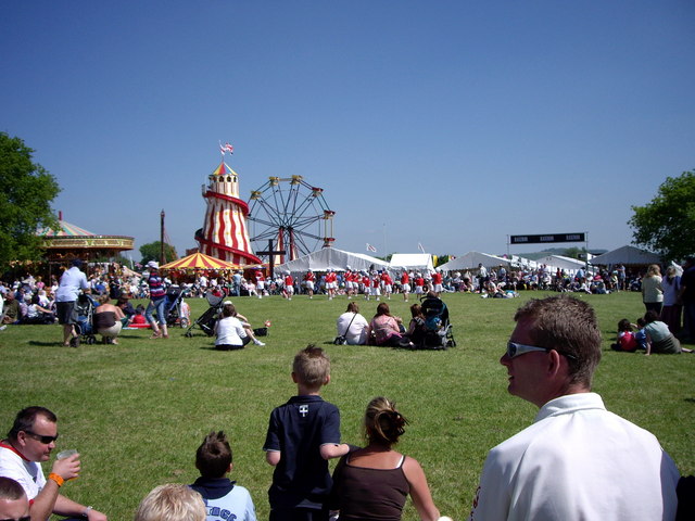
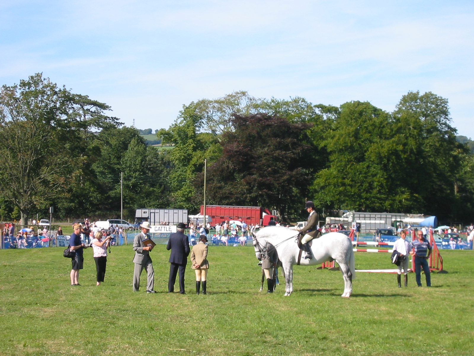
Royal Bath and West Show

The Royal Bath and West is an agricultural show for the West of England. Held every year at its permanent show ground near Shepton Mallet, Somerset, it...

Pylle railway station

Pylle railway station was a station on the Highbridge branch of the Somerset and Dorset Joint Railway. Opened 3 February 1862 on the original S&DJR main...

Mendip Vale railway station

Mendip Vale is the western terminus of the East Somerset Railway. == Services == All trains terminate at Mendip Vale, with a 5-10 minute wait while the...

Mid-Somerset Show

The Mid-Somerset Show, also known as Shepton Show, is a one-day agricultural show held annually in August on a site at Shepton Mallet, Somerset, England...

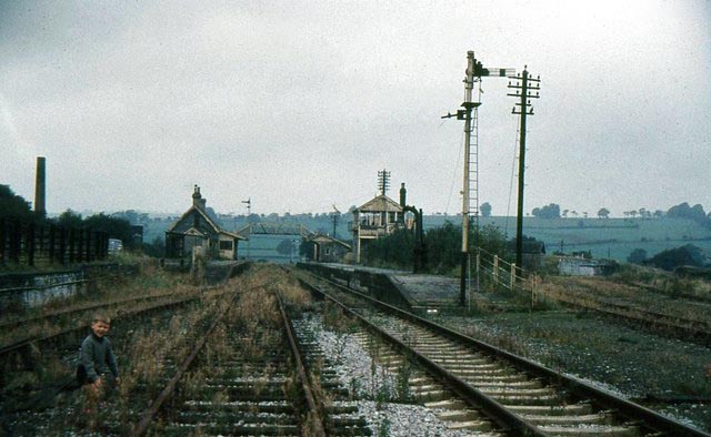
Shepton Mallet (Charlton Road) railway station

Shepton Mallet (Charlton Road) was a station on the Somerset and Dorset Joint Railway in the county of Somerset in England. Opened as Shepton Mallet on...

Maes Down

Maes Down (grid reference ST647406) is a 0.2 hectare geological Site of Special Scientific Interest between Shepton Mallet and Stoney Stratton in Somerset...

Shepton Mallet (High Street) railway station

Shepton Mallet (High Street) was a railway station on the East Somerset Railway, serving the town of Shepton Mallet in the English county of Somerset....

Nearby Amenities

Located within 500m of 51.164779,-2.540721
Beard Hill
Place: hamlet
Source: npe
Lat/Long: 51.1654186/-2.540149
Note: National speed limit sign southbound
Source: survey
Traffic Sign Backward: GB:671
Lat/Long: 51.1681552/-2.5378942
Colour: grey
Design: three-level
Height: 135.96
Line Attachment: suspension
Material: metal
Operator: National Grid
Operator Wikidata: Q1465461
Power: tower
Ref: ZG128
Source: Bing
Start Date: 1960
Structure: lattice
Lat/Long: 51.1630272/-2.5347217
Colour: grey
Design: three-level
Height: 105.07
Line Attachment: suspension
Material: metal
Operator: National Grid
Operator Wikidata: Q1465461
Power: tower
Ref: ZG127
Source: Bing
Start Date: 1960
Structure: lattice
Lat/Long: 51.1616799/-2.5398642
Barrier: stile
Lat/Long: 51.1644592/-2.541871
Post Box
Operator: Royal Mail
Operator Wikidata: Q638098
Post Box Type: lamp
Lat/Long: 51.165844/-2.539097
Power: pole
Lat/Long: 51.1683044/-2.5427905
Power: pole
Lat/Long: 51.1673082/-2.5425883
Power: pole
Lat/Long: 51.1660792/-2.5423127
Power: pole
Lat/Long: 51.1649102/-2.5420394
Power: pole
Lat/Long: 51.1638079/-2.5418061
Power: pole
Lat/Long: 51.1627475/-2.5415728
Power: pole
Lat/Long: 51.1617874/-2.5403439
Power: pole
Lat/Long: 51.161216/-2.5398884
Power: pole
Lat/Long: 51.1606906/-2.5393173
Barrier: yes
Lat/Long: 51.1644219/-2.5368474
Barrier: yes
Lat/Long: 51.1639199/-2.5383272
The data included in this document is from www.openstreetmap.org. The data is made available under ODbL.

Have you been to Beard Hill?

Leave your review of Beard Hill below (or comments, questions and feedback).