Ashtead, Lower

Settlement in Surrey Mole Valley

England

Ashtead, Lower

Leatherhead Waitrose Supermarket in the town centre.
Leatherhead Waitrose Credit: James Emmans

Ashtead is a village located in the county of Surrey, England. It is situated in the Mole Valley District and lies approximately 17 miles south-west of central London. Ashtead is part of the civil parish of Ashtead, which also incorporates the neighbouring village of Ashtead Common.

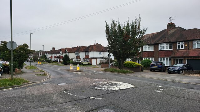
The village is known for its picturesque setting, surrounded by lush green countryside and woodland areas. It benefits from excellent transport links, with the A24 road running through the village, providing easy access to the nearby towns of Leatherhead and Epsom. Ashtead railway station is also conveniently located, offering regular train services to London Waterloo and other destinations.

Ashtead has a rich history, with evidence of human habitation dating back to the Roman times. The village features several historic buildings, including St. Giles' Church, which dates back to the 12th century, and Ashtead House, a Grade II listed building.

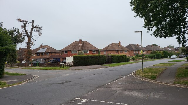
The village offers a range of amenities, including local shops, restaurants, and pubs, providing residents with essential services and leisure opportunities. Ashtead also boasts several highly regarded schools, making it an attractive location for families.

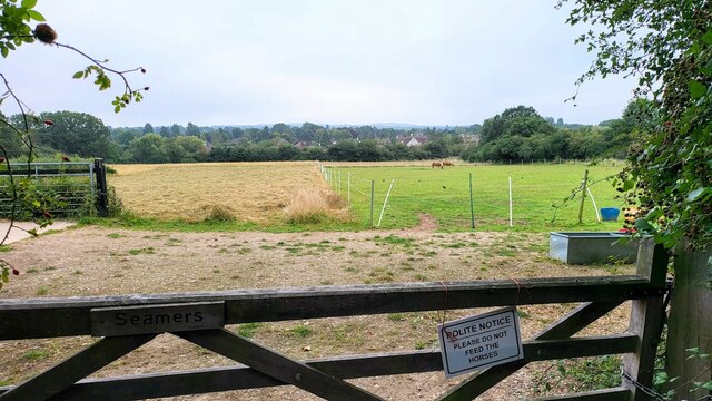
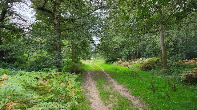
For outdoor enthusiasts, Ashtead Common is a notable feature of the area, encompassing over 500 acres of woodland and open space. The common attracts visitors with its walking trails, bridleways, and abundant wildlife, providing a tranquil escape from the hustle and bustle of urban life.

In summary, Ashtead is a charming village in Surrey that offers a blend of natural beauty, historical significance, and convenient amenities, making it an appealing place to live or visit.

If you have any feedback on the listing, please let us know in the comments section below.

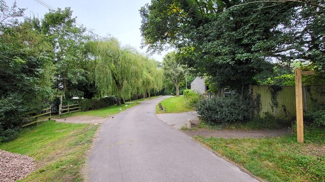
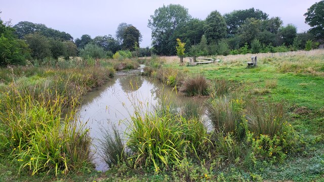
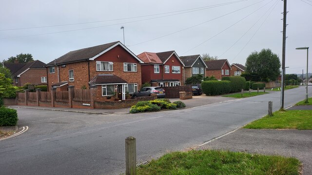
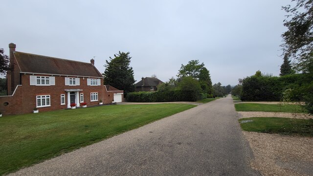
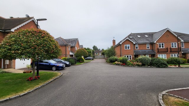
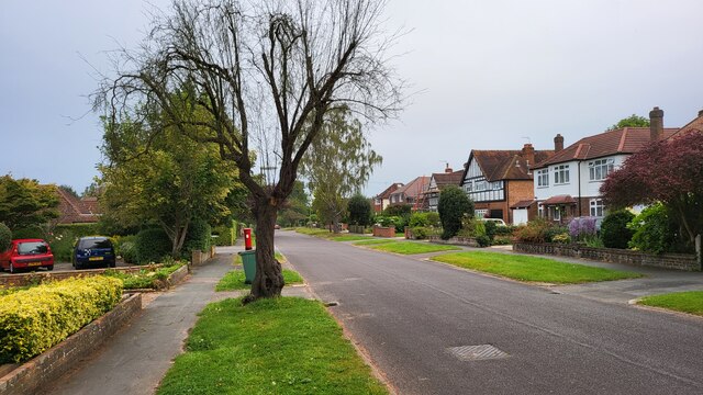
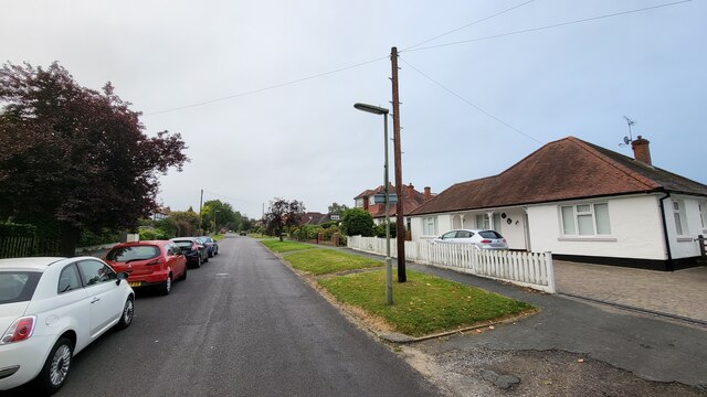
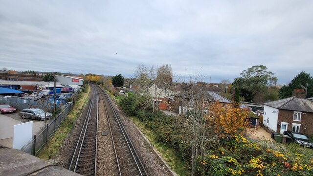
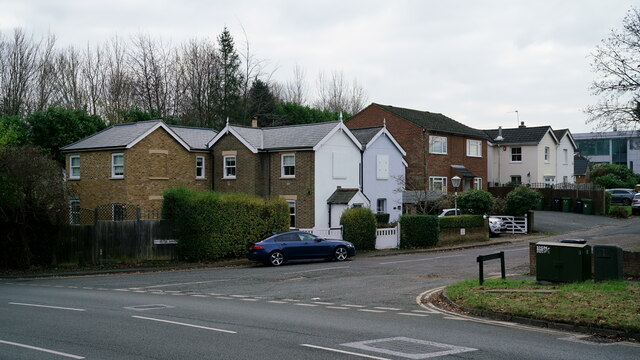
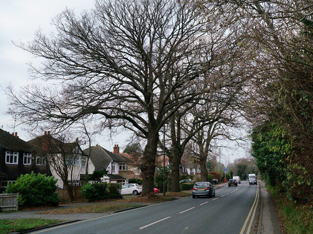
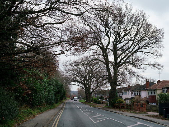
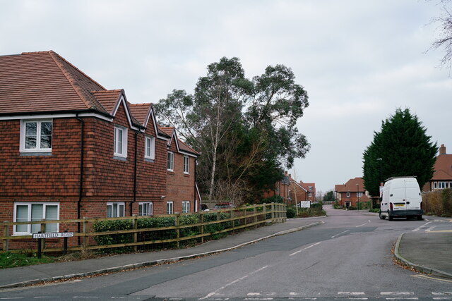
Ashtead, Lower Images

Images are sourced within 2km of 51.309277/-0.314184 or Grid Reference TQ1758. Thanks to Geograph Open Source API. All images are credited.

Leatherhead Waitrose Supermarket in the town centre.
Leatherhead Waitrose
Supermarket in the town centre.
Field south of Ashtead Woods Road
Ashtead - Craddocks Avenue Residential road near Ashtead Station.
Ashtead - Craddocks Avenue
Residential road near Ashtead Station.
Bramley Way Junction with Cray Avenue and Berry Meade.
Bramley Way
Junction with Cray Avenue and Berry Meade.
Woodland track on Ashtead Common 495 acres common and national nature reserve, owned and run by the City of London Corporation. SSSI status due to rear invertebrates and an important breeding area for birds
Woodland track on Ashtead Common
495 acres common and national nature reserve, owned and run by the City of London Corporation. SSSI status due to rear invertebrates and an important breeding area for birds
Footpath crossing Ashstead Woods Road
Rye Meadows Wetlands Managed area next to the Rye Brook to improve wildlife and reduce flooding.

<span class="nowrap"><a title="https://www.ryemeadows.org.uk/" rel="nofollow ugc noopener" href="https://www.ryemeadows.org.uk/">Link</a><img style="margin-left:2px;" alt="External link" title="External link - shift click to open in new window" src="https://s1.geograph.org.uk/img/external.png" width="10" height="10"/></span>
Rye Meadows Wetlands
Managed area next to the Rye Brook to improve wildlife and reduce flooding. LinkExternal link
Bramley Way junction with Stonny Croft
Ralliwood Road Residential estate with private roads and public footpaths. The Thames Down Link national trail passes the north end of this road. The 15 mile trail links the Thames path national trail to the North Downs Way national path.
Ralliwood Road
Residential estate with private roads and public footpaths. The Thames Down Link national trail passes the north end of this road. The 15 mile trail links the Thames path national trail to the North Downs Way national path.
Bramley Grove Housing infill development on a school site.
Bramley Grove
Housing infill development on a school site.
West Farm Avenue Residential street with post box on the corner to West Farm Close.
West Farm Avenue
Residential street with post box on the corner to West Farm Close.
Northern end of West Farm Avenue
Railway line towards Leatherhead Station Photo taken from the railway bridge for the Kingston Road which was a part of an improved road becoming the B2430. The original road was a narrow windy road with a railway crossing.
Railway line towards Leatherhead Station
Photo taken from the railway bridge for the Kingston Road which was a part of an improved road becoming the B2430. The original road was a narrow windy road with a railway crossing.
Leatherhead Old Station Approach. The original station (now demolished) was opened by the London & South Western Railway in 1867. Some of the houses, in this picture, appear to date from that era.

The current railway station lies to the north of this location.
Leatherhead
Old Station Approach. The original station (now demolished) was opened by the London & South Western Railway in 1867. Some of the houses, in this picture, appear to date from that era. The current railway station lies to the north of this location.
Leatherhead Randalls Road.
Leatherhead
Randalls Road.
Leatherhead Randalls Road.
Leatherhead
Randalls Road.
Leatherhead Hartfield Road, seen from Cleeve Road.
Leatherhead
Hartfield Road, seen from Cleeve Road.
Leatherhead Commercial site, awaiting redevelopment.
Leatherhead
Commercial site, awaiting redevelopment.
Show me another place!

Ashtead, Lower is located at Grid Ref: TQ1758 (Lat: 51.309277, Lng: -0.314184)

Administrative County: Surrey

District: Mole Valley

Police Authority: Surrey

What 3 Words

///camps.intent.prone. Near Ashtead, Surrey

Related Wikis

Parsons Mead School

Parsons Mead School was a private girls school founded by Jessie Elliston in Ashtead, Surrey, England, which existed from 1897 to 2006. == Founder == Jessie...

St Andrew's Catholic School

St Andrew's Catholic School is a Christian secondary school and sixth form college in Grange Road, Ottways Lane, Leatherhead, close to the town of Epsom...

Epsom Rural District

Epsom was a rural district of Surrey from 1894 to 1933. It was created in 1894 and covered the area of the formed Epsom Rural Sanitary District – i.e....

Downsend School

Downsend School is a co-educational independent school for pupils aged between two and sixteen. In 2020, Downsend became a through-school, offering a three...

Nearby Amenities

Located within 500m of 51.309277,-0.314184
Parking
Lat/Long: 51.3133423/-0.3137242
Post Box
Post Box Type: pillar
Ref: KT21 1
Royal Cypher: GR
Royal Cypher Wikidata: Q33102273
Lat/Long: 51.3059248/-0.3099715
Telephone
Booth: KX100
Covered: booth
Lat/Long: 51.3058738/-0.3100272
Post Box
Ref: KT21 121
Lat/Long: 51.3065276/-0.318556
Post Box
Operator: Royal Mail
Post Box Type: pillar
Ref: KT21 39
Royal Cypher: GR
Royal Cypher Wikidata: Q33102273
Lat/Long: 51.3108064/-0.3164901
Post Box
Ref: KT21 178
Lat/Long: 51.3066564/-0.3148653
Bus Stop
Harriots Lane
Naptan AtcoCode: 40004408194A
Naptan Bearing: SW
Naptan CommonName: Harriots Lane
Naptan Indicator: adj
Naptan Landmark: Harriots Lane
Naptan NaptanCode: surdapjm
Naptan Street: Barnett Wood Lane
Naptan Verified: no
Public Transport: platform
Source: naptan_import
Lat/Long: 51.3088459/-0.3208331
Bus Stop
Harriots Lane
Naptan AtcoCode: 40004408194B
Naptan Bearing: NE
Naptan CommonName: Harriots Lane
Naptan Indicator: Just after
Naptan Landmark: Harriots Lane
Naptan NaptanCode: surdapjp
Naptan Street: Barnett Wood Lane
Naptan Verified: no
Public Transport: platform
Source: naptan_import
Lat/Long: 51.3093211/-0.3204288
Bus Stop
West Farm Avenue
Naptan AtcoCode: 40004408195A
Naptan Bearing: SW
Naptan CommonName: West Farm Avenue
Naptan Indicator: Just Before
Naptan Landmark: West Farm Avenue
Naptan NaptanCode: surdapjt
Naptan Street: Barnett Wood Lane
Naptan Verified: no
Public Transport: platform
Source: naptan_import
Lat/Long: 51.3105645/-0.3172257
Bus Stop
West Farm Avenue
Naptan AtcoCode: 40004408195B
Naptan Bearing: NE
Naptan CommonName: West Farm Avenue
Naptan Indicator: Just after
Naptan Landmark: West Farm Avenue
Naptan NaptanCode: surdapjw
Naptan Street: Barnett Wood Lane
Naptan Verified: no
Public Transport: platform
Source: naptan_import
Lat/Long: 51.3109976/-0.3163198
Bus Stop
Agates Lane
Naptan AtcoCode: 40004408196A
Naptan Bearing: SW
Naptan CommonName: Agates Lane
Naptan Indicator: Just after
Naptan Landmark: Agates Lane
Naptan NaptanCode: surdapma
Naptan Street: Barnett Wood Lane
Naptan Verified: no
Public Transport: platform
Source: naptan_import
Lat/Long: 51.3115427/-0.3146632
Bus Stop
Agates Lane
Naptan AtcoCode: 40004408196B
Naptan Bearing: NE
Naptan CommonName: Agates Lane
Naptan Indicator: Opp
Naptan Landmark: Agates Lane
Naptan NaptanCode: surdapmd
Naptan Street: Barnett Wood Lane
Naptan Verified: no
Public Transport: platform
Source: naptan_import
Lat/Long: 51.3120997/-0.3135451
Post Box
Collection Times: Mo-Fr 09:00; Sa 07:00
Operator: Royal Mail
Operator Wikidata: Q638098
Post Box Type: pillar
Ref: KT21 68
Royal Cypher: EVIIR
Royal Cypher Wikidata: Q33102195
Lat/Long: 51.3093686/-0.3084685
Mini Roundabout
Lat/Long: 51.3090232/-0.3206293
Traffic Calming: table
Lat/Long: 51.3130645/-0.3115063
Direction: 165
Generator Method: photovoltaic
Generator Output Electricity: yes
Generator Solar Modules: 16
Generator Source: solar
Generator Type: solar_photovoltaic_panel
Location: roof
Power: generator
Lat/Long: 51.3129558/-0.3156007
Direction: 145
Generator Method: photovoltaic
Generator Output Electricity: yes
Generator Solar Modules: 16
Generator Source: solar
Generator Type: solar_photovoltaic_panel
Location: roof
Power: generator
Lat/Long: 51.3116972/-0.3169404
Direction: 145
Generator Method: photovoltaic
Generator Output Electricity: yes
Generator Solar Modules: 6
Generator Source: solar
Generator Type: solar_photovoltaic_panel
Location: roof
Power: generator
Lat/Long: 51.3119654/-0.3193742
Direction: 235
Generator Method: photovoltaic
Generator Output Electricity: yes
Generator Solar Modules: 8
Generator Source: solar
Generator Type: solar_photovoltaic_panel
Location: roof
Power: generator
Lat/Long: 51.311979/-0.3194278
Direction: SSE
Generator Method: photovoltaic
Generator Output Electricity: yes
Generator Solar Modules: 12
Generator Source: solar
Generator Type: solar_photovoltaic_panel
Location: roof
Power: generator
Lat/Long: 51.3099884/-0.3184167
Direction: SE
Generator Method: photovoltaic
Generator Output Electricity: yes
Generator Solar Modules: 16
Generator Source: solar
Generator Type: solar_photovoltaic_panel
Location: roof
Power: generator
Lat/Long: 51.3092503/-0.3200444
Post Box
Collection Times: Mo-Fr 09:00; Sa 07:00
Operator: Royal Mail
Post Box Type: pillar
Ref: KT21 61D
Royal Cypher: VR
Royal Cypher Wikidata: Q33102356
Lat/Long: 51.3130506/-0.3153902
Lower Ashtead
Place: suburb
Lat/Long: 51.3098384/-0.3190667
Crossing
Crossing: unmarked
Crossing Island: no
Kerb: lowered
Tactile Paving: yes
Lat/Long: 51.308776/-0.3211597
The data included in this document is from www.openstreetmap.org. The data is made available under ODbL.

Have you been to Ashtead, Lower?

Leave your review of Ashtead, Lower below (or comments, questions and feedback).