Mullery Geo

Coastal Feature, Headland, Point in Orkney

Scotland

Mullery Geo

Holms of Ire, Sanday, Orkney Uninhabited tidal islands linked to the island of Sanday at low tide.
Holms of Ire, Sanday, Orkney Credit: Karl Cooper

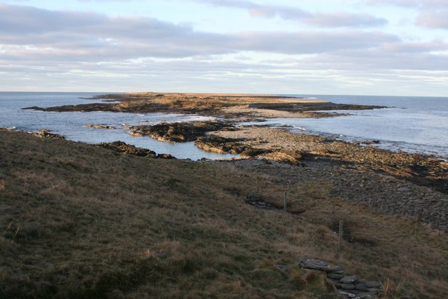
Mullery Geo is a prominent coastal feature located in the Orkney Islands, off the northeastern coast of Scotland. It is classified as a headland or a point due to its distinct protrusion into the North Sea. The geo is situated on the easternmost part of the Mainland, the largest island in the Orkney archipelago.

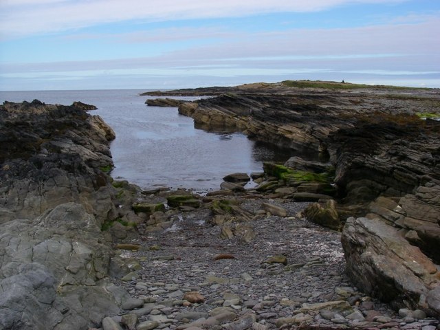
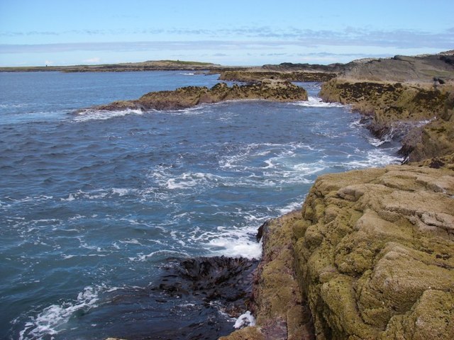
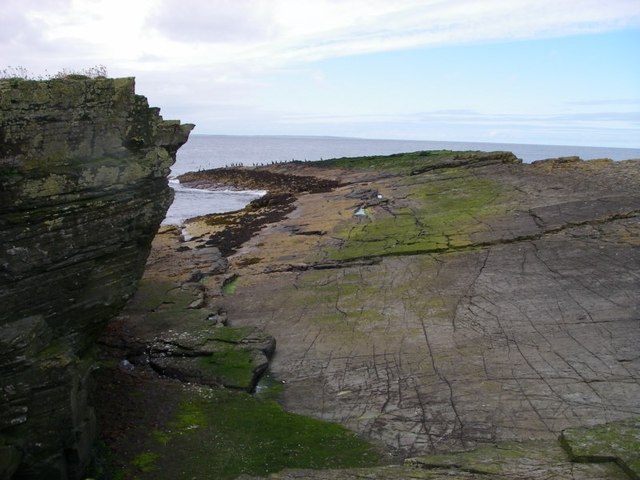
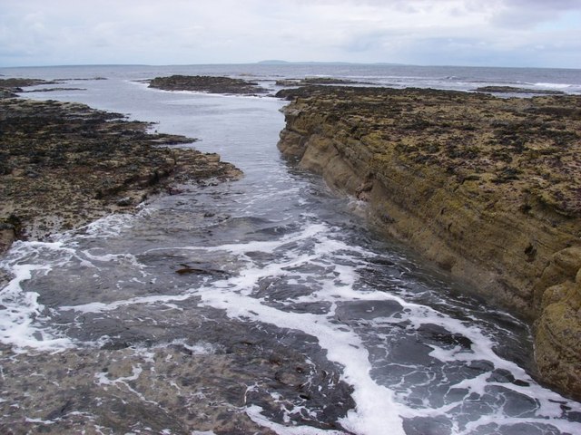
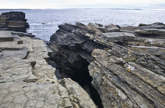
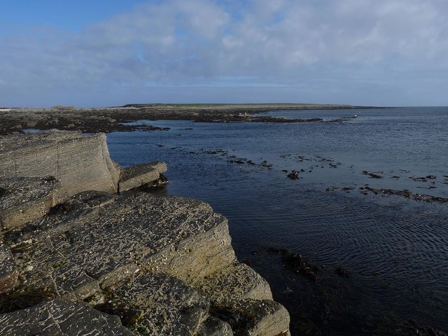
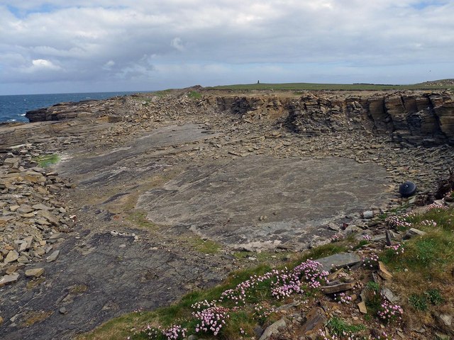
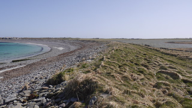
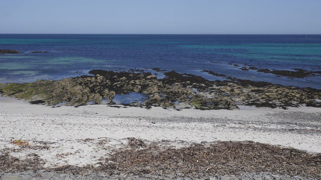
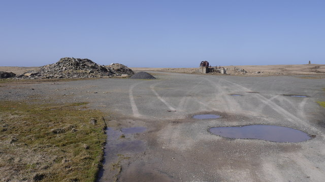
Mullery Geo is characterized by its rugged and rocky terrain, with towering cliffs that rise steeply from the sea. These cliffs are composed of sandstone, giving them a distinct reddish hue that contrasts beautifully with the surrounding blue waters. The geo provides breathtaking views of the North Sea, with its crashing waves and dramatic coastal scenery.

The area surrounding Mullery Geo is rich in biodiversity, attracting a wide array of marine and bird life. Visitors can often spot various seabirds, such as puffins, guillemots, and fulmars, nesting on the cliffs. The surrounding waters are also home to diverse marine species, including seals, dolphins, and even occasional sightings of whales.

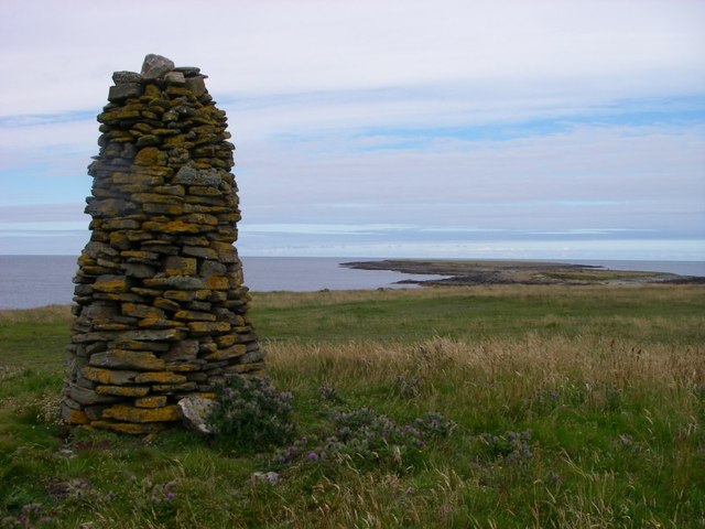
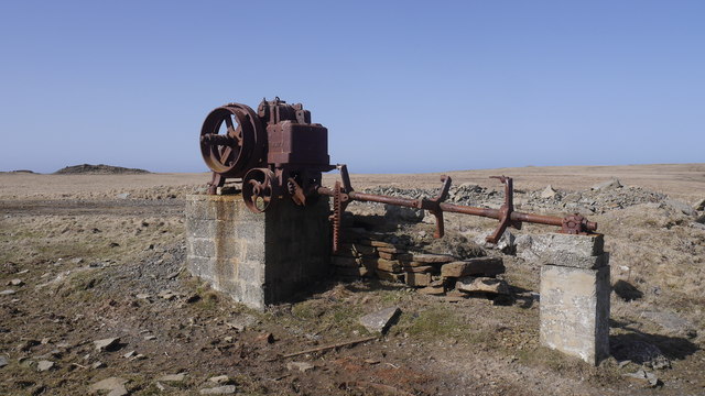
Mullery Geo is a popular destination for outdoor enthusiasts and nature lovers. Hikers and walkers can explore the surrounding cliffs and coastal paths, enjoying the stunning views and observing the local wildlife. The geo can also be accessed by boat, offering a unique perspective of the dramatic cliffs and the surrounding landscape.

In summary, Mullery Geo is a picturesque headland or point on the eastern coast of the Orkney Islands. Its rugged cliffs, rich biodiversity, and stunning coastal views make it a must-visit destination for those exploring this unique region of Scotland.

If you have any feedback on the listing, please let us know in the comments section below.
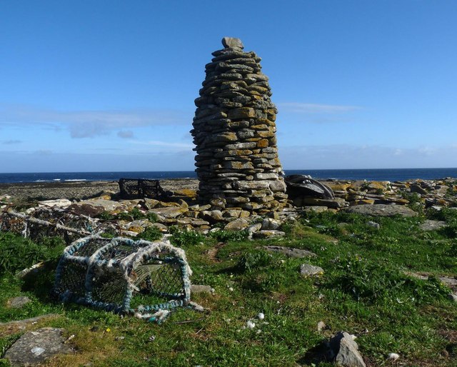
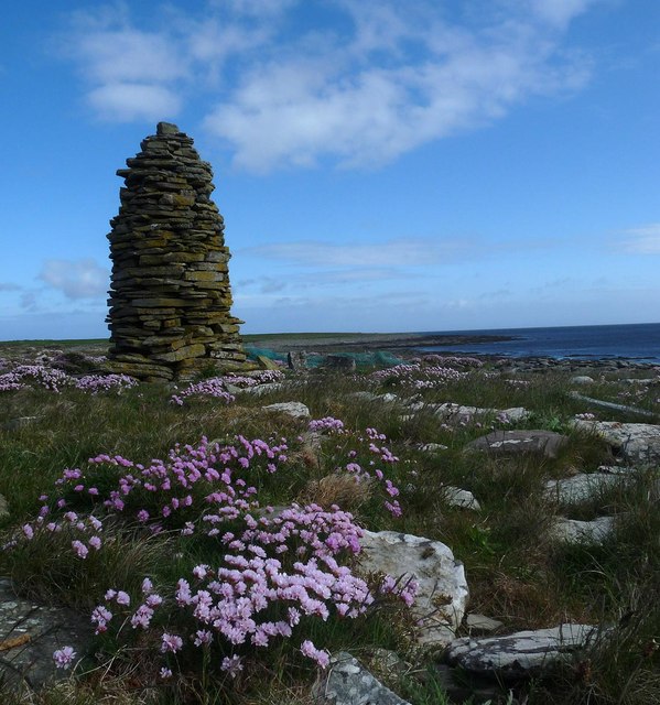
Mullery Geo Images

Images are sourced within 2km of 59.30661/-2.6164863 or Grid Reference HY6446. Thanks to Geograph Open Source API. All images are credited.

Holms of Ire, Sanday, Orkney Uninhabited tidal islands linked to the island of Sanday at low tide.
Holms of Ire, Sanday, Orkney
Uninhabited tidal islands linked to the island of Sanday at low tide.
Cairn overlooking Holms of Ire One of many such cairns on the Holms of Ire and adjacent part of Sanday
Cairn overlooking Holms of Ire
One of many such cairns on the Holms of Ire and adjacent part of Sanday
Inlet within Inner Sound at Holms of Ire
Rocks near Craw's Nest Prominent cairns atop the Holms of Ire can be seen in the distance.
Rocks near Craw's Nest
Prominent cairns atop the Holms of Ire can be seen in the distance.
Rock slabs on the more northerly of the Holms of Ire
Seawashed rocks near the Lotheran One of the more remote spots off Sanday, reached only with a risk of getting cut off by the rising tide.
Seawashed rocks near the Lotheran
One of the more remote spots off Sanday, reached only with a risk of getting cut off by the rising tide.
Natural Arch near Holms of Ire, Sanday, Orkney
Airon, Sanday, Orkney
The Holms of Ire, Sanday, Orkney The Holms are two islands accessible at low tide.
The Holms of Ire, Sanday, Orkney
The Holms are two islands accessible at low tide.
Quarry, Sanday, Orkney The quarry lies on the western coast of the peninsula forming the NW tip of Sanday, below the Holms of Ire.  <a href="https://www.geograph.org.uk/photo/2561603">HY6545 : Cairn overlooking Holms of Ire</a> can be seen on the horizon.
Quarry, Sanday, Orkney
The quarry lies on the western coast of the peninsula forming the NW tip of Sanday, below the Holms of Ire. HY6545 : Cairn overlooking Holms of Ire can be seen on the horizon.
Stonebreaker, Sanday, Orkney The machine is inscribed,
"Rob Broadbent & Son Stalybridge
Blake Stonebreaker 8077"
and it lies some 150m to the NW of <a href="https://www.geograph.org.uk/photo/3770987">HY6544 : Quarry, Sanday, Orkney</a>.
<a href="https://www.geograph.org.uk/photo/2561603">HY6545 : Cairn overlooking Holms of Ire</a> can be seen on the horizon.
Stonebreaker, Sanday, Orkney
The machine is inscribed, "Rob Broadbent & Son Stalybridge Blake Stonebreaker 8077" and it lies some 150m to the NW of HY6544 : Quarry, Sanday, Orkney. HY6545 : Cairn overlooking Holms of Ire can be seen on the horizon.
Planticrubs, Holms of Ire, Sanday, Orkney According to the Royal Commission on the Ancient and Historical Monuments of Scotland's thesaurus, a planticrub (or planticrue) is "a small square, circular or rectangular enclosure used for growing root crops, usually without an entrance".

At <span class="nowrap"><a title="http://canmore.rcahms.gov.uk/en/site/3499/details/sanday+holms+of+ire" rel="nofollow ugc noopener" href="http://canmore.rcahms.gov.uk/en/site/3499/details/sanday+holms+of+ire">Link</a><img style="margin-left:2px;" alt="External link" title="External link - shift click to open in new window" src="https://s1.geograph.org.uk/img/external.png" width="10" height="10"/></span> these ones are described as 

"a spectacular and well-preserved row of 4 circular and 2
square plantie-crus each 1.5m high to top of wall which in most
cases is complete, average 4.2m across, without openings".
Planticrubs, Holms of Ire, Sanday, Orkney
According to the Royal Commission on the Ancient and Historical Monuments of Scotland's thesaurus, a planticrub (or planticrue) is "a small square, circular or rectangular enclosure used for growing root crops, usually without an entrance". At LinkExternal link these ones are described as "a spectacular and well-preserved row of 4 circular and 2 square plantie-crus each 1.5m high to top of wall which in most cases is complete, average 4.2m across, without openings".
Cairn, Holms of Ire, Sanday, Orkney This cairn is on the outer holm.  There are similar cairns located nearby on the inner holm (<a href="https://www.geograph.org.uk/photo/4336569">HY6446 : Cairn, Holms of Ire, Sanday, Orkney</a>) and on the main island (<a href="https://www.geograph.org.uk/photo/2561603">HY6545 : Cairn overlooking Holms of Ire</a>).
Cairn, Holms of Ire, Sanday, Orkney
This cairn is on the outer holm. There are similar cairns located nearby on the inner holm (HY6446 : Cairn, Holms of Ire, Sanday, Orkney) and on the main island (HY6545 : Cairn overlooking Holms of Ire).
Cairn, Holms of Ire, Sanday, Orkney This cairn is on the inner holm. There are similar cairns located nearby on the outer holm (<a href="https://www.geograph.org.uk/photo/4336564">HY6446 : Cairn, Holms of Ire, Sanday, Orkney</a>) and on the main island (<a href="https://www.geograph.org.uk/photo/2561603">HY6545 : Cairn overlooking Holms of Ire</a>).
Cairn, Holms of Ire, Sanday, Orkney
This cairn is on the inner holm. There are similar cairns located nearby on the outer holm (HY6446 : Cairn, Holms of Ire, Sanday, Orkney) and on the main island (HY6545 : Cairn overlooking Holms of Ire).
Ayre of Roo Beach cutting off the Roos Loch.
Ayre of Roo
Beach cutting off the Roos Loch.
Beach, Roos Wick The white sand produces some fine colours in the sea.
Beach, Roos Wick
The white sand produces some fine colours in the sea.
Quarry by Airon Remains of a quarry near Roos Wick, Sanday.
Quarry by Airon
Remains of a quarry near Roos Wick, Sanday.
Stonebreaker At the Roos Wick quarry on Sanday, inscribed "Rob Broadbent & Son Stalybridge Blake Stonebreaker 8077"
Stonebreaker
At the Roos Wick quarry on Sanday, inscribed "Rob Broadbent & Son Stalybridge Blake Stonebreaker 8077"
Show me another place!

Mullery Geo is located at Grid Ref: HY6446 (Lat: 59.30661, Lng: -2.6164863)

Unitary Authority: Orkney Islands

Police Authority: Highlands and Islands

What 3 Words

///rattler.recur.fatherly. Near Kettletoft, Orkney Islands

Related Wikis

Scar, Orkney

Scar is a village and farm complex on the island of Sanday in Orkney, Scotland. The B9068 road runs from Scar to Kettletoft. The Scar boat burial was found...

Scar boat burial

The Scar boat burial is a Viking boat burial near the village of Scar, on Sanday, in Orkney, Scotland. The burial, which dates to between 875 and 950 AD...

Broughtown

Broughtown is a village on the island of Sanday, in Orkney, Scotland. The settlement is within the parish of Cross and Burness. Sanday Airport is adjacent...

Sanday Airport

Sanday Airport (IATA: NDY, ICAO: EGES) is located 20 NM (37 km; 23 mi) north northeast of Kirkwall Airport on Sanday, Orkney Islands, Scotland. Sanday...

Sanday, Orkney

Sanday (, Scots: Sandee) is one of the inhabited islands of Orkney that lies off the north coast of mainland Scotland. With an area of 50.43 km2 (19.5...

East Sanday Coast

The East Sanday Coast is a protected wetland area on and around the island of Sanday, the third-largest of the Orkney islands off the north coast of Scotland...

Kettletoft

Kettletoft is a settlement on the island of Sanday in Orkney, Scotland. The B9068 road runs from Kettletoft to Scar and the B9069 from Kettletoft to Northwall...

Have you been to Mullery Geo?

Leave your review of Mullery Geo below (or comments, questions and feedback).