Pool Geo

Coastal Feature, Headland, Point in Orkney

Scotland

Pool Geo

Holms of Ire, Sanday, Orkney Uninhabited tidal islands linked to the island of Sanday at low tide.
Holms of Ire, Sanday, Orkney Credit: Karl Cooper

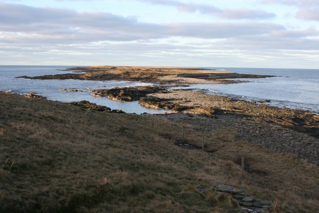
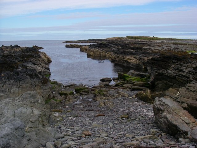
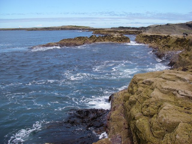
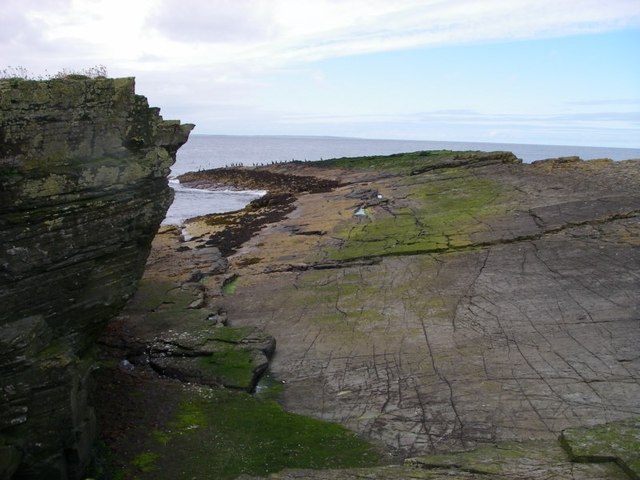
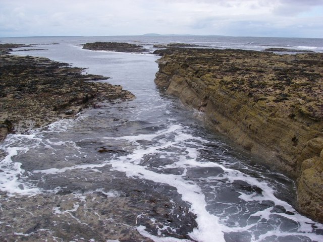
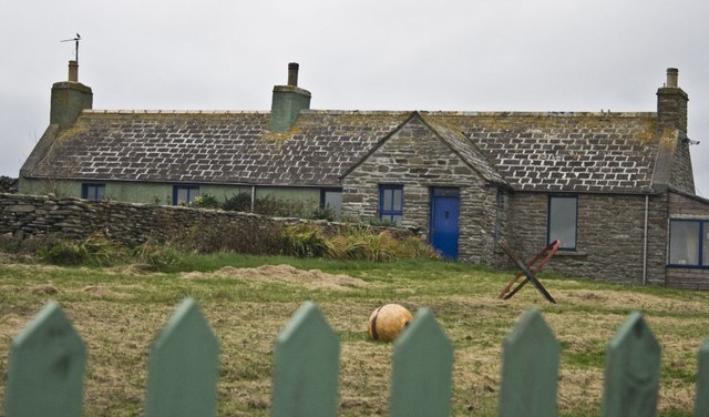
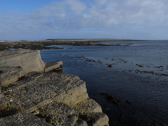
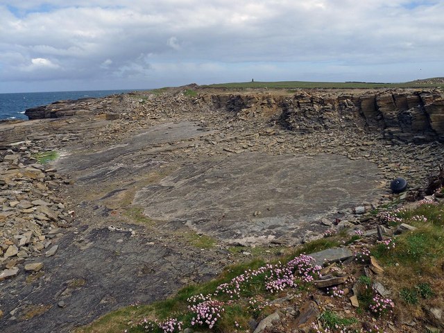
Pool Geo is a coastal feature located on the island of Orkney in Scotland. It is a headland that juts out into the North Sea, offering stunning views of the surrounding coastline. The name "geo" is derived from the Old Norse word for a narrow inlet or cleft in the cliffs, which accurately describes the geological formation of Pool Geo.

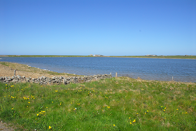
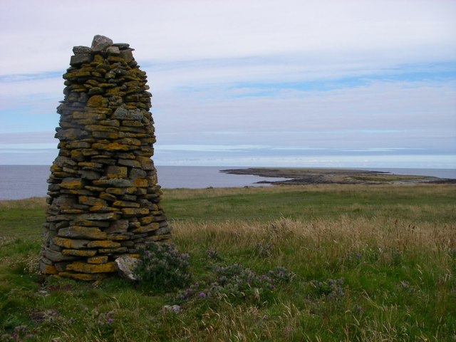
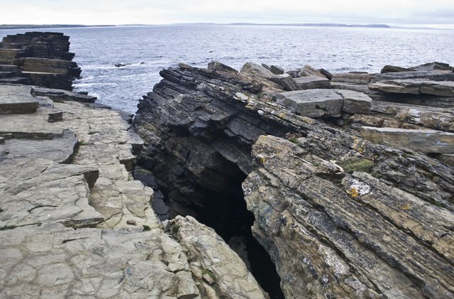
This rocky headland is characterized by steep cliffs that rise dramatically from the sea, creating a picturesque and rugged landscape. The area is known for its unique rock formations, including natural arches and sea stacks, which have been shaped by centuries of erosion from the sea.

Pool Geo is a popular spot for birdwatchers, as the cliffs provide nesting sites for a variety of seabirds, including puffins, razorbills, and guillemots. The area is also rich in marine life, with seals often seen basking on the rocks below.

Visitors to Pool Geo can enjoy hiking along the coastal paths, taking in the breathtaking views of the sea and surrounding countryside. The remote and wild beauty of Pool Geo makes it a must-visit destination for nature lovers and outdoor enthusiasts.

If you have any feedback on the listing, please let us know in the comments section below.

Pool Geo Images

Images are sourced within 2km of 59.297944/-2.6166982 or Grid Reference HY6445. Thanks to Geograph Open Source API. All images are credited.

Holms of Ire, Sanday, Orkney Uninhabited tidal islands linked to the island of Sanday at low tide.
Holms of Ire, Sanday, Orkney
Uninhabited tidal islands linked to the island of Sanday at low tide.
Woo near Scar, Sanday Track from Scar to the beach via Woo.
Woo near Scar, Sanday
Track from Scar to the beach via Woo.
View across Roos Loch, Sanday Roos Loch is now land locked with a barrier that can be seen just left of the building in the centre.
View across Roos Loch, Sanday
Roos Loch is now land locked with a barrier that can be seen just left of the building in the centre.
Cattle in fields at Burness
Passing place at Burness
Cairn overlooking Holms of Ire One of many such cairns on the Holms of Ire and adjacent part of Sanday
Cairn overlooking Holms of Ire
One of many such cairns on the Holms of Ire and adjacent part of Sanday
Inlet within Inner Sound at Holms of Ire
Rocks near Craw's Nest Prominent cairns atop the Holms of Ire can be seen in the distance.
Rocks near Craw's Nest
Prominent cairns atop the Holms of Ire can be seen in the distance.
Rock slabs on the more northerly of the Holms of Ire
Seawashed rocks near the Lotheran One of the more remote spots off Sanday, reached only with a risk of getting cut off by the rising tide.
Seawashed rocks near the Lotheran
One of the more remote spots off Sanday, reached only with a risk of getting cut off by the rising tide.
Woo, Sanday, Orkney The names on Sanday (and other Orkney Isles) are just delightful. My favourites are Woo and Rue, Mount Misery (or Maesry), Purgatory and Galilee.
Woo, Sanday, Orkney
The names on Sanday (and other Orkney Isles) are just delightful. My favourites are Woo and Rue, Mount Misery (or Maesry), Purgatory and Galilee.
Natural Arch near Holms of Ire, Sanday, Orkney
Airon, Sanday, Orkney
Sign for Roo, Sanday, Orkney The property is spelt Rue on the OS map.
Sign for Roo, Sanday, Orkney
The property is spelt Rue on the OS map.
Kelp drying wall, Knowe of Yarrow, Sanday, Orkney Looking towards North Bay.

Kelp production took place on Sanday primarily in the late 18th and early 19th centuries.  Making kelp involved collecting seaweed, drying it and then burning it in a pit.  The resulting kelp was exported for use in the manufacture of glass and soap.  Sanday produced a quarter of Orkney's total.
Kelp drying wall, Knowe of Yarrow, Sanday, Orkney
Looking towards North Bay. Kelp production took place on Sanday primarily in the late 18th and early 19th centuries. Making kelp involved collecting seaweed, drying it and then burning it in a pit. The resulting kelp was exported for use in the manufacture of glass and soap. Sanday produced a quarter of Orkney's total.
The Holms of Ire, Sanday, Orkney The Holms are two islands accessible at low tide.
The Holms of Ire, Sanday, Orkney
The Holms are two islands accessible at low tide.
Quarry, Sanday, Orkney The quarry lies on the western coast of the peninsula forming the NW tip of Sanday, below the Holms of Ire.  <a href="https://www.geograph.org.uk/photo/2561603">HY6545 : Cairn overlooking Holms of Ire</a> can be seen on the horizon.
Quarry, Sanday, Orkney
The quarry lies on the western coast of the peninsula forming the NW tip of Sanday, below the Holms of Ire. HY6545 : Cairn overlooking Holms of Ire can be seen on the horizon.
Stonebreaker, Sanday, Orkney The machine is inscribed,
"Rob Broadbent & Son Stalybridge
Blake Stonebreaker 8077"
and it lies some 150m to the NW of <a href="https://www.geograph.org.uk/photo/3770987">HY6544 : Quarry, Sanday, Orkney</a>.
<a href="https://www.geograph.org.uk/photo/2561603">HY6545 : Cairn overlooking Holms of Ire</a> can be seen on the horizon.
Stonebreaker, Sanday, Orkney
The machine is inscribed, "Rob Broadbent & Son Stalybridge Blake Stonebreaker 8077" and it lies some 150m to the NW of HY6544 : Quarry, Sanday, Orkney. HY6545 : Cairn overlooking Holms of Ire can be seen on the horizon.
Show me another place!

Pool Geo is located at Grid Ref: HY6445 (Lat: 59.297944, Lng: -2.6166982)

Unitary Authority: Orkney Islands

Police Authority: Highlands and Islands

What 3 Words

///sober.cold.nooks. Near Kettletoft, Orkney Islands

Nearby Locations

Vegan Pool Geo

Related Wikis

Scar, Orkney

Scar is a village and farm complex on the island of Sanday in Orkney, Scotland. The B9068 road runs from Scar to Kettletoft. The Scar boat burial was found...

Scar boat burial

The Scar boat burial is a Viking boat burial near the village of Scar, on Sanday, in Orkney, Scotland. The burial, which dates to between 875 and 950 AD...

Broughtown

Broughtown is a village on the island of Sanday, in Orkney, Scotland. The settlement is within the parish of Cross and Burness. Sanday Airport is adjacent...

Sanday Airport

Sanday Airport (IATA: NDY, ICAO: EGES) is located 20 NM (37 km; 23 mi) north northeast of Kirkwall Airport on Sanday, Orkney Islands, Scotland. Sanday...

Have you been to Pool Geo?

Leave your review of Pool Geo below (or comments, questions and feedback).