Lower Ansty

Settlement in Dorset

England

Lower Ansty

Nordon Hill from private road to Higher Melcombe
Nordon Hill from private road to Higher Melcombe Credit: Becky Williamson

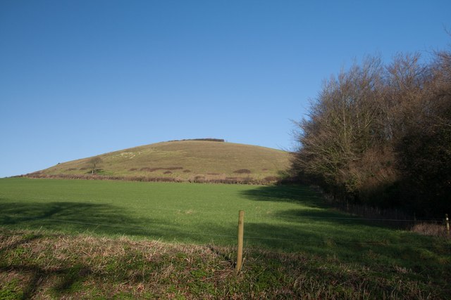
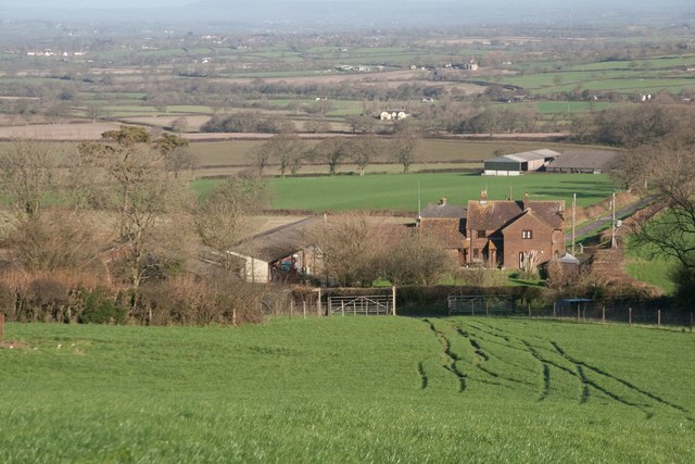
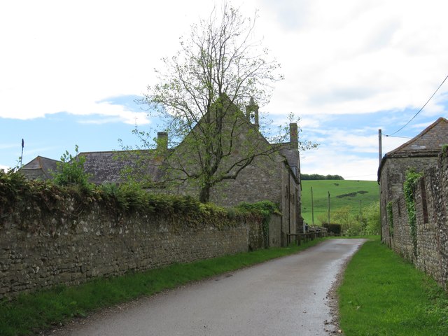
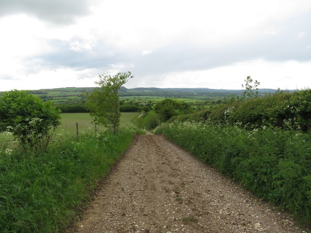
Lower Ansty is a small village located in the county of Dorset, England. Situated near the A352 road, it is part of the district of West Dorset. The village is surrounded by picturesque countryside, with rolling hills and meadows making up the landscape.

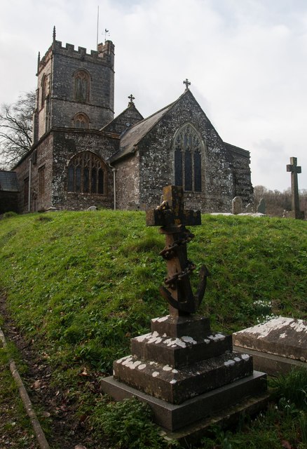
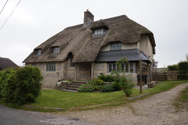
With a population of around 200 residents, Lower Ansty is a close-knit community where a sense of community spirit is evident. The village features a mix of traditional and modern houses, alongside a few historic buildings that add character to the area.

Lower Ansty is well-known for its tranquil and peaceful atmosphere, providing an ideal retreat from the hustle and bustle of city life. The village is surrounded by several walking and cycling routes, making it popular among outdoor enthusiasts. The nearby Dorset Downs and Cranborne Chase Areas of Outstanding Natural Beauty offer stunning vistas and opportunities for exploring the surrounding countryside.

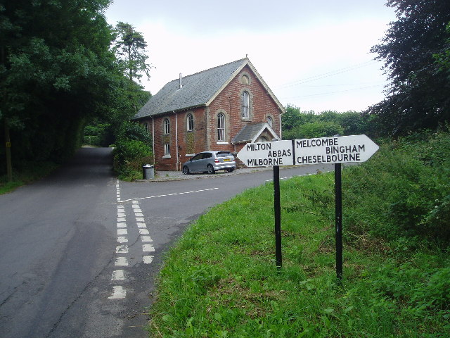
Although a small village, Lower Ansty benefits from its proximity to larger towns and cities. The vibrant market town of Dorchester is just a short drive away, offering a range of amenities including shops, restaurants, and leisure facilities. The village is also well-connected by public transport, with regular bus services providing links to nearby towns.

Overall, Lower Ansty is a charming village that offers a peaceful and idyllic lifestyle, with easy access to the natural beauty of the surrounding Dorset countryside.

If you have any feedback on the listing, please let us know in the comments section below.
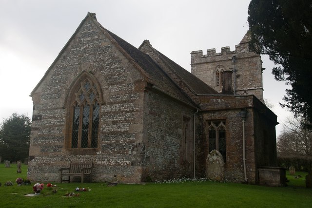
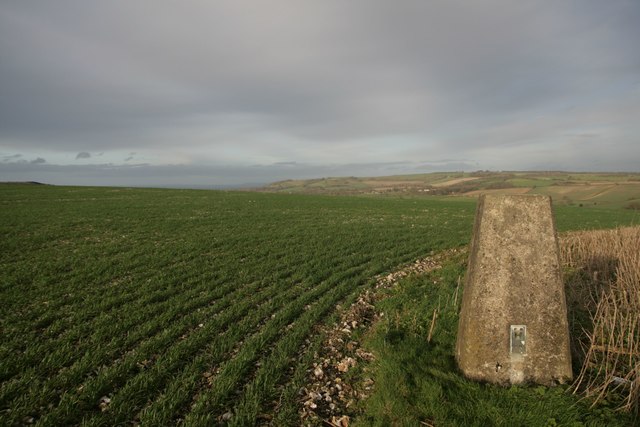
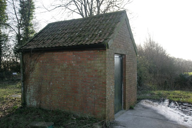
Lower Ansty Images

Images are sourced within 2km of 50.82764/-2.3347998 or Grid Reference ST7603. Thanks to Geograph Open Source API. All images are credited.

Nordon Hill from private road to Higher Melcombe
Leading to Melcombe Park Farm from the south
Benchmark on All Saints Church, Hilton Ordnance Survey benchmark, described on database at <span class="nowrap"><a title="http://www.bench-marks.org.uk/bm72978" rel="nofollow ugc noopener" href="http://www.bench-marks.org.uk/bm72978">Link</a><img style="margin-left:2px;" alt="External link" title="External link - shift click to open in new window" src="https://s1.geograph.org.uk/img/external.png" width="10" height="10"/></span>. See also <a href="https://www.geograph.org.uk/photo/4807895">ST7802 : All Saints Church, Hilton</a>
Benchmark on All Saints Church, Hilton
Ordnance Survey benchmark, described on database at LinkExternal link. See also ST7802 : All Saints Church, Hilton
All Saints Church, Hilton The photo shows an interesting gravestone with an anchor. The inscription was too faint to read.
All Saints Church, Hilton
The photo shows an interesting gravestone with an anchor. The inscription was too faint to read.
Benchmark on St Andrew's Church, Bingham's Melcombe Ordnance Survey benchmark, described on database at <span class="nowrap"><a title="http://www.bench-marks.org.uk/bm72979" rel="nofollow ugc noopener" href="http://www.bench-marks.org.uk/bm72979">Link</a><img style="margin-left:2px;" alt="External link" title="External link - shift click to open in new window" src="https://s1.geograph.org.uk/img/external.png" width="10" height="10"/></span>. See also <a href="https://www.geograph.org.uk/photo/4807901">ST7702 : St Andrew's Church, Bingham's Melcombe</a>.
Benchmark on St Andrew's Church, Bingham's Melcombe
Ordnance Survey benchmark, described on database at LinkExternal link. See also ST7702 : St Andrew's Church, Bingham's Melcombe.
St Andrew's Church, Bingham's Melcombe There is an Ordnance Survey benchmark on this delightful country estate church. See <a href="https://www.geograph.org.uk/photo/4807899">ST7702 : Benchmark on St Andrew's Church, Bingham's Melcombe</a> for photo.
St Andrew's Church, Bingham's Melcombe
There is an Ordnance Survey benchmark on this delightful country estate church. See ST7702 : Benchmark on St Andrew's Church, Bingham's Melcombe for photo.
Lime kiln in Link's Plantation At least I think it is. I did a little research, which suggested the erstwhile existence of a lime kiln, or at least a kiln of some description at this grid reference.
Lime kiln in Link's Plantation
At least I think it is. I did a little research, which suggested the erstwhile existence of a lime kiln, or at least a kiln of some description at this grid reference.
Trig point on Henning Hill
Flush Bracket on Henning Hill trigpoint
Benchmark on Pump House, Cross Lanes Ordnance Survey benchmark, described on database at <span class="nowrap"><a title="http://www.bench-marks.org.uk/bm47096" rel="nofollow ugc noopener" href="http://www.bench-marks.org.uk/bm47096">Link</a><img style="margin-left:2px;" alt="External link" title="External link - shift click to open in new window" src="https://s1.geograph.org.uk/img/external.png" width="10" height="10"/></span>. See also <a href="https://www.geograph.org.uk/photo/4807920">ST7502 : Pump House, Cross Lanes</a>.
Benchmark on Pump House, Cross Lanes
Ordnance Survey benchmark, described on database at LinkExternal link. See also ST7502 : Pump House, Cross Lanes.
Pump House, Cross Lanes There is an Ordnance Survey benchmark on this building (left side of door). For photo, see <a href="https://www.geograph.org.uk/photo/4807918">ST7502 : Benchmark on Pump House, Cross Lanes</a>. For full description on database, see <span class="nowrap"><a title="http://www.bench-marks.org.uk/bm47096" rel="nofollow ugc noopener" href="http://www.bench-marks.org.uk/bm47096">Link</a><img style="margin-left:2px;" alt="External link" title="External link - shift click to open in new window" src="https://s1.geograph.org.uk/img/external.png" width="10" height="10"/></span>.
Pump House, Cross Lanes
There is an Ordnance Survey benchmark on this building (left side of door). For photo, see ST7502 : Benchmark on Pump House, Cross Lanes. For full description on database, see LinkExternal link.
Higher Melcombe Farm There is a benchmark on the building on the right. See <a href="https://www.geograph.org.uk/photo/4963247">ST7402 : Benchmark on building, Higher Melcombe Farm</a>.
Higher Melcombe Farm
There is a benchmark on the building on the right. See ST7402 : Benchmark on building, Higher Melcombe Farm.
Benchmark on building, Higher Melcombe Farm Ordnance Survey benchmark, described on database at <span class="nowrap"><a title="http://www.bench-marks.org.uk/bm75743" rel="nofollow ugc noopener" href="http://www.bench-marks.org.uk/bm75743">Link</a><img style="margin-left:2px;" alt="External link" title="External link - shift click to open in new window" src="https://s1.geograph.org.uk/img/external.png" width="10" height="10"/></span>. See also <a href="https://www.geograph.org.uk/photo/4963245">ST7402 : Higher Melcombe Farm</a>.
Benchmark on building, Higher Melcombe Farm
Ordnance Survey benchmark, described on database at LinkExternal link. See also ST7402 : Higher Melcombe Farm.
Ascending the southern slopes of Bulbarrow Hill
House at Badger Lane, Cross Lanes
Cross Roads at Cross Lanes
Spring House On Hartfoot Lane, Melcombe Bingham.
Spring House
On Hartfoot Lane, Melcombe Bingham.
The Old Brewery Hall, Ansty
Show me another place!

Lower Ansty is located at Grid Ref: ST7603 (Lat: 50.82764, Lng: -2.3347998)

Unitary Authority: Dorset

Police Authority: Dorset

What 3 Words

///masts.thumb.grove. Near Milborne St Andrew, Dorset

Related Wikis

Ansty, Dorset

Ansty is a village in Dorset, England, north of Cheselbourne and west of Milton Abbas. It consists of the settlements of Higher Ansty, Lower Ansty, Pleck...

Ansty Cross

Ansty Cross is a village in Dorset, England.

Melcombe Horsey

Melcombe Horsey is a civil parish in the county of Dorset in South West England. It contains the small settlements of Melcombe Bingham, Bingham's Melcombe...

Hilton, Dorset

Hilton is a village and civil parish in the county of Dorset in southern England. It is sited at an elevation of 135 metres (443 feet) in a small valley...

Related Videos

WALKS IN DORSET at ANSTY , BINGHAM's MELCOMBE & HILTON (4K)

In this episode of my series “ Walks in Dorset”, I take a 3.5 mile “circular” walk from the village of Ansty to the settlements at ...

Wild Ramsons #dorset #hiking #nature

Micro adventure right outside my backdoor. watch more by subscribe to my channel.

Nearby Amenities

Located within 500m of 50.82764,-2.3347998
Pub
The Fox at Ansty
Addr Postcode: DT2 7PN
Fhrs Id: 1000932
Source Addr Postcode: FHRS Open Data
Lat/Long: 50.8281427/-2.3339462
Barrier: stile
Lat/Long: 50.8276215/-2.3355369
Barrier: stile
Lat/Long: 50.8279037/-2.3368053
Post Office
Ansty Post Office
Addr City: Dorchester
Addr Country: GB
Addr Housename: Brewery Farm
Addr Postcode: DT2 7PN
Addr Village: Ansty
Opening Hours: Mo-Fr 09:00-13:00
Operator: Brewery Farm
Ref Pol Id: 4513
Lat/Long: 50.8286738/-2.3348962
Ansty
Place: village
Wikidata: Q4770793
Lat/Long: 50.8242527/-2.3368695
Turning Circle
Lat/Long: 50.8244054/-2.3378608
Lower Ansty
Place: village
Lat/Long: 50.8269769/-2.3344429
Post Box
Lat/Long: 50.8286437/-2.3348125
Barrier: stile
Lat/Long: 50.8283764/-2.3400144
Barrier: stile
Lat/Long: 50.8276195/-2.3349103
Material: wood
Power: pole
Source: bing
Lat/Long: 50.8261932/-2.3386673
Material: wood
Power: pole
Source: bing
Lat/Long: 50.826825/-2.3382576
Material: wood
Power: pole
Source: bing
Lat/Long: 50.8274749/-2.3378622
Material: wood
Power: pole
Source: bing
Lat/Long: 50.8281392/-2.3374523
Material: wood
Power: pole
Source: bing
Lat/Long: 50.828674/-2.3371669
Material: wood
Power: pole
Source: bing
Lat/Long: 50.8302384/-2.3347753
Material: wood
Power: pole
Source: bing
Lat/Long: 50.8307177/-2.3338113
Material: wood
Power: pole
Source: bing
Lat/Long: 50.8311753/-2.3329045
Material: wood
Power: pole
Source: bing
Lat/Long: 50.8316291/-2.3320205
Fire Hydrant
Emergency: fire_hydrant
Fire Hydrant Diameter: 3 inch
Fire Hydrant Type: underground
Ref: 10579
Lat/Long: 50.826093/-2.335969
Material: wood
Power: pole
Source: survey
Transformer: distribution
Voltage Primary: 11000
Lat/Long: 50.8263209/-2.3360089
Power: pole
Source: bing
Lat/Long: 50.8259935/-2.338783
Power: pole
Source: bing
Lat/Long: 50.8258732/-2.3389962
Power: pole
Source: bing
Lat/Long: 50.8254861/-2.3390807
Power: pole
Source: bing
Lat/Long: 50.8247965/-2.3394978
Poles: bipole
Power: pole
Source: bing
Transformer: distribution
Lat/Long: 50.825791/-2.3327024
Power: pole
Source: bing
Lat/Long: 50.8254208/-2.333495
Power: pole
Source: bing
Lat/Long: 50.8260435/-2.3342353
Material: wood
Power: pole
Source: survey
Lat/Long: 50.8264789/-2.3355362
Power: pole
Source: bing
Lat/Long: 50.826268/-2.3369417
Power: pole
Source: bing
Lat/Long: 50.82624/-2.3377933
Material: wood
Power: pole
Source: bing
Lat/Long: 50.8296573/-2.3340181
Power: pole
Source: bing
Lat/Long: 50.8295234/-2.3361705
Power: pole
Source: bing
Lat/Long: 50.8298795/-2.335476
Material: wood
Poles: bipole
Power: pole
Source: survey
Transformer: distribution
Voltage Primary: 11000
Voltage Secondary: 400
Voltage Tertiary: 230
Lat/Long: 50.8288847/-2.3337767
Fire Hydrant
Emergency: fire_hydrant
Fire Hydrant Diameter: 100
Fire Hydrant Type: underground
Source: survey
Lat/Long: 50.825112/-2.337744
Board Type: notice
Information: board
Tourism: information
Lat/Long: 50.8274417/-2.3350744
Post Box
Brand: Royal Mail
Brand Wikidata: Q638098
Collection Times: Mo-Fr 13:15; Sa 09:00
Operator: Royal Mail
Operator Wikidata: Q638098
Post Box Type: wall
Ref: DT2 54
Ref GB Uprn: 10015399531
Royal Cypher: VR
Royal Cypher Wikidata: Q33102356
Source: survey
Lat/Long: 50.8274507/-2.3350646
Fire Hydrant
Emergency: fire_hydrant
Fire Hydrant Type: underground
Source: survey
Lat/Long: 50.827606/-2.334787
The data included in this document is from www.openstreetmap.org. The data is made available under ODbL.

Have you been to Lower Ansty?

Leave your review of Lower Ansty below (or comments, questions and feedback).