Large Burra Geo
Coastal Feature, Headland, Point in Orkney
Scotland
Large Burra Geo

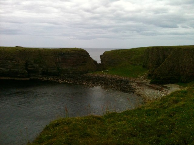
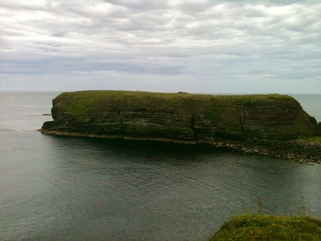
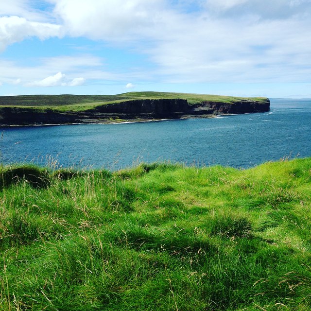
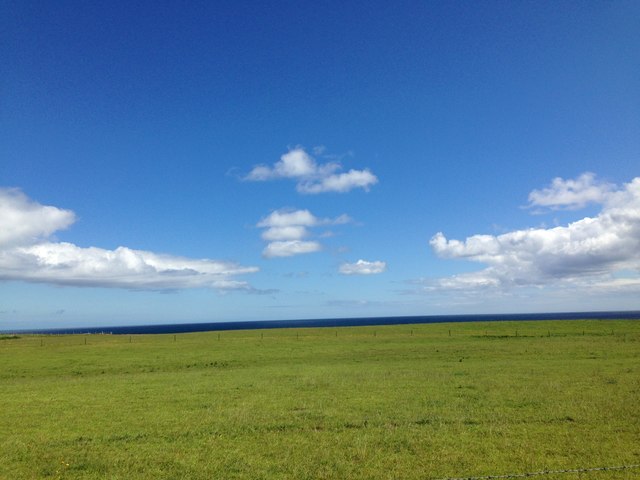
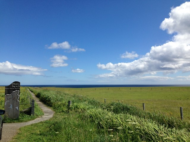
Large Burra Geo is a prominent coastal feature located on the island of Orkney, Scotland. It is a captivating headland that stretches out into the North Sea, offering breathtaking views of the surrounding landscape. The geo is situated on the eastern coast of Orkney, about 3 miles northeast of the village of St. Margaret's Hope.
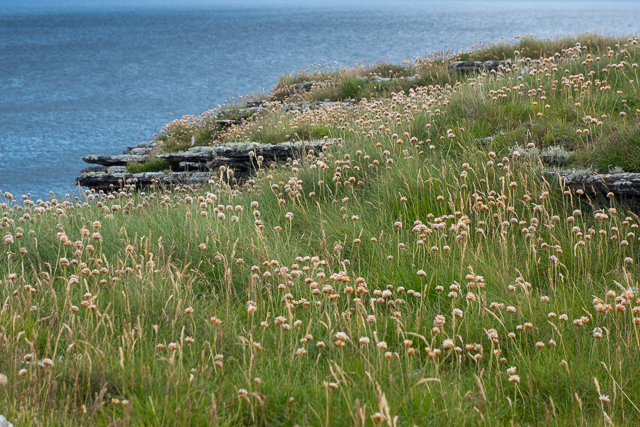
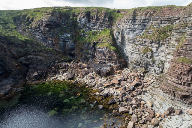
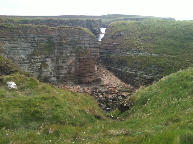
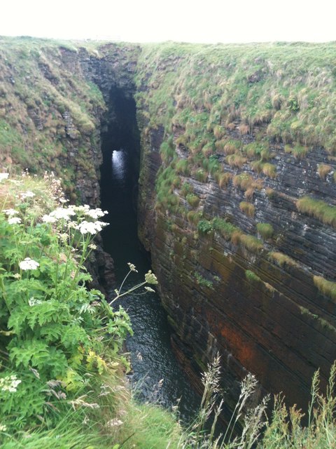
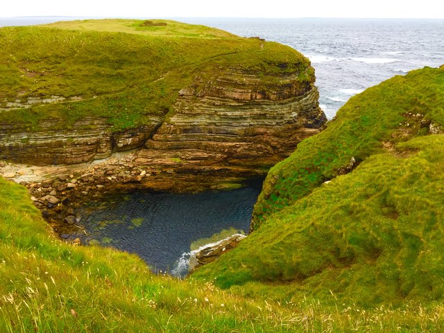
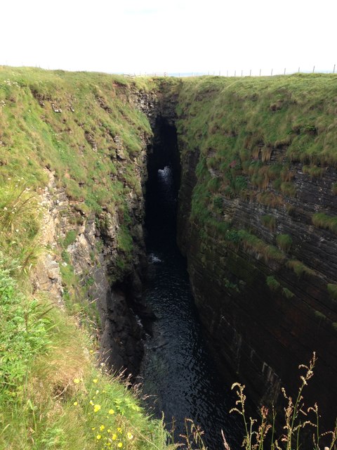
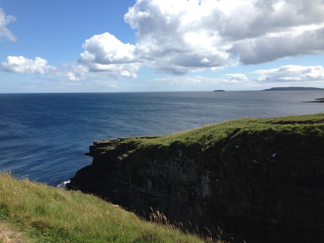
This rugged headland is characterized by its impressive cliffs, which rise dramatically from the sea. The cliffs are made up of layers of sandstone and shale, showcasing a variety of colors and textures. Large Burra Geo is particularly renowned for its striking rock formations and sea stacks, which have been shaped over millennia by the relentless forces of the ocean.
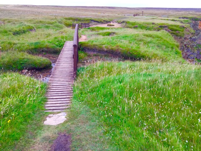
The site is a haven for birdwatchers, as it is home to a diverse range of seabirds. Visitors can spot species such as fulmars, guillemots, razorbills, and even puffins during the breeding season. Large Burra Geo also offers opportunities for coastal walks, allowing visitors to explore the area's natural beauty and observe the abundant wildlife.
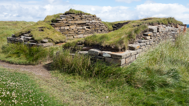
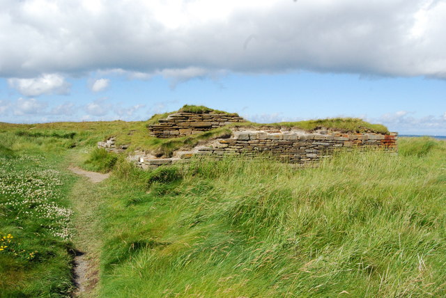
In addition to its scenic appeal, Large Burra Geo has archaeological significance. The area has been inhabited since ancient times, with evidence of human activity dating back to the Neolithic period. Archaeologists have discovered burial cairns and other ancient structures in the vicinity, providing insights into the island's rich history.
Overall, Large Burra Geo is a captivating coastal feature that combines stunning natural scenery with archaeological significance. Its striking cliffs, diverse birdlife, and historical importance make it a popular destination for nature enthusiasts and history buffs alike.
If you have any feedback on the listing, please let us know in the comments section below.
Large Burra Geo Images
Images are sourced within 2km of 58.964516/-2.706521 or Grid Reference HY5908. Thanks to Geograph Open Source API. All images are credited.


Large Burra Geo is located at Grid Ref: HY5908 (Lat: 58.964516, Lng: -2.706521)
Unitary Authority: Orkney Islands
Police Authority: Highlands and Islands
What 3 Words
///lows.clip.gratitude. Near Deerness, Orkney Islands
Nearby Locations
Related Wikis

The Gloup
The Gloup () is a collapsed sea cave in the Mull Head Nature Reserve in the islands of Orkney, Scotland. The name derives from the Old Norse "gluppa",...

Deerness
Deerness (, locally , Old Norse: Dyrnes) is a quoad sacra parish (i.e. one created and functioning for ecclesiastical purposes only) and peninsula in Mainland...

Point of Ayre, Orkney
There are also two similarly named points in the British Isles: Point of Ayre, Isle of Man and Point of Ayr, Wales. Point of Ayre is a headland in the...

Horse of Copinsay
The Horse of Copinsay, also known as the Horse, is a rectangular uninhabited sea stack to the north east of Copinsay in the Orkney Islands, Scotland....
Nearby Amenities
Located within 500m of 58.964516,-2.706521Have you been to Large Burra Geo?
Leave your review of Large Burra Geo below (or comments, questions and feedback).