Brough of Deerness
Coastal Feature, Headland, Point in Orkney
Scotland
Brough of Deerness

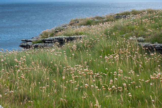
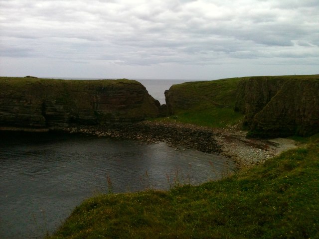
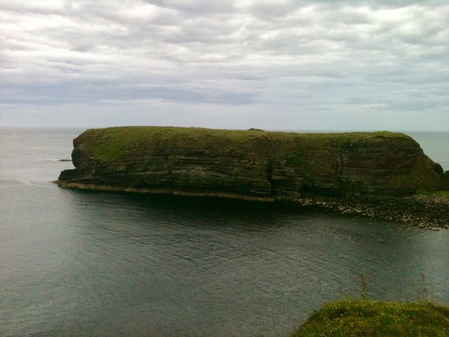
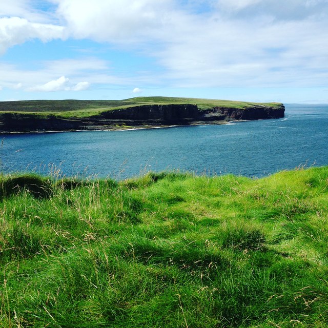
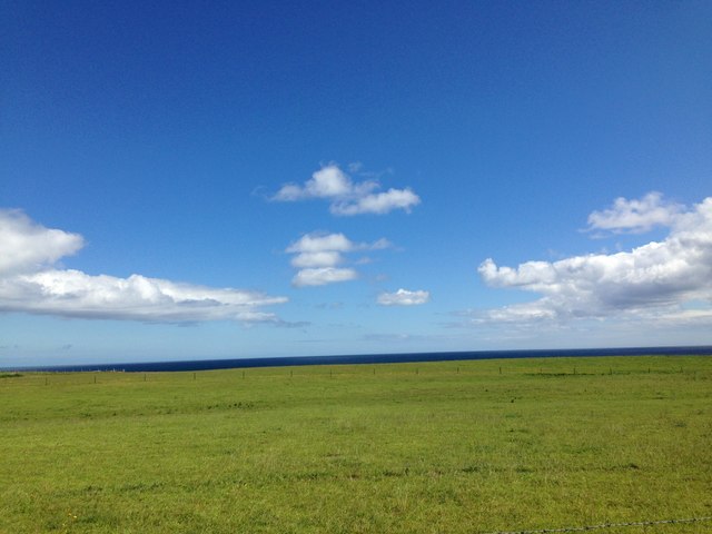
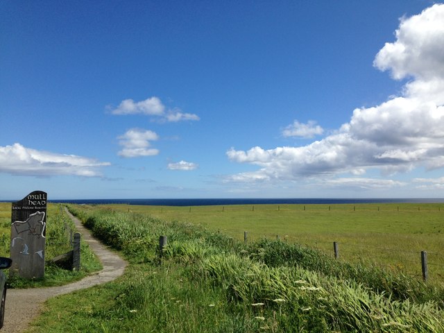
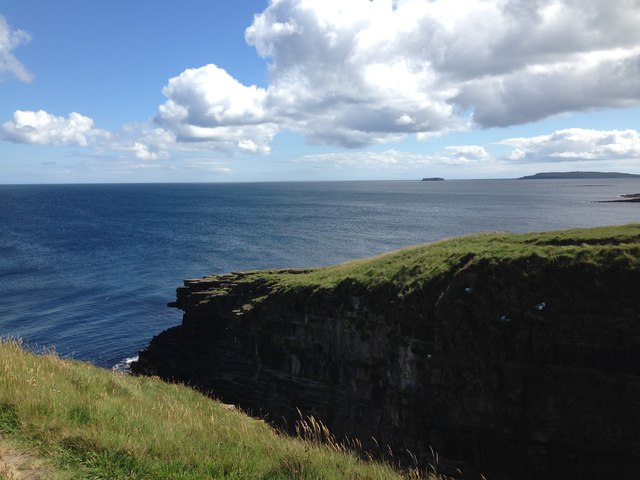
The Brough of Deerness is a prominent coastal feature located on the east coast of the Orkney Islands, Scotland. Situated on a headland, it juts out into the North Sea, forming a distinct point that offers breathtaking views of the surrounding landscape.
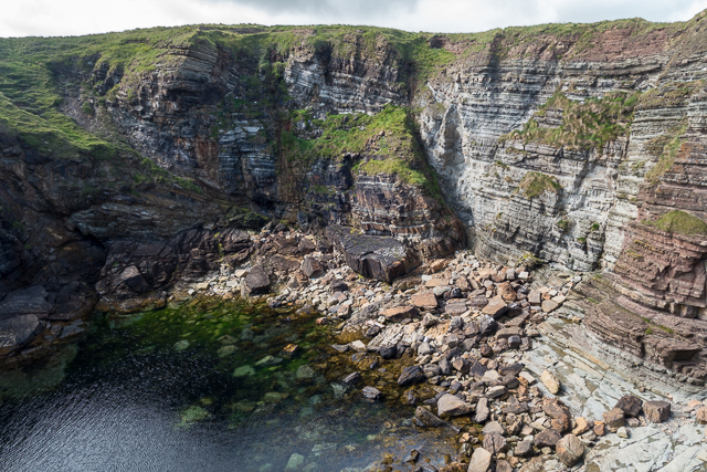
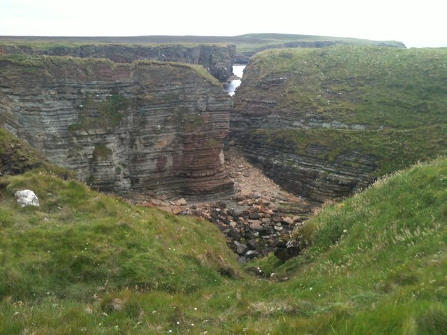
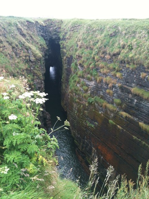
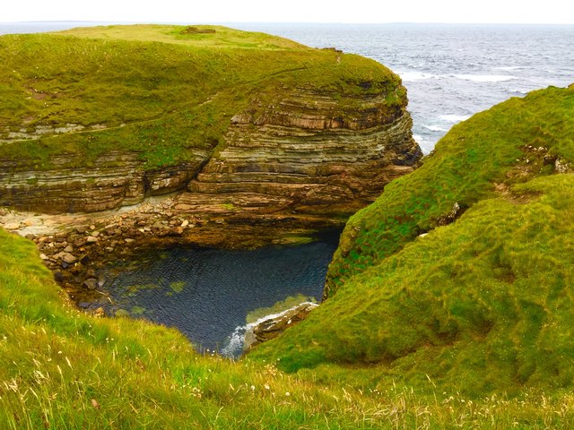
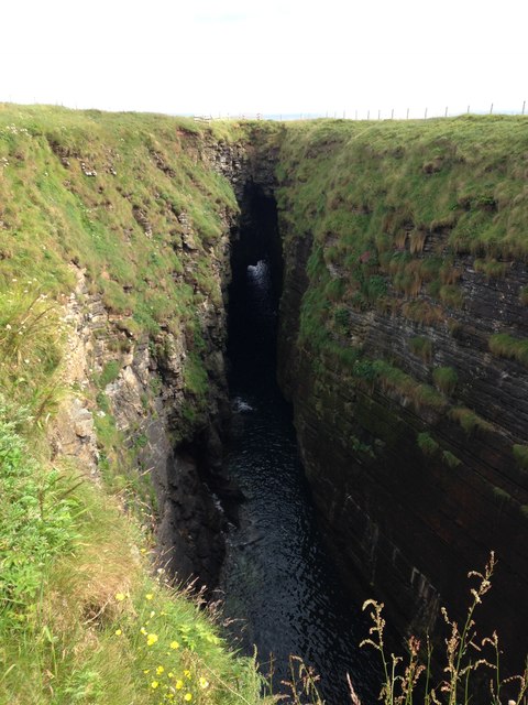
The Brough of Deerness is characterized by its rugged cliffs and rocky terrain, which provide a habitat for a variety of bird species, including puffins, guillemots, and razorbills. The area is also known for its impressive sea caves, which have been formed by the relentless pounding of the waves over thousands of years.
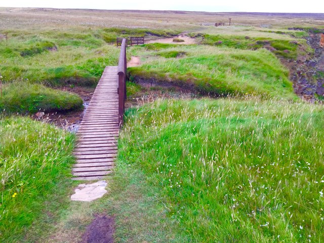
Access to the Brough of Deerness is via a narrow causeway that is exposed during low tide, making it possible for visitors to explore the site on foot. However, caution is advised, as the causeway can become submerged during high tide, cutting off access.
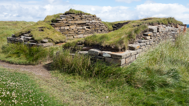
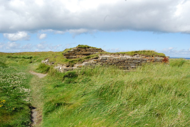
The Brough of Deerness has a rich history, with archaeological evidence suggesting that it was inhabited as early as the Iron Age. The remains of a Pictish settlement, including a broch (a fortified roundhouse) and a stone tower, can still be seen on the headland. These ancient structures provide valuable insight into the lives and culture of the people who once lived here.
Today, the Brough of Deerness is a popular tourist destination, attracting visitors from around the world who come to marvel at its natural beauty and explore its historical significance. It offers a unique opportunity to experience the ruggedness and tranquility of the Orkney coastline.
If you have any feedback on the listing, please let us know in the comments section below.
Brough of Deerness Images
Images are sourced within 2km of 58.964212/-2.7047586 or Grid Reference HY5908. Thanks to Geograph Open Source API. All images are credited.


Brough of Deerness is located at Grid Ref: HY5908 (Lat: 58.964212, Lng: -2.7047586)
Unitary Authority: Orkney Islands
Police Authority: Highlands and Islands
What 3 Words
///croutons.informs.towers. Near Deerness, Orkney Islands
Related Wikis

The Gloup
The Gloup () is a collapsed sea cave in the Mull Head Nature Reserve in the islands of Orkney, Scotland. The name derives from the Old Norse "gluppa",...

Deerness
Deerness (, locally , Old Norse: Dyrnes) is a quoad sacra parish (i.e. one created and functioning for ecclesiastical purposes only) and peninsula in Mainland...

Point of Ayre, Orkney
There are also two similarly named points in the British Isles: Point of Ayre, Isle of Man and Point of Ayr, Wales.Point of Ayre is a headland in the parish...

Horse of Copinsay
The Horse of Copinsay, also known as the Horse, is a rectangular uninhabited sea stack to the north east of Copinsay in the Orkney Islands, Scotland....

Black Holm
Black Holm is a small tidal island in the Orkney Islands, near Copinsay to the west of Corn Holm off the north-eastern coast of Scotland. == Geography... ==

St Peter's Pool, Orkney
St Peter's Pool is a bay in the East Mainland of Orkney, Scotland. This bay was the site of significant coastal defences during World War II, when a German...
Corn Holm
Corn Holm is a small tidal island in Orkney, near Copinsay to the west, off the north-eastern coast of Scotland. There was once a small chapel there, and...

Copinsay
Copinsay (Old Norse: Kolbeinsey) is one of the Orkney Islands in Scotland, lying off the east coast of the Orkney Mainland. The smaller companion island...
Nearby Amenities
Located within 500m of 58.964212,-2.7047586Have you been to Brough of Deerness?
Leave your review of Brough of Deerness below (or comments, questions and feedback).