Babbet Ness

Coastal Feature, Headland, Point in Fife

Scotland

Babbet Ness

Kingsbarns Harbour The remains of the former harbour at Kingsbarns, on the East coast of Fife, are clearly visible. Records exist of a harbour in this location as early as the 16th century. The harbour has not been used for at least a hundred years.
Kingsbarns Harbour Credit: Bob Jones

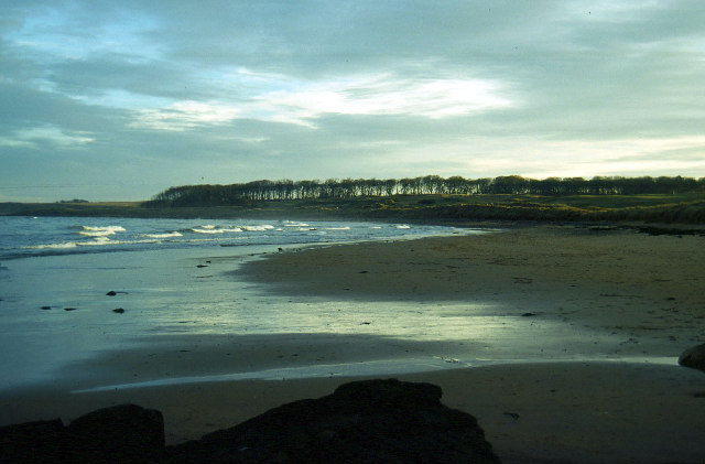
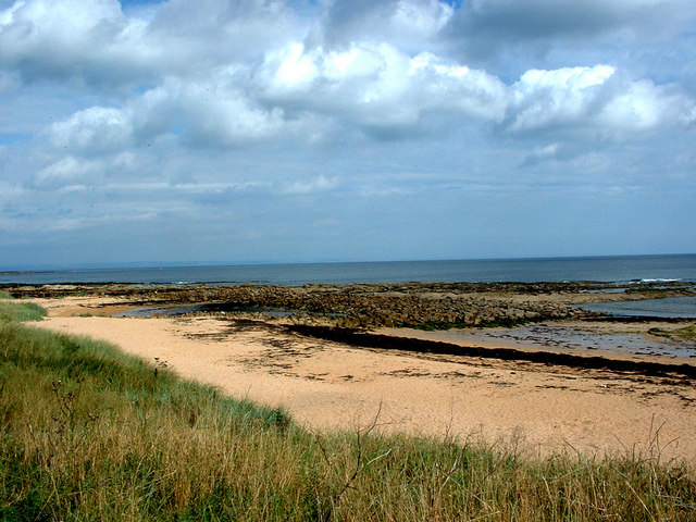
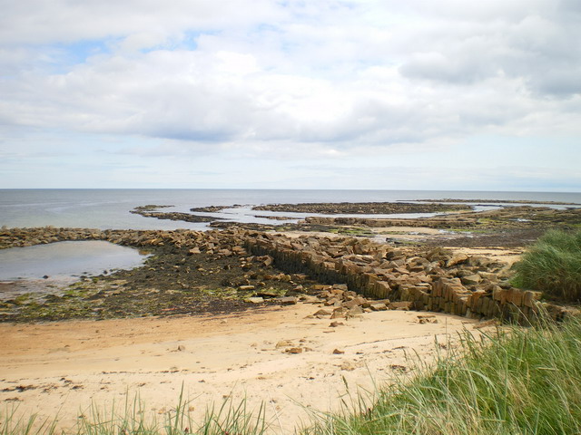
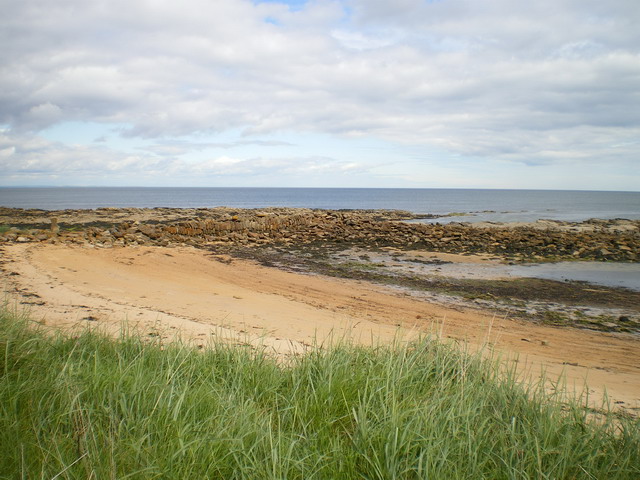
Babbet Ness is a prominent headland located on the eastern coast of Scotland, specifically in Fife. Situated near the charming town of Anstruther, Babbet Ness juts out into the North Sea, marking a notable point along the coastline.

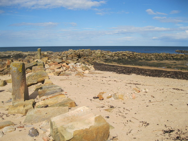
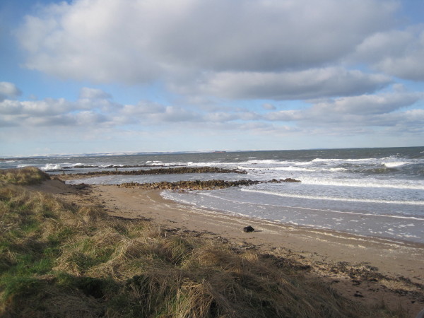
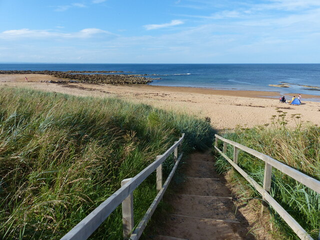
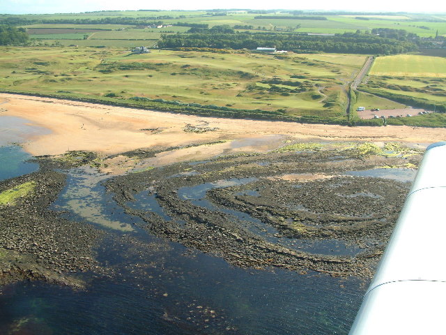
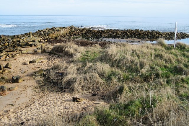
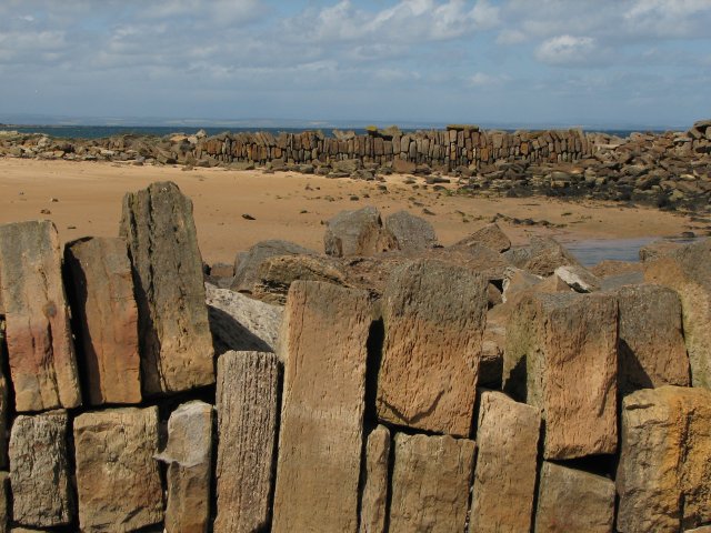
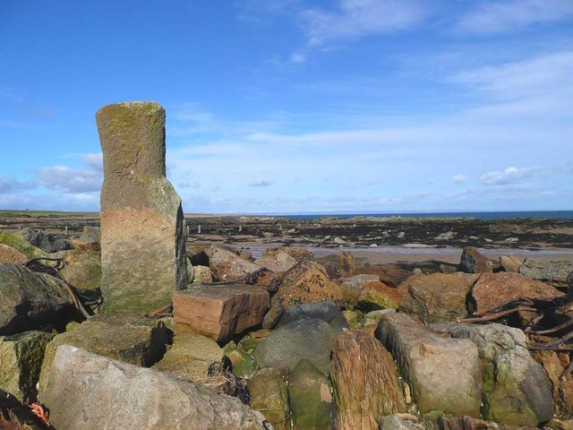
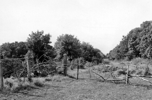
This coastal feature is characterized by its rugged and rocky terrain, which is a result of the constant erosion caused by the relentless waves crashing against it. The headland is formed by layers of sedimentary rocks, with distinct bands of sandstone and shale visible in its cliffs.

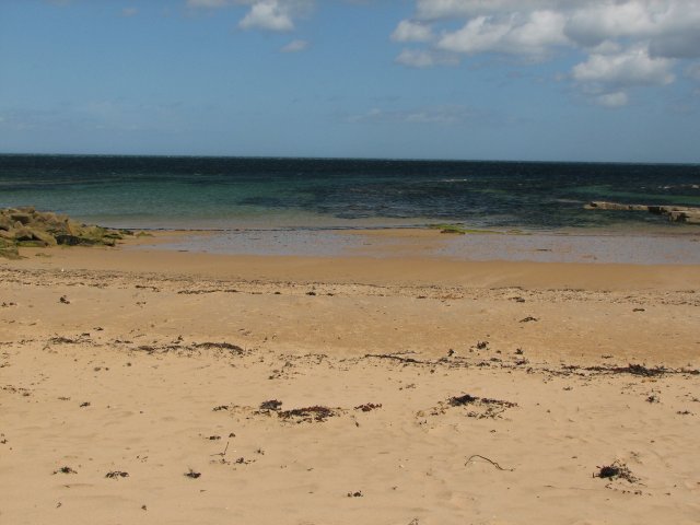
Babbet Ness offers captivating views of the surrounding area, including panoramic vistas of the North Sea and the nearby coastline. On clear days, visitors can even catch glimpses of the Isle of May, an uninhabited island known for its abundant wildlife, situated just off the coast.

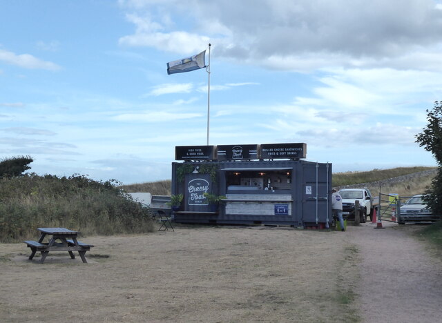
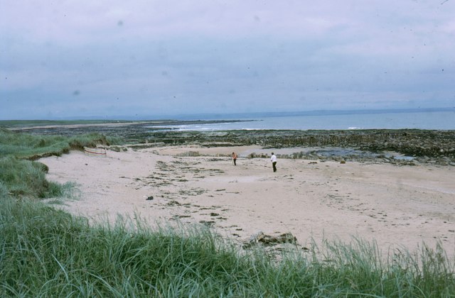
The headland is a popular spot for locals and tourists alike who enjoy activities such as hiking, birdwatching, and photography. The diverse marine and birdlife that can be found in the area makes it particularly attractive to nature enthusiasts. Seabirds such as gannets, puffins, and razorbills can often be spotted nesting on the cliffs of Babbet Ness.

In addition to its natural beauty, Babbet Ness is also steeped in history. It is believed that the headland was named after a local fisherman named Babbet who lost his life at sea. The surrounding area is dotted with remnants of old fishing villages and historic landmarks, adding to the charm and intrigue of this coastal feature.

If you have any feedback on the listing, please let us know in the comments section below.

Babbet Ness Images

Images are sourced within 2km of 56.317847/-2.6577602 or Grid Reference NO5914. Thanks to Geograph Open Source API. All images are credited.

Kingsbarns Harbour The remains of the former harbour at Kingsbarns, on the East coast of Fife, are clearly visible. Records exist of a harbour in this location as early as the 16th century. The harbour has not been used for at least a hundred years.
Kingsbarns Harbour
The remains of the former harbour at Kingsbarns, on the East coast of Fife, are clearly visible. Records exist of a harbour in this location as early as the 16th century. The harbour has not been used for at least a hundred years.
Beach and Harbour at Kingsbarns
Third tee at Kingsbarn's golf course The view towards the third tee at Kingsbarn's golf course.  This is a par 5 hole.  The fairway <a href="https://www.geograph.org.uk/photo/3034395">NO5912 : The 3rd hole on the Kingsbarns links course</a> leads to the hole <a href="https://www.geograph.org.uk/photo/2143034">NO5912 : Kingsbarns Golf Links</a>.
Third tee at Kingsbarn's golf course
The view towards the third tee at Kingsbarn's golf course. This is a par 5 hole. The fairway NO5912 : The 3rd hole on the Kingsbarns links course leads to the hole NO5912 : Kingsbarns Golf Links.
Toilet block, shelter and picnic area The view of the public conveniences and the picnic area at Kingsbarns Harbour.
Toilet block, shelter and picnic area
The view of the public conveniences and the picnic area at Kingsbarns Harbour.
The Cheesy Toast Popular snack bar on Kingsbarns beach.
The Cheesy Toast
Popular snack bar on Kingsbarns beach.
Steps leading to Cambo Sands The steps are next to the car park.
Steps leading to Cambo Sands
The steps are next to the car park.
Car park at Cambo Sands
New sauna at Kingsbarns harbour
Cambo Sands
Cambo Sands
Volcanic Dome The concentric circles of rock (partly hidden by the aircraft's wing) are the remains of layers of sedimentary rock that were forced upwards by a volcano which never erupted, and which were later eroded.
Volcanic Dome
The concentric circles of rock (partly hidden by the aircraft's wing) are the remains of layers of sedimentary rock that were forced upwards by a volcano which never erupted, and which were later eroded.
Kingsbarns Beach
Kingsbarns Beach
Kingsbarns Harbour The harbour is now a ruin and much of the stonework destroyed.  However, it is possible to see part of the harbour wall which is still intact and also some upright stone pillars which would have acted as mooring posts. (Two are visible in the photo). Historically, grain (stored in the 'Kings Barns') was exported from here.
Kingsbarns Harbour
The harbour is now a ruin and much of the stonework destroyed. However, it is possible to see part of the harbour wall which is still intact and also some upright stone pillars which would have acted as mooring posts. (Two are visible in the photo). Historically, grain (stored in the 'Kings Barns') was exported from here.
Walls at Cambo Sands Old breakwaters on the beach at Kingsbarns.
Walls at Cambo Sands
Old breakwaters on the beach at Kingsbarns.
Cambo Sands The water may look inviting but there was a cold wind blowing - often the case on the East Neuk.
Cambo Sands
The water may look inviting but there was a cold wind blowing - often the case on the East Neuk.
Old bollard at Cambo Sands
Cambo Sands
Cambo Sands
Harbour walls and the volcanic dome The partially collapsed south wall of Kingsbarns harbour runs across the centre of this image, with the eroded top of a volcanic dome in the background. This is well seen in the aerial shot of <a href="https://www.geograph.org.uk/photo/106103">NO6012 : Volcanic Dome</a>.
Harbour walls and the volcanic dome
The partially collapsed south wall of Kingsbarns harbour runs across the centre of this image, with the eroded top of a volcanic dome in the background. This is well seen in the aerial shot of NO6012 : Volcanic Dome.
The north wall of Kingsbarns harbour Although more or less in ruins, the walls of the former harbour are still recognisable for what they once were.
The north wall of Kingsbarns harbour
Although more or less in ruins, the walls of the former harbour are still recognisable for what they once were.
Show me another place!

Babbet Ness is located at Grid Ref: NO5914 (Lat: 56.317847, Lng: -2.6577602)

Unitary Authority: Fife

Police Authority: Fife

What 3 Words

///laws.demanding.hint. Near Crail, Fife

Nearby Locations

Babbet Ness

Related Wikis

Kingsbarns

Kingsbarns is a village and parish in Scotland lies near the eastern coast of Fife, in an area known as the East Neuk, 6.5 miles (10.5 km) southeast of...

2017 Women's British Open

The 2017 Ricoh Women's British Open was played 3–6 August in Scotland at Kingsbarns Golf Links in Fife. It was the 41st Women's British Open, the 17th...

Kingsbarns Golf Links

Kingsbarns Golf Links is a seaside Scottish links golf course along 1.8 miles of shoreline near St Andrews, Scotland. It opened in 2000 and has been rated...
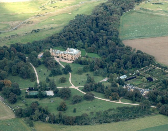
Cambo Estate

Cambo Estate lies close to the village of Kingsbarns in north-east Fife, Scotland. It is within the East Neuk, 10 kilometres (6.2 mi) south-east of St...

Boarhills

Boarhills is a hamlet close to Kingsbarns in the East Neuk of Fife, Scotland. It is located off the A917 road, 4+1⁄2 miles (7 km) from St Andrews and 5...

Boarhills railway station

Boarhills railway station served the hamlet of Boarhills, Fife, Scotland from 1883 to 1930 on the Anstruther and St Andrews Railway. == History == The...

Kingsbarns railway station

Kingsbarns railway station served the village of Kingsbarns, Fife, Scotland from 1883 to 1930 on the Fife Coast Railway. == History == The station opened...

RNAS Dunino (HMS Jackdaw II)

Royal Naval Air Station Dunino or more simply RNAS Dunino (HMS Jackdaw II) is a former Fleet Air Arm base located 1.8 miles (2.9 km) west of Kingsbarns...

Nearby Amenities

Located within 500m of 56.317847,-2.6577602
Airbow Point
Place: locality
Lat/Long: 56.3143263/-2.6571162
Babbet Ness
Place: locality
Lat/Long: 56.3185006/-2.6596078
The data included in this document is from www.openstreetmap.org. The data is made available under ODbL.

Have you been to Babbet Ness?

Leave your review of Babbet Ness below (or comments, questions and feedback).