Craignoon

Coastal Feature, Headland, Point in Fife

Scotland

Craignoon

The North Carr Lightship in Anstruther harbour In 1989, the lightship was part of the Scottish Fisheries Museum.  She is in Dundee's Victoria Dock - see <span class="nowrap"><a title="http://www.northcarr-lightship.org/" rel="nofollow ugc noopener" href="http://www.northcarr-lightship.org/">Link</a><img style="margin-left:2px;" alt="External link" title="External link - shift click to open in new window" src="https://s1.geograph.org.uk/img/external.png" width="10" height="10"/></span>.  

On 8 December 1959, the lifeboat "Mona" was launched from Broughty Ferry to assist the North Carr Lightship which was reported adrift in St Andrews Bay.  Later that day, the Mona was found capsized on Buddon Sands. Her crew of eight were all drowned. The Lightship's crew of six were able to drop their spare anchor and were all rescued alive and well by a helicopter the next morning.
The North Carr Lightship in Anstruther harbour Credit: Elliott Simpson

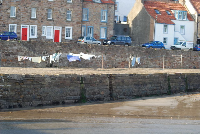
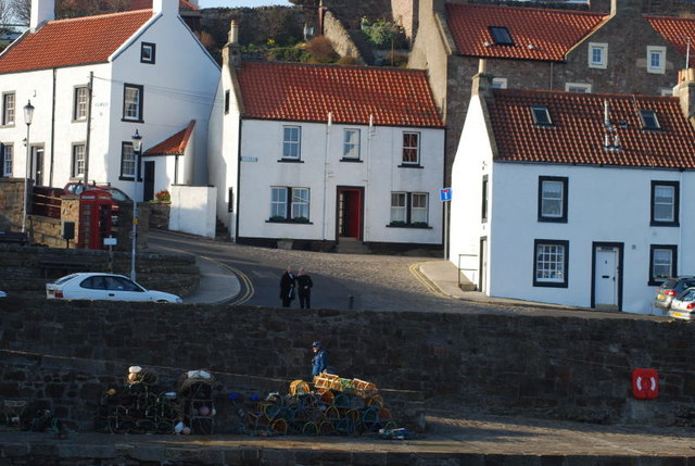
Craignoon is a prominent headland located in the picturesque coastal region of Fife, Scotland. Situated on the eastern coast, it is positioned between the towns of Anstruther and Pittenweem. This rugged and striking headland juts out into the North Sea, providing stunning panoramic views of the surrounding area.

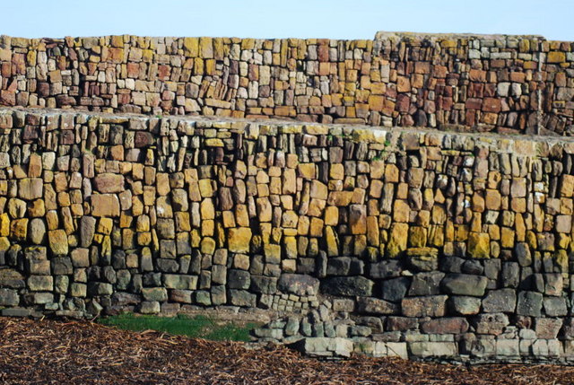
The geology of Craignoon is characterized by its towering cliffs and rocky terrain. The headland is composed mainly of sandstone, which has been shaped and sculpted by the relentless waves over thousands of years. This has resulted in the formation of numerous sea caves and natural arches that add to the dramatic beauty of the landscape.

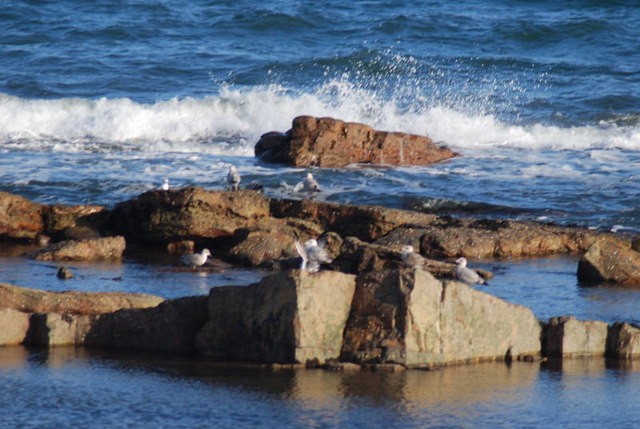
The headland is a haven for wildlife enthusiasts and nature lovers, as it is home to a diverse range of flora and fauna. The coastal grasslands are abundant with wildflowers during the summer months, attracting a variety of butterflies and insects. Visitors may also spot seals basking on the rocks or catch a glimpse of seabirds such as gannets, puffins, and guillemots nesting in the cliffs.

Craignoon offers several walking trails that allow visitors to explore its rugged beauty. The paths wind along the cliff edge, providing breathtaking views of the surrounding coastline and the expansive North Sea. There are also designated viewpoints that offer an ideal vantage point for capturing memorable photographs.

Overall, Craignoon is a remarkable headland that offers a captivating blend of natural beauty, geological wonders, and abundant wildlife. It is a must-visit destination for anyone seeking a unique coastal experience in the enchanting region of Fife.

If you have any feedback on the listing, please let us know in the comments section below.
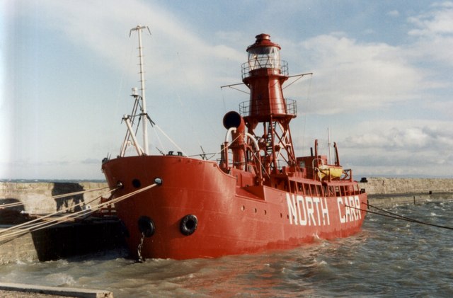
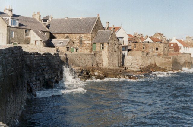
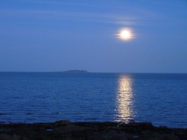
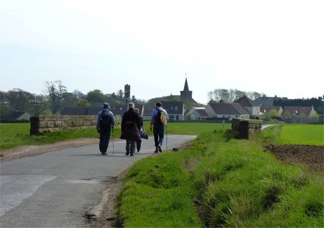
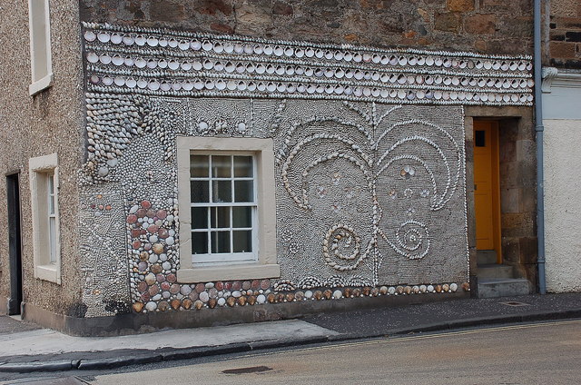
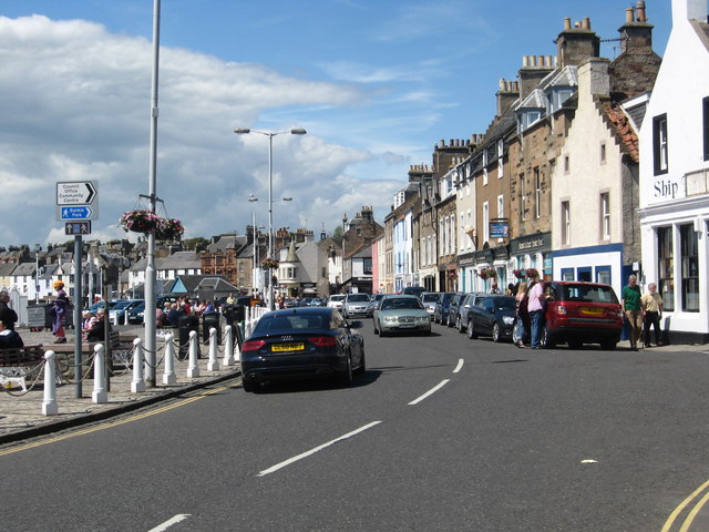
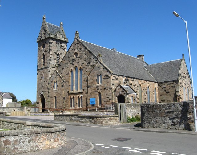
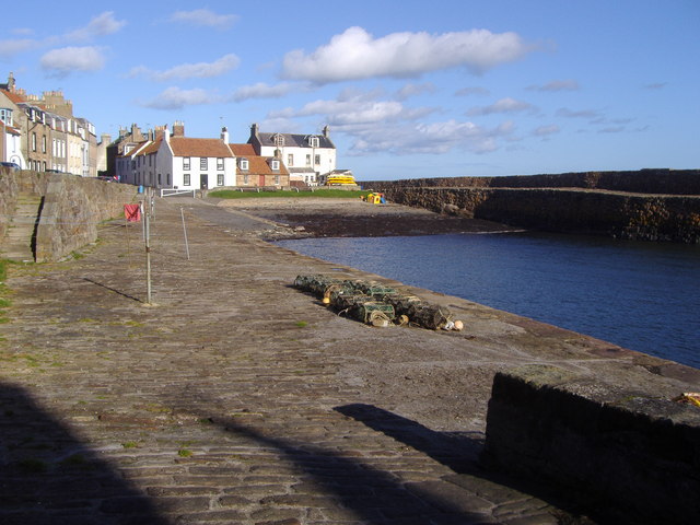
Craignoon Images

Images are sourced within 2km of 56.222504/-2.687379 or Grid Reference NO5703. Thanks to Geograph Open Source API. All images are credited.

The North Carr Lightship in Anstruther harbour In 1989, the lightship was part of the Scottish Fisheries Museum.  She is in Dundee's Victoria Dock - see <span class="nowrap"><a title="http://www.northcarr-lightship.org/" rel="nofollow ugc noopener" href="http://www.northcarr-lightship.org/">Link</a><img style="margin-left:2px;" alt="External link" title="External link - shift click to open in new window" src="https://s1.geograph.org.uk/img/external.png" width="10" height="10"/></span>.  

On 8 December 1959, the lifeboat "Mona" was launched from Broughty Ferry to assist the North Carr Lightship which was reported adrift in St Andrews Bay.  Later that day, the Mona was found capsized on Buddon Sands. Her crew of eight were all drowned. The Lightship's crew of six were able to drop their spare anchor and were all rescued alive and well by a helicopter the next morning.
The North Carr Lightship in Anstruther harbour
In 1989, the lightship was part of the Scottish Fisheries Museum. She is in Dundee's Victoria Dock - see LinkExternal link. On 8 December 1959, the lifeboat "Mona" was launched from Broughty Ferry to assist the North Carr Lightship which was reported adrift in St Andrews Bay. Later that day, the Mona was found capsized on Buddon Sands. Her crew of eight were all drowned. The Lightship's crew of six were able to drop their spare anchor and were all rescued alive and well by a helicopter the next morning.
Anstruther Baptist Church
Silver street to St Abbs The reflection of the full moon seems to lead from Cellardyke foreshore towards St Abbs Head. The island to the left is the Isle of May.
Silver street to St Abbs
The reflection of the full moon seems to lead from Cellardyke foreshore towards St Abbs Head. The island to the left is the Isle of May.
Coming in to Kilrenny Walkers crossing what once was a bridge across a railway.
Coming in to Kilrenny
Walkers crossing what once was a bridge across a railway.
Wall Detail The Cellardyke harbour wall is both beautifully crafted and coloured - a work of art.
Wall Detail
The Cellardyke harbour wall is both beautifully crafted and coloured - a work of art.
Blowing in the Wind Typical of many fife coastal villages the washing is dried by the harbour.  These houses and cottages rarely have front gardens.
Blowing in the Wind
Typical of many fife coastal villages the washing is dried by the harbour. These houses and cottages rarely have front gardens.
Fishing Village Houses Typical of the Neuk of Fife these attractive houses in the Royal Burgh of Cellardyke have pantiled roofs
Fishing Village Houses
Typical of the Neuk of Fife these attractive houses in the Royal Burgh of Cellardyke have pantiled roofs
Over the Harbour Wall Looking down on the seaward side of Anstruther's harbour wall there is a rocky shore which is enjoyed by the bird life.
Over the Harbour Wall
Looking down on the seaward side of Anstruther's harbour wall there is a rocky shore which is enjoyed by the bird life.
Anstruther - 1987 North Carr Lightship moored at Anstruther harbour.
North Carr is the last remaining Scottish lightship.
Anstruther - 1987
North Carr Lightship moored at Anstruther harbour. North Carr is the last remaining Scottish lightship.
Anstruther - 1987 Anstruther, Fife, Scotland, East Shore (B9131)
Anstruther - 1987
Anstruther, Fife, Scotland, East Shore (B9131)
Anstruther - 1987 Anstruther, Fife, Scotland, East Shore (B9131)
Anstruther - 1987
Anstruther, Fife, Scotland, East Shore (B9131)
Anstruther from the southwest Blue water and the red and white houses give a Mediterranean feel in this view of the town across the harbour.
Anstruther from the southwest
Blue water and the red and white houses give a Mediterranean feel in this view of the town across the harbour.
Decorated house wall, Anstruther Shells decorate the wall of this house on a corner of the main road.
Decorated house wall, Anstruther
Shells decorate the wall of this house on a corner of the main road.
The main street in Anstruther in Fife Overlooking the harbour.
The main street in Anstruther in Fife
Overlooking the harbour.
The Parish Kirk at Cellardyke in Fife.
Cellardyke Harbour Cellardyke Harbour or Skinfast Haven dates back to 1542 and was constructed with the aid of Dutch dyke builders.  Further improvement to the harbour came in 1829 with assistance from the Fishery Board, although it should be noted that the fishermen themselves raised a third of the required investment.
Cellardyke Harbour
Cellardyke Harbour or Skinfast Haven dates back to 1542 and was constructed with the aid of Dutch dyke builders. Further improvement to the harbour came in 1829 with assistance from the Fishery Board, although it should be noted that the fishermen themselves raised a third of the required investment.
Boat maintenance at Anstruther With the tide out, work has commenced cleaning the hull of a yacht, moored against the wall of Anstruther Harbour.
Boat maintenance at Anstruther
With the tide out, work has commenced cleaning the hull of a yacht, moored against the wall of Anstruther Harbour.
Anstruther Harbour Much of the former fishing harbour has been converted to facilities for leisure craft.
Anstruther Harbour
Much of the former fishing harbour has been converted to facilities for leisure craft.
Show me another place!

Craignoon is located at Grid Ref: NO5703 (Lat: 56.222504, Lng: -2.687379)

Unitary Authority: Fife

Police Authority: Fife

What 3 Words

///boat.guarded.thickens. Near Anstruther, Fife

Related Wikis

Cellardyke

Cellardyke is a village in the East Neuk of Fife, Scotland. The village is to the immediate east of Anstruther (the two effectively being conjoined) and...

Cellardyke Town Hall

Cellardyke Town Hall is a municipal structure in Tolbooth Wynd, Cellardyke, Fife, Scotland. The building accommodates a local history museum and is also...

Scottish Fisheries Museum

The Scottish Fisheries Museum is a museum in Anstruther, Fife, that records the history of the Scottish fishing industry and its people from earliest times...

Anstruther Lifeboat Station

Anstruther Lifeboat Station is a Royal National Lifeboat Institution (RNLI) station located in the town of Anstruther, Fife. The station has been in operation...

Anstruther Fish Bar

The Anstruther Fish Bar is a fish and chip shop in Anstruther, a fishing village in the East Neuk of Fife, Scotland. == History == The Bar is situated...

Anstruther Town Hall

Anstruther Town Hall is a municipal building in School Green, Anstruther Easter, Fife, Scotland. The structure, which is used as a community events venue...

Anstruther

Anstruther (Scots: Ainster or Enster ; Scottish Gaelic: Ànsruthair) is a small coastal resort town in Fife, Scotland, situated on the north-shore of...

Dreel Halls

Dreel Halls is a municipal complex in Elizabeth Place, Anstruther Wester, Fife, Scotland. The complex, which is used as a community events venue, consists...

Nearby Amenities

Located within 500m of 56.222504,-2.687379
Barrier: bollard
Bollard: fixed
Lat/Long: 56.2226596/-2.6946598
Turning Circle
Lat/Long: 56.2240082/-2.6892722
Post Box
Brand: Royal Mail
Brand Wikidata: Q638098
Brand Wikipedia: en:Royal Mail
Operator: Royal Mail
Operator Wikidata: Q638098
Post Box Type: pillar
Lat/Long: 56.2230397/-2.69002
Post Box
Post Box Type: wall
Lat/Long: 56.2237965/-2.6868697
Restaurant
The Haven - Bar and Restaurant
Addr City: Cellardyke
Addr Housenumber: 1
Addr Postcode: KY10 3BD
Addr Street: Shore Street
Fhrs Id: 133657
Phone: +44 1333 310574
Lat/Long: 56.2251264/-2.6844907
Access: yes
Leisure: playground
Lat/Long: 56.222795/-2.6949979
Phone: +44 1333 310697
Tourism: guest_house
Lat/Long: 56.2233592/-2.6944859
Mini Roundabout
Lat/Long: 56.2267714/-2.6865072
Cellardyke
Place: village
Source: OS_OpenData_StreetView
Wikidata: Q3664279
Wikipedia: en:Cellardyke
Lat/Long: 56.2245767/-2.688596
The Coastal Inn
Addr City: Cellardyke
Addr Housenumber: 14
Addr Postcode: KY10 3BB
Addr Street: John Street
Fhrs Id: 113591
Tourism: hotel
Lat/Long: 56.2231902/-2.6889886
Turning Circle
Lat/Long: 56.2244384/-2.6882794
Leisure: playground
Lat/Long: 56.226073/-2.6921364
Barrier: cycle_barrier
Lat/Long: 56.2243052/-2.6876565
Barrier: cycle_barrier
Lat/Long: 56.2247445/-2.6879789
Addr City: Cellardyke
Addr Housenumber: 23
Addr Postcode: KY10 3BD
Addr Street: Shore Street
Entrance: yes
Level: 1
Lat/Long: 56.2259072/-2.6827101
Barrier: bollard
Lat/Long: 56.2249679/-2.6841325
Bus Stop
Bus: yes
Public Transport: platform
Shelter: no
Lat/Long: 56.2250843/-2.6914648
Kia-Ora Bed And Breakfast
Addr Country: GB
Addr Housename: Williamson Place
Addr Postcode: KY10 3BL
Addr Street: Toll Road
Fhrs Id: 858611
Guest House: bed_and_breakfast
Tourism: guest_house
Lat/Long: 56.2247167/-2.6904783
Restaurant
The golden lion
Addr City: Anstruther
Addr Housenumber: 1
Addr Postcode: KY10 3BA
Addr Street: John Street
Cuisine: chinese
Opening Hours: closed
Phone: +44 1333 311490
Website: https://www.goldenliononline.com/
Lat/Long: 56.2230035/-2.6897531
Public Bookcase
Booth: K6
Disused Amenity: telephone
Man Made: telephone_box
Operator: Cellardyke Trust
Public Bookcase Type: phone_box
Lat/Long: 56.2230487/-2.6899806
Gallery 495
Booth: K6
Covered: booth
Disused Amenity: telephone
Man Made: telephone_box
Operator: Cellardyke Trust
Tourism: gallery
Lat/Long: 56.2252887/-2.6843859
Bench
Lat/Long: 56.2252631/-2.6844217
Bench
Lat/Long: 56.2252296/-2.6843935
Bench
Lat/Long: 56.2252579/-2.684364
Description: Most likely what remains of the Caddies Burn, the former border between Cellardyke and Anstruther.
Man Made: outfall
Substance: sewage
Lat/Long: 56.2222157/-2.6937973
Addr City: Cellardyke
Addr Housename: Curlew Cottage
Addr Housenumber: 25
Addr Postcode: KY10 3BD
Addr Street: Shore Street
Entrance: yes
Level: 0
Lat/Long: 56.2259608/-2.6828115
Addr City: Cellardyke
Addr Housenumber: 22
Addr Postcode: KY10 3BD
Addr Street: Shore Street
Entrance: yes
Lat/Long: 56.2259562/-2.6829748
Addr City: Cellardyke
Addr Housenumber: 24
Addr Postcode: KY10 3BD
Addr Street: Shore Street
Entrance: yes
Lat/Long: 56.2259792/-2.6829316
Addr City: Cellardyke
Addr Housenumber: 9
Addr Postcode: KY10 3BD
Addr Street: Shore Street
Entrance: yes
Level: 0
Lat/Long: 56.2255364/-2.6838649
Addr City: Cellardyke
Addr Housenumber: 73
Addr Postcode: KY10 3AS
Addr Street: George Street
Entrance: yes
Lat/Long: 56.2248788/-2.6846744
Addr City: Cellardyke
Addr Housenumber: 69
Addr Postcode: KY10 3AS
Addr Street: George Street
Entrance: yes
Lat/Long: 56.2248136/-2.6847981
Addr City: Cellardyke
Addr Housename: 1 Sharps Close
Addr Housenumber: 27
Addr Postcode: KY10 3AS
Addr Street: George Street
Entrance: yes
Lat/Long: 56.2241353/-2.6858362
Addr City: Cellardyke
Addr Housename: 2 Sharpes Close
Addr Housenumber: 27
Addr Postcode: KY10 3AS
Addr Street: George Street
Entrance: yes
Lat/Long: 56.2240816/-2.6857424
Addr City: Cellardyke
Addr Housenumber: 1
Addr Postcode: KY10 3BA
Addr Street: John Street
Entrance: yes
Lat/Long: 56.2230227/-2.689678
Addr City: Cellardyke
Addr Housenumber: 1
Addr Postcode: KY10 3BG
Addr Street: Tolbooth Wynd
Entrance: yes
Lat/Long: 56.2229563/-2.689785
Addr City: Cellardyke
Addr Housenumber: 5
Addr Postcode: KY10 3BG
Addr Street: Tolbooth Wynd
Entrance: yes
Lat/Long: 56.2228353/-2.6897153
Addr City: Cellardyke
Addr Housenumber: 7
Addr Postcode: KY10 3BG
Addr Street: Tolbooth Wynd
Entrance: yes
Lat/Long: 56.2227919/-2.6896911
The Plough and the Reaper
Artist Name: Marion Smith RSA
Artwork Type: sculpture
Material: metal
Start Date: 2009-04-04
Tourism: artwork
Lat/Long: 56.2221123/-2.6951399
Board Type: history
Information: board
Tourism: information
Lat/Long: 56.2257387/-2.6830516
Bench
Lat/Long: 56.2257219/-2.6829248
Bench
Lat/Long: 56.2257124/-2.6828695
Bench
Lat/Long: 56.2256949/-2.6827975
The data included in this document is from www.openstreetmap.org. The data is made available under ODbL.

Have you been to Craignoon?

Leave your review of Craignoon below (or comments, questions and feedback).