Geo of Crowber
Coastal Feature, Headland, Point in Orkney
Scotland
Geo of Crowber
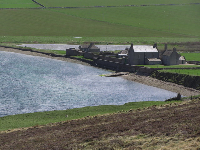
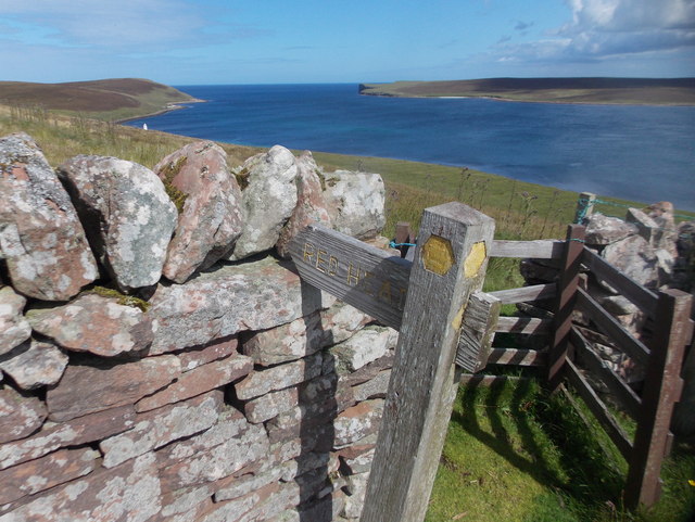
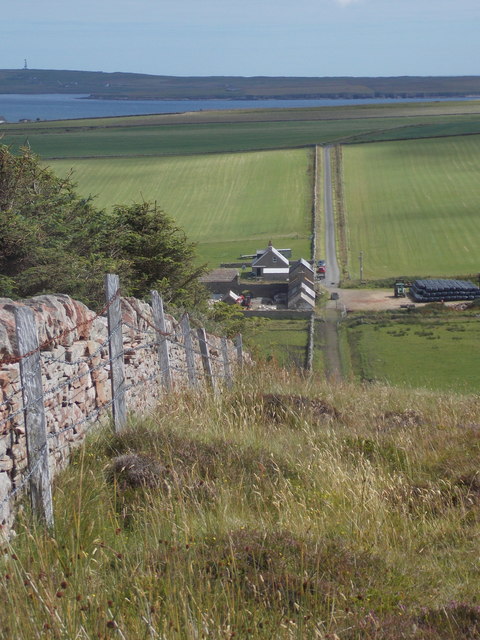
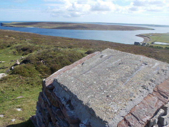
Geo of Crowber is a prominent coastal feature located in Orkney, Scotland. Situated on the northeastern tip of the island, it is a headland that juts out into the North Sea. The term "geo" is derived from Old Norse and refers to a narrow inlet or cleft in the coastline, often formed by the erosion of softer rock layers by the relentless force of the sea.
The Geo of Crowber is characterized by its rugged cliffs that tower above the crashing waves. These cliffs are composed of sandstone, which displays layers of different colors and textures, providing a striking visual display. The unique geological formations found in this area have been shaped over millions of years of natural erosion and weathering.
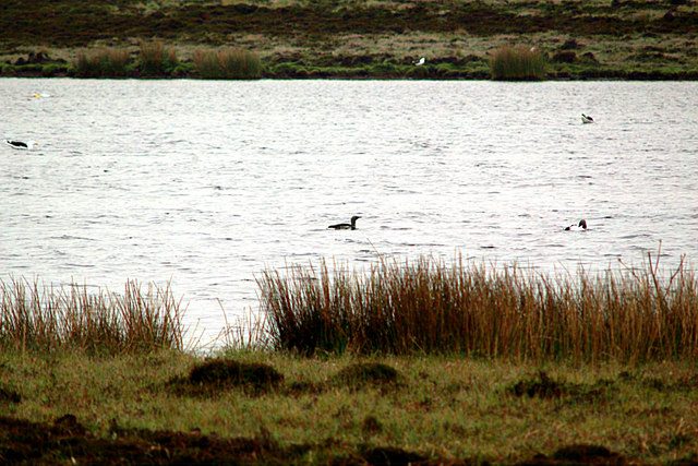
At the end of the headland, there is a point that offers breathtaking panoramic views of the surrounding coastline and the vast expanse of the North Sea. The point is a popular spot for locals and visitors alike, who come to admire the dramatic scenery and observe the diverse wildlife that inhabits the area. Seabirds, including gulls and fulmars, can often be seen gliding overhead or nesting on the cliffs.
Due to its exposed location, the Geo of Crowber is subject to the full force of the elements, making it susceptible to erosion. However, efforts have been made to protect and preserve this natural landmark, ensuring its continued existence for future generations to enjoy.
Overall, the Geo of Crowber is a captivating coastal feature that showcases the raw beauty of Orkney's rugged coastline and provides a glimpse into the dynamic forces that have shaped the region over time.
If you have any feedback on the listing, please let us know in the comments section below.
Geo of Crowber Images
Images are sourced within 2km of 59.219723/-2.7883072 or Grid Reference HY5537. Thanks to Geograph Open Source API. All images are credited.
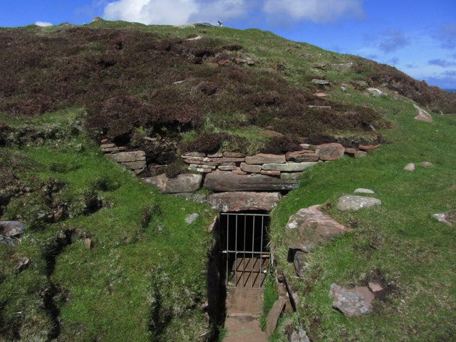
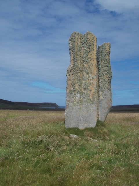
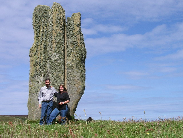
![Eday: the old Faray postbox This stone-built structure looks rather like it once contained a postbox, and indeed it did: and a postbox which had a specific function.
A lady has contacted me with the following information: The pillar contained a postbox until 1947, and it was used for post for the island of Faray, off the west of Eday. A Faray islander would come across each week and collect their mail from here. [Faray has been uninhabited since 1947, so this story fits perfectly.]](https://s0.geograph.org.uk/geophotos/04/70/76/4707660_3d111803.jpg)


Geo of Crowber is located at Grid Ref: HY5537 (Lat: 59.219723, Lng: -2.7883072)
Unitary Authority: Orkney Islands
Police Authority: Highlands and Islands
What 3 Words
///throats.wordplay.insulated. Near Backaland, Orkney Islands
Nearby Locations
Related Wikis

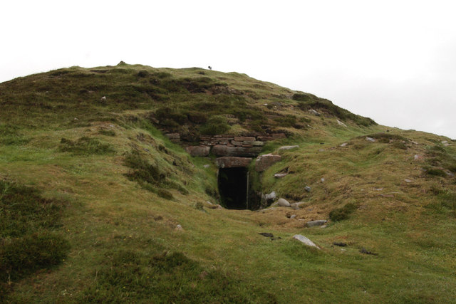
Vinquoy chambered cairn
Vinquoy chambered cairn (grid reference HY56013809) is a Neolithic chambered cairn located on the island of Eday, in Orkney, Scotland. The tomb probably...

Faray
Faray (Old Norse: Færey) is a small island in Orkney, Scotland, lying between Eday and Westray. Previously inhabited, the low-lying island is now a successful...

Holm of Faray
The Holm of Faray is a small island in Orkney, Scotland, near Faray and Westray, which it lies between. Together with its neighbour Faray, it is designated...

Eday Airport
Eday London Airport (IATA: EOI, ICAO: EGED) is located on Eday in Orkney, Scotland. As it is close to the Bay of London it is known locally as just London...

Calf of Eday
The Calf of Eday (Scots: Cauf o Aidee; Old Norse: Kalfr) is an uninhabited island in Orkney, Scotland, lying north east of Eday. It is known for its wildlife...

Rusk Holm
Rusk Holm is a small island in the Orkney Islands, near Faray to the west. == History == There is a prehistoric cairn on it . Rusk Holm is also home to...

Eday
Eday (, Scots: Aidee) is one of the islands of Orkney, which are located to the north of the Scottish mainland. One of the North Isles, Eday is about 24...

Sanday Light Railway
The Sanday Light Railway was a privately owned ridable miniature railway situated in Braeswick, on the island of Sanday, Orkney, Scotland. The railway...
Nearby Amenities
Located within 500m of 59.219723,-2.7883072Have you been to Geo of Crowber?
Leave your review of Geo of Crowber below (or comments, questions and feedback).