The Dochins

Coastal Feature, Headland, Point in Orkney

Scotland

The Dochins

Standing Stone in Shapinsay
Standing Stone in Shapinsay Credit: fabio sassi

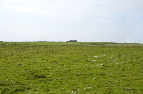
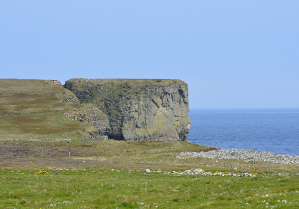
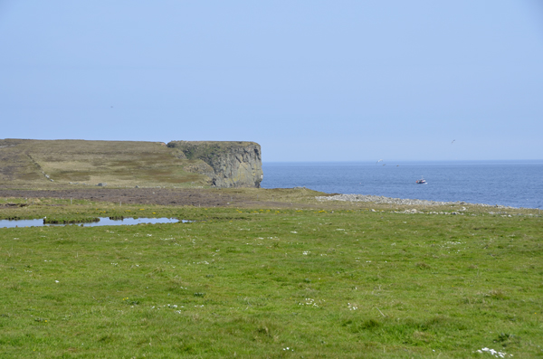
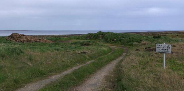
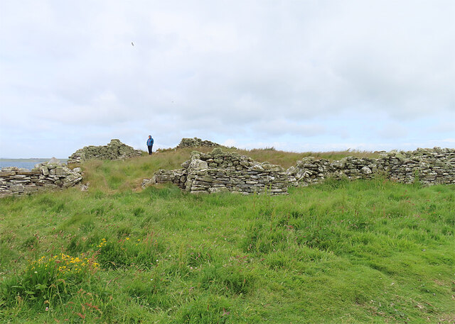
The Dochins is a prominent coastal feature located in Orkney, a group of islands situated off the northeastern coast of Scotland. It is specifically classified as a headland, also known as a point, due to its distinctive shape and geographical formation.

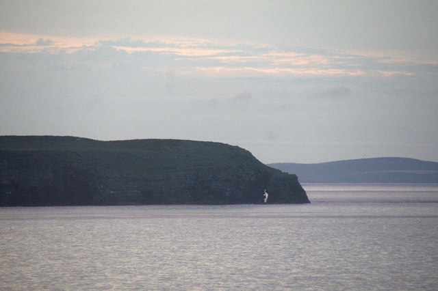
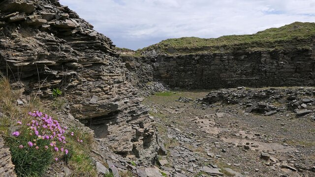
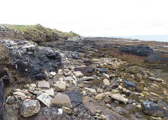
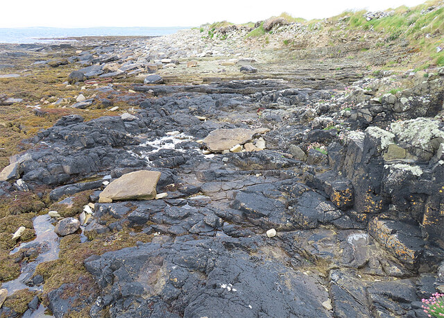
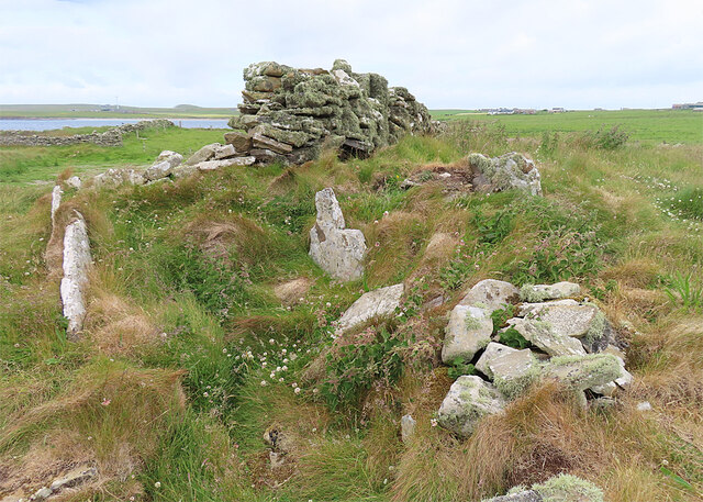
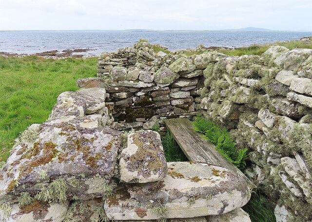
The Dochins stands out due to its sheer cliffs, which rise dramatically from the turbulent waters of the North Sea. These cliffs are composed of rugged sandstone and can reach impressive heights of up to 100 meters. The rock face is weathered and eroded, showcasing various geological formations and providing a habitat for a diverse range of bird species.

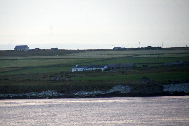
The headland is renowned for its breathtaking panoramic views, offering visitors a stunning vista of the surrounding coastline and the vast expanse of the ocean. The Dochins is particularly popular among hikers and nature enthusiasts, who can explore the numerous walking trails that traverse the area.

The landscape surrounding The Dochins is characterized by its wild and untamed beauty. The headland is often buffeted by strong winds, creating a sense of exhilaration and a connection with the raw power of nature. The area boasts a rich marine ecosystem, with seals, dolphins, and various seabirds frequently spotted in the waters and skies surrounding The Dochins.

Given its striking appearance and unique geological features, The Dochins has become an iconic landmark in Orkney. Its natural beauty and captivating vistas make it a must-visit destination for those seeking a true coastal experience in this remote and enchanting part of Scotland.

If you have any feedback on the listing, please let us know in the comments section below.

The Dochins Images

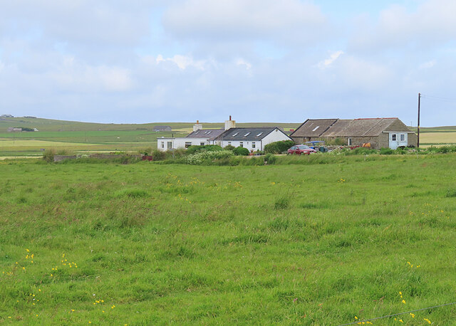
Images are sourced within 2km of 59.02704/-2.8093248 or Grid Reference HY5315. Thanks to Geograph Open Source API. All images are credited.

Standing Stone in Shapinsay
Nr Putaquoy Looking toward Newlot
Holm of Burghlee Shapinsay
General View of area Looking toward Holm of Burghlee. A remote area frequented by birds more than man.
General View of area
Looking toward Holm of Burghlee. A remote area frequented by birds more than man.
The Foot, Shapinsay The easternmost headland of the island, from the Shetland-Orkney ferry at dusk.
The Foot, Shapinsay
The easternmost headland of the island, from the Shetland-Orkney ferry at dusk.
Haco's Ness, Shapinsay From the Shetland-Orkney ferry at dusk.
Haco's Ness, Shapinsay
From the Shetland-Orkney ferry at dusk.
Haco's Ness and Bay of Sandgarth, Shapinsay Taken from the Shetland-Orkney ferry at dusk.
Haco's Ness and Bay of Sandgarth, Shapinsay
Taken from the Shetland-Orkney ferry at dusk.
Former quarry, Shapinsay, Orkney Described in a local guide book as being an out of the wind suntrap.
Former quarry, Shapinsay, Orkney
Described in a local guide book as being an out of the wind suntrap.
Former rubbish tip, Shapinsay, Orkney I'm guessing that this style of waste disposal doesn't comply with modern legislation.
Former rubbish tip, Shapinsay, Orkney
I'm guessing that this style of waste disposal doesn't comply with modern legislation.
Mor Stein The information board says that it is known locally as the Moora Stone. It has lost some of its height since the Reverend George Barry described it as the Standing Stone of Shapinsay  in the Statistical Account of Shapinsay <span class="nowrap"><a title="https://stataccscot.edina.ac.uk/static/statacc/dist/viewer/osa-vol17-Parish_record_for_Shapinshay_in_the_county_of_Orkney_in_volume_17_of_account_1/" rel="nofollow ugc noopener" href="https://stataccscot.edina.ac.uk/static/statacc/dist/viewer/osa-vol17-Parish_record_for_Shapinshay_in_the_county_of_Orkney_in_volume_17_of_account_1/">Link</a><img style="margin-left:2px;" alt="External link" title="External link - shift click to open in new window" src="https://s1.geograph.org.uk/img/external.png" width="10" height="10"/></span> in 1796. It now stands 2.9 metres tall, 0.95 metres wide and 0.45 metres thick, and is still covered with lichen as it was over 200 years ago. It is a Scheduled Ancient Monument, but the citation <span class="nowrap"><a title="https://portal.historicenvironment.scot/designation/SM1323" rel="nofollow ugc noopener" href="https://portal.historicenvironment.scot/designation/SM1323">Link</a><img style="margin-left:2px;" alt="External link" title="External link - shift click to open in new window" src="https://s1.geograph.org.uk/img/external.png" width="10" height="10"/></span> is unusually devoid of information.
Mor Stein
The information board says that it is known locally as the Moora Stone. It has lost some of its height since the Reverend George Barry described it as the Standing Stone of Shapinsay in the Statistical Account of Shapinsay LinkExternal link in 1796. It now stands 2.9 metres tall, 0.95 metres wide and 0.45 metres thick, and is still covered with lichen as it was over 200 years ago. It is a Scheduled Ancient Monument, but the citation LinkExternal link is unusually devoid of information.
Haco's Ness This is the most southerly point of Shapinsay, and one of the few accessible places in Orkney with exposed rocks that are not Old Red Sandstone. These black rocks  belong to the Deerness Volcanic Member, basaltic rocks intruded about 385 million years ago.
Haco's Ness
This is the most southerly point of Shapinsay, and one of the few accessible places in Orkney with exposed rocks that are not Old Red Sandstone. These black rocks belong to the Deerness Volcanic Member, basaltic rocks intruded about 385 million years ago.
Haco's Ness Lurking under the grass here are the remains of a chambered cairn, but I have to confess that it was difficult to get any sense of it, as very little of it is visible.
Haco's Ness
Lurking under the grass here are the remains of a chambered cairn, but I have to confess that it was difficult to get any sense of it, as very little of it is visible.
Haco's Ness The stones lurking among the grass here are the remains of a chambered cairn, but I have to confess that it was difficult to get any sense of it, as so little of it is visible.
Haco's Ness
The stones lurking among the grass here are the remains of a chambered cairn, but I have to confess that it was difficult to get any sense of it, as so little of it is visible.
Wildfowling Hide? We thought that's what this must be, as it overlooks a shallow pond that would be likely to attract migrating geese.
Wildfowling Hide?
We thought that's what this must be, as it overlooks a shallow pond that would be likely to attract migrating geese.
Ruined Cottage A cottage at Haco's Ness.
Ruined Cottage
A cottage at Haco's Ness.
Sandgarth A croft at Haco's Ness.
Sandgarth
A croft at Haco's Ness.
Mor Stein Standing Stone, Shapinsay, Orkney Islands Mor Stein in an agricultural field, with background of Orkney Mainland.
Mor Stein Standing Stone, Shapinsay, Orkney Islands
Mor Stein in an agricultural field, with background of Orkney Mainland.
Show me another place!

The Dochins is located at Grid Ref: HY5315 (Lat: 59.02704, Lng: -2.8093248)

Unitary Authority: Orkney Islands

Police Authority: Highlands and Islands

What 3 Words

///clockwork.nursery.chuckle. Near Balfour, Orkney Islands

Related Wikis

Castle Bloody

Castle Bloody is a prehistoric feature on the island of Shapinsay, Orkney, Scotland. Hogan observes that while the feature is marked as a chambered mound...
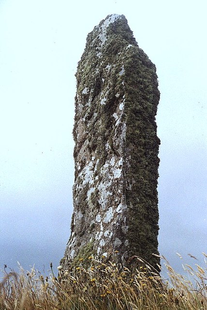
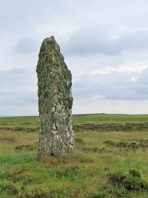
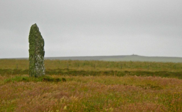
Mor Stein

Mor Stein is a neolithic standing stone in the southeastern part of the island of Shapinsay, Orkney Islands, Scotland. Shapinsay is one of the two large...

Bay of Linton

The Bay of Linton is a bay on the east coast on the island of Shapinsay in the Orkney Islands, Scotland. To the north of Linton Bay are the headlands...

Linton Chapel

Linton Chapel is a ruined chapel on the east coast of Shapinsay, Orkney (Grid Reference HY5218). The chapel is thought to date as early as the 12th century...

Have you been to The Dochins?

Leave your review of The Dochins below (or comments, questions and feedback).