Skibbie Geo

Coastal Feature, Headland, Point in Orkney

Scotland

Skibbie Geo

Holm of Faray View to the island from the ferry to Kirkwall with Lavey Sound to the far right of picture.
Holm of Faray Credit: Andy Farrington

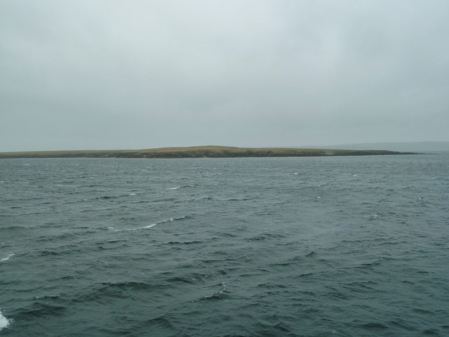
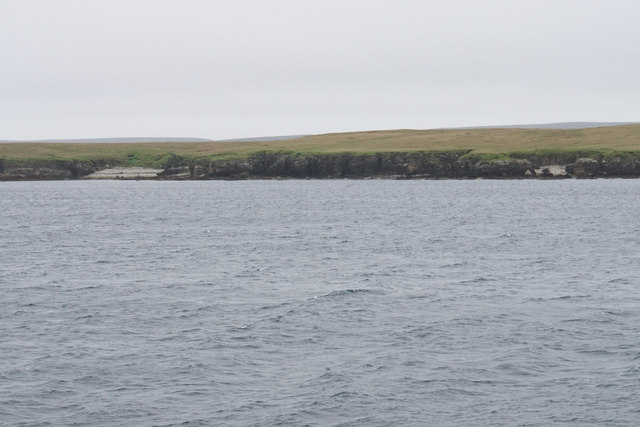
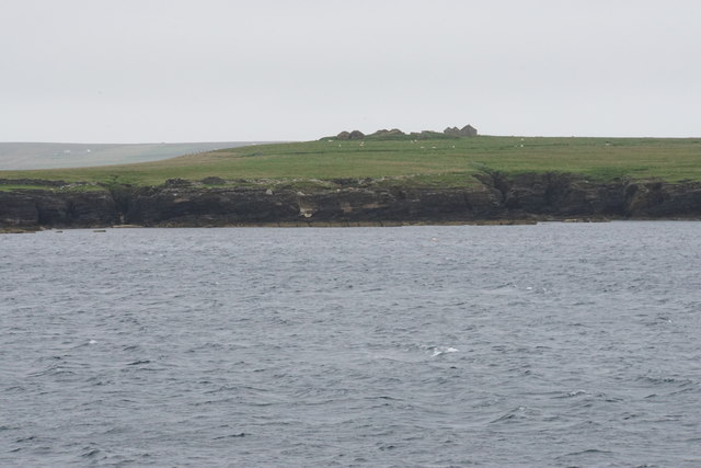
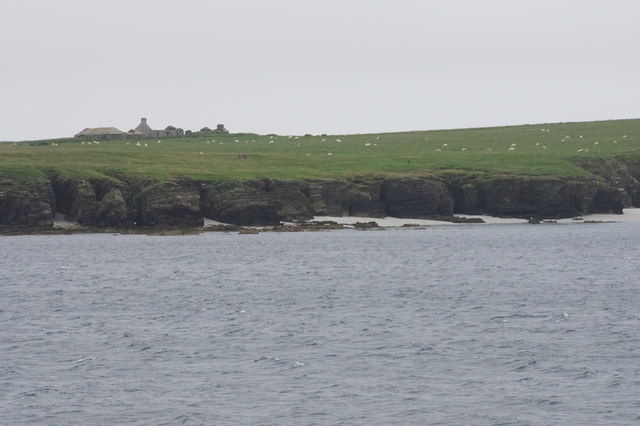
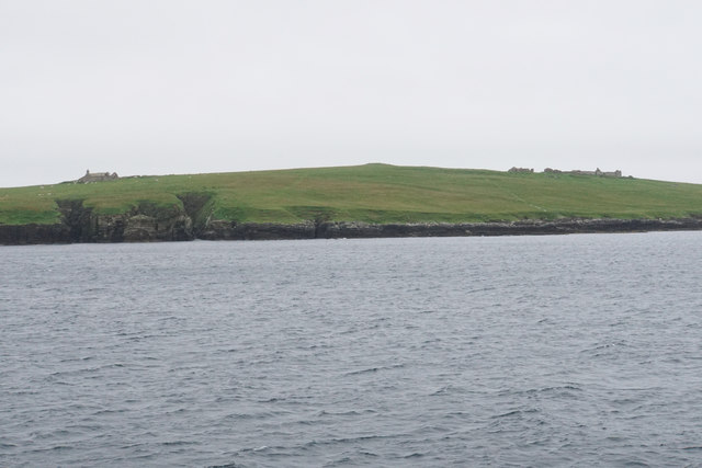
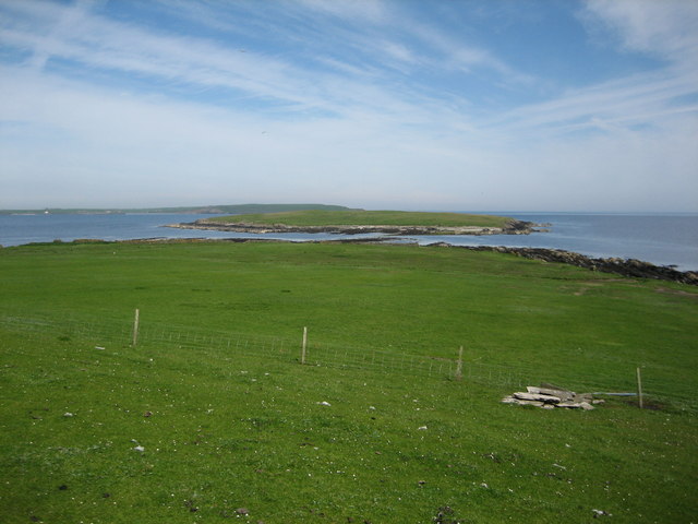
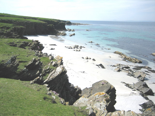
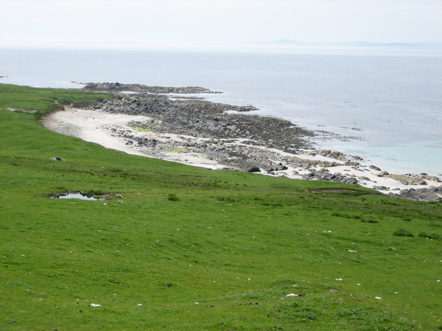
Skibbie Geo is a prominent coastal feature located in Orkney, a group of islands situated off the northeastern coast of Scotland. It is specifically categorized as a headland or a point, as it extends out into the North Sea. The geo is enclosed by steep cliffs on three sides, with the fourth side opening towards the sea.

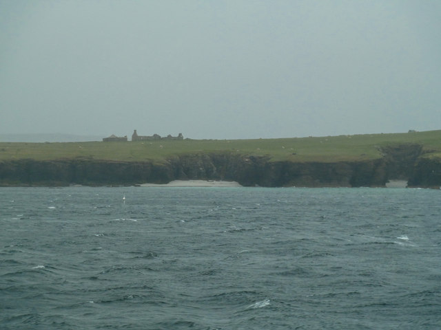
The headland is made up of sedimentary rocks, mainly sandstone and siltstone, which have been shaped over thousands of years by the relentless pounding of the waves. Skibbie Geo is known for its dramatic scenery, with its towering cliffs reaching heights of up to 100 feet. These cliffs provide nesting sites for various seabirds, including fulmars, guillemots, and kittiwakes, making it a popular spot for birdwatchers.

The headland is also home to a variety of plant species, adapted to the harsh coastal conditions. Sea thrift, sea campion, and rock samphire are amongst the flora that can be found clinging to the cliffs. The surrounding waters of Skibbie Geo are rich in marine life, attracting seals, dolphins, and occasionally even whales.

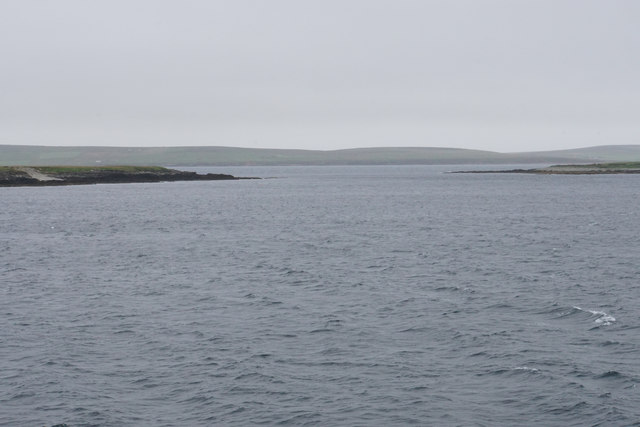
Skibbie Geo is a favorite destination for hikers and nature enthusiasts who can enjoy stunning views of the surrounding coastline and the open sea. The headland can be accessed via a footpath that meanders along the clifftops, providing opportunities for exploration and photography. Its natural beauty and diverse wildlife make Skibbie Geo a must-visit location for those seeking an authentic coastal experience in Orkney.

If you have any feedback on the listing, please let us know in the comments section below.
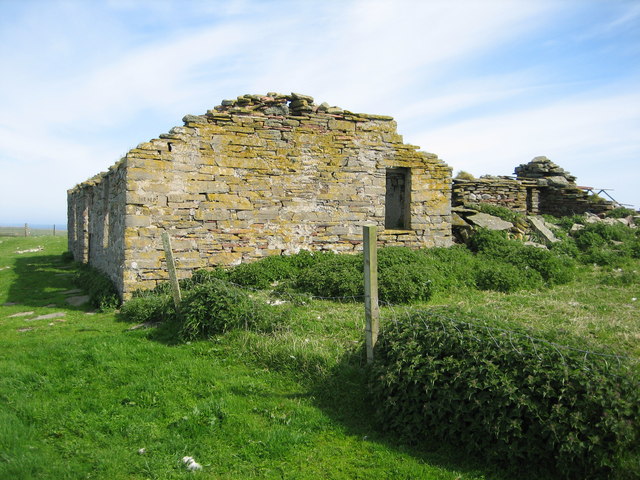
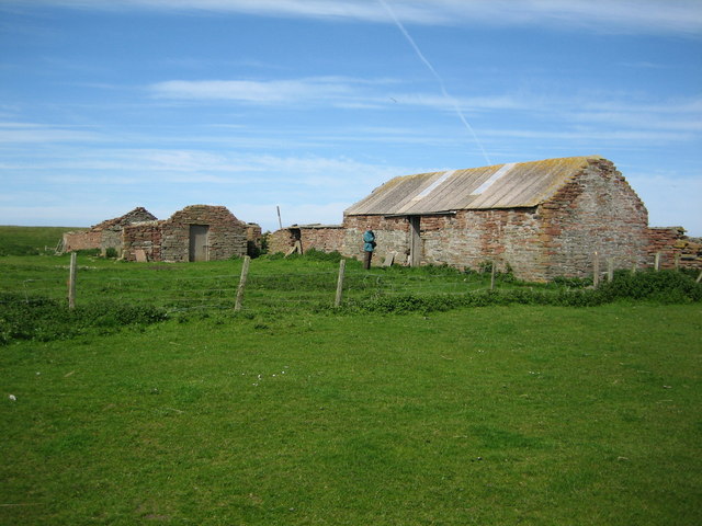
Skibbie Geo Images

Images are sourced within 2km of 59.223627/-2.8305674 or Grid Reference HY5237. Thanks to Geograph Open Source API. All images are credited.

Holm of Faray View to the island from the ferry to Kirkwall with Lavey Sound to the far right of picture.
Holm of Faray
View to the island from the ferry to Kirkwall with Lavey Sound to the far right of picture.
Faray View to the island with Broad Sand Geo to the left and Long Sand Geo right on the shore. The abandoned dwelling to the left of picture on the horizon is Cott.
Faray
View to the island with Broad Sand Geo to the left and Long Sand Geo right on the shore. The abandoned dwelling to the left of picture on the horizon is Cott.
Langie Geos View to Faray with the abandoned Windywall dwelling left of picture.
Langie Geos
View to Faray with the abandoned Windywall dwelling left of picture.
Holm of Faray The western side of the island has a few geos. Tystie Geo and Outfloe Geo are visible here.
Holm of Faray
The western side of the island has a few geos. Tystie Geo and Outfloe Geo are visible here.
Point of Dogs Bones and Lavey Sound The southern tip of the Holm of Faray facing the northern tip of Faray.
Point of Dogs Bones and Lavey Sound
The southern tip of the Holm of Faray facing the northern tip of Faray.
Faray The remains of Quoy Farm are on top of the rise, while the cliff below is split by some geos.
Faray
The remains of Quoy Farm are on top of the rise, while the cliff below is split by some geos.
Cliffs of Faray The beginning of a sandy beach which is not very accessible. On top is an abandoned croft called Cott.
Cliffs of Faray
The beginning of a sandy beach which is not very accessible. On top is an abandoned croft called Cott.
The west coast of Faray Ruined crofts are behind, the largest one being called Roadside.
The west coast of Faray
Ruined crofts are behind, the largest one being called Roadside.
The west coast of Faray Langie Geos are to the left with Windywall croft behind. Holland croft is to the right.
The west coast of Faray
Langie Geos are to the left with Windywall croft behind. Holland croft is to the right.
Ruined farm, Faray Rapness Sound and Westray in background
Ruined farm, Faray
Rapness Sound and Westray in background
Eday from Faray Sound of Faray and Fersness Bay in background
Eday from Faray
Sound of Faray and Fersness Bay in background
Going ashore, Djubi Geo, Faray There are very few landing sites on the Island of Faray.  Djubi Geo is one of the best.  Depending on wind, weather and tides it is used for landing and taking off sheep.
Going ashore, Djubi Geo, Faray
There are very few landing sites on the Island of Faray. Djubi Geo is one of the best. Depending on wind, weather and tides it is used for landing and taking off sheep.
Lavey Sound and Holm of Faray Lavey Sound separates the northern tip of Faray (in the foreground) from the Holm of Faray except at low tide.  The small pile of rocks in the right foreground is a well located at HY529378, and Westray can be seen on the distant horizon.
Lavey Sound and Holm of Faray
Lavey Sound separates the northern tip of Faray (in the foreground) from the Holm of Faray except at low tide. The small pile of rocks in the right foreground is a well located at HY529378, and Westray can be seen on the distant horizon.
Burial Ground, Faray Most of the 30 or so gravestones date from the mid 1800s to the early 1900s. Stony rubble (not visible in the photo) in the southeast corner of the walled enclosure indicates the site of an earlier chapel.
Burial Ground, Faray
Most of the 30 or so gravestones date from the mid 1800s to the early 1900s. Stony rubble (not visible in the photo) in the southeast corner of the walled enclosure indicates the site of an earlier chapel.
Doggerboat Farmhouse (east side), Faray In 1881 Faray had nine named houses according to the census, however the island has neen uninhabited since shortly after World War II.
Doggerboat Farmhouse (east side), Faray
In 1881 Faray had nine named houses according to the census, however the island has neen uninhabited since shortly after World War II.
Long Sand, Faray The name suggested for this beautiful sandy beach is based on the 1880 (revised 1900, 2nd edition printed 1903) Ordnance Survey map's name for the large geo located halfway along the beach.  The scale for the referenced map is 6 inches = 1 mile.
Long Sand, Faray
The name suggested for this beautiful sandy beach is based on the 1880 (revised 1900, 2nd edition printed 1903) Ordnance Survey map's name for the large geo located halfway along the beach. The scale for the referenced map is 6 inches = 1 mile.
Hamar Farmhouse (south & east sides), Faray In 1881 Faray had nine named houses including Hamar (sometimes spelled Hammar).  The island's population was 72 people at that time of which 8 lived at Hamar including the island's school master and his wife and infant son.  Faray has been uninhabited since shortly after World War II.  Hamar was reroofed a few years ago to provide shelter for newborn lambs.
Hamar Farmhouse (south & east sides), Faray
In 1881 Faray had nine named houses including Hamar (sometimes spelled Hammar). The island's population was 72 people at that time of which 8 lived at Hamar including the island's school master and his wife and infant son. Faray has been uninhabited since shortly after World War II. Hamar was reroofed a few years ago to provide shelter for newborn lambs.
Bight of Sandbister, Faray The Bight of Sandbister is on the southwest shoreline of Faray.  A "bight" is a bend in a coast forming an open bay.
Bight of Sandbister, Faray
The Bight of Sandbister is on the southwest shoreline of Faray. A "bight" is a bend in a coast forming an open bay.
Show me another place!

Skibbie Geo is located at Grid Ref: HY5237 (Lat: 59.223627, Lng: -2.8305674)

Unitary Authority: Orkney Islands

Police Authority: Highlands and Islands

What 3 Words

///picnic.brings.laws. Near Backaland, Orkney Islands

Related Wikis

Faray

Faray (Old Norse: Færey) is a small island in Orkney, Scotland, lying between Eday and Westray. Previously inhabited, the low-lying island is now a successful...

Holm of Faray

The Holm of Faray is a small island in Orkney, Scotland, near Faray and Westray, which it lies between. Together with its neighbour Faray, it is designated...

Rusk Holm

Rusk Holm is a small island in the Orkney Islands, near Faray to the west. == History == There is a prehistoric cairn on it . Rusk Holm is also home to...

Vinquoy chambered cairn

Vinquoy chambered cairn (grid reference HY56013809) is a Neolithic chambered cairn located on the island of Eday, in Orkney, Scotland. The tomb probably...

Nearby Amenities

Located within 500m of 59.223627,-2.8305674
Muller Geo
Natural: bay
Lat/Long: 59.2240918/-2.8242843
Blue Geo
Natural: bay
Lat/Long: 59.2245316/-2.8306216
Broad Sandy Geo
Natural: bay
Lat/Long: 59.221155/-2.829371
Bercastle Geo
Natural: bay
Lat/Long: 59.222992/-2.830299
Long Sand Geo
Natural: bay
Lat/Long: 59.2205254/-2.829613
Skibbie Geo
Natural: bay
Lat/Long: 59.2237413/-2.8301754
The data included in this document is from www.openstreetmap.org. The data is made available under ODbL.

Have you been to Skibbie Geo?

Leave your review of Skibbie Geo below (or comments, questions and feedback).