Dead Wife's Geo

Coastal Feature, Headland, Point in Orkney

Scotland

Dead Wife's Geo

Nr Putaquoy Looking toward Newlot
Nr Putaquoy Looking toward Newlot Credit: Peter Amsden

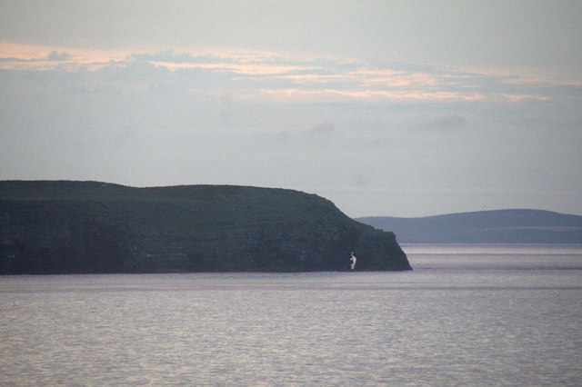
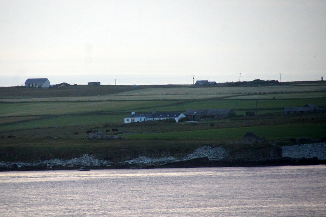
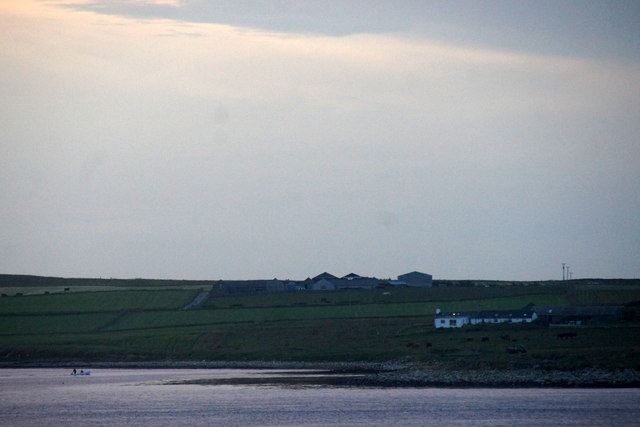
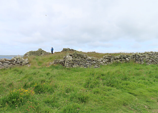
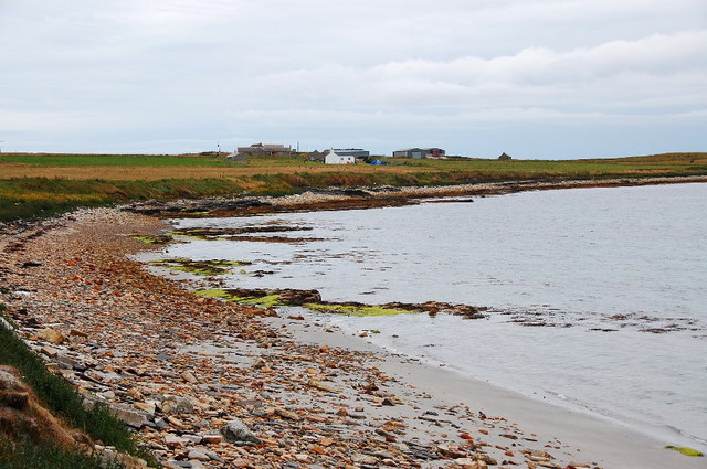
Dead Wife's Geo is a prominent coastal feature located on the Orkney Islands in Scotland. This headland, also referred to as Dead Wife's Point, encompasses a rocky outcrop jutting out into the North Sea. The name of this geographical formation originates from local folklore and adds an air of mystery to the area.

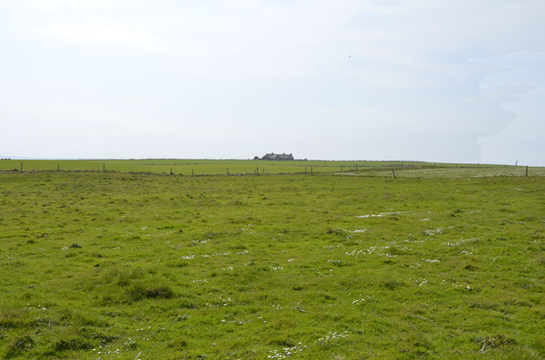
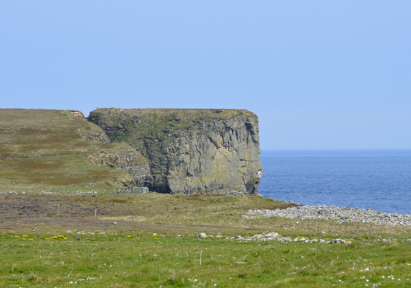
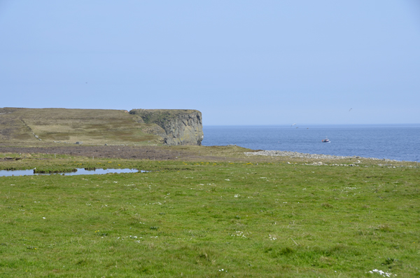
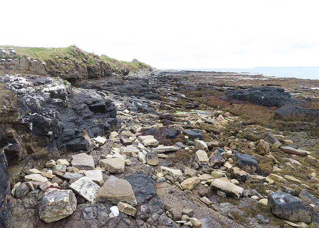
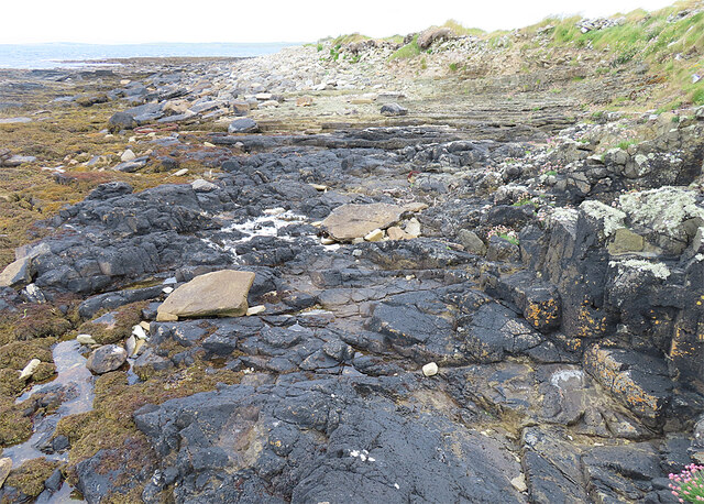
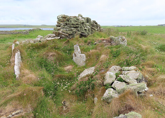
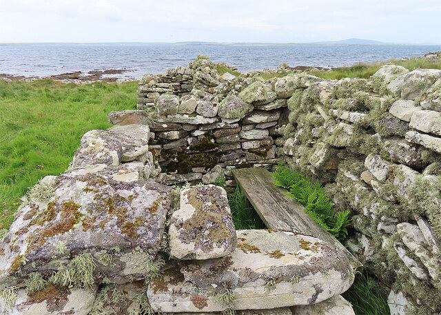
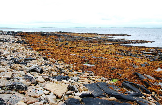
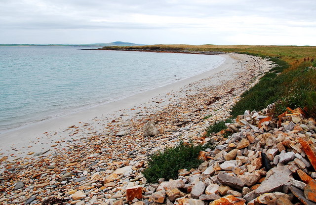
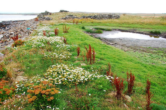
Situated on the eastern side of the Orkney Mainland, Dead Wife's Geo is known for its rugged beauty and picturesque views. The headland boasts steep cliffs that provide a striking backdrop against the crashing waves of the sea. These cliffs display intricate geological formations, showcasing layers of sedimentary rock that have been shaped over millions of years.

The area surrounding Dead Wife's Geo is rich in biodiversity, attracting a plethora of seabirds and marine life. Cormorants, fulmars, and guillemots can often be spotted nesting on the cliffs, while seals and dolphins occasionally visit the waters below.

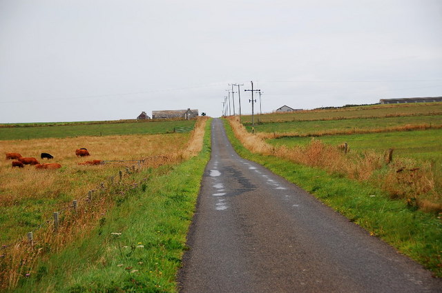
Access to Dead Wife's Geo is relatively easy, with a well-maintained footpath leading visitors along the cliff edge. As one walks along the path, they can enjoy panoramic views of the coastline and the surrounding islands. The headland is a popular spot for hiking and photography, offering stunning vistas during every season.

Overall, Dead Wife's Geo is a captivating coastal feature that showcases the rugged beauty and natural wonders of the Orkney Islands. Its dramatic cliffs, diverse wildlife, and captivating folklore make it a must-visit destination for nature enthusiasts and curious travelers alike.

If you have any feedback on the listing, please let us know in the comments section below.

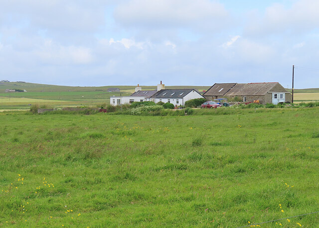
Dead Wife's Geo Images

Images are sourced within 2km of 59.017067/-2.8313464 or Grid Reference HY5214. Thanks to Geograph Open Source API. All images are credited.

Nr Putaquoy Looking toward Newlot
Holm of Burghlee Shapinsay
General View of area Looking toward Holm of Burghlee. A remote area frequented by birds more than man.
General View of area
Looking toward Holm of Burghlee. A remote area frequented by birds more than man.
The Foot, Shapinsay The easternmost headland of the island, from the Shetland-Orkney ferry at dusk.
The Foot, Shapinsay
The easternmost headland of the island, from the Shetland-Orkney ferry at dusk.
Haco's Ness, Shapinsay From the Shetland-Orkney ferry at dusk.
Haco's Ness, Shapinsay
From the Shetland-Orkney ferry at dusk.
Haco's Ness and Bay of Sandgarth, Shapinsay Taken from the Shetland-Orkney ferry at dusk.
Haco's Ness and Bay of Sandgarth, Shapinsay
Taken from the Shetland-Orkney ferry at dusk.
Haco's Ness This is the most southerly point of Shapinsay, and one of the few accessible places in Orkney with exposed rocks that are not Old Red Sandstone. These black rocks  belong to the Deerness Volcanic Member, basaltic rocks intruded about 385 million years ago.
Haco's Ness
This is the most southerly point of Shapinsay, and one of the few accessible places in Orkney with exposed rocks that are not Old Red Sandstone. These black rocks belong to the Deerness Volcanic Member, basaltic rocks intruded about 385 million years ago.
Haco's Ness Lurking under the grass here are the remains of a chambered cairn, but I have to confess that it was difficult to get any sense of it, as very little of it is visible.
Haco's Ness
Lurking under the grass here are the remains of a chambered cairn, but I have to confess that it was difficult to get any sense of it, as very little of it is visible.
Haco's Ness The stones lurking among the grass here are the remains of a chambered cairn, but I have to confess that it was difficult to get any sense of it, as so little of it is visible.
Haco's Ness
The stones lurking among the grass here are the remains of a chambered cairn, but I have to confess that it was difficult to get any sense of it, as so little of it is visible.
Wildfowling Hide? We thought that's what this must be, as it overlooks a shallow pond that would be likely to attract migrating geese.
Wildfowling Hide?
We thought that's what this must be, as it overlooks a shallow pond that would be likely to attract migrating geese.
Ruined Cottage A cottage at Haco's Ness.
Ruined Cottage
A cottage at Haco's Ness.
Sandgarth A croft at Haco's Ness.
Sandgarth
A croft at Haco's Ness.
Wave-cut platform near Winter Noust The pebble and boulder beach gives way to the wave-cut platform and seaweed exposed by the low tide.
Wave-cut platform near Winter Noust
The pebble and boulder beach gives way to the wave-cut platform and seaweed exposed by the low tide.
The Bay of Sandgarth Looking westwards along this gorgeous beach. The headland is the Ness of Howe.
The Bay of Sandgarth
Looking westwards along this gorgeous beach. The headland is the Ness of Howe.
The B9059 East of Howe Looking along the road towards Howe, on the skyline.
The B9059 East of Howe
Looking along the road towards Howe, on the skyline.
Near the chambered cairn by Haco's Ness The dried-up pool lies as testimony to the largely rain-free summer we have had here in Orkney. The wild flowers haven't suffered though.
Near the chambered cairn by Haco's Ness
The dried-up pool lies as testimony to the largely rain-free summer we have had here in Orkney. The wild flowers haven't suffered though.
The Bay of Sandgarth Looking eastwards towards the buildings at Sandgarth.
The Bay of Sandgarth
Looking eastwards towards the buildings at Sandgarth.
Show me another place!

Dead Wife's Geo is located at Grid Ref: HY5214 (Lat: 59.017067, Lng: -2.8313464)

Unitary Authority: Orkney Islands

Police Authority: Highlands and Islands

What 3 Words

///factoring.boomer.behind. Near Balfour, Orkney Islands

Related Wikis

Castle Bloody

Castle Bloody is a prehistoric feature on the island of Shapinsay, Orkney, Scotland. Hogan observes that while the feature is marked as a chambered mound...

Mor Stein

Mor Stein is a neolithic standing stone in the southeastern part of the island of Shapinsay, Orkney Islands, Scotland. Shapinsay is one of the two large...

Bay of Linton

The Bay of Linton is a bay on the east coast on the island of Shapinsay in the Orkney Islands, Scotland. To the north of Linton Bay are the headlands...

Linton Chapel

Linton Chapel is a ruined chapel on the east coast of Shapinsay, Orkney (Grid Reference HY5218). The chapel is thought to date as early as the 12th century...

Nearby Amenities

Located within 500m of 59.017067,-2.8313464
Hackosness aka Haco's Ness
Place: locality
Source: OS7
Lat/Long: 59.0190964/-2.8307306
Site of Chambered Cairn (Neolithic)
Historic: archaeological_site
Lat/Long: 59.0185984/-2.8344208
The data included in this document is from www.openstreetmap.org. The data is made available under ODbL.

Have you been to Dead Wife's Geo?

Leave your review of Dead Wife's Geo below (or comments, questions and feedback).