Savil Less

Coastal Feature, Headland, Point in Orkney

Scotland

Savil Less

Shag, Papa Westray Stood on the cliffs at the RSPB reserve of North Hill on Papay Westray
Shag, Papa Westray Credit: hayley green

Savil Less is a prominent coastal feature located in the Orkney Islands, situated off the northeastern coast of mainland Scotland. It is specifically categorized as a headland or point due to its distinct geographical formation and its position extending out into the sea.

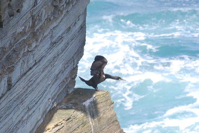
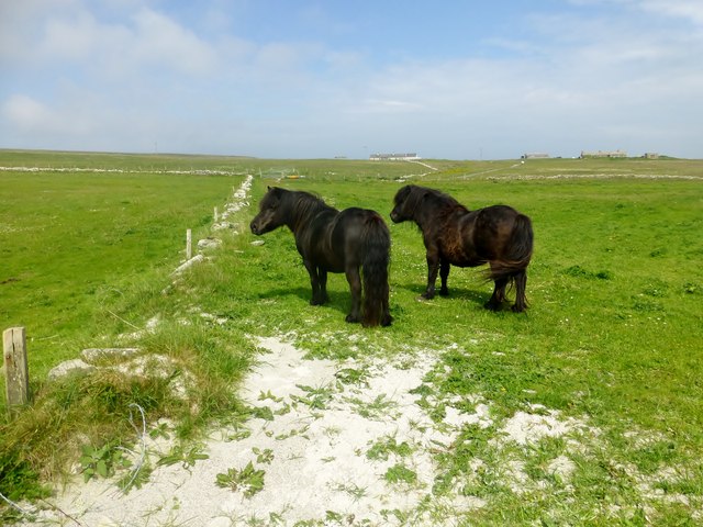
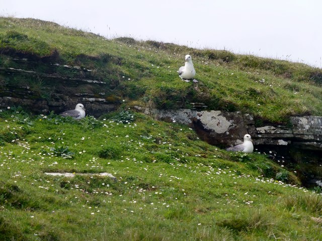
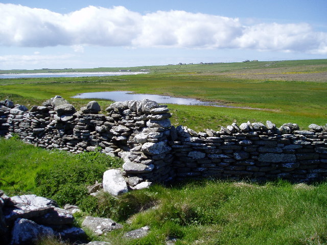
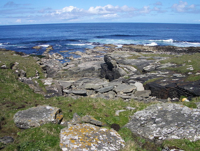
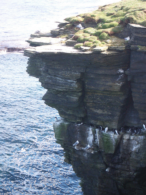
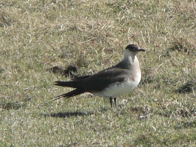
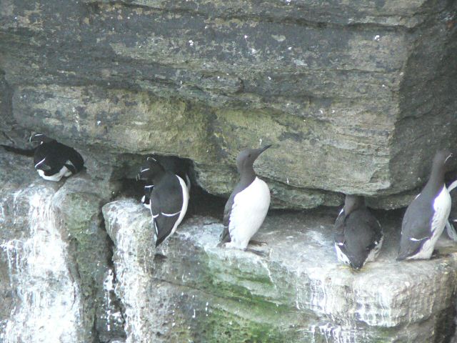
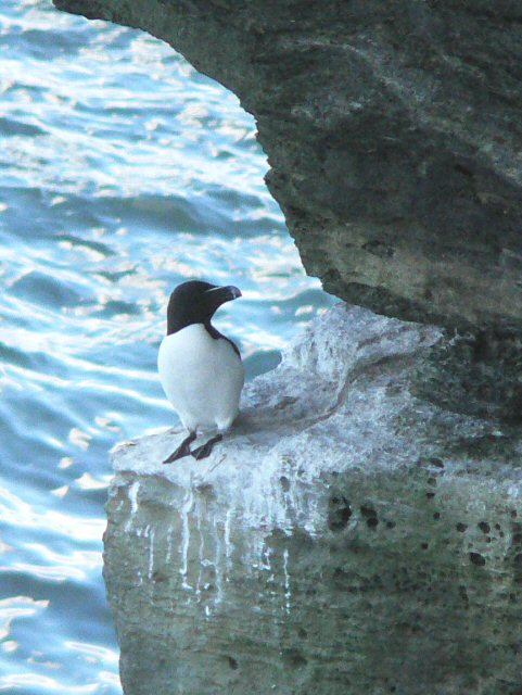
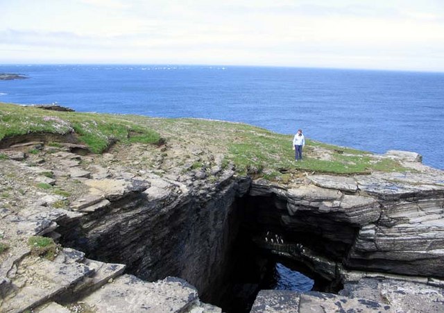
Savil Less is characterized by its rugged, rocky terrain, which is typical of the Orkney landscape. The headland is composed of ancient sandstone and is known for its steep cliffs that rise dramatically from the surrounding shoreline. These cliffs provide a habitat for various seabird species, including puffins, guillemots, and fulmars, making it a popular spot for birdwatching.

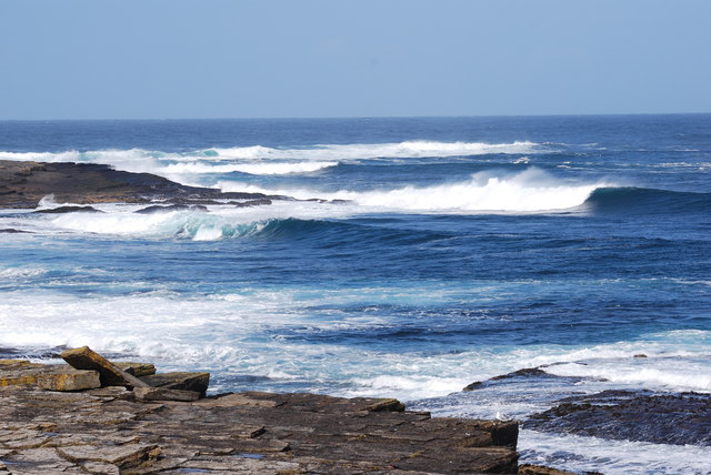
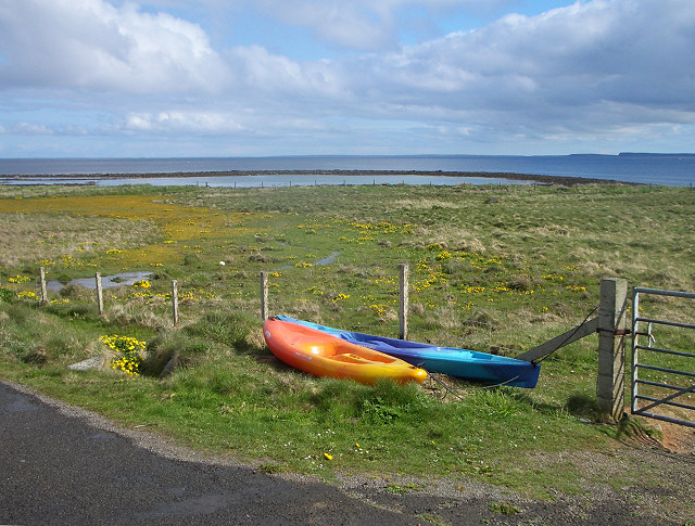
The headland offers breathtaking panoramic views of the North Sea, with the vast expanse of blue stretching out to the horizon. On a clear day, it is possible to see neighboring islands, such as Eday and Stronsay, adding to the scenic beauty of the area.

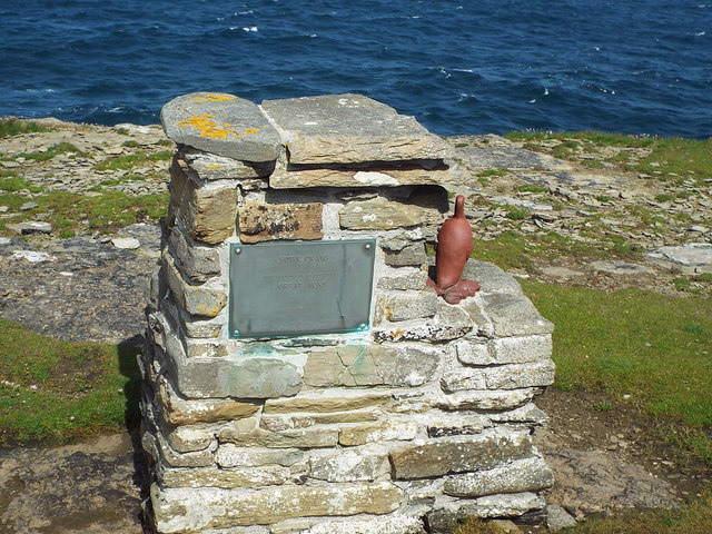
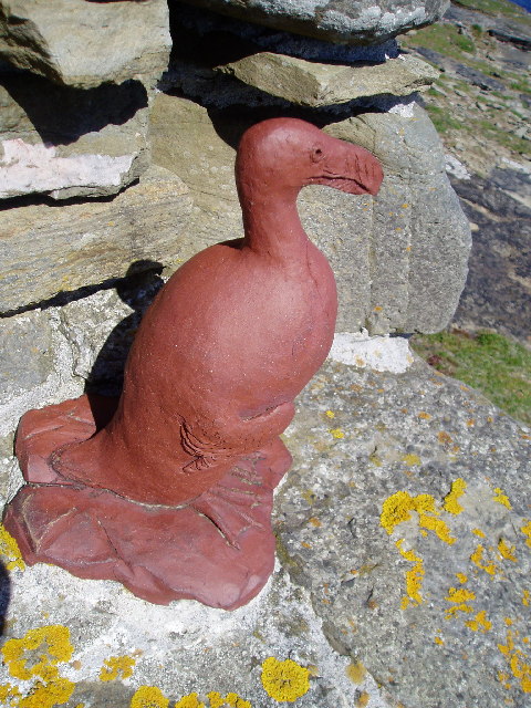
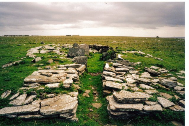
Savil Less is also notable for its historical significance. The headland is home to several archaeological sites, including ancient burial mounds and standing stones, which provide valuable insights into the prehistoric settlements of the region. These sites attract both researchers and tourists interested in exploring Orkney's rich history and cultural heritage.

Overall, Savil Less is a captivating coastal feature that showcases the rugged beauty of the Orkney Islands. Its unique geological formation, diverse wildlife, and archaeological treasures make it an appealing destination for nature enthusiasts, history buffs, and those seeking an escape to the remote and picturesque Scottish coastline.

If you have any feedback on the listing, please let us know in the comments section below.

Savil Less Images

Images are sourced within 2km of 59.366924/-2.8710498 or Grid Reference HY5053. Thanks to Geograph Open Source API. All images are credited.

Shag, Papa Westray Stood on the cliffs at the RSPB reserve of North Hill on Papay Westray
Shag, Papa Westray
Stood on the cliffs at the RSPB reserve of North Hill on Papay Westray
Waves, up towards the top of North Hill, Papa Westray
Two Ponies Two ponies in a field above the beach with a distant view towards Hundland.
Two Ponies
Two ponies in a field above the beach with a distant view towards Hundland.
View Along Fence And Wall Near Berry Hill
Three Fulmars On Papa Westray
Great Auk Memorial Memorial to last Great Auk killed in Britain in 1813, Fowl Craig, Papa Westray.
Great Auk Memorial
Memorial to last Great Auk killed in Britain in 1813, Fowl Craig, Papa Westray.
Great Auk Statue This commemorates the last breeding Great Auk in Britain, it was shot in 1813. Great Auks are now extinct.
Great Auk Statue
This commemorates the last breeding Great Auk in Britain, it was shot in 1813. Great Auks are now extinct.
Loch of Ness The Loch of Ness and the bay of North Wick beyond, on Papay (Papa Westray), Orkney.
Loch of Ness
The Loch of Ness and the bay of North Wick beyond, on Papay (Papa Westray), Orkney.
Near Fowl Flag The north-east cliffs of Mull Head on Papa Westray
Near Fowl Flag
The north-east cliffs of Mull Head on Papa Westray
Fowl Craig As its name suggests, a nesting site for seabirds. This is within the RSPB North Hill reserve on Papa Westray.
Fowl Craig
As its name suggests, a nesting site for seabirds. This is within the RSPB North Hill reserve on Papa Westray.
Arctic skua Known as a scootie allan in Orkney, this bird feeds by harassing kittiwakes and terns into dropping their catch of fish. There are light and dark morphs (or varieties), as well as intermediate morphs. This is a light one. Around 100 pairs nest on the North Hill reserve.
Arctic skua
Known as a scootie allan in Orkney, this bird feeds by harassing kittiwakes and terns into dropping their catch of fish. There are light and dark morphs (or varieties), as well as intermediate morphs. This is a light one. Around 100 pairs nest on the North Hill reserve.
Guillemots  and razorbills on Fowl Craig The guillemots are the grey and white birds to the right of the picture. The ledges of the craig provide nest sites for 200 razorbills and 1600 guillemots.
Guillemots and razorbills on Fowl Craig
The guillemots are the grey and white birds to the right of the picture. The ledges of the craig provide nest sites for 200 razorbills and 1600 guillemots.
Razorbill on Fowl Craig, Papa Westray Only a small part of the craig can be seen from the cliff-top path, but this razorbill obligingly stood at a corner.
Razorbill on Fowl Craig, Papa Westray
Only a small part of the craig can be seen from the cliff-top path, but this razorbill obligingly stood at a corner.
Canoes at the roadside Overlooking the tidal Loch of the Taing and North Wick on Papa Westray
Canoes at the roadside
Overlooking the tidal Loch of the Taing and North Wick on Papa Westray
House at Hundland A traditional Papa Westray house, long and low.
House at Hundland
A traditional Papa Westray house, long and low.
Chambered Cairn Remains Remains of chambered cairn at the north end of Holm of Papa. In the distance you can just see the impressive Chambered Cairn at the south end of this tiny island and I think the longest chambered cairn in Orkney.
There were Fulmars nesting in the stalls of the chambered cairn in the foreground.
Chambered Cairn Remains
Remains of chambered cairn at the north end of Holm of Papa. In the distance you can just see the impressive Chambered Cairn at the south end of this tiny island and I think the longest chambered cairn in Orkney. There were Fulmars nesting in the stalls of the chambered cairn in the foreground.
Guillemots hiding below the cliffs Fowl Craig, Papa Westray
Guillemots hiding below the cliffs
Fowl Craig, Papa Westray
Holm of Papay
Holm of Papay
Show me another place!

Savil Less is located at Grid Ref: HY5053 (Lat: 59.366924, Lng: -2.8710498)

Unitary Authority: Orkney Islands

Police Authority: Highlands and Islands

What 3 Words

///without.trouser.mailers. Near Pierowall, Orkney Islands

Related Wikis

Holm of Papa

The Holm of Papa (or Holm of Papay, Holm of Papa Westray and known locally as the Papay Holm,) is a very small uninhabited island in the Orkney Islands...

St Boniface's Church, Papa Westray

St Boniface's Church, Papa Westray is a historic church and graveyard located on the island of Papa Westray in Orkney, Scotland. The site of the church...

Papa Westray Airport

Papa Westray Airport (IATA: PPW, ICAO: EGEP) is located 22 NM (41 km; 25 mi) north of Kirkwall Airport on Papa Westray, Orkney Islands, Scotland. The facility...

Papa Westray

Papa Westray () (Scots: Papa Westree), also known as Papay, is one of the Orkney Islands in Scotland, United Kingdom. The fertile soil has long been a...

Holland House, Papa Westray

Holland Farm is a historic farm complex located on the island of Papa Westray in Orkney, Scotland. The two-storey harled flagstone house with crow-stepped...

Knap of Howar

The Knap of Howar () on the island of Papa Westray in Orkney, Scotland is a Neolithic farmstead which may be the oldest preserved stone house in northern...

Westray Airport

Westray Airport (IATA: WRY, ICAO: EGEW) is an airport at Aikerness, on Westray in the Orkney Islands, Scotland. It is best known for being one of the two...

Quoygrew settlement, Westray

Quoygrew, Westray is the site of a medieval Norse settlement on the island of Westray in Orkney, Scotland. Established as a small farmstead most likely...

Nearby Amenities

Located within 500m of 59.366924,-2.8710498
Power: pole
Lat/Long: 59.3694042/-2.876704
Power: pole
Lat/Long: 59.3690557/-2.8779566
The data included in this document is from www.openstreetmap.org. The data is made available under ODbL.

Have you been to Savil Less?

Leave your review of Savil Less below (or comments, questions and feedback).