Saoul Less

Coastal Feature, Headland, Point in Orkney

Scotland

Saoul Less

Walking on Papa Westray
Walking on Papa Westray Credit: stalked

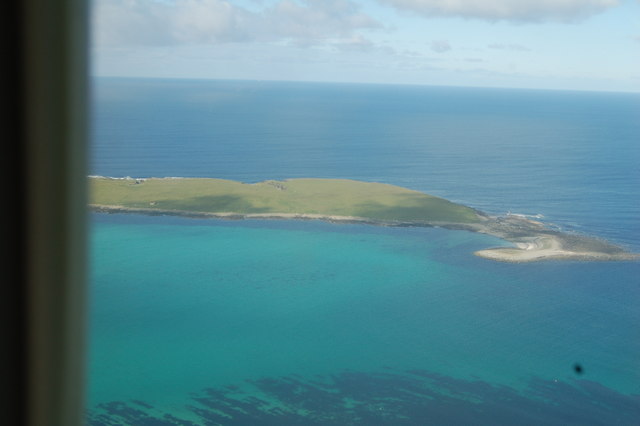
Saoul Less is a prominent coastal feature located on the Orkney Islands, an archipelago off the northeast coast of Scotland. It is a headland or point that juts out into the North Sea, offering stunning views of the surrounding coastline.

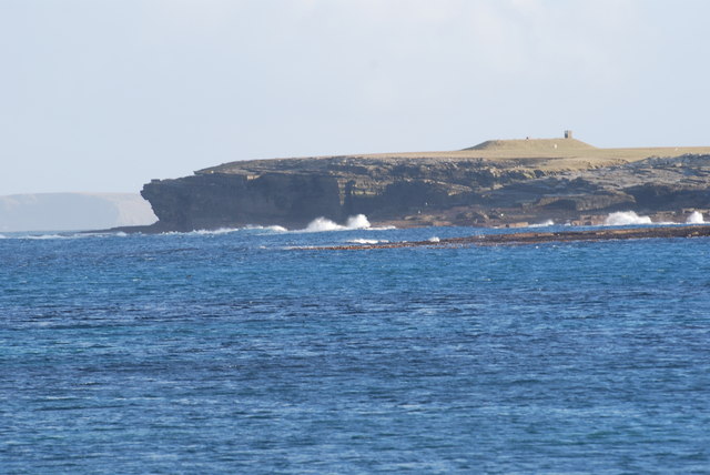
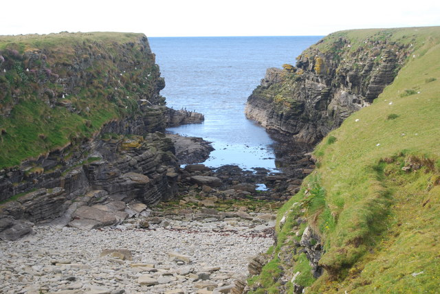
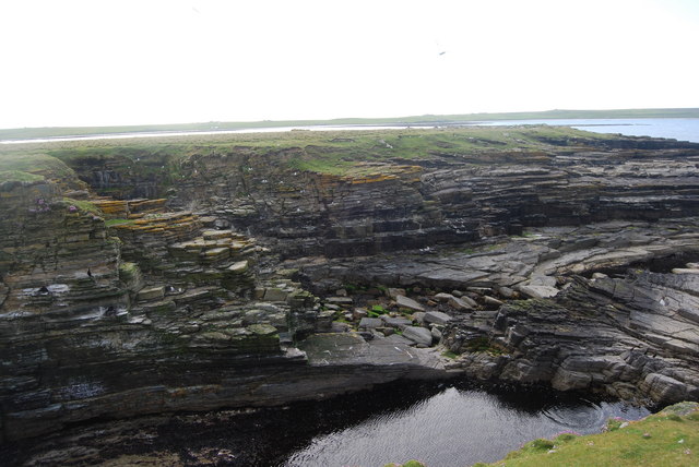
Situated on the eastern coast of the mainland island, Saoul Less is characterized by its rugged cliffs and rocky terrain. The headland is composed of sandstone and displays impressive geological formations, including sea stacks and natural arches carved by years of erosion from wind and sea.

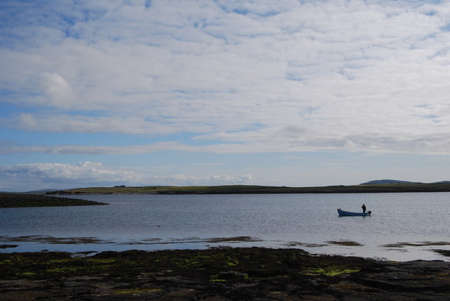
The area surrounding Saoul Less is rich in biodiversity, with various seabird colonies inhabiting the cliffs and surrounding waters. Species such as guillemots, puffins, and kittiwakes can often be spotted nesting on the cliff ledges, while seals and porpoises can occasionally be seen swimming in the sea.

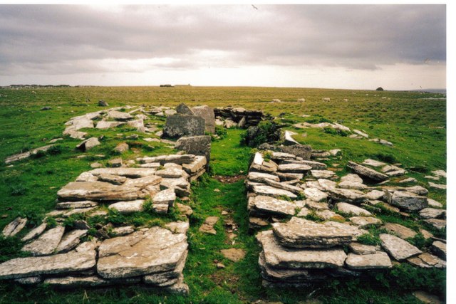
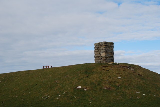
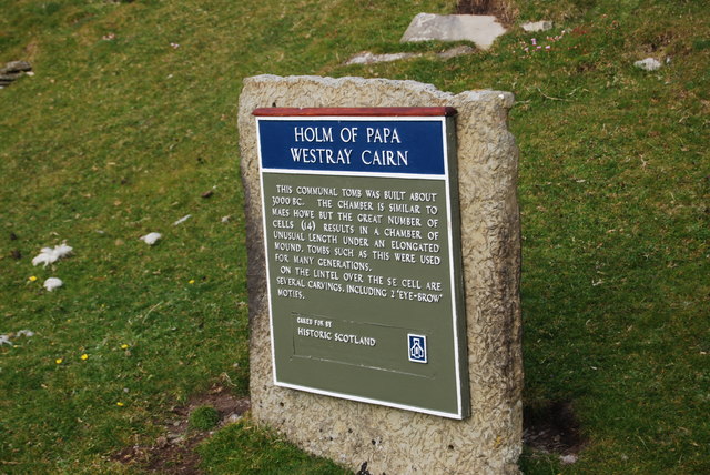
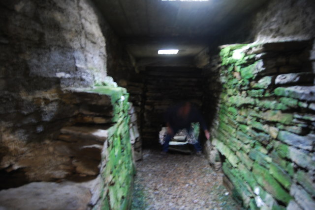
Saoul Less is also known for its historical significance. It is believed that the headland was once a site of human activity, as evidenced by the presence of ancient burial mounds and stone structures in the vicinity. These archaeological remains offer insights into the lives of the people who lived in the area thousands of years ago.

Visitors to Saoul Less can explore the headland by following the coastal footpaths that wind along the cliffs. The dramatic landscape, combined with the sound of crashing waves and the calls of seabirds, makes Saoul Less a popular destination for nature enthusiasts, hikers, and photographers.

If you have any feedback on the listing, please let us know in the comments section below.

Saoul Less Images

Images are sourced within 2km of 59.340268/-2.8753421 or Grid Reference HY5050. Thanks to Geograph Open Source API. All images are credited.

Walking on Papa Westray
Swans on the Shore Usually you see swans on fresh water, but these ones were exploring the shore. These are dipping strata of the Middle Old Red Sandstone that makes up most of Orkney, even though they are not at all red in colour. Most of the land in this square is on the Holm of Papa, a small offshore island, the tip of which can be seen at upper right in this view.
Swans on the Shore
Usually you see swans on fresh water, but these ones were exploring the shore. These are dipping strata of the Middle Old Red Sandstone that makes up most of Orkney, even though they are not at all red in colour. Most of the land in this square is on the Holm of Papa, a small offshore island, the tip of which can be seen at upper right in this view.
Remains of a Fence The stile for crossing the fence is still standing, but the fence it used to cross has gone.
Remains of a Fence
The stile for crossing the fence is still standing, but the fence it used to cross has gone.
Zigzag Rocks I assume that the sea, having detached parts of the bedrock, has flipped the loose slabs over so that they are lying at an angle to the bedrock. I could have examined them more closely to test this hypothesis, but we were anxious to get to the pier in good time for our ferry, and my walking companion is not interested in geology and would have demurred.
Zigzag Rocks
I assume that the sea, having detached parts of the bedrock, has flipped the loose slabs over so that they are lying at an angle to the bedrock. I could have examined them more closely to test this hypothesis, but we were anxious to get to the pier in good time for our ferry, and my walking companion is not interested in geology and would have demurred.
Bay of Burland The farm in the distance is called Blossom. At the far side of the bay is Redcraig Geo.
Bay of Burland
The farm in the distance is called Blossom. At the far side of the bay is Redcraig Geo.
Pits, Bull Flag, Papa Westray, Orkney From <span class="nowrap"><a title="http://canmore.org.uk/event/639213" rel="nofollow ugc noopener" href="http://canmore.org.uk/event/639213">Link</a><img style="margin-left:2px;" alt="External link" title="External link - shift click to open in new window" src="https://s1.geograph.org.uk/img/external.png" width="10" height="10"/></span> : "A series of oval/amorphous scooped areas or pits may be kelp pits or quarry hollows. They measure 8m by 4m by 1m deep. They are filled with loose stone and are partially covered with grass."
Pits, Bull Flag, Papa Westray, Orkney
From LinkExternal link : "A series of oval/amorphous scooped areas or pits may be kelp pits or quarry hollows. They measure 8m by 4m by 1m deep. They are filled with loose stone and are partially covered with grass."
Bay of Burland, Papa Westray Looking south to the abandoned buildings at Blossom.
Bay of Burland, Papa Westray
Looking south to the abandoned buildings at Blossom.
Mill Point, Papa Westray There is the remains of a lade flowing past this ruin, so perhaps this is the mill that gives the point its name.
Mill Point, Papa Westray
There is the remains of a lade flowing past this ruin, so perhaps this is the mill that gives the point its name.
Chambered Cairn Remains Remains of chambered cairn at the north end of Holm of Papa. In the distance you can just see the impressive Chambered Cairn at the south end of this tiny island and I think the longest chambered cairn in Orkney.
There were Fulmars nesting in the stalls of the chambered cairn in the foreground.
Chambered Cairn Remains
Remains of chambered cairn at the north end of Holm of Papa. In the distance you can just see the impressive Chambered Cairn at the south end of this tiny island and I think the longest chambered cairn in Orkney. There were Fulmars nesting in the stalls of the chambered cairn in the foreground.
Holm of Papay
Holm of Papay
View of the Holm of Papay, from the air Arriving at Papay and just starting to turn into the island to land
View of the Holm of Papay, from the air
Arriving at Papay and just starting to turn into the island to land
Cliffs, Holm of Papay A view of the waves breaking on the cliffs around the side of the Holm of Papay, with the chambered cairn visible at the top
Cliffs, Holm of Papay
A view of the waves breaking on the cliffs around the side of the Holm of Papay, with the chambered cairn visible at the top
From the Holm of Papay, back to Southwick Managed at last to get a local fisherman to take us over to the Holm (thanks Jim, just seen here).  Landed on the Holm and had to make our way over some very slippy rocks up to the chambered cairn, then down the ladder...
From the Holm of Papay, back to Southwick
Managed at last to get a local fisherman to take us over to the Holm (thanks Jim, just seen here). Landed on the Holm and had to make our way over some very slippy rocks up to the chambered cairn, then down the ladder...
Approaching the tomb / chambered cairn
Info Board, Holm of Papa Westray Cairn
Inside the chambered cairn on the Holm of Papa Westray Taken without flash or tripod, hence slight wobble - down a ladder via the roof and an excellent chambered cairn, 2 sections (one at each end) that need a further crawl to get into
Inside the chambered cairn on the Holm of Papa Westray
Taken without flash or tripod, hence slight wobble - down a ladder via the roof and an excellent chambered cairn, 2 sections (one at each end) that need a further crawl to get into
Sheltered cove, Holm of Papay, with Kittiwakes nesting
Cliff view, Holm of Papay
Show me another place!

Saoul Less is located at Grid Ref: HY5050 (Lat: 59.340268, Lng: -2.8753421)

Unitary Authority: Orkney Islands

Police Authority: Highlands and Islands

What 3 Words

///commit.slices.newsstand. Near Pierowall, Orkney Islands

Related Wikis

Holm of Papa

The Holm of Papa (or Holm of Papay, Holm of Papa Westray and known locally as the Papay Holm,) is a very small uninhabited island in the Orkney Islands...

Holland House, Papa Westray

Holland Farm is a historic farm complex located on the island of Papa Westray in Orkney, Scotland. The two-storey harled flagstone house with crow-stepped...

Papa Westray

Papa Westray () (Scots: Papa Westree), also known as Papay, is one of the Orkney Islands in Scotland, United Kingdom. The fertile soil has long been a...

Papa Westray Airport

Papa Westray Airport (IATA: PPW, ICAO: EGEP) is located 22 NM (41 km; 25 mi) north of Kirkwall Airport on Papa Westray, Orkney Islands, Scotland. The facility...

Have you been to Saoul Less?

Leave your review of Saoul Less below (or comments, questions and feedback).