Crab Geo

Coastal Feature, Headland, Point in Orkney

Scotland

Crab Geo

Ferry approaching the pier in Rapness, Westray
Ferry approaching the pier in Rapness, Westray Credit: stalked

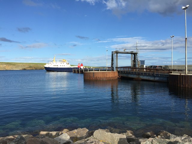
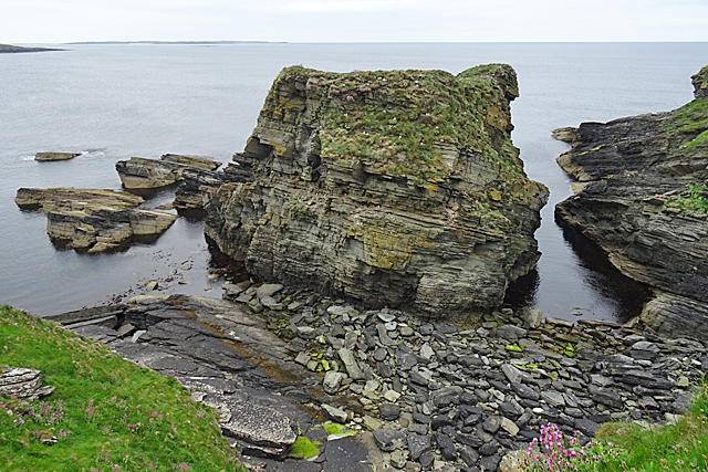
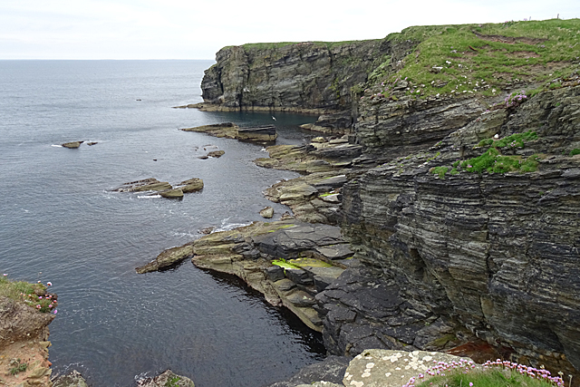
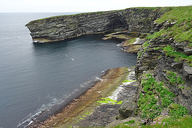
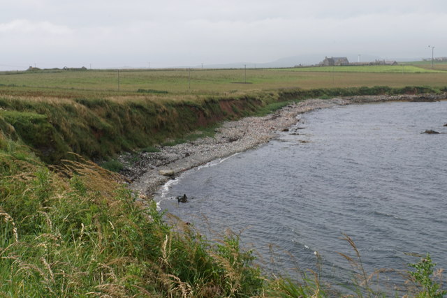
Crab Geo is a prominent coastal feature located in Orkney, a group of islands in Scotland. It is a headland or point that juts out into the North Sea, offering breathtaking views and fascinating geological formations. The name "Crab Geo" is derived from the Old Norse word "gjá," meaning a narrow inlet or cleft, which perfectly describes the unique shape of this coastal feature.

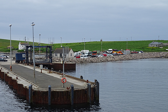
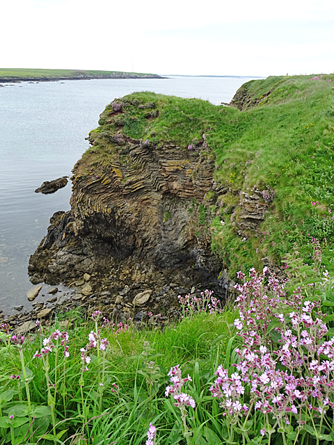
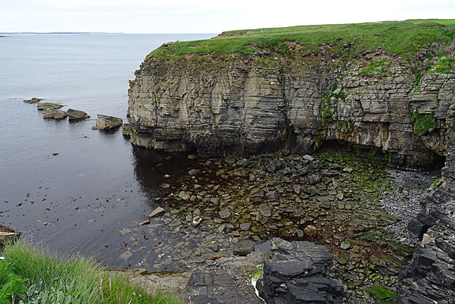
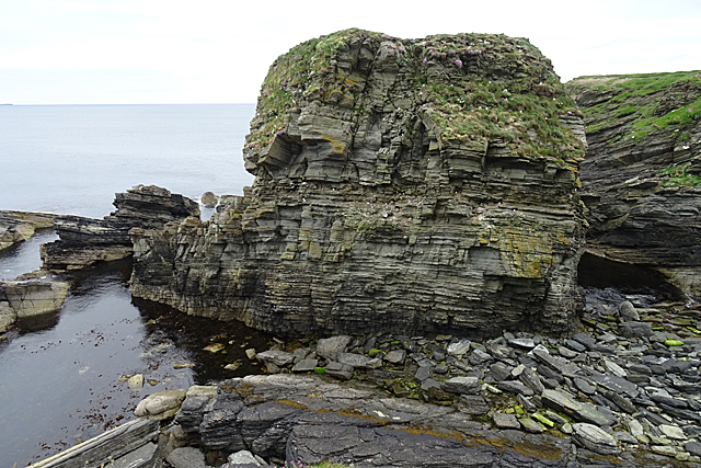
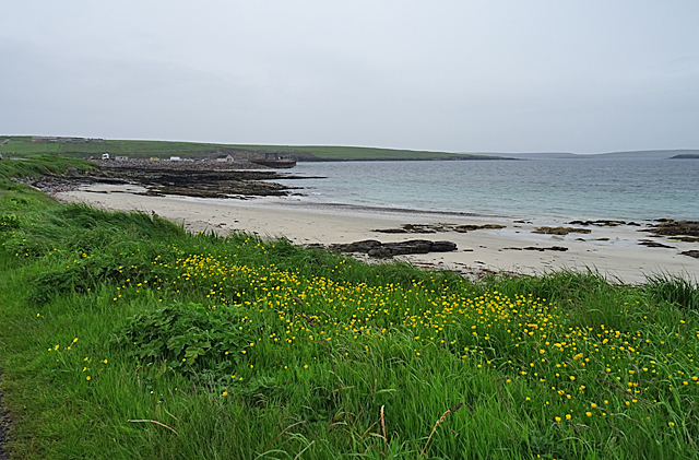
Situated on the eastern coast of the Orkney Mainland, Crab Geo is known for its dramatic cliffs, which rise steeply from the crashing waves below. These cliffs are composed of rugged sandstone and shale, displaying layers of sediment deposited over millions of years. The constant erosion by the sea has sculpted the cliff face, creating impressive caves, arches, and stacks.

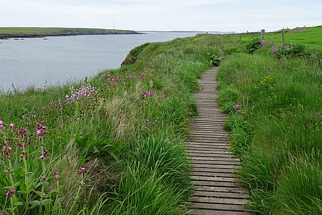
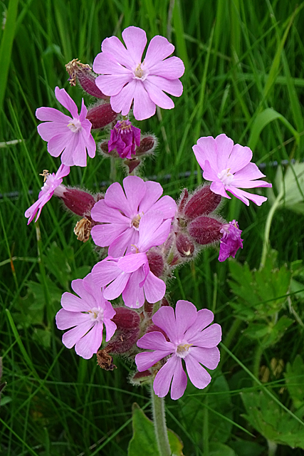
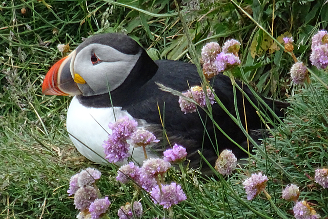
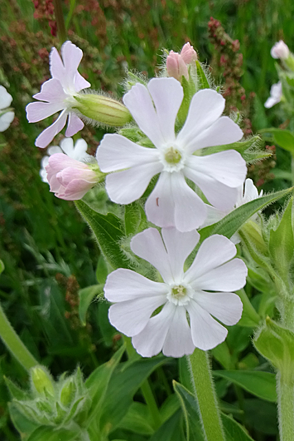
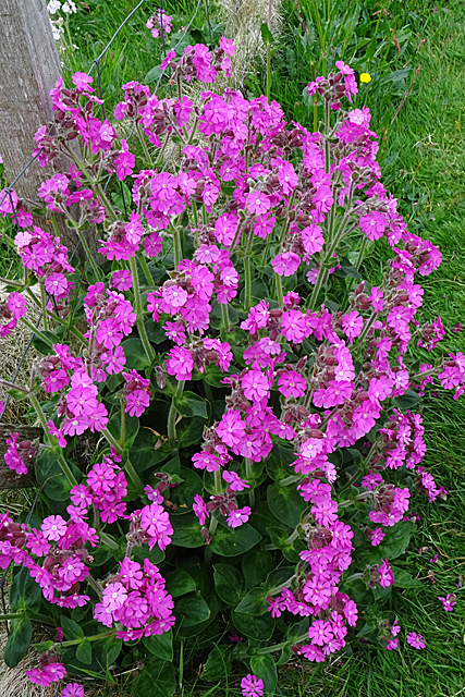
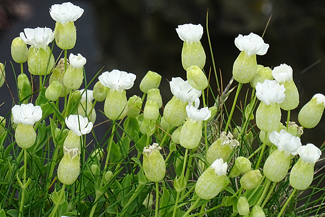
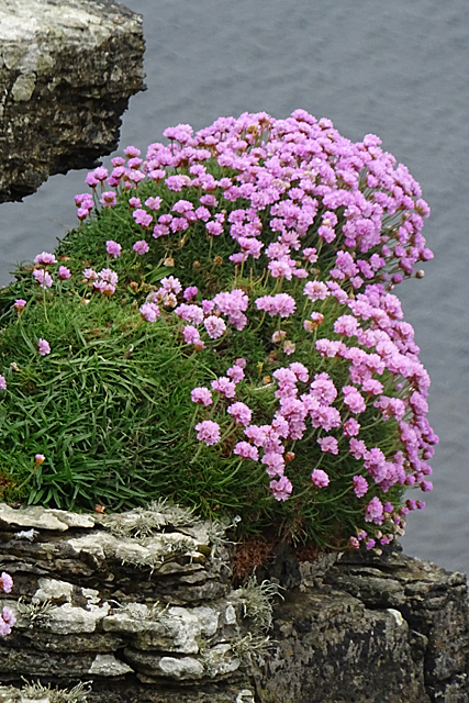
The surrounding area of Crab Geo is abundant in marine wildlife, providing a haven for seabirds such as fulmars, guillemots, and puffins. It is also home to a variety of plant species that thrive in the coastal environment, including sea pinks and sea campion.

Visitors to Crab Geo can experience the raw power of the North Sea as it pounds against the cliffs, creating a mesmerizing display of crashing waves and sprays. The headland offers a perfect vantage point to observe the stunning coastal scenery, with panoramic views stretching out across the sea.

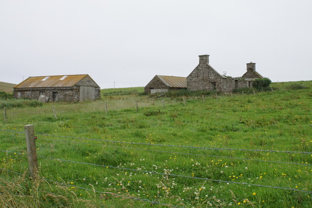
Crab Geo is not only a natural wonder but also an important historical site. It is believed that the headland was once a Viking trading post, as evidenced by the numerous archaeological finds in the vicinity. These artifacts provide valuable insights into the rich history of the Orkney Islands and their connection to the Norse culture.

Overall, Crab Geo is a captivating coastal feature that showcases the raw beauty of nature and the fascinating geological and historical heritage of Orkney.

If you have any feedback on the listing, please let us know in the comments section below.

Crab Geo Images

Images are sourced within 2km of 59.254064/-2.8754624 or Grid Reference HY5041. Thanks to Geograph Open Source API. All images are credited.

Ferry approaching the pier in Rapness, Westray
Rapness Pier This is where the vehicle ferry from Kirkwall lands, at the south end of the island of Westray.
Rapness Pier
This is where the vehicle ferry from Kirkwall lands, at the south end of the island of Westray.
Craw Nev Having got accustomed to all the rocks in Orkney being in fairly orderly strata with a gentle dip, I was astonished to see this headland of extensively deformed rock.
Craw Nev
Having got accustomed to all the rocks in Orkney being in fairly orderly strata with a gentle dip, I was astonished to see this headland of extensively deformed rock.
Boardwalk For the convenience of those walking to and from the cliff path, a boardwalk has been provided to get across a rough or wet patch.
Boardwalk
For the convenience of those walking to and from the cliff path, a boardwalk has been provided to get across a rough or wet patch.
Pink Campion Red Campion and White Campion, both of which occur here, are known to hybridise. This pale-flowered plant is probably such a hybrid.
Pink Campion
Red Campion and White Campion, both of which occur here, are known to hybridise. This pale-flowered plant is probably such a hybrid.
Puffin (Fratercula arctica) Although we were assured by several people that there were hundreds of Puffins at the Castle of Burrian, we saw only a few, of which this one posed obligingly for several minutes for us.
Puffin (Fratercula arctica)
Although we were assured by several people that there were hundreds of Puffins at the Castle of Burrian, we saw only a few, of which this one posed obligingly for several minutes for us.
Cove at Saaclay The old six-inch map suggests that Saaclay is the name of the promontory from which this view was taken, but none of the maps names the cove itself.
Cove at Saaclay
The old six-inch map suggests that Saaclay is the name of the promontory from which this view was taken, but none of the maps names the cove itself.
Castle o' Burrian The name seems to be applied to the sea stack rather than just to the prehistoric site on its summit. It is supposed to be one of the best places to see Puffins, but we saw even fewer here than we had seen at the Brough of Birsay or the Brough of Bigging the previous day.
Castle o' Burrian
The name seems to be applied to the sea stack rather than just to the prehistoric site on its summit. It is supposed to be one of the best places to see Puffins, but we saw even fewer here than we had seen at the Brough of Birsay or the Brough of Bigging the previous day.
Castle o' Burrian From here you can clearly see that this is a rock stack, cut off from the land at high tide.
Castle o' Burrian
From here you can clearly see that this is a rock stack, cut off from the land at high tide.
Bare Rowa Bare Rowa seems to be the name of the bay or cove enclosed by the headland here.
Bare Rowa
Bare Rowa seems to be the name of the bay or cove enclosed by the headland here.
White Campion (Silene latifolia) The cliffs were thick with both White Campion and Red Campion, and a range of hybrids of all shades of pink.
White Campion (Silene latifolia)
The cliffs were thick with both White Campion and Red Campion, and a range of hybrids of all shades of pink.
Bight of Stangerhead The bay and the cliffs on the right are in this square, but Stanger Head itself is in the next square.
Bight of Stangerhead
The bay and the cliffs on the right are in this square, but Stanger Head itself is in the next square.
Red Campion (Silene dioica) One of the numerous fine large clumps of Red Campion along the cliffs.
Red Campion (Silene dioica)
One of the numerous fine large clumps of Red Campion along the cliffs.
Sea Campion (Silene uniflora) This campion is fairly common alongside the clifftop path.
Sea Campion (Silene uniflora)
This campion is fairly common alongside the clifftop path.
Thrift (Armeria maritima) A particularly fine clump of Thrift or Sea Pink.
Thrift (Armeria maritima)
A particularly fine clump of Thrift or Sea Pink.
Sands of Helzie Another of the string of little sandy beaches along the south coast of Westray. At the far side of the bay is Rapness Pier, where the vehicle ferry from Kirkwall comes in.
Sands of Helzie
Another of the string of little sandy beaches along the south coast of Westray. At the far side of the bay is Rapness Pier, where the vehicle ferry from Kirkwall comes in.
Rack Wick A bay which penetrates towards the central spine of Westray.
Rack Wick
A bay which penetrates towards the central spine of Westray.
Helzie Farm The barns are still in use, but the farmhouse is roofless.
Helzie Farm
The barns are still in use, but the farmhouse is roofless.
Show me another place!

Crab Geo is located at Grid Ref: HY5041 (Lat: 59.254064, Lng: -2.8754624)

Unitary Authority: Orkney Islands

Police Authority: Highlands and Islands

What 3 Words

///tidy.routs.odds. Near Pierowall, Orkney Islands

Nearby Locations

Crab Geo

Related Wikis

Rapness

Rapness is a settlement on the island of Westray in Orkney, Scotland. The slipway is the ferry terminal for the Orkney Ferries crossing from Kirkwall on...

Holm of Faray

The Holm of Faray is a small island in Orkney, Scotland, near Faray and Westray, which it lies between. Together with its neighbour Faray, it is designated...

Westside Church

Westside Church, (also known as Cross Kirk), is a ruined 12th century church located on the island of Westray in Orkney, Scotland. Archaeological excavations...

Rusk Holm

Rusk Holm is a small island in the Orkney Islands, near Faray to the west. == History == There is a prehistoric cairn on it . Rusk Holm is also home to...

Faray

Faray (Old Norse: Færey) is a small island in Orkney, Scotland, lying between Eday and Westray. Previously inhabited, the low-lying island is now a successful...

Vinquoy chambered cairn

Vinquoy chambered cairn (grid reference HY56013809) is a Neolithic chambered cairn located on the island of Eday, in Orkney, Scotland. The tomb probably...

Calf of Eday

The Calf of Eday (Scots: Cauf o Aidee; Old Norse: Kalfr) is an uninhabited island in Orkney, Scotland, lying north east of Eday. It is known for its wildlife...

Westray

Westray (, Scots: Westree) is one of the Orkney Islands in Scotland, with a usual resident population of just under 600 people. Its main village is Pierowall...

Nearby Amenities

Located within 500m of 59.254064,-2.8754624
Power: pole
Lat/Long: 59.2579554/-2.8764868
Power: pole
Lat/Long: 59.257326/-2.8753522
Power: pole
Lat/Long: 59.2567104/-2.8742686
Power: pole
Lat/Long: 59.2560728/-2.8732064
Power: pole
Lat/Long: 59.2554462/-2.8721094
Power: pole
Lat/Long: 59.2548868/-2.871125
Power: pole
Lat/Long: 59.254049/-2.8715059
Power: pole
Lat/Long: 59.2533373/-2.8718278
Power: pole
Lat/Long: 59.2525694/-2.8722167
Power: pole
Lat/Long: 59.251929/-2.8725117
Power: pole
Lat/Long: 59.251268/-2.8728095
Power: pole
Lat/Long: 59.2505988/-2.8731045
Power: pole
Lat/Long: 59.2498596/-2.8734452
Bay of Tafts
Natural: bay
Lat/Long: 59.2555929/-2.8823233
Knowe Of Hamar - Burnt Mound (Prehistoric)
Historic: archaeological_site
Lat/Long: 59.25502/-2.8715779
Power: pole
Lat/Long: 59.2516655/-2.8688838
Power: pole
Lat/Long: 59.2523714/-2.8701513
Give Way
Direction: backward
Lat/Long: 59.2567707/-2.8694462
The data included in this document is from www.openstreetmap.org. The data is made available under ODbL.

Have you been to Crab Geo?

Leave your review of Crab Geo below (or comments, questions and feedback).