Veathery Quoy

Coastal Feature, Headland, Point in Orkney

Scotland

Veathery Quoy

Towards Point of Geldibist Near the southern tip of Westray is this small rocky beach looking out on Rapness Sound.
Towards Point of Geldibist Credit: Stuart Wilding

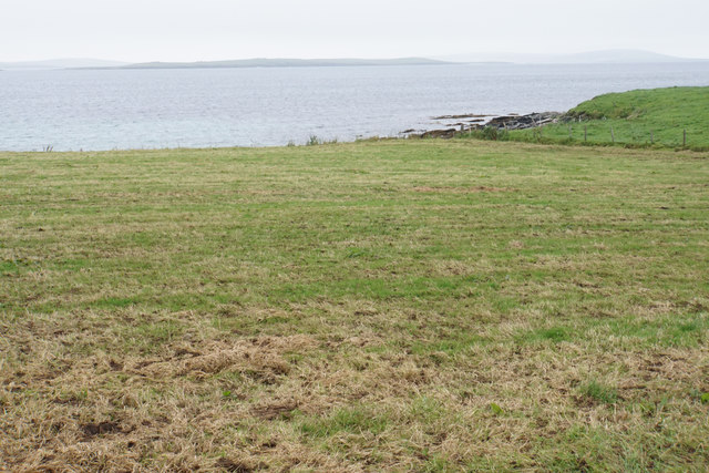
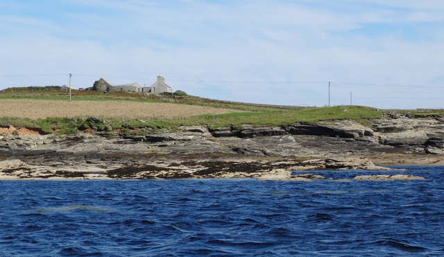
Veathery Quoy is a coastal feature located in Orkney, a group of islands situated off the northeastern coast of Scotland. It is a prominent headland that juts out into the North Sea, forming a distinct point along the coastline.

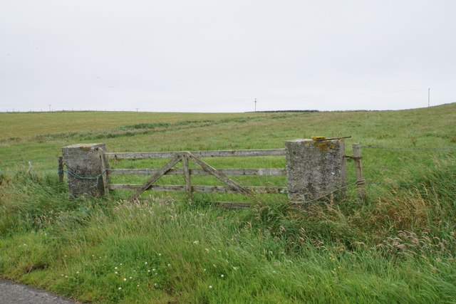
The name "Veathery Quoy" originates from the Scots word "quoy," meaning a piece of enclosed land. This suggests that the area may have been used for agricultural purposes in the past. The term "veathery" refers to the exposed and often stormy nature of the headland, highlighting the region's harsh weather conditions.

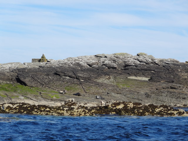
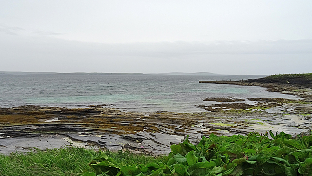
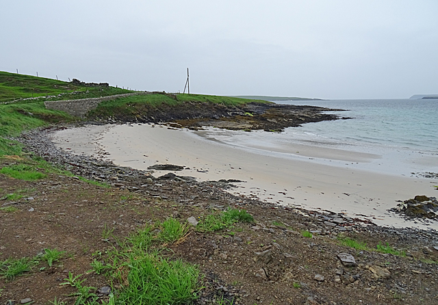
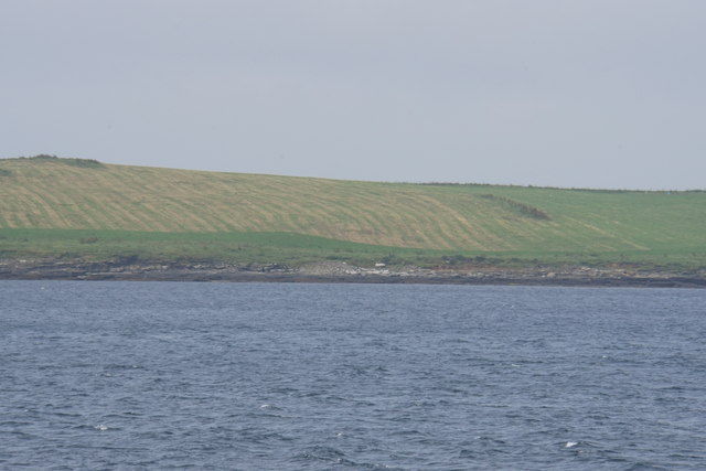
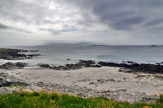
Veathery Quoy is characterized by its rugged and rocky terrain, with cliffs that rise steeply from the sea below. These cliffs provide a nesting site for various seabird species, including guillemots, puffins, and razorbills. The headland also offers breathtaking panoramic views of the surrounding coastline, making it a popular spot for nature enthusiasts and photographers.

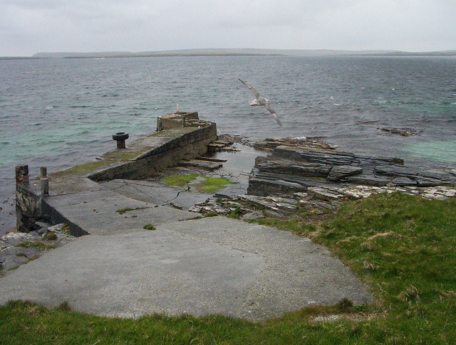
Due to its location on the eastern coast of Orkney, Veathery Quoy is exposed to the full force of the North Sea, resulting in strong winds and powerful waves crashing against the cliffs. The area is subject to erosion, which is evident in the eroded rock formations and caves that can be found along the coastline.

Veathery Quoy is a significant landmark in Orkney, not only for its natural beauty but also for its historical and cultural significance. The headland has likely witnessed the passage of countless ships throughout history, serving as a navigational point and a refuge for seafarers during storms. Today, it continues to be a captivating destination for visitors, offering a glimpse into the region's diverse coastal ecosystems and rich maritime heritage.

If you have any feedback on the listing, please let us know in the comments section below.

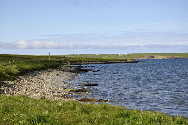
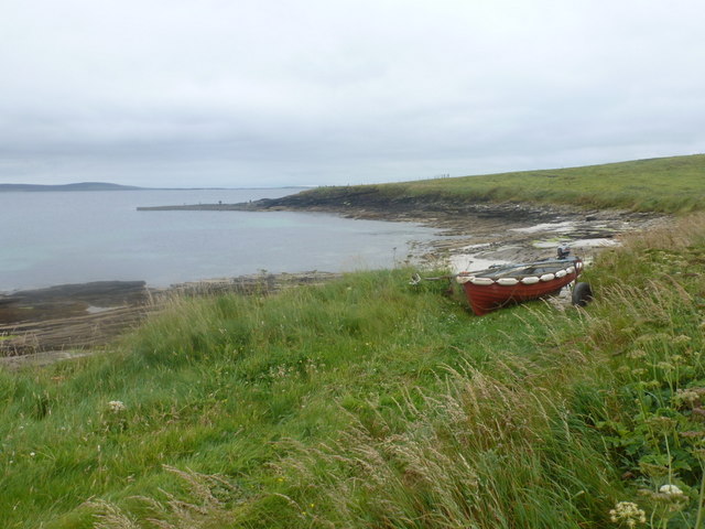
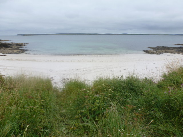
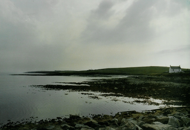
Veathery Quoy Images

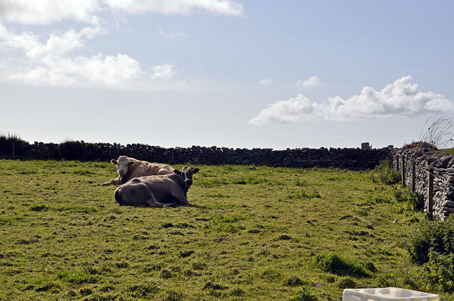
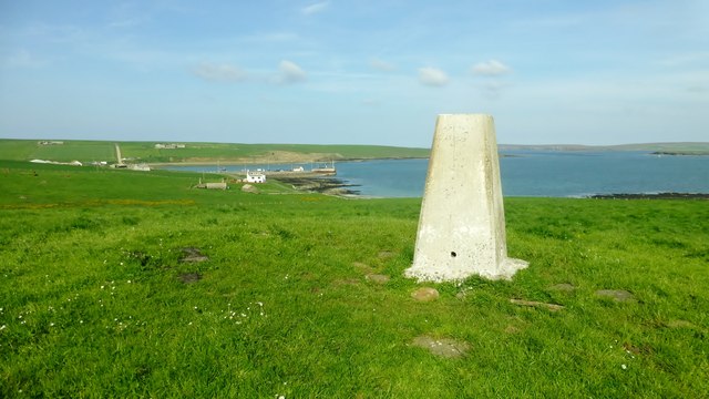
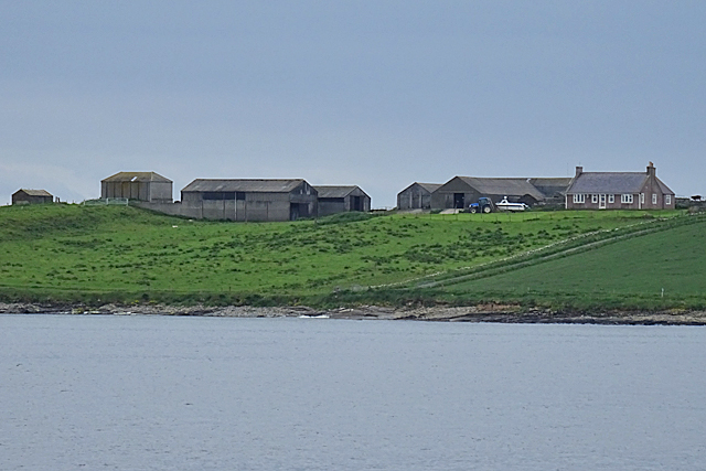
Images are sourced within 2km of 59.232419/-2.887718 or Grid Reference HY4938. Thanks to Geograph Open Source API. All images are credited.

Towards Point of Geldibist Near the southern tip of Westray is this small rocky beach looking out on Rapness Sound.
Towards Point of Geldibist
Near the southern tip of Westray is this small rocky beach looking out on Rapness Sound.
Westray: the coast near Ness Looking towards the southern tip of Westray, which is a bit farther round, from the end of the coast road.
Westray: the coast near Ness
Looking towards the southern tip of Westray, which is a bit farther round, from the end of the coast road.
Westray: short sandy beach near Ness Looking across a tiny sandy inlet on the road to Ness. Eday is the island spread out in the background.
Westray: short sandy beach near Ness
Looking across a tiny sandy inlet on the road to Ness. Eday is the island spread out in the background.
Coastline at Rapness The white house is (from memory) Whitelet
Coastline at Rapness
The white house is (from memory) Whitelet
Ness, Westray A couple of cows in a small field. The field is so small with regards to Westray that it suggests it is used to keep animals on a temporary basis.
Ness, Westray
A couple of cows in a small field. The field is so small with regards to Westray that it suggests it is used to keep animals on a temporary basis.
Whitelet Trig Point Bagged with Tricky Speirs just before the ferry to complete my Westray set of trigs.
Whitelet Trig Point
Bagged with Tricky Speirs just before the ferry to complete my Westray set of trigs.
Bedrock foreshore and sheepfold, Wart Holm, Westray Wart Holm is an uninhabited remote island on the west side of Westray. The only building is a sheepfold, built on top of a cobble storm beach. The foreshore, surrounding the small island, is sandstone bedrock.
Bedrock foreshore and sheepfold, Wart Holm, Westray
Wart Holm is an uninhabited remote island on the west side of Westray. The only building is a sheepfold, built on top of a cobble storm beach. The foreshore, surrounding the small island, is sandstone bedrock.
Coast of Westray The farm buildings are in the next square but the shore and fields are in this one. Photographer location from in-camera GPS.
Coast of Westray
The farm buildings are in the next square but the shore and fields are in this one. Photographer location from in-camera GPS.
Looking towards Scarra Taing Scarra Taing is the promontory with a small pier. It is in the next square, but all the foreground is in this square.
Looking towards Scarra Taing
Scarra Taing is the promontory with a small pier. It is in the next square, but all the foreground is in this square.
East Sous This is a small sandy beach among the rocky coast of southern Westray.
East Sous
This is a small sandy beach among the rocky coast of southern Westray.
Coast between Scarra Taing and Cubby Geo Behind the coast is farmland near the southern tip of Westray.
Coast between Scarra Taing and Cubby Geo
Behind the coast is farmland near the southern tip of Westray.
Cattle above the Point of Geldibist On the sound beyond, the ferry from Kirkwall is approaching Rapness.
Cattle above the Point of Geldibist
On the sound beyond, the ferry from Kirkwall is approaching Rapness.
Point of Geldibist Just about visible from the road. In the distance is the island of Faray, with the fainter profile of Eday behind it.
Point of Geldibist
Just about visible from the road. In the distance is the island of Faray, with the fainter profile of Eday behind it.
Field access on Rapness A little-used gate to the field, leading up to the spine of this southern peninsula.
Field access on Rapness
A little-used gate to the field, leading up to the spine of this southern peninsula.
Westray. Orkney Islands The southern tip of Westray.Marks in the sand are made by cattle!
Westray. Orkney Islands
The southern tip of Westray.Marks in the sand are made by cattle!
Pier at Scarra Taing A small private pier accessed by a grassy track.
Pier at Scarra Taing
A small private pier accessed by a grassy track.
Point of Peterkirk, Westray Showing the sandstone bedrock foreshore of Point of Peterkirk near the south end of Westray.
Point of Peterkirk, Westray
Showing the sandstone bedrock foreshore of Point of Peterkirk near the south end of Westray.
Show me another place!

Veathery Quoy is located at Grid Ref: HY4938 (Lat: 59.232419, Lng: -2.887718)

Unitary Authority: Orkney Islands

Police Authority: Highlands and Islands

What 3 Words

///coherent.emperor.mingles. Near Backaland, Orkney Islands

Related Wikis

Rapness

Rapness is a settlement on the island of Westray in Orkney, Scotland. The slipway is the ferry terminal for the Orkney Ferries crossing from Kirkwall on...

Holm of Faray

The Holm of Faray is a small island in Orkney, Scotland, near Faray and Westray, which it lies between. Together with its neighbour Faray, it is designated...

Rusk Holm

Rusk Holm is a small island in the Orkney Islands, near Faray to the west. == History == There is a prehistoric cairn on it . Rusk Holm is also home to...

Faray

Faray (Old Norse: Færey) is a small island in Orkney, Scotland, lying between Eday and Westray. Previously inhabited, the low-lying island is now a successful...

Nearby Amenities

Located within 500m of 59.232419,-2.887718
Point of Huro
Place: locality
Source: OS7
Lat/Long: 59.2290725/-2.8842528
The data included in this document is from www.openstreetmap.org. The data is made available under ODbL.

Have you been to Veathery Quoy?

Leave your review of Veathery Quoy below (or comments, questions and feedback).