Clyar

Coastal Feature, Headland, Point in Orkney

Scotland

Clyar

Two Ponies Two ponies in a field above the beach with a distant view towards Hundland.
Two Ponies Credit: Rude Health

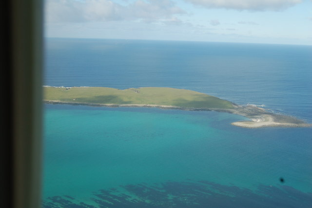
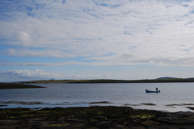
Clyar is a small headland located on the Orkney Islands, off the northeastern coast of Scotland. Situated on the eastern coast of the main island, it is positioned between the towns of Kirkwall and Stromness. Clyar is renowned for its stunning coastal landscape and picturesque views of the North Sea.

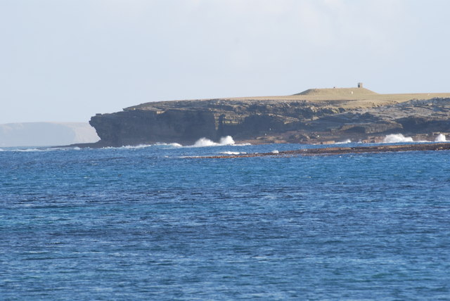
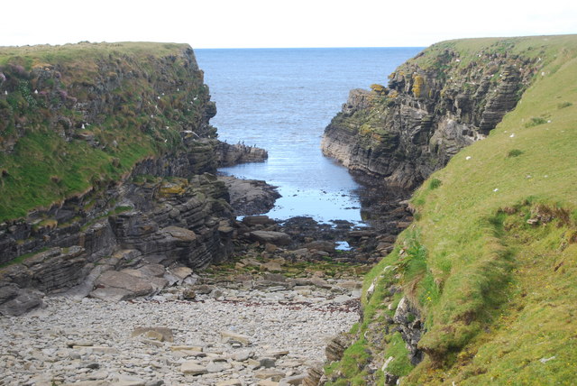
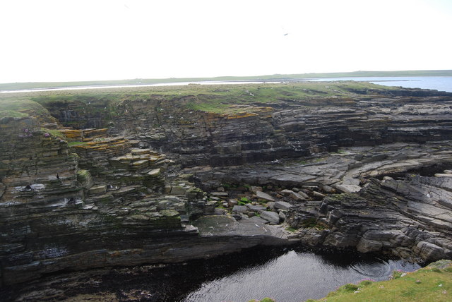
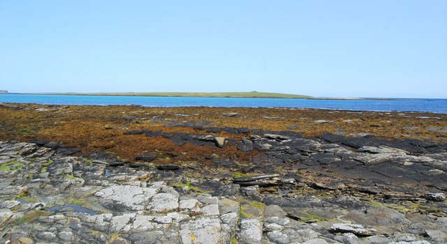
The headland is characterized by its rugged terrain, with steep cliffs that drop dramatically into the sea. These cliffs, which reach heights of approximately 50 meters, are composed of sandstone and are often covered in vibrant green vegetation, providing a striking contrast against the deep blue waters below.

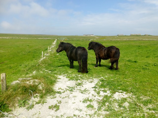
Clyar is a popular destination for nature enthusiasts and photographers, as it offers breathtaking panoramas of the surrounding area. Visitors can enjoy walks along the cliff tops, where they may spot a variety of seabirds, including puffins, guillemots, and kittiwakes. The headland also provides a vantage point for observing marine life, such as seals and dolphins, which can often be seen swimming in the waters below.

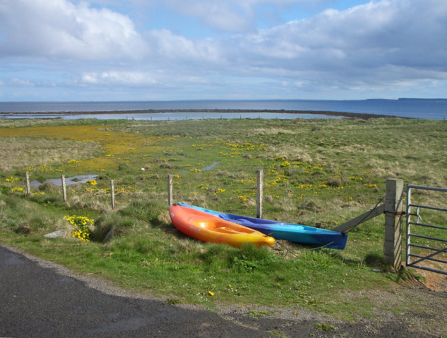
Access to Clyar is relatively easy, with a well-maintained footpath leading from a nearby car park. The headland is open to the public year-round, although caution is advised, as the cliffs can be dangerous in adverse weather conditions.

With its striking natural beauty and abundant wildlife, Clyar is a must-visit destination for those seeking to explore the rugged coastal landscapes of the Orkney Islands.

If you have any feedback on the listing, please let us know in the comments section below.

Clyar Images

Images are sourced within 2km of 59.357493/-2.9056165 or Grid Reference HY4852. Thanks to Geograph Open Source API. All images are credited.

Two Ponies Two ponies in a field above the beach with a distant view towards Hundland.
Two Ponies
Two ponies in a field above the beach with a distant view towards Hundland.
Canoes at the roadside Overlooking the tidal Loch of the Taing and North Wick on Papa Westray
Canoes at the roadside
Overlooking the tidal Loch of the Taing and North Wick on Papa Westray
Chambered Cairn Remains Remains of chambered cairn at the north end of Holm of Papa. In the distance you can just see the impressive Chambered Cairn at the south end of this tiny island and I think the longest chambered cairn in Orkney.
There were Fulmars nesting in the stalls of the chambered cairn in the foreground.
Chambered Cairn Remains
Remains of chambered cairn at the north end of Holm of Papa. In the distance you can just see the impressive Chambered Cairn at the south end of this tiny island and I think the longest chambered cairn in Orkney. There were Fulmars nesting in the stalls of the chambered cairn in the foreground.
View of the Holm of Papay, from the air Arriving at Papay and just starting to turn into the island to land
View of the Holm of Papay, from the air
Arriving at Papay and just starting to turn into the island to land
Cliffs, Holm of Papay A view of the waves breaking on the cliffs around the side of the Holm of Papay, with the chambered cairn visible at the top
Cliffs, Holm of Papay
A view of the waves breaking on the cliffs around the side of the Holm of Papay, with the chambered cairn visible at the top
From the Holm of Papay, back to Southwick Managed at last to get a local fisherman to take us over to the Holm (thanks Jim, just seen here).  Landed on the Holm and had to make our way over some very slippy rocks up to the chambered cairn, then down the ladder...
From the Holm of Papay, back to Southwick
Managed at last to get a local fisherman to take us over to the Holm (thanks Jim, just seen here). Landed on the Holm and had to make our way over some very slippy rocks up to the chambered cairn, then down the ladder...
Sheltered cove, Holm of Papay, with Kittiwakes nesting
Cliff view, Holm of Papay
Papa Westray Hostel
Papa Westray Hostel
Holland on Papa Westray Holland is the village centre on Papa Westray.
Holland on Papa Westray
Holland is the village centre on Papa Westray.
Ruined buildings near Mill Point on Papa Westray
Papa Westray The Holm of Papa seen in the foreground.
Papa Westray
The Holm of Papa seen in the foreground.
Holland on Papa Westray Holland is the small village community centre on Papa Westray. My camera is facing North and you can see the information sign directing you to the Knap of Howar.
Holland on Papa Westray
Holland is the small village community centre on Papa Westray. My camera is facing North and you can see the information sign directing you to the Knap of Howar.
The community Fire Station at Papa Westray
Loch of St Tredwell, Papa Westray
Road on Papa Westray Visiting Papa Westray on the Orkney Islands. Approaching the small Community named Holland.
Latitude 59.345353 North and Longitude 2.900881 West.
Altitude 20.36252546 m Above Sea Level
Road on Papa Westray
Visiting Papa Westray on the Orkney Islands. Approaching the small Community named Holland. Latitude 59.345353 North and Longitude 2.900881 West. Altitude 20.36252546 m Above Sea Level
Unloading at Papa Westray To my great disappointment, my seat on the shortest commercial flight in the world was right at the back and I could barely see out, let alone record the event. This is the aircraft being unloaded at Papa Westray Airport before returning to Kirkwall.
Unloading at Papa Westray
To my great disappointment, my seat on the shortest commercial flight in the world was right at the back and I could barely see out, let alone record the event. This is the aircraft being unloaded at Papa Westray Airport before returning to Kirkwall.
Reception Committee The small crowd at the gate wasn't waiting for us, of course, but for four of our fellow passengers, who had flown in from Kirkwall via Westray and were joining an organised tour of Papa Westray which had already collected most of its participants from the passenger ferry from Gill Bay on Westray.
Reception Committee
The small crowd at the gate wasn't waiting for us, of course, but for four of our fellow passengers, who had flown in from Kirkwall via Westray and were joining an organised tour of Papa Westray which had already collected most of its participants from the passenger ferry from Gill Bay on Westray.
Show me another place!

Clyar is located at Grid Ref: HY4852 (Lat: 59.357493, Lng: -2.9056165)

Unitary Authority: Orkney Islands

Police Authority: Highlands and Islands

What 3 Words

///technical.stack.trespass. Near Pierowall, Orkney Islands

Related Wikis

St Boniface's Church, Papa Westray

St Boniface's Church, Papa Westray is a historic church and graveyard located on the island of Papa Westray in Orkney, Scotland. The site of the church...

Papa Westray Airport

Papa Westray Airport (IATA: PPW, ICAO: EGEP) is located 22 NM (41 km; 25 mi) north of Kirkwall Airport on Papa Westray, Orkney Islands, Scotland. The facility...

Papa Westray

Papa Westray () (Scots: Papa Westree), also known as Papay, is one of the Orkney Islands in Scotland, United Kingdom. The fertile soil has long been a...

Knap of Howar

The Knap of Howar () on the island of Papa Westray in Orkney, Scotland is a Neolithic farmstead which may be the oldest preserved stone house in northern...

Nearby Amenities

Located within 500m of 59.357493,-2.9056165
The data included in this document is from www.openstreetmap.org. The data is made available under ODbL.

Have you been to Clyar?

Leave your review of Clyar below (or comments, questions and feedback).