Little Galt Skerry

Coastal Feature, Headland, Point in Orkney

Scotland

Little Galt Skerry

Galt Skerry Navigation Buoy The Orkney Ports Handbook (5th edition) 2012 describes this as a north cardinal buoy, which is sited to the north west of Galt Skerry with a view across to Shapinsay. I passed by the buoy twice in the same day when visiting Westray, although the conditions on the return journey didn't make for a particularly good picture with lots of mist and drizzle on the crossing.
Galt Skerry Navigation Buoy Credit: Andy Farrington

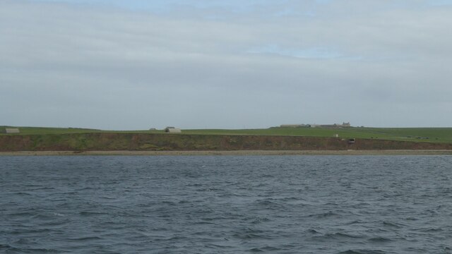
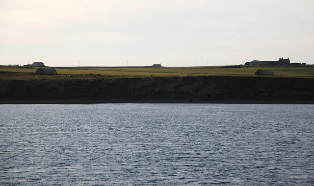
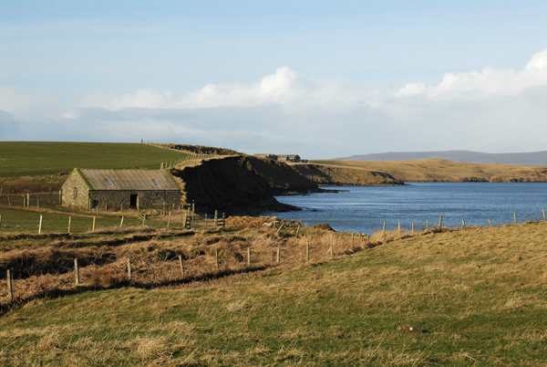
Little Galt Skerry is a prominent coastal feature located in the Orkney Islands, Scotland. It is classified as a headland or point due to its elevated position and protrusion into the sea. Situated on the eastern side of Orkney Mainland, it offers stunning panoramic views of the surrounding waters and the rugged coastline.

This rocky headland is composed of ancient sandstone and is characterized by its steep cliffs, which rise up to approximately 40 meters (130 feet) above sea level. The cliffs are battered by the relentless waves of the North Sea, and their exposed nature makes Little Galt Skerry a fascinating site for geologists and nature enthusiasts alike.

The headland is also known for its diverse wildlife. Seabirds, such as fulmars, kittiwakes, and guillemots, can be spotted nesting on the cliffs, while seals and otters can often be seen swimming in the surrounding waters. The area surrounding Little Galt Skerry is designated as a Special Protection Area due to its importance for the conservation of these bird species.

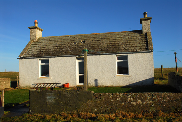
Access to Little Galt Skerry is relatively challenging, as it requires navigating narrow, winding roads and a short hike along a coastal path. However, the effort is rewarded with breathtaking views and a sense of solitude. The headland's rugged beauty and tranquil atmosphere make it a popular destination for nature walks, photography, and birdwatching.

Overall, Little Galt Skerry is a remarkable coastal feature in the Orkney Islands, offering a glimpse into the raw and untamed beauty of Scotland's coastline.

If you have any feedback on the listing, please let us know in the comments section below.

Little Galt Skerry Images

Images are sourced within 2km of 59.075686/-2.8983724 or Grid Reference HY4821. Thanks to Geograph Open Source API. All images are credited.

Galt Skerry Navigation Buoy The Orkney Ports Handbook (5th edition) 2012 describes this as a north cardinal buoy, which is sited to the north west of Galt Skerry with a view across to Shapinsay. I passed by the buoy twice in the same day when visiting Westray, although the conditions on the return journey didn't make for a particularly good picture with lots of mist and drizzle on the crossing.
Galt Skerry Navigation Buoy
The Orkney Ports Handbook (5th edition) 2012 describes this as a north cardinal buoy, which is sited to the north west of Galt Skerry with a view across to Shapinsay. I passed by the buoy twice in the same day when visiting Westray, although the conditions on the return journey didn't make for a particularly good picture with lots of mist and drizzle on the crossing.
Banks of Runabout Several Nissen Huts stand as reminder of WWII activities in this area which housed a coastal battery to protect Kirkwall.
Banks of Runabout
Several Nissen Huts stand as reminder of WWII activities in this area which housed a coastal battery to protect Kirkwall.
Banks of Runabout Low cliffs and a precariously placed building on the north side of Shapinsay.
Banks of Runabout
Low cliffs and a precariously placed building on the north side of Shapinsay.
Galt Skerry buoy Cardinal buoy off a reef north of Shapinsay.
Galt Skerry buoy
Cardinal buoy off a reef north of Shapinsay.
Banks of Runabout The steep sandy banks don't look very stable. On top is one of the Nissen huts supporting the coastal defences on Salt Ness.
Banks of Runabout
The steep sandy banks don't look very stable. On top is one of the Nissen huts supporting the coastal defences on Salt Ness.
Galt Skerry buoy
Galt Skerry buoy
Coastal erosion at Banks of Runabout
Garth This is the last farm on the north end of the western tip on Shapinsay.
Garth
This is the last farm on the north end of the western tip on Shapinsay.
Coastal erosion The soft cliffs are collapsing and eroding away. A worry as the remains of a wartime coastal battery lie here and some of the features are in danger of collapsing into the sea. The buildings in the middle distance, looking a little like Nissen huts, will have been generator houses for searchlights etc.
Coastal erosion
The soft cliffs are collapsing and eroding away. A worry as the remains of a wartime coastal battery lie here and some of the features are in danger of collapsing into the sea. The buildings in the middle distance, looking a little like Nissen huts, will have been generator houses for searchlights etc.
The Galt Viewed from the Varagen, an inter-island ferry. Veantrow Bay is beyond.
The Galt
Viewed from the Varagen, an inter-island ferry. Veantrow Bay is beyond.
Shapinsay, Farm of Garth Farm of Garth has an excellent stock of Orkney rare farm animals.
Shapinsay, Farm of Garth
Farm of Garth has an excellent stock of Orkney rare farm animals.
Ware Geo, Shapinsay Looking along Veantrow Bay toward Ware Geo.
Ware Geo, Shapinsay
Looking along Veantrow Bay toward Ware Geo.
Galtness Coast Gun Battery Director Tower and Searchlight of WWII Galtness Coastal Gun Battery on island of Shapinsay in the Orkney Islands.  Photograph taken from Sanday ferry.
Galtness Coast Gun Battery
Director Tower and Searchlight of WWII Galtness Coastal Gun Battery on island of Shapinsay in the Orkney Islands. Photograph taken from Sanday ferry.
Galtness Gun Battery This WW2 gun battery commands the sea approach to Kirkwall. Like <a href="https://www.geograph.org.uk/photo/14949">HY4719 : Galtness Coast Gun Battery</a> this was taken from a ferry, but in better weather.
Galtness Gun Battery
This WW2 gun battery commands the sea approach to Kirkwall. Like HY4719 : Galtness Coast Gun Battery this was taken from a ferry, but in better weather.
Fields near Gebro, Shapinsay View of fields near Gebro, Shapinsay.
Fields near Gebro, Shapinsay
View of fields near Gebro, Shapinsay.
Burness Cottage Stone built cottage at Burness
Burness Cottage
Stone built cottage at Burness
Galtness Coastal Gun Battery Director Tower and Searchlight of WWII Galtness Coastal Gun Battery on Shapinsay taken from the ferry on route to Westray.
Galtness Coastal Gun Battery
Director Tower and Searchlight of WWII Galtness Coastal Gun Battery on Shapinsay taken from the ferry on route to Westray.
Gun Battery Seen from the ferry on the way to Kirkwall.
Gun Battery
Seen from the ferry on the way to Kirkwall.
Show me another place!

Little Galt Skerry is located at Grid Ref: HY4821 (Lat: 59.075686, Lng: -2.8983724)

Unitary Authority: Orkney Islands

Police Authority: Highlands and Islands

What 3 Words

///joyously.hops.pave. Near Balfour, Orkney Islands

Related Wikis

Veantro Bay

Veantro Bay is a bay on the northwest coast of Shapinsay in the Orkney Islands, Scotland.At the head of the bay is a large stone, thought to be associated...

The Ouse

The Ouse is a tidal estuary in northern Shapinsay, Orkney Islands. This water body has been shown on early maps of the island in a very similar shape to...

Shapinsay

Shapinsay (, Scots: Shapinsee) is one of the Orkney Islands off the north coast of mainland Scotland. There is one village on the island, Balfour, from...

Vasa Loch

Vasa Loch is a brackish lagoon in southwestern Shapinsay, Orkney Islands. (Ordnance, 2002) This water body has been shown on early maps of the island...

Lairo Water

Lairo Water is a surface water body known as an ayre situated on the western coast of Shapinsay in the Orkney Islands. This brackish water body is separated...

Sweyn Holm

Note: There is also a "Sweyn Holm" off St Ninian's Isle, Shetland Sweyn Holm is a small island in the Orkney Islands, next to Gairsay. It is thought to...

Quholm

Quholm (grid reference HY5221) is a hamlet in the northeast of Shapinsay, in the islands of Orkney, Scotland. It is located between the Loch of Stenness...

Mill Dam

Mill Dam is a wetland in western Shapinsay, in Orkney, Scotland. This water body was not shown on the 1840 survey map of the island, since it is a man...

Nearby Amenities

Located within 500m of 59.075686,-2.8983724
The Galt
Place: locality
Source: OS7
Lat/Long: 59.0771755/-2.9004728
The data included in this document is from www.openstreetmap.org. The data is made available under ODbL.

Have you been to Little Galt Skerry?

Leave your review of Little Galt Skerry below (or comments, questions and feedback).