Coach Rock

Coastal Feature, Headland, Point in Fife

Scotland

Coach Rock

Chapel Ness  Elie Elie beach at sunset.
Chapel Ness Elie Credit: edward mcmaihin

Coach Rock is a prominent coastal feature located in Fife, Scotland. It is a headland that juts out into the North Sea, forming a distinctive point along the coastline. The rock gets its name from its resemblance to a coach or carriage when viewed from a certain angle.

Standing at an impressive height, Coach Rock offers breathtaking panoramic views of the surrounding area. Its rugged cliffs and rocky outcrops contribute to its dramatic appearance. The headland is made up of layers of sedimentary rock, which have been shaped over centuries by erosion from wind and waves.

The area around Coach Rock is rich in marine life, attracting both divers and nature enthusiasts. The rock provides a habitat for a variety of seabirds, including guillemots, puffins, and gannets. Visitors can often spot these birds nesting and fishing in the surrounding waters.

Due to its exposed location and strong currents, Coach Rock is not easily accessible by foot. However, it is a popular spot for boat trips and coastal walks. Adventurous climbers and hikers can also attempt to scale its cliffs, but this requires experience and caution.

Overall, Coach Rock is a striking coastal feature that offers both natural beauty and wildlife diversity. Its unique shape and stunning vistas make it a must-visit destination for those exploring the Fife coastline.

If you have any feedback on the listing, please let us know in the comments section below.

Coach Rock Images

Images are sourced within 2km of 56.18548/-2.8464435 or Grid Reference NT4799. Thanks to Geograph Open Source API. All images are credited.

Chapel Ness  Elie Elie beach at sunset.
Chapel Ness Elie
Elie beach at sunset.
Rocky foreshore Elie Rocky foreshore at Chapel Ness,Elie.
Rocky foreshore Elie
Rocky foreshore at Chapel Ness,Elie.
Child's play A grandfather (in red) introducing his grandchildren to the thrills of the Elie Chain Walk, Scotland's only Via Ferrata.
Child's play
A grandfather (in red) introducing his grandchildren to the thrills of the Elie Chain Walk, Scotland's only Via Ferrata.
Cottages, The Toft, Elie
The Granary at Elie Harbour
Coastline rocks, Kincraig Point Several families of eiders with ducklings were bobbing about just off the shore.
Coastline rocks, Kincraig Point
Several families of eiders with ducklings were bobbing about just off the shore.
Sea-washed rock platform, Kincraig Point Near-horizontal bedding of the rocks has produced this platform on the coastal edge. Across the Forth, Bass Rock is to the left and North Berwick Law to the right.
Sea-washed rock platform, Kincraig Point
Near-horizontal bedding of the rocks has produced this platform on the coastal edge. Across the Forth, Bass Rock is to the left and North Berwick Law to the right.
Earlsferry Links from Kincraig Looking from the Fife Coast path which follows the cliff edge before descent to Earlsferry. The Isle of May is in view on the horizon.
Earlsferry Links from Kincraig
Looking from the Fife Coast path which follows the cliff edge before descent to Earlsferry. The Isle of May is in view on the horizon.
Gun pit, Kincraig gun battery Part of the remains of a World War II gun battery. An information board near the foot of the cliff has photographs of the battery in 1943. The site housed up to 200 men to operate two 6-inch guns with a range of 10 miles (16 km); there were also ammunition stores, an observation post and a command bunker.  This is gun pit no. 3 in which a gun was never installed.
Gun pit, Kincraig gun battery
Part of the remains of a World War II gun battery. An information board near the foot of the cliff has photographs of the battery in 1943. The site housed up to 200 men to operate two 6-inch guns with a range of 10 miles (16 km); there were also ammunition stores, an observation post and a command bunker. This is gun pit no. 3 in which a gun was never installed.
Coast path signpost, Earlsferry The Fife Coast path turns inland to cross the golf course.
Coast path signpost, Earlsferry
The Fife Coast path turns inland to cross the golf course.
Beachside path, Earlsferry An informal path through the grass leads to the beach.
Beachside path, Earlsferry
An informal path through the grass leads to the beach.
Beach near Elie The beach is never far from the houses in these Fife coast villages.
Beach near Elie
The beach is never far from the houses in these Fife coast villages.
Seashore at Elie A winding creek of shallow water at a corner of the beach in this attractive village on the Fife Coast path.
Seashore at Elie
A winding creek of shallow water at a corner of the beach in this attractive village on the Fife Coast path.
A lane in Elie Elie is one of several attractive coastal villages in Fife, with the red tiled cottages that are common around the Firth of Forth.
A lane in Elie
Elie is one of several attractive coastal villages in Fife, with the red tiled cottages that are common around the Firth of Forth.
Elie Harbour at low tide
Seaside scene at Elie in Fife Houses overlooking the beach near the harbour.
Seaside scene at Elie in Fife
Houses overlooking the beach near the harbour.
Low tide at Earlsferry Kincraig Point is the prominent headland.
Low tide at Earlsferry
Kincraig Point is the prominent headland.
Elie Harbour Once a busy commercial port, nowadays there are only a few fishing boats that work from Elie. The harbour primarily plays host to sailing, windsurfing and other water-based activities.
Elie Harbour
Once a busy commercial port, nowadays there are only a few fishing boats that work from Elie. The harbour primarily plays host to sailing, windsurfing and other water-based activities.
Show me another place!

Coach Rock is located at Grid Ref: NT4799 (Lat: 56.18548, Lng: -2.8464435)

Unitary Authority: Fife

Police Authority: Fife

What 3 Words

///stooping.printout.backdrop. Near St Monans, Fife

Nearby Locations

West Vows Coach Rock

Related Wikis

Elie and Earlsferry Town Hall

Elie and Earlsferry Town Hall is a former municipal structure in High Street in Elie and Earlsferry, Scotland. The structure, which is currently used as...

The Golf House Club

The Golf House Club, Elie established in 1875, is a historic members golf club located in the East Neuk of Fife, Scotland. Members have playing rights...

Elie and Earlsferry

Elie and Earlsferry is a coastal town and former royal burgh in Fife, and parish, Scotland, situated within the East Neuk beside Chapel Ness on the north...
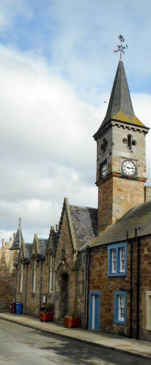
Elie Primary School

Elie Primary School is a school in Elie, Fife, Scotland. It is located partly in a Category C listed building dating from 1858. The architect of the relevant...

Elie Parish Church

Elie Parish Church is a church building in Elie, Fife, Scotland. It is Category B listed, its oldest surviving part (the clock tower) dating to the 1726...

Kilconquhar railway station

Kilconquhar railway station served the village of Kilconquhar, Fife, Scotland from 1857 to 1965 on the Leven and East of Fife Railway. == History == The...

Elie railway station

Elie railway station served the town of Elie and Earlsferry, Fife, Scotland, from 1863 to 1965 on the Fife Coast Railway. == History == The station was...
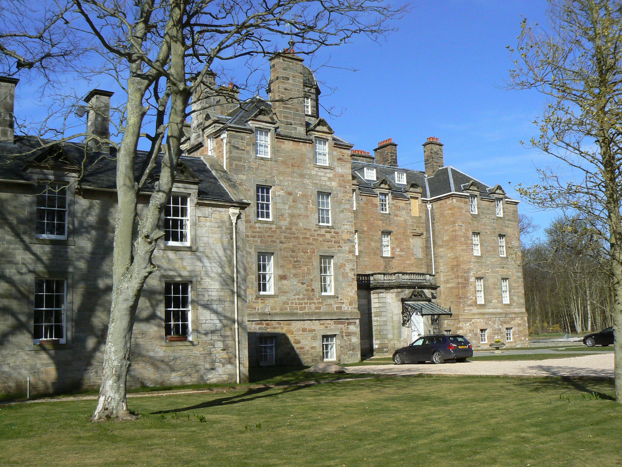
Elie House

Elie House is a country house in Elie, Fife, Scotland. It is a Category A listed building.The house, built in 1697 and incorporating an earlier structure...

Nearby Amenities

Located within 500m of 56.18548,-2.8464435
Turning Circle
Lat/Long: 56.1848771/-2.8384904
Golf: pin
Lat/Long: 56.1867128/-2.8389766
Golf: pin
Lat/Long: 56.1859535/-2.8430738
Golf: pin
Lat/Long: 56.1869953/-2.8398025
Golf: pin
Lat/Long: 56.1866616/-2.8435409
Golf: pin
Lat/Long: 56.184172/-2.8425223
Golf: pin
Lat/Long: 56.1846623/-2.8438198
Golf: pin
Lat/Long: 56.1877128/-2.845939
Golf: pin
Lat/Long: 56.1892032/-2.8497862
Golf: pin
Lat/Long: 56.189719/-2.8440059
Golf: pin
Lat/Long: 56.1873696/-2.8444698
Information: route_marker
Operator: Fife Coast & Countryside Trust
Tourism: information
Lat/Long: 56.1890352/-2.8510206
Post Box
Brand: Royal Mail
Brand Wikidata: Q638098
Brand Wikipedia: en:Royal Mail
Collection Times: Mo-Fr 09:00; Sa 07:00
Operator: Royal Mail
Operator Wikidata: Q638098
Post Box Type: wall
Ref: KY9 183D
Royal Cypher: scottish_crown
Lat/Long: 56.1860887/-2.8384875
West Vows
Place: locality
Lat/Long: 56.1811872/-2.8481212
Power: pole
Lat/Long: 56.1851231/-2.8405252
Power: pole
Lat/Long: 56.1853456/-2.8399516
Power: pole
Lat/Long: 56.1857125/-2.839509
Power: pole
Lat/Long: 56.1860217/-2.8391567
Power: pole
Lat/Long: 56.186273/-2.8388789
Power: pole
Lat/Long: 56.1865269/-2.838583
Bench
Backrest: yes
Material: plastic
Lat/Long: 56.1850165/-2.8419439
Bench
Backrest: yes
Material: plastic
Lat/Long: 56.184943/-2.8418809
Bench
Backrest: yes
Material: plastic
Lat/Long: 56.1847985/-2.8417531
Bench
Backrest: yes
Material: plastic
Lat/Long: 56.1844691/-2.8410174
Bench
Backrest: yes
Material: plastic
Lat/Long: 56.1845014/-2.8407517
Bench
Backrest: yes
Material: plastic
Lat/Long: 56.1842947/-2.8392871
Bench
Backrest: yes
Material: plastic
Lat/Long: 56.1842222/-2.8388775
Bench
Backrest: yes
Material: plastic
Lat/Long: 56.1842402/-2.8387889
Bench
Backrest: yes
Material: plastic
Lat/Long: 56.1842625/-2.838685
Bench
Backrest: yes
Material: plastic
Lat/Long: 56.1845748/-2.8385837
Bench
Backrest: yes
Material: plastic
Lat/Long: 56.1847037/-2.8385743
The data included in this document is from www.openstreetmap.org. The data is made available under ODbL.

Have you been to Coach Rock?

Leave your review of Coach Rock below (or comments, questions and feedback).